I can’t really write about walking without writing about maps. Hand drawn, Ordnance Survey, road, tube, physical, nautical, political, climatic, thematic, ancient, fictional maps, if you can think of it there is probably a map for it. A note before we proceed, everyone can learn to read maps, don’t believe any nonsense that some people just can’t, they just can.
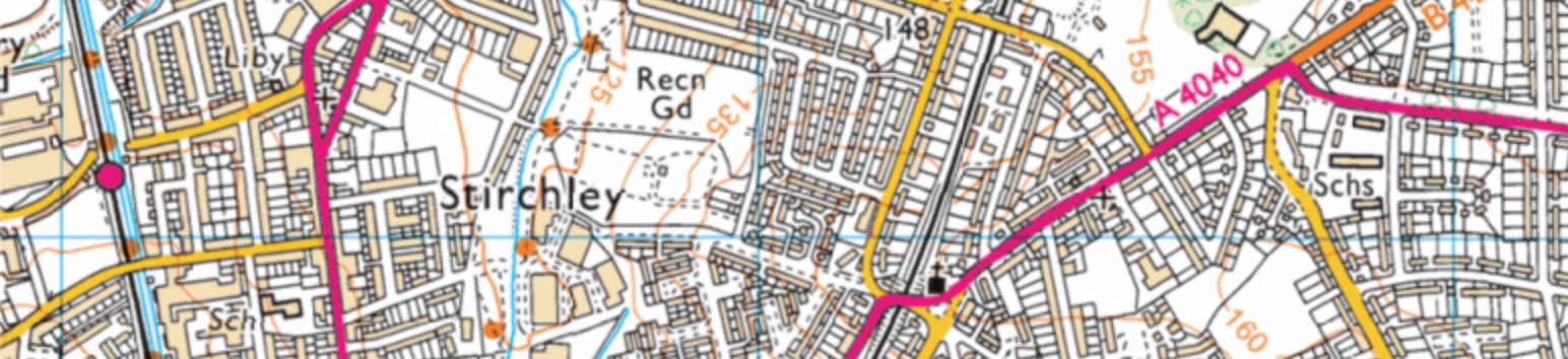
Ordnance Survey (OS) Explorer maps are the best maps you can purchase of these islands. If anyone ever tries to persuade you differently, politely correct them and clarify that they should never raise the matter again. There are currently 403 available and you can spot them by their orange cover. They are 1:25000 scale, meaning what ever the distance on the map multiply it by 25000 to get the actual distance across the land. I encourage you to buy the explorer map of the area you wish to explore, open it on the table or the floor and pore to your hearts content. (Bing maps has a useful OS layer but is not available on mobiles devices and it’s not the same as studying a paper map.)
Maps are political even when they are physical. They have been used for 100’s of years to show borders, denote ownership of land and, often, imply the exclusion of one people in preference of another. (Ordnance means artillery, the original remit of OS was to map Scotland after the Jacobite uprising of 1745.) To be ‘put on the map’ suggests recognition. A map can explain why a border is in a particular place and they are often situated where there is already a natural boundary. A river, a range of hills or sometimes a change in flora have all indicated a change of ‘ownership’. When you live on an island, as we do in the UK, you have a big wet natural boundary, usually called the sea, but when you sail out of UK coastal waters there is no bobbing line of buoys on the ocean to inform you. Similarly when you cross the Welsh Marches on foot from England into Wales there is not a painted line on the fields or hillsides.
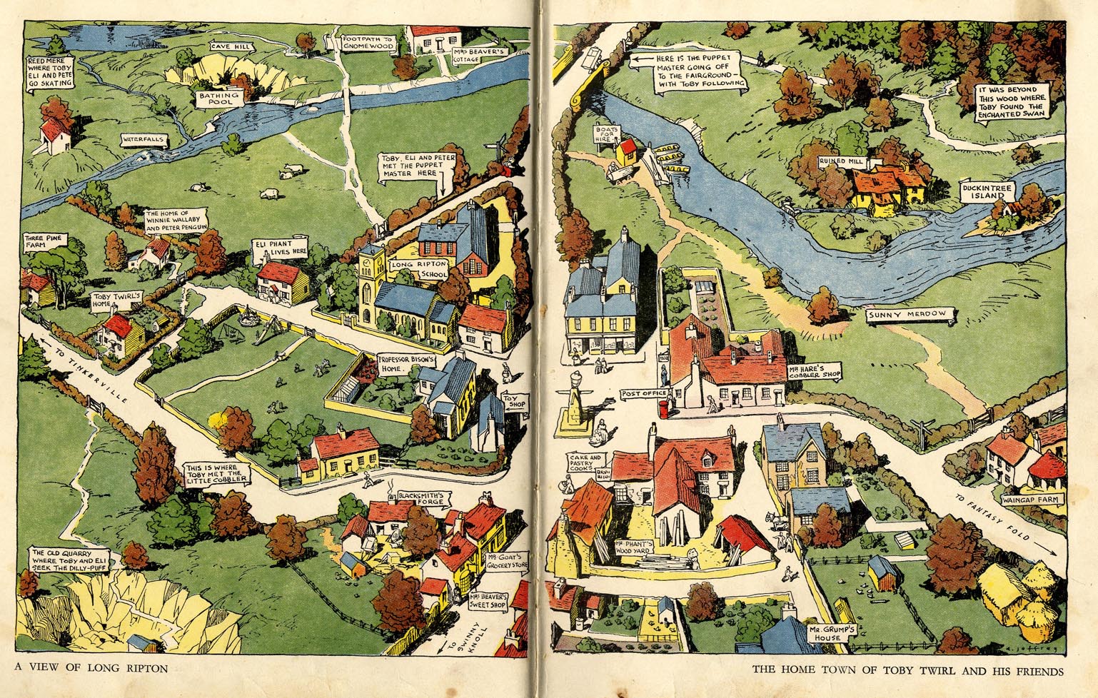
Maps are show us a version of what is really there but, in a sense, they are all fictional. Many fantastic books start with a fictional map. A map helps immerse the reader in the world that is being created. Treasure Island, Winnie the Pooh, The Hobbit, The Wind in the Willows, Toby Twirl, all these books have maps, often picture maps, that have become as cherished by readers as the stories themselves and the way we read those maps is the same as we would for real locations.
There are too many wonderful ‘real’ maps to do justice here but the Mappa Mundi in Hereford Cathedral is worth a mention and a visit. It’s a 700 year old map of what was then the ‘known’ world, from a European perspective, painted on vellum. Amongst many accuracies it includes several species of dubious provenance including the Sciapods, who used their one giant foot to shield them from rain and the cynocephalus who had a human body and the head of a dog.
Draw your own map or map a route for friends to follow. Remember though, as famous explorer Jon Bon Jovi said, 'Map out your future – but do it in pencil.’ He really did. A good map can be trusted but they are rarely 100% accurate. By the time a map goes to print a row of shops might have been knocked down or a road layout might have changed. Generally, what you can see in front of you with your actual eyes is probably actually there. If the map you’re reading says there is a small stream at the bottom of the valley but when you get there it’s a raging torrent at the bottom of a gorge, no matter what the map suggests, the raging torrent is really there.
Investigate a map of a distant district, one you may never even visit, and you will start to be able to read the terrain, the vales and valleys, roads and rivers, schools and scree. Study an OS map of your own neighbourhood and look for the features you have not noticed before. Learn where the stream flows under the railway or where the high ground is. Studying old maps of your manor can inform you why a street has a particular name or where a farm used to sit. This will enrich your understanding and your enjoyment of you local environment.
So go and buy a map and explore the area in your head, then buy a map of your local area and go for a walk.
Robson on… Marvellous maps
Categories