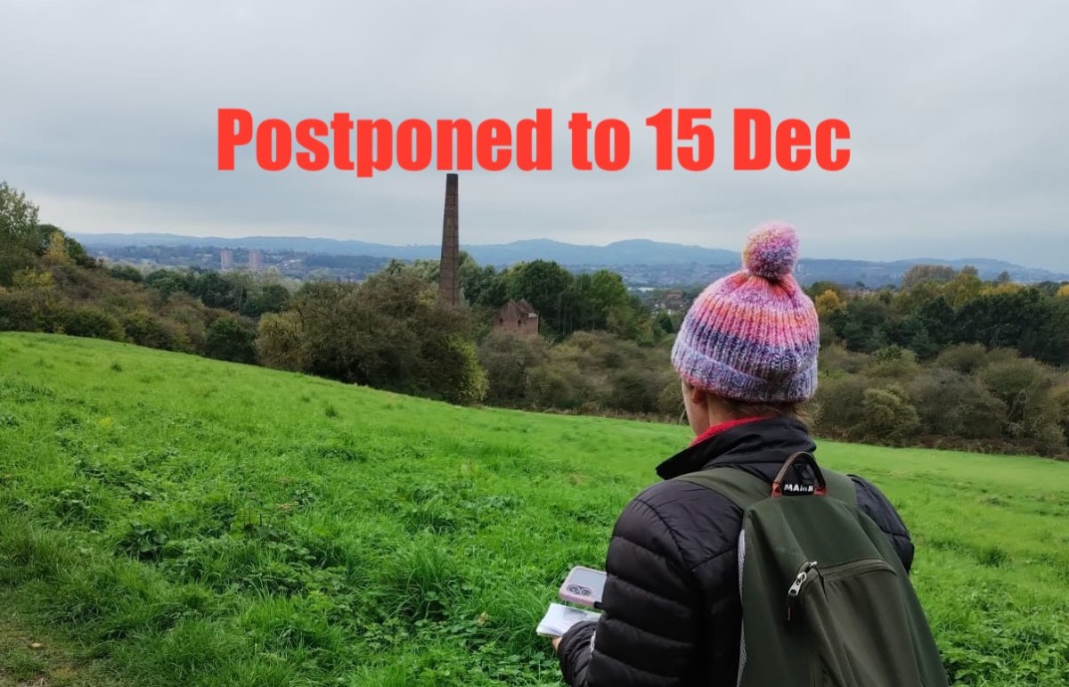
PLEASE NOTE THIS WALK HAS BEEN POSTPONED TO 15TH DECEMBER. IT WILL NO LONGER GO AHEAD ON THE 8TH.
Dudley might not be the first place people associate with hiking and outdoor adventure. It is predominantly an urban area best known for its zoo, museum and out-of-town shopping centre, but there is a wilder, rockier side to the borough too. Dudley’s geography is overwhelmingly shaped by a dramatic hill range spanning over 6 miles from Sedgley Beacon in the north to Rowley Regis in the south.
Reaching heights of over 250 meters above sea level, this rocky ridge contains an abundance of green space amongst the commercial, cultural and residential districts. It’s an extremely rich and biodiverse landscape that does indeed lend itself to the type of outdoor adventuring more associated with national parks and mountain ranges.
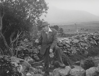
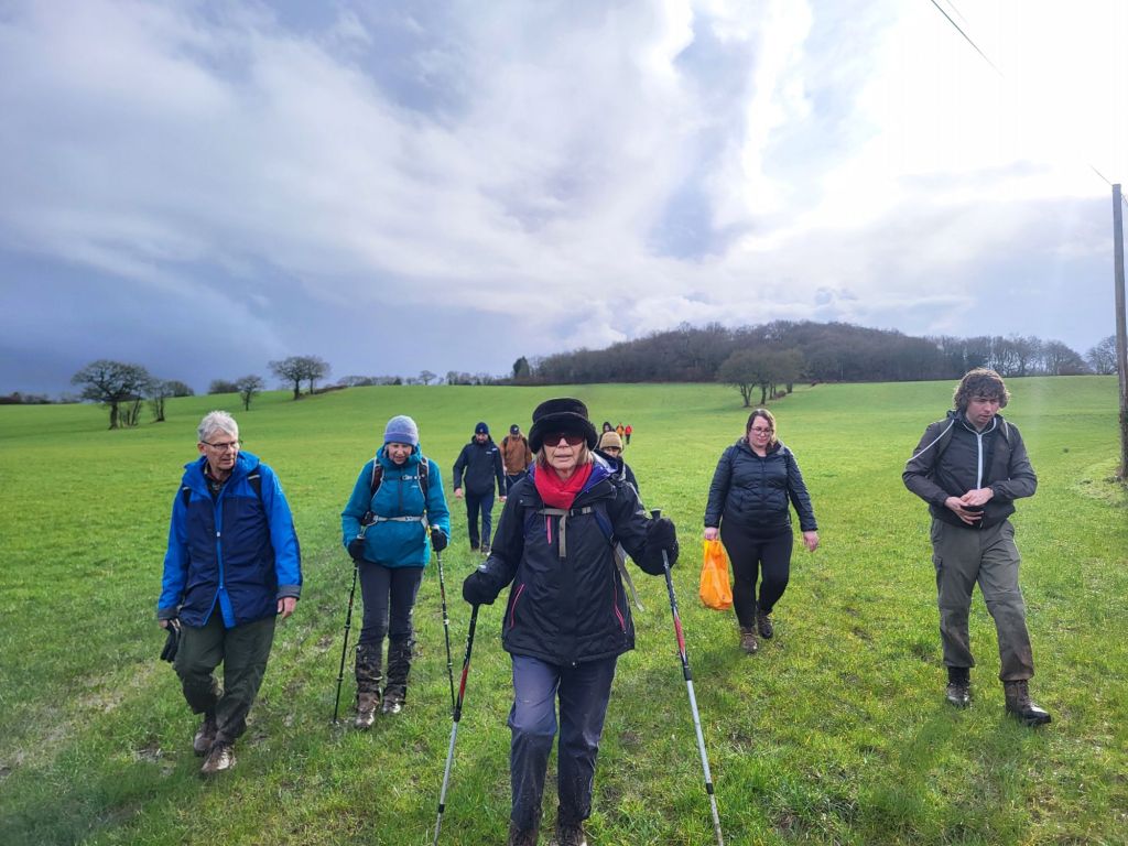
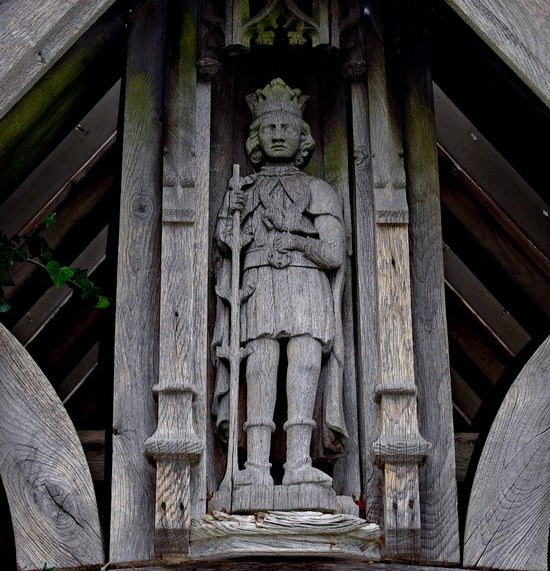
For this public walk, artists Daniella Turbin and Andy Howlett will be demonstrating creative ways of exploring the southern half of the Rowley/Dudley hill range. They’ll be drawing on Daniella’s experience as a long-distance walker and rock climber, and they’ll be taking inspiration from the adventures of Dudley-born mountaineer and peace campaigner Bert Bissell, AKA “God’s Mountaineer”. Please note: no mountaineering experience required! Just a good pair of walking boots.
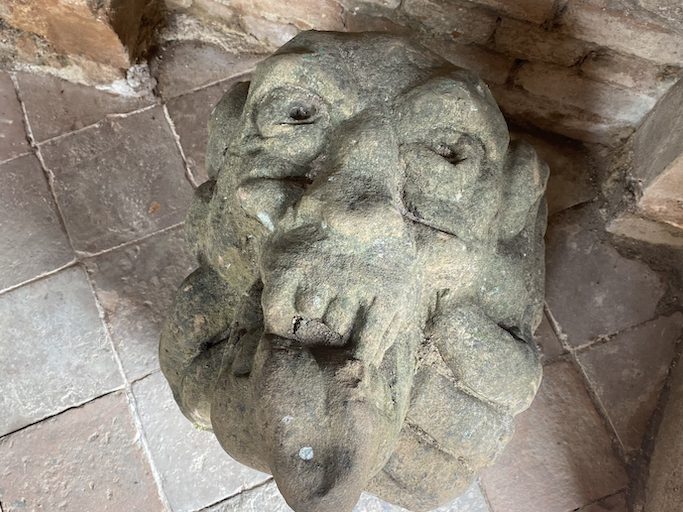
“God’s Mountaineer” Bert Bissell on Ben Nevis
The artists will draw on their creative practices to explore how the remarkable geology of the hills determines so much about the landscape including what sort of plants can grow, how the land is used, what animal species can make their homes here, and even which directions the local rivers flow. They’ll demonstrate the intrigue to be found in the urbanised areas as well as the green spaces and they’ll explore some unexpected connections to other locations such as Ben Nevis, the Humber Bridge and Ancient Rome.
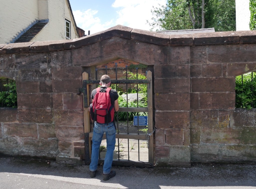
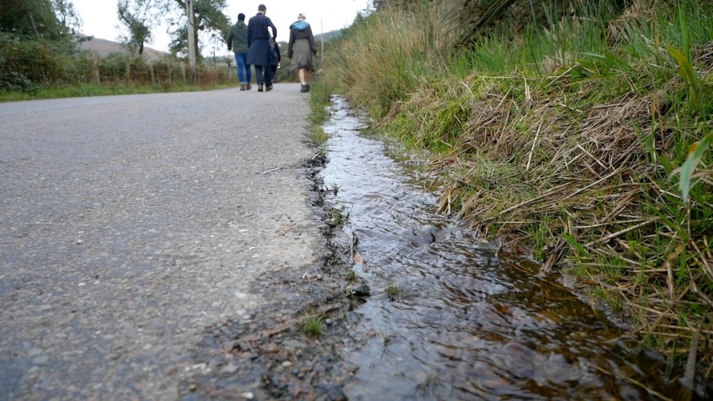
Join Andy and Daniella at 10am on Sunday 15th December (postponed from the 8th) at the Wolverhampton Road entrance to Bury Hill Park in Oldbury, B69 2BJ. The walk is about 5.5 miles long, finishing up at the market place on Dudley High Street at around 3:30pm. The walk is free to attend but booking is essential.
The terrain includes roads, pavements, rocky footpaths, grassy areas, stiles, steps and considerable inclines. Please dress accordingly for a winter walk and be prepared for some muddy sections. Bring a packed lunch as we’ll be stopping for a break at Bumble Hole nature reserve. Toilet facilities can be found at The Lakeside pub/restaurant near the start of the walk (if you ask nicely), at Bumble Hole visitor centre at the half way point, and in various establishments in Dudley town centre at the end.
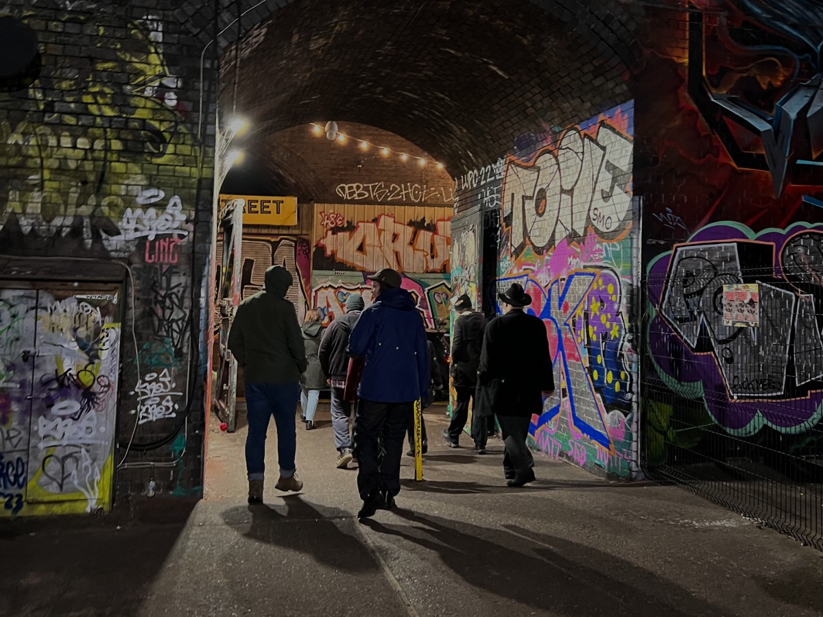
Coventry is a place of striking architectural contrasts where different historical periods collide. This is well known in the city centre where medieval timber framed buildings rub shoulders with Brutalist monoliths, but it’s also true in some of the less visited areas outside of the ring road. The area surrounding Charterhouse just southeast of the city centre is a case in point: a landscape of monuments both ancient and modern where layers of history pile up and overlap.
Charterhouse itself is a recently restored 14th Century monastery and just over the road is a Victorian “garden cemetery” and arboretum built on the site of a former quarry. In stark contrast to these is the hyper-modern Technology Park with its pristine lawns and the colossal waste disposal centre with its belching chimney. Residential estates occupy the sites of former car factories and a Victorian viaduct stands ignored in the woodland.
The landscape tells the story of a rapidly expanding city with ever evolving land requirements. Snaking its way through the confusion is the River Sherbourne and an intriguing network of woodland pathways and tunnels; portals between the different worlds. It’s rich pickings for urban walkers and it’s in this spirit of curiosity that you are invited to come and experience a different side of Coventry.
Walkspace members Adele Mary Reed and Andy Howlett have devised some creative walking prompts to guide the group’s exploration of this fascinating area. The prompts will draw attention to the changing ambiences and unexpected juxtapositions by focusing on different senses and breaking out of our habitual ways of walking.
Meet at Coventry Train Station’s Visitors Centre at 13:30 on Saturday 28th September. The distance is approximately 3 miles and we’ll finish up at the Anglican Chapel for refreshments in London Road Cemetery at roughly 15:30.This is a ticketed event commissioned by Historic Coventry Trust. Tickets are £10 for adults, £5 for under 18s. Walkspace members get a 50% discount (contact Andy or Adele for discount code). Ticket price includes juice, biscuits and hot drinks at the end.
The terrain will be pavement, lawn and woodland with some uneven paths and moderate inclines. Steps will be avoided. This event is suitable for age 12+. Anyone under 18 must be accompanied by an adult. Toilets are available in Coventry Station at the start of the walk and the Anglican Chapel at the end.
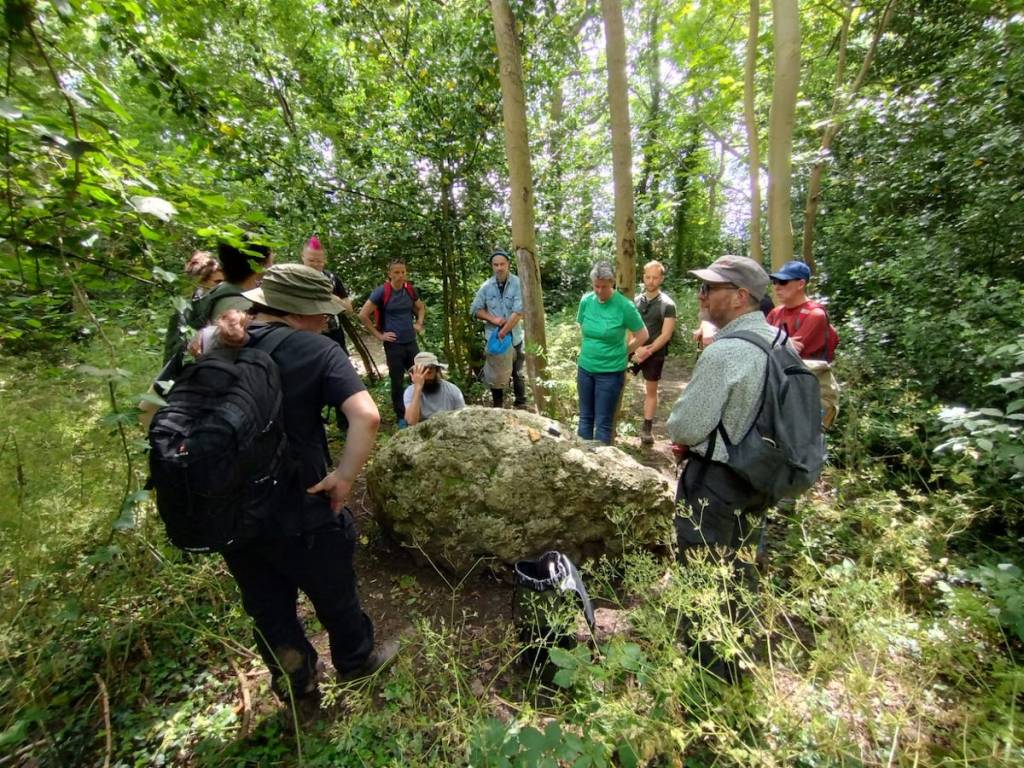
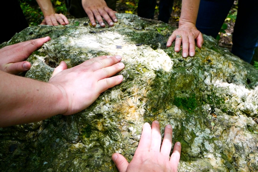
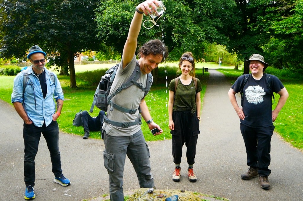
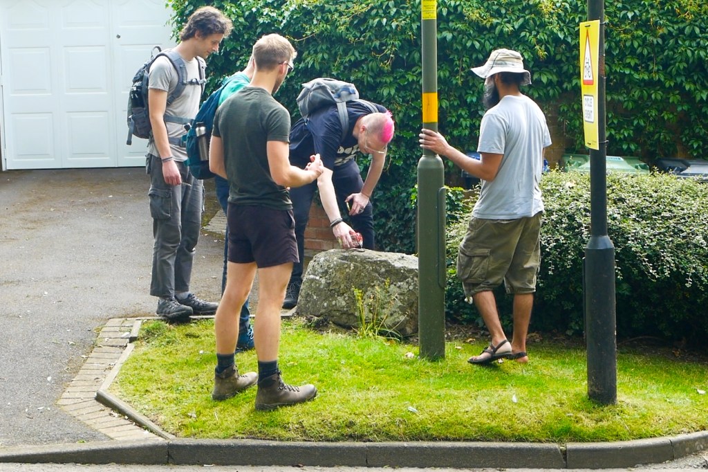
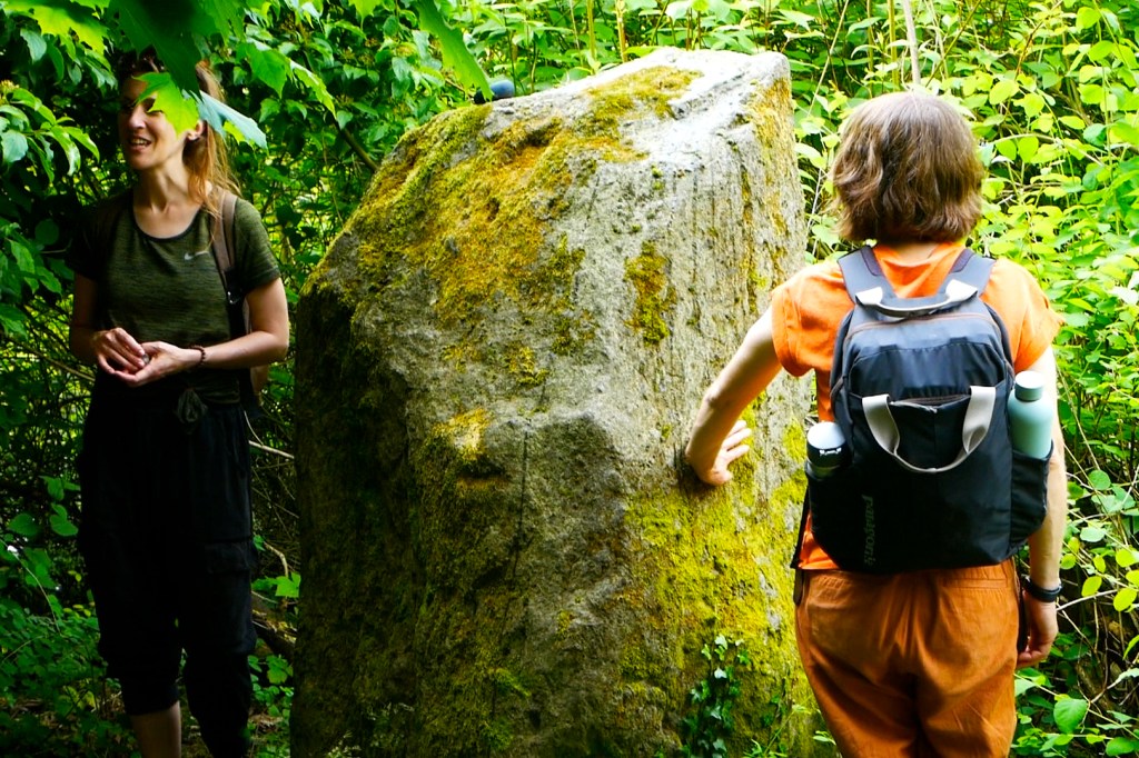
To celebrate the Summer Solstice we walked a new stone circle into existence. The West Midlands may not be as blessed with megalithic monuments as other parts of the country but we DO have an abundance of another type of ancient rock: the glacial erratics which travelled here from North Wales on an ice sheet.
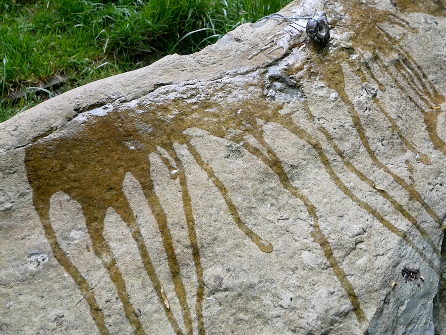
Thanks to the mapping efforts of the Erratics Project we can see that several of these boulders can be joined up in a giant circle. In order to activate this newly discovered ancient monument (several hundred thousand years older than Stonehenge), we walked the entire 13 mile circuit, anointed each boulder and took turns reading aloud The Stone Monologues by Alyson Hallett. We were honoured to be joined by Alyson herself who took a detour on her journey back from Scotland to spend the day with us.
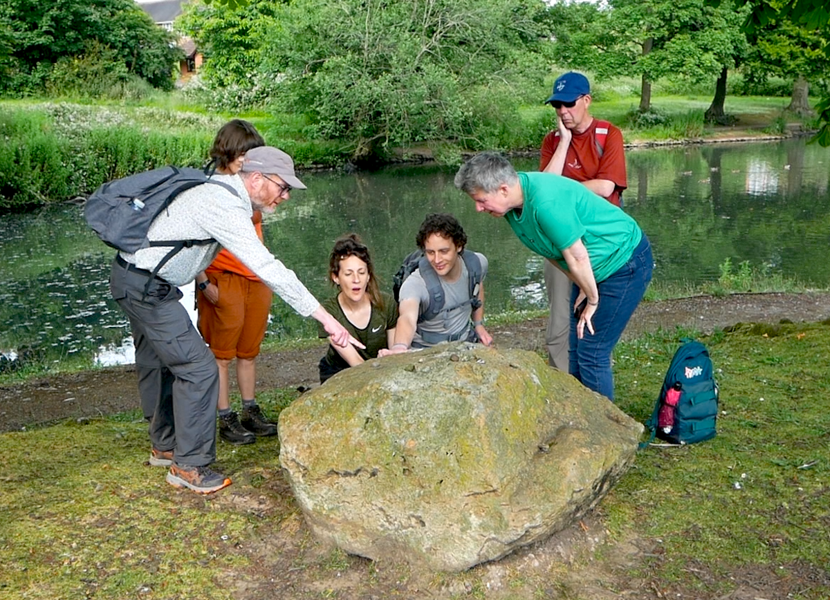
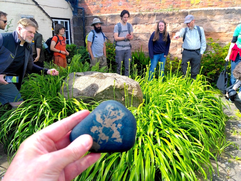
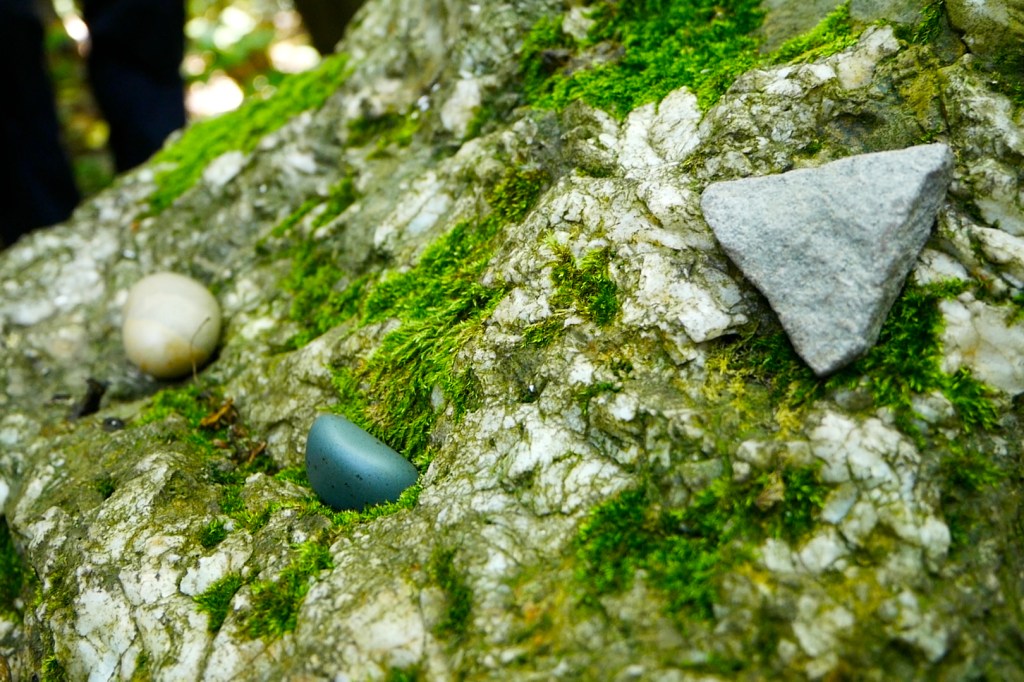
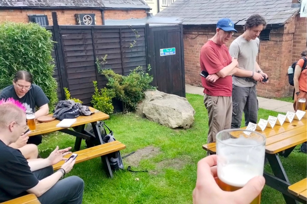
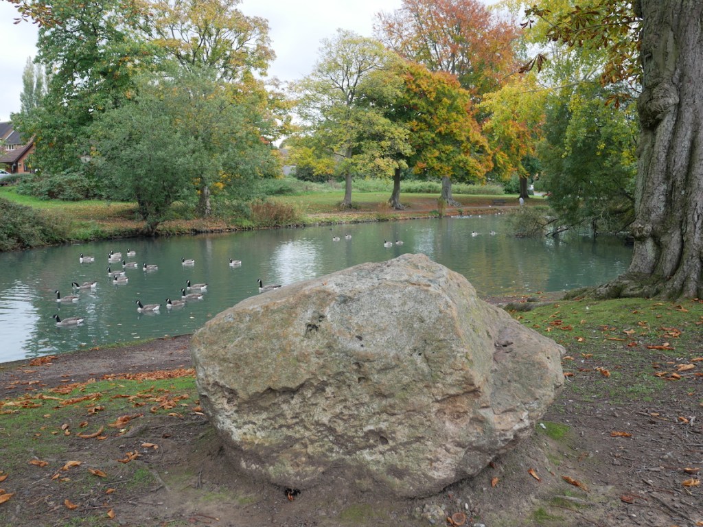
The walk started and finished at The Great Stone Inn in Northfield. This historic pub is custodian of not one but two erratic boulders and the landlady kindly granted us access to the 17th Century village pound which contains the titular Great Stone itself. Participants were asked to bring along a pocket-sized stone of their own and we opened proceedings by placing the stones at our feet, creating a miniature stone circle around the Great Stone erratic.
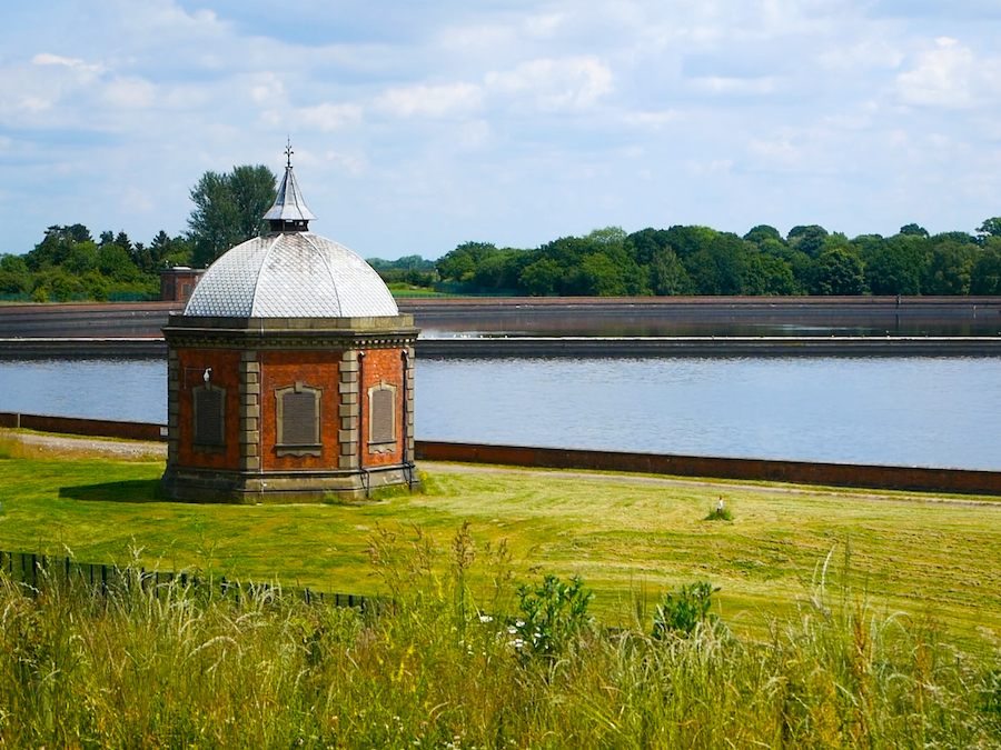
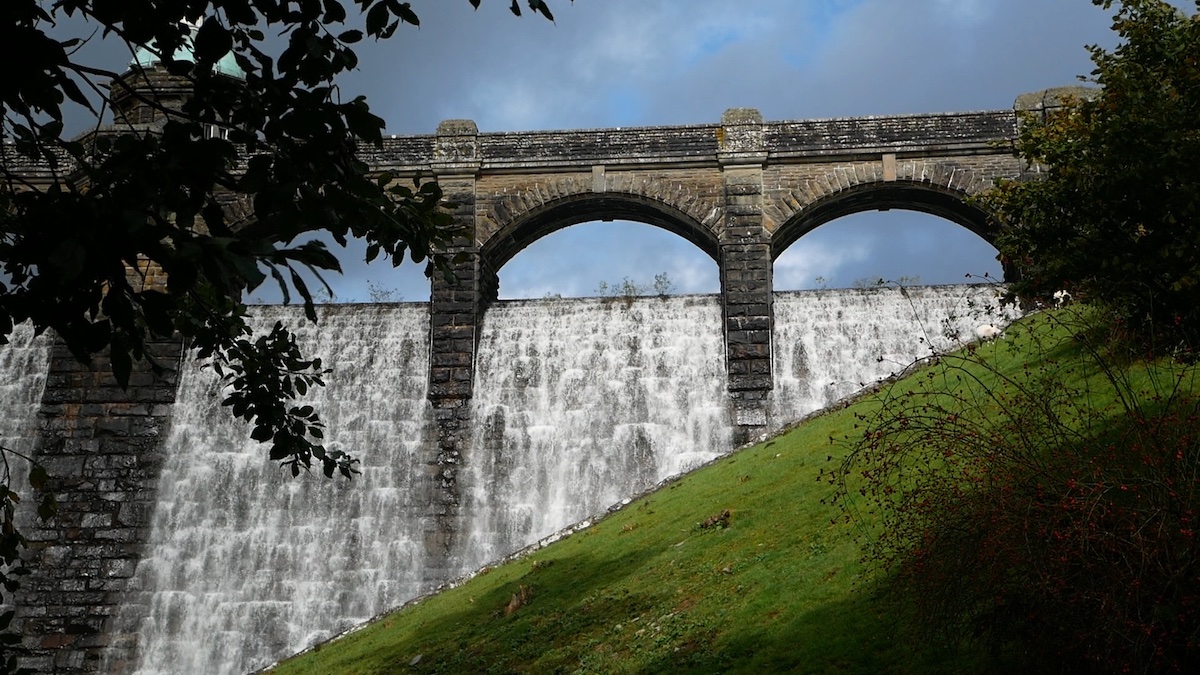
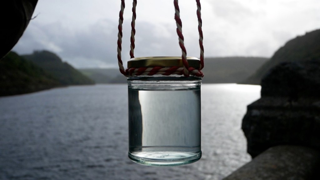
The walk took us close to the Bartley and Frankley Reservoirs, the home of Birmingham’s drinking water. This water also travels here from Wales, in this case from the colossal reservoirs of the Elan Valley. The water makes the 73 mile journey through a huge pipe called the Elan Aqueduct, powered only by gravity. Welsh tap water to anoint the Welsh stones.
The Stone Monologues is a ten part poem written from the perspective of an erratic boulder. Alyson Hallett wrote the monologues after encountering an erratic on Cader Idris and becoming obsessed with travelling stones. Since then she has taken five migrating stones on journeys around the world. The stones have a line of her poetry carved into them and are sited in Scotland, England, USA and Australia. A sixth stone is destined for Ukraine. On all her travels Alyson says she has never known anywhere so abundant with erratics as Birmingham.
Particles of myself ride the wind into homes and hands of strangers. Rain washes me into the earth and the earth’s fast running rivers. I record the touch of a hand, step of a fly, scud of clouds. I have small pockets that catch words from a walker’s lips, light from the moon’s bright lyre.
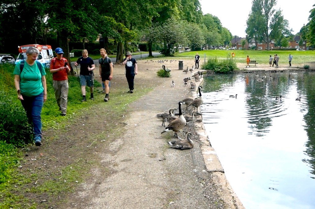
We walked for seven and a half hours in the midsummer heat, arriving back at The Great Stone exactly as the church bell struck 6 o’clock. Pleasingly the final stone sits in the pub beer garden. By then we were ready for a pint. Alyson summed up the day nicely: “it was ceremonial, sacred, fun and I met amazing people. Days like this allow me to experience how poems can come into the communities of more-than-human beings and expand the cosmic soul. Happy Solstice to everyone.”
The West Midlands isn’t very well served for ancient monuments or stone circles. Those wishing to mark the solstices at such sites might have to travel out to the Rollright Stones on the Oxfordshire/Warwickshire border or Mitchell’s Fold on the far side of Shropshire. But what about those of us in the urban centres unable to make such trips? One option is to make use of the municipal stone circles and megaliths which adorn many of our public parks, such as the stunning Bordesley Henge in Birmingham. This is something we’ve done in the past, but this summer we’re going to try something different.
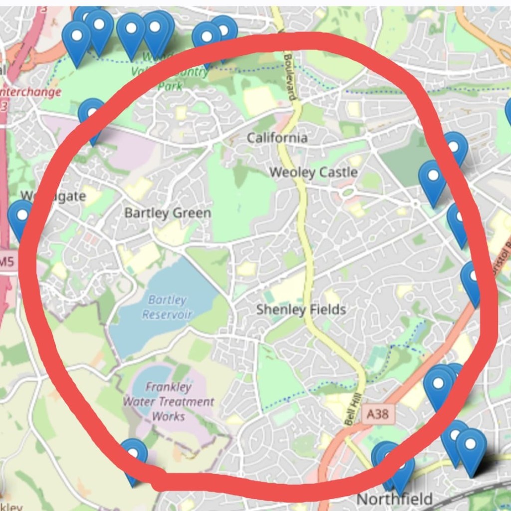
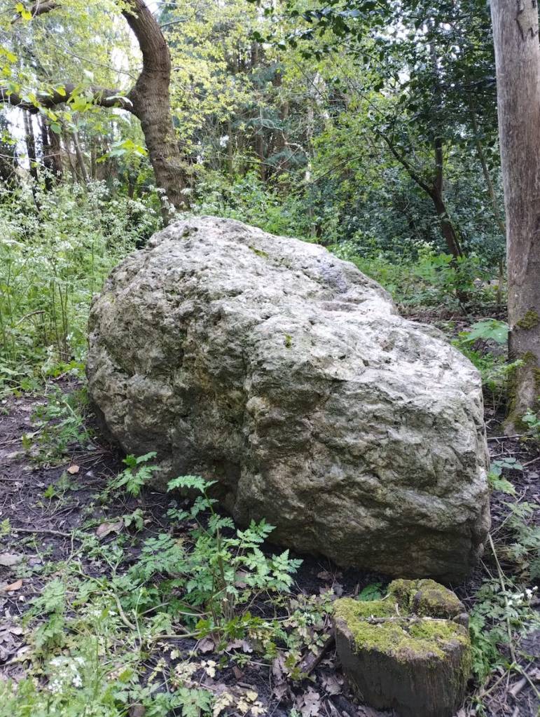
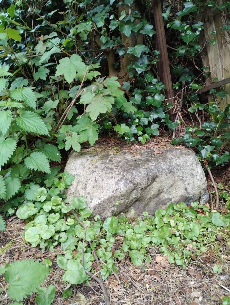
Suburban Birmingham may not be famed for its neolithic sacred stones, but it does contain an abundance of another type of ancient rock. We are of course referring to the erratic boulders which were deposited here by glacier 450,000 years ago. These lumps of volcanic rock travelled from the mountains of North Wales during a severe ice age and now litter the parks, gardens, churchyards and roadside verges of 21st Century suburbia. (For our previous boulder walks see here and here)
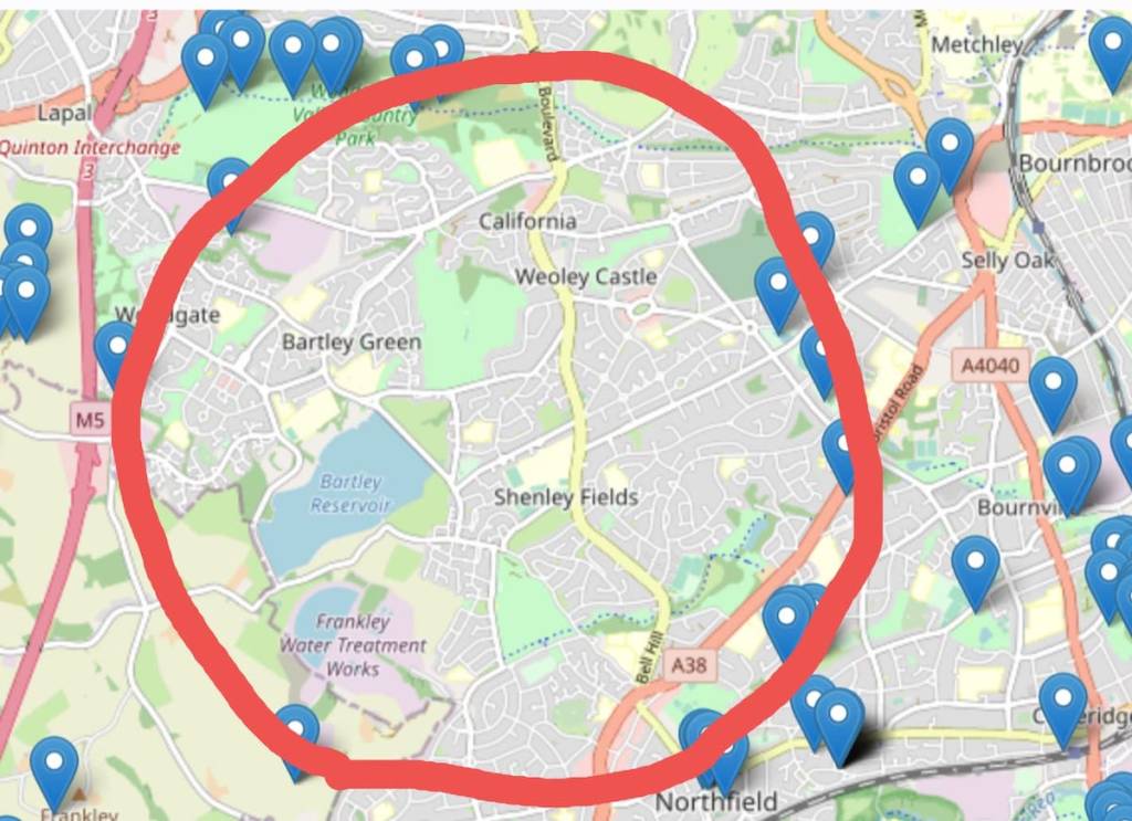
Thanks to the efforts of the Erratics Project, the boulder locations have been plotted on a handy online map. From this we can see that some of the boulders of the western suburbs are arranged in something of a circular formation, albeit spread across many miles. And there we have it. The West Midlands DOES have a stone circle, completely unique and several hundred thousand years older than Stonehenge.
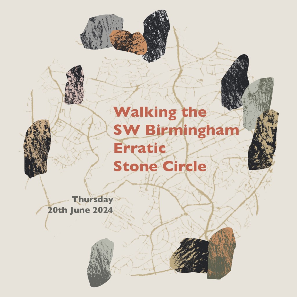
To activate this newly discovered ancient monument we shall walk the entire circuit, anoint each of the 16 stones and read aloud from Alyson Hallett’s “Stone Monologues”. We’re very grateful to the Great Stone Inn in Northfield for granting us access to the historic village pound, home of The Great Stone itself, the first erratic boulder of our walk. The 17th Century village pound was formerly used to hold stray animals but it’s now used for stray boulders and we can’t think of a better place to begin this momentous walk.
At 13 miles this is the longest public walk we’ve ever done so it’s just as well the Solstice happens to fall on the longest day of the year. The walk takes us out to the far western fringes of the city with great views of rural Worcestershire. As well as the historic stones, the route also takes in the Frankley Reservoirs, home of Birmingham’s drinking water; a ruined castle; a holy well; the Severn/Trent watershed; a 12th Century church, and some spectacular views of the M5. We encourage you to bring along a pocket-sized stone of your own for the journey.
Meet outside the Great Stone Inn in Northfield at 10am, Thursday 20th June. We aim to finish back at the Great Stone by 6pm for refreshments and a much needed sit down. Wear your sturdiest walking boots and come prepared for a 13 mile trek through suburbs, country parks and some semi-rural terrain. There will be stiles, steps and some moderate inclines. Bring sunscreen, a packed lunch and PLENTY of drinking water. Please don’t underestimate the challenges of an all-day walk on a summer’s day. Public restrooms are next to non-existent so we recommend walkers of all genders have strong bladders and/or be comfortable finding somewhere to go discretely in the wooded sections.
Book
Please let us know you’re coming by emailing: walkspace.uk@gmail.com
Nine films explore a dizzying array of responses to walking and landscape, both urban and rural. From Rachel Henaghan’s sensual, sensory delight, Elan, to Fiona Cullinan’s witty, super-short Roadwords, from Andy Howlett’s engrossing Escarpment, to Kate Green’s musical Mindwalk.
In Andrew Howe’sCinderloo we delve deep into history, Adele Mary Reed takes us on a visually delightful tour of Coventry whilst grappling with ideas about art and the commons. Fiona Cullinan shows us how it can be to walk as a woman in the world, …kruse takes a surprisingly eloquent pen for a walk, while Simon Jefferies’, WalkaDay is an upbeat celebration of walking and Walkspace.
Saturday 11th May, 7pm. Tickets £6.50 price includes a programme. There will be a licensed bar available all evening.
Walking Shorts is hosted by …kruse who hopes that if people enjoy this sort of thing it might become an annual event, perhaps with talks and walks thrown in too. If you have any queries or questions please email susankruse(at)yahoo(dot)com
Address: Playhouse Cinema, Leominster Community Centre, School Road, Leominster, Herefordshire, HR6 8NJ
Leominster is accessible by train from Birmingham either via Shrewsbury or Hereford. There is free parking at the Community Centre and in Broad st car park, behind the Community Centre.
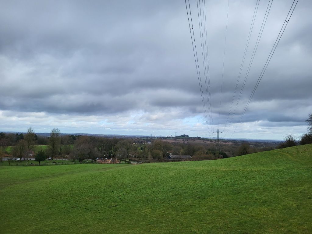
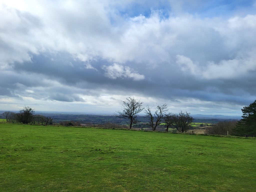
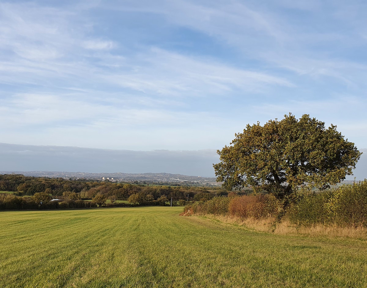
Looking south from Windmill Hill (287 metres above sea level) in the heart of the Waseley Hills Country Park you can see Bredon, Malvern and Abberley, the three great ridges which dominate the otherwise gently hilly landscape of Worcestershire.
To the north and east inside West Midlands county sprawls the raised metropolis of Birmingham and the Black Country up upon the Midlands plateau. Due north of Windmill Hill the towers of Birmingham city centre align closely with the curve of the M5 motorway and the patch of woodland, Frankley Beeches, above a hill straight ahead. To the east lies the craggy boundary between urban West Midlands and rural Worcestershire that are the Lickey Hills. While on the western horizon the towns of the southwestern Black Country, Rowley Regis, Blackheath, Halesowen, Old Hill, Cradley, Lye and Stourbridge, cluster like the names of calling points a railway carriage or express double decker’s passenger information screen. Running up the slopes of Turner’s Hill, the vulcanised limestone, communications masts bedecked, highest point in West Midlands.
Atop Windmill Hill, the toposcope that illustrates all of this in engraved form, was the first calling point of Walkspace’s Severn/Trent Watershed Walk for Terminalia Festival 2024. Occurring on the 23rd of February each year Terminalia is a transnational festival inspired by a Roman god which explores boundaries in all their myriad, fluid, culturally contingent, forms.
Why Walk the Watershed?
This year, in conjunction with Andy Howlett (filmmaker, artist and Walkspace Co-founder), I was pleased to deliver Walkpace’s contribution to the event, which celebrated the Severn/Trent watershed, one of the Midland’s most important and defining geographical features. I have written before about how in broad terms the Severn/Trent watershed marks the boundary between the southern and west parts of the Midlands in the Severn catchment area which are considered more bucolic, even mystical, than the modern modern, industrial and postindustrial, heavily populated River Trent basin. It was this which encouraged Andy to reach out to me about co-producing Walkspace’s Terminalia Festival 2024 walk as he was keen to explore the watershed. Though whilst the walk was initiated and developed by Andy and I, many members of the Walkspace Collective contributed to the event on the day.
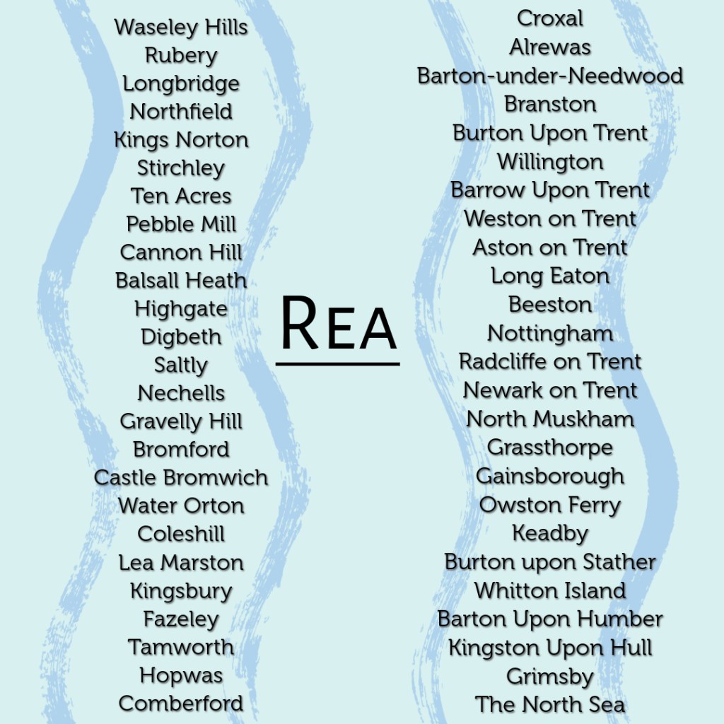
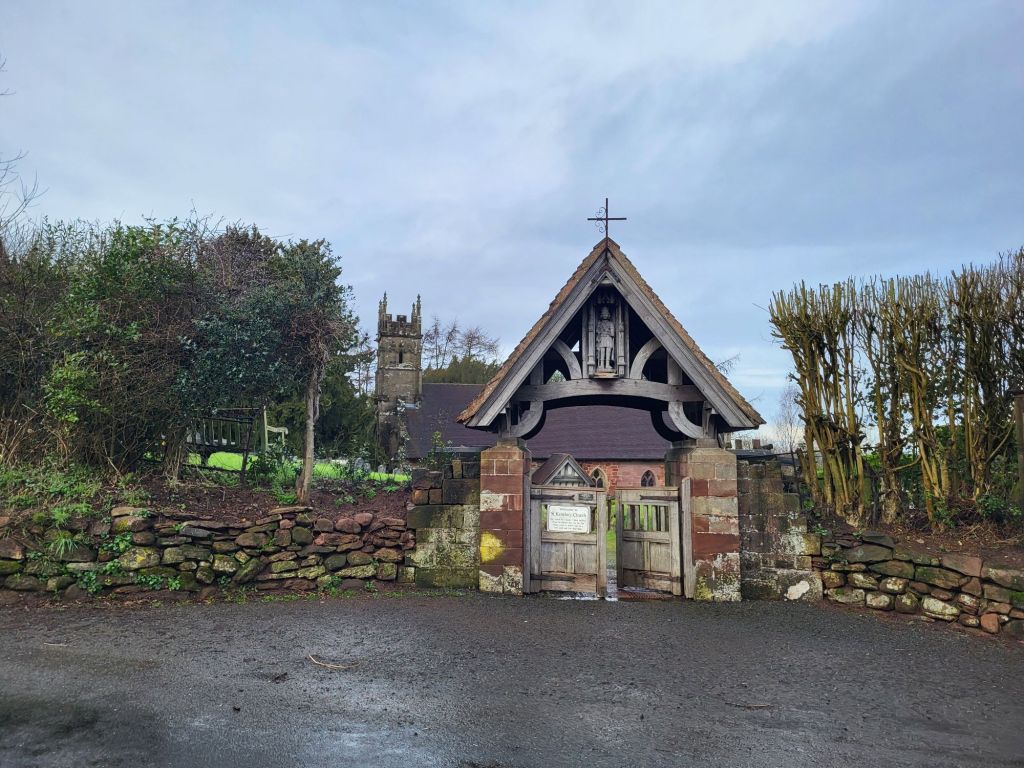
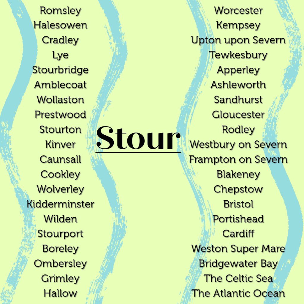
Walking between the two river’s starting points requires a short, but intense, amidst the muddy late-February conditions, hike across quite hilly ground. Rising only two and a half miles apart the River Rea flows north across Birmingham to the Tame, which in turn runs in a northeasterly direction to its confluence with the River Trent, through which it eventually flows out past Kingston-upon-Hull to the North Sea. While from a well behind St. Kenelm’s Church the River Stour trickles forth and commences its journey, wending its way across the southwestern Black Country and out into the Staffordshire and Worcestershire countryside, through Kidderminster and into the River Severn at Stourport. From there the water flows on and out into the Celtic Sea via the Bristol Channel.
The contrasting myths and histories associated with the rivers brilliantly illustrate the contrasting perceptions of the southern and western Midlands versus the north and eastern parts of the region. The Rea is feted as an industrial river. Its waters turned the mill wheels and cooled the metal which drove Birmingham’s growth and expansion as the Midland’s major metropolis. An expansion which led with a certain degree of irony, indicative of Birmingham’s utilitarian unsentimental character, to the Rea being culverted and covered over for large stretches of its course through Birmingham. By contrast, the Stour, flowing through some of the leafier parts of the Black Country and then down through mixed rural and urban terrain in northern Worcestershire, is chiefly associated with the mystical, allegorical, medieval Chrisitan myth of the murdered Merican boy king St. Kenelm. A tale which sounds like it would be more at home in the depths of rural Cornwall, Wales or Ireland, rather than on the skirts of the urban West Midlands.
Windmill Hills’ toposcope handily aligns with the Severn/Trent Watershed. As a cultural and historical appreciator of watersheds, rather than a geographical, geological and hydrological one, I had naturally assumed that crudely speaking water falling on the southern flank of Windmill Hill would eventually run into the Severn via the Stour. While water falling on the northern slope would flow via the initial conduit of the Rea into the Trent. As Walkspace member Robson observed things are not so simple, rather both the Rea and the Stour initially flow north, albeit one towards the east into Birmingham and the other to the west through the southwestern Black Country.
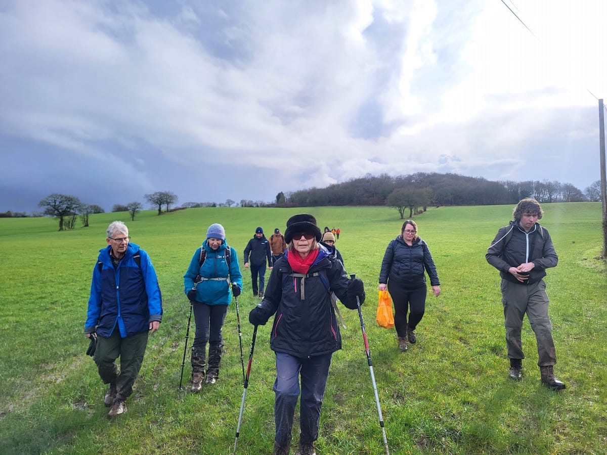
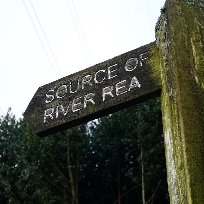
Having clambered down Windmill Hill, the fourteen of us in the party, Walkspace members, and members of the public alike, made for the Source of the River Rea, another of Waseley Hills Country Park’s attractions.
After a brief psychogeographical ceremony and a poetic recital by Andy, resembling in parts a rural North Midlands version of the KLF’s“It’s Grim Up North”, of many of the settlements along the Rea, Tame and Trent which the water would flow enroute to the North Sea, the party set-off to head west leaving Waseley Hills Country Park to cross the M5 into rural Worcestershire.
As many on the walk noted, the M5 is an important barrier in its own right. Indeed if Environment Agency maps are to be believed it runs quite close, even in parallel with the Severn/Trent watershed. Perhaps West Midlands residents are conditioned to associate the M5 with escape through years of West Country holidays? However, there can be no doubt that the majesty and thunder of the river of cars flowing beneath the motorway bridge aside, that the massive road does mark a barrier, both psychological and physical, between the West Midlands conurbation and the rural north Worcestershire countryside.
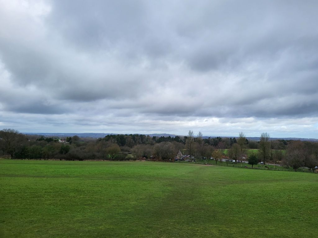
Beyond the M5 the walking party moved into open countryside. Heading downhill towards Dowery Dell then turning left to head up to the hilltop village of Romsley. It is simultaneously a freestanding ancient hilltop village and a suburbanised exurb of Halesowen and the rest of the leafy southwestern Black Country fringe.
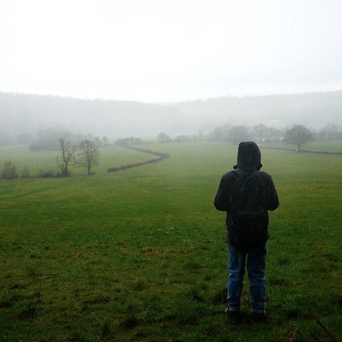
It being February progress was slow across waterlogged fields. Little surprise in a part of the country with rich claggy soil that is the genesis for so many rivers. Then the hail started. A brief pause was made in the car park of the Swallow’s Nest pub, patrons scurrying between the hostelry and their cars eyeing the group with a mixture of respect and pity, before setting up again even further uphill to the southern edge of the village.
Romsley is high up as large villages in England go. The Swallows Nest where we paused stands 241 metres above sea level. Reaching the edge of the village and making good time, despite the mud and the weather, it being the coldest day for at least three weeks, we climbed to nearly 275 metres and the top of Romsley Hill.
Here something went a little bit awry with a footpath not adhering to the right of way, a common problem on the edge of settlements, where villagers tend to carve their own folkways. This lack of local knowledge occasioned a quick scramble across a couple of fields, down into a pretty valley ringed with trees opposite the Clent Hills, and then escape back into human settlement via gaps in a hedge onto a campsite shut for the winter.
Hastily getting back to where we should have been via the campsite’s access road, having deftly navigated a gate, swift progress the rest of the way to St. Kenelm’s Church was made. The walking route was mostly along the capillary thread of bucolic lanes which skirt the Clent Hills.
Reaching woodland beneath the larger of the Clent Hills spectacular views of the hilly southwestern edge of the Black Country came into view to the right. Handily the sun came out just at this point illuminating the varied urban, industrial, yet also highly green fringe of West Midlands county. Pleasingly most of the final stretch of the walk to St. Kenelm’s Church and the well which is the source of the River Stour was across a field with spectacular views towards the nearby conurbation.
St. Kenelm, a Midlands saint subject of a popular quasi-religious legend during the middle ages, can be glimpsed in a lovely, characterful carving on the front of the lychgate into the churchyard.
The church itself is ancient and evidently much added to over the years. Today St. Kenelm serves the parish of Romsley and the surrounding villages, the current building evidently Victorian in part, but with lots of far older components and embellishments. If Wikipedia can be believed the little church’s crypt is formed from the remains of a shrine which lay at the heart of the pre-Reformation cult of St. Kenelm.
After a late lunch, Andy recounted the legend of St. Kenelm outside the church’s porch, before the watershed walking party made its way down to the well behind the church which is the source of the River Stour. Here there was another psychogeographical ceremony, featuring a sheep skull (providentially discovered in a tree during the walk), spreading of flowers, and a recital of the names of the settlement which the water bubbling from the well would flow through on its way to the sea. A jar half filled with water from the River Rea was dipped into the well to capture water destined for the Stour too.
This event was the closing ceremony for Walkspace West Midlands’ Terminalia Festival 2024 watershed walk. Signifying the boundary between the Trent and the Severn had been well and truly crossed.
Here most of the party continued walking straight downhill in the shadow of the Clent down towards Halesowen and private cars, buses and taxis home. Along the way we passed through scuzzy, almost heath-like countryside on the northernmost edge of Worcestershire. This included skirting the fringe of Uffmoor Wood, a scrap of ancient woodland, surviving in the greenbelt just outside the Black Country. The footpath runs close to the gathering watercourse of the River Stour. This contributed to it being very wet under foot. Soon we reached the dual carriageway on the edge of Halesowen and were rapidly absorbed back into the West Midlands conurbation beyond.
A geographical quirk of living in the middle of the country is that half of our rivers flow northeast towards the Humber estuary and the other half flow southwest towards the Bristol Channel. The natural boundary that separates the two catchments is called a watershed. In the West Midlands the watershed lies along the ridge of the Lickey, Waseley, Clent and Rowley hill ranges. Rainwater that falls on the eastern side of these hills ends up in the North Sea via the Trent, whereas rain landing on the western side ends up in the Atlantic Ocean via the Severn.
For Terminalia 2024 we will celebrate this quietly mind-blowing feature by walking from the source of the river Rea to the source of the river Stour. The river sources are only 2.5 miles apart but the Rea springs on the east face of the hills and the Stour springs on the west so the two water courses have drastically different journeys, ultimately reaching the sea over 200 miles apart.
Josh Allen of Walk Midlands (and co-facillitator of this walk) argues that the watershed also forms a significant cultural boundary between the rural southern Midlands, “a land of Morris Dancers, part-timbered buildings, ancient earthworks, 12th Century churches and cider orchards”, and the industrialised northern Midlands, “pockmarked by former collieries and industrial sites, redeveloped as warehouses, retail parks and Barrett houses”. This is reflected in the very different mythologies associated with the two waters: the Rea as Birmingham’s founding river, and the Stour’s role in the fantastical legend of St. Kenelm, Prince of Mercia.
Meet Andy and Josh outside the visitor centre of the Waseley Hills Country Park (B45 9AT) at 12pm, Friday 23rd February. No need to book, just turn up. This is a four mile walk via Romsley and finishing up at Hagley Road on the southwest tip of Halesowen (B63 1DT). This is a walk in the hills so be prepared for some steep sections and muddy conditions. Walking boots advised! Bring a packed lunch and some water. Due to the time of year we can’t recommend ritual bathing but feel free to bring a votive offering of some sort. We aim to be finished by 3pm.
There are toilets and a cafe at Waseley visitor centre and there’s a Harvester at the end of the walk. We can stop half way for a toilet break in Romsley too.The 63 and 61 buses get you close to the Waseley Hills Country Park entrance for the start of the walk. The 4H, 142A and 192 buses can be picked up at the end of the walk for connections to Hagley Station and Halesowen Bus Station. We can advise anyone who needs to get back to Birmingham!
This walk is part of Terminalia, a one day festival of walking, space, place and psychogeography on 23rd February. Terminalia was the festival of Terminus, Roman god of boundaries and landmarks. See what events are happening in other parts of the country here.
In late September 2023, eight Walkspace members took part in a micro-residency at the Elan Valley in Wales, the source of Birmingham’s drinking water. We undertook our journey in the manner of a pilgrimage, carrying with us a jar of Birmingham tap water to return to its source. We had thought we might respond to themes such as sustenance, displacement and extraction, but Dan Carins soon found there was something else bubbling up.Here Dan reflects on day one of our visit and the walk from Rhayader.This trip was made possible with the support of Elan Links.
We would walk from Rhayader to the bunkhouse not far from the top reservoir of the Elan Valley: approximately eight miles through beautiful Mid Wales countryside. We’d be there by the late afternoon and the others would go on ahead by car with our bags and the food we’d just bought. On a mild, sunny day in late September there would be plenty of daylight – there’d also be a kitchen, hot showers, wine and beds with pillows. There didn’t seem much else to worry about.
We five follow the path along a disused railway keeping a brisk pace, and we talk. The conversations skip and jump back, finding grooves of common interest among the frequency of observations. We spot a slow worm (or is it a grass snake?), a face in the front of a church made of windows and the door, maybe that’s a kite circling over a field. Someone runs off to take a picture of a river – a proper river! – and to scrump a couple of the largest pears we’ve ever seen. There are giant mushrooms growing on straight, tall trunks. Lambs’ ears growing alongside the path. There are pines – although we can’t agree on which species they are. I opt for Loblolly, only for the word; later I’ll conclude they’re Scots Pines. I say I’ll point one out when I see one.
I don’t see many, and the few that I spot were probably planted ornamentally – they appear at the end of large back gardens of the houses on the edge of town. Pines used to cover Britain from top to toe, but now I associate pines with Greece or Rome, after Respighi no doubt but I distinctly remember being struck by a row of majestic pines, dark green against a brilliant blue Roman morning sky, probably on the way to the forum – unless that’s the name of a TV sitcom that was old when I was young. With the other fruity chap who wasn’t Kenneth Williams. I spot another pine where the former railway disappears into a tunnel. Maybe it grew there naturally, left alone by farmers and protected by the ghosts of a Beeching line.
The halfway point will be the visitor centre at the first reservoir. We head past the car park straight for the dam further along the valley. It’s here we see the first water and begin to piece together the first blocks of understanding the significance of the trip. The valley below the dam wall, the water above it. The scars cut into the rock on the steep valley sides, the bulk of the dam wall. The sluice at the bottom of the dam, the mass of the reservoir behind it. The broadleaf woods we walked past on the valley floor, the firs high up in the hills behind the reservoir. Two old blokes in flat caps talk quietly nearby as they look out across the sun-dappled water.
A couple try to arrange a picnic on a table whilst their young child, wrapped up warm in a pink puffer suit, attempts to gain their attention. She tugs on her dad’s coat as he pours from a flask. The water in the reservoir makes another persistent tug, relentlessly lapping against the top of the dam wall. The sluice thunders below.
Screenshot
From here, it all looks serene and entirely natural: God’s in his heaven – all’s right with the world. Isn’t that Robert Browning? I once set that poem to music: I was proud of it. No – that was Porphyria’s Lover: the preceding poem in my Penguin Poetry Library paperback from 1992. On a plinth, we read the list of numbers and dimensions from the construction of the reservoir and agree that there’s a lot of water behind the dam, and a lot of men and horses moved a lot of earth and stone to build it. We realise we should make a move if we want to keep to our timetable.
I relax more as the walking begins to feel monotonous. We follow a narrow road around the edge of the reservoir, which stretches out far into the distance. The firs I’d seen from the car park have huge scars carved through them: they’re plantations, of course. Suddenly a raven flaps above, making its ridiculous croak: I thought ravens only lived in the Tower of London, and it turns out I’ve been completely wrong for the 12 years since I took my son there. We spot a small white wooden box marked “FISHING RETURNS” on a gate and speculate as to its purpose. There are few people about. Did Fishing ever leave? Who was she? Thoughts like these pop in and out of my head: they’re welcome distractions. I imagine synapses lighting up as we spark from one subject to another.
When I’m walking alone, I find that the more interesting thoughts quickly bubble to the surface once I’ve stopped worrying about work and daily life admin. The same applies when I’m doing the washing up, or cooking – but walking is much more fun. I can make a walk last much longer. Walking in a group doesn’t have the same effect: either there’s no time for the bubbles to rise to the surface, or I remain guarded and awkward. Or: too many ravens. It makes me realise the sheer weight of the daily life admin, and the pervasiveness of my work. I wonder what might have been: what could I have discovered if I hadn’t wasted half my life thinking about employment numbers of now obsolete companies, or how I could have encouraged them to invest? Too late. My brain now feels sluggish, reliant on the vim at the surface of my memory – whatever’s most recent is what sparks my contributions to the conversation. I get by this way. I feel I never dive down deep and really submerge myself these days. It’s probably why I keep talking about the same things, telling the same stories, and mentioning the same books or music or events. There must be some shockers down at the depths.
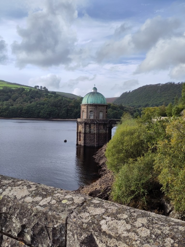
We approach a bridge that crosses between two reservoirs, past the green cupola of what we call “the plughole”. It’s in the distinctive and unique Birmingham Gothic style, straight out of a Wes Anderson film: not quite British, not quite Austro-Hungarian; not quite fin-de-siecle, not quite anytime else. It reminds me of the Palais de Justice in Brussels, not necessarily because of its style, but more its incongruity: its oddness visible for miles around.
I learn afterwards that this bridge runs atop a submerged dam: it makes sense now, but at the time it simply felt like a footpath built for our convenience: so much infrastructure, so little time to appreciate it. I make a mental note to talk to the others at some point about heuristics, my new reductionist Answer To Everything. On the other side, however, I’m interrupted by a more immediate indicator of what used to be below the water: a small church built to replace the one now submerged on the valley floor. Maybe because it’s slightly elevated from the road, or maybe because it’s a building with a dedicated purpose rather than a more general road. Or maybe because there’s a panel by the road explaining the church’s history. Either way, we stop to ponder and think for a while about what may lie beneath. Apparently, Shelley’s uncle owned a property down there. I think of the plughole, and now this becomes a very tangible and probably very concrete, connection between here and all the way back home. It looks tiny as we begin to walk uphill. It’s covered in a metal grille.
I start to think about the monsters in that Douglas Adams novel that think if they close their eyes, they can’t be seen. Which book was it? What were they called? I hate the way my brain instantly tries to shut down gaps in detail and memory, rather than focus on the problem in hand. I’m worried about what lies beneath, not about The Restaurant at the End of the Universe. Bingo! That’s the one. If we can’t see a submerged church, is it still there? Is it still a church? What was lost – for them, or for us? I see a reservoir below me. Before, it wasn’t there, and instead people would have seen a wooded valley either side of a river. Would they have had the same thoughts? Or would they be thinking about getting to church on time, and whether their bonnet was fastened securely enough? We don’t think much about what might have been, but we think a lot about what might be: ask anyone objecting to a planning application for new houses on greenbelt who lives in a house that was built on greenbelt. Ask National Trust members: preserving a particular point in history, rather than what was there before it. It’s called loss aversion – finding a £ in the underground generates less excitement than the annoyance we feel when we lose a £. We keep walking, and I keep my eyes peeled for pine trees.
Screenshot
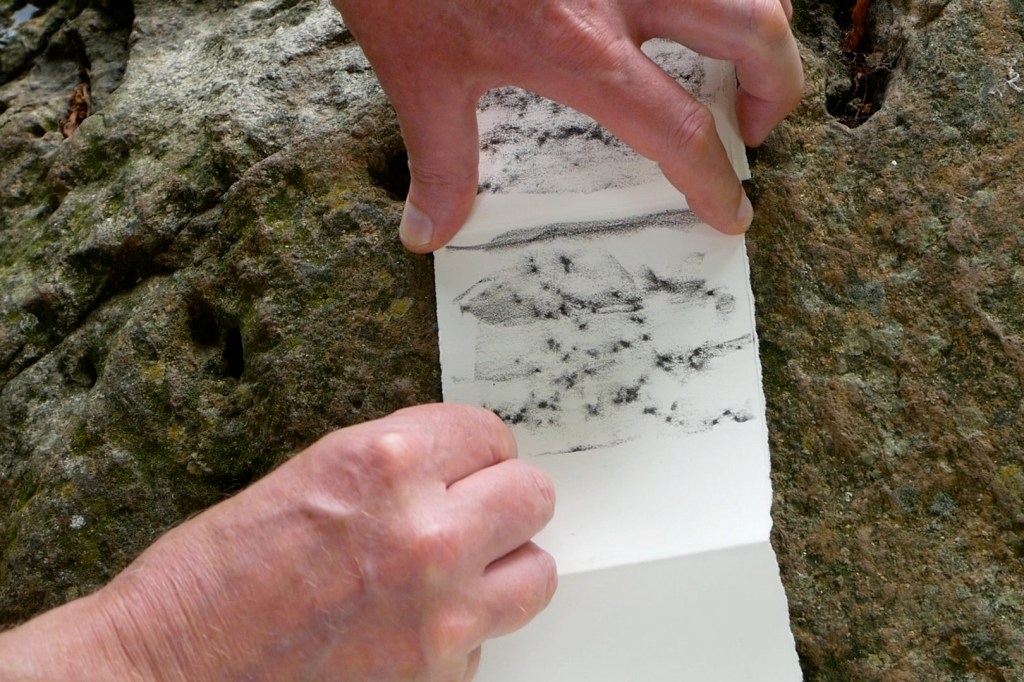
We speak about the project we’ve been asked to complete. I’m minded to prepare some drawings of the reservoirs and dams. Only, drawing water is incredibly difficult. Drawing moving water sounds impossible, especially since my drawing skills don’t extend far beyond buildings and trees. I think about inserting drawings of cross-sections into a model valley made from card, to create a sense of movement, place and scale. This quickly turns into a simple V-shaped structure once I realise how difficult making a paper model of a valley will be. I’ll worry about the purpose later: for now, I’m eager to think of what I can draw.
Pine trees feature highly, but I need broad vistas. I scout the horizon. I’m grateful for this: before I started drawing, I would look around, and up, but I’d be looking for the economics, the human geography. I’d be looking for the implications of public policy on the built environment. I’d be looking because of my work. Whilst interesting, it also feels remarkably limiting – or futile. So what if I notice the layouts of factories along the Colne Valley, or observe the customers of retail outlets in North Norfolk? They might help me relate to someone at an event or talking to consultants. But ultimately, no one cares. Meanwhile, I’m not paying attention to whoever I’m with because I’m too busy noticing the flows of stock or material, and observing people spending money they don’t have. Starting to draw gave me a different incentive to pay the same attention to detail, but with a far more modest and practical purpose: subject matter for sketches. At this point I’m less interested in aesthetics and composition, and more about whether I have the technical skill to draw places faithfully enough to resemble the real thing.
And so I look. After a while, it stops me thinking. And when I stop thinking, more thoughts rise to the surface. Different thoughts. Thoughts that were lying further beneath the surface and which haven’t seen the light of day for a long time. These in turn, give me new perspectives on what I’m looking at, which generate novel thoughts. There must be an awful lot buried down there.
I’ve been reading about how stress and trauma can alter the shape and form of our brains as we learn to obfuscate, ignore memories and associations, and try to skirt around the past or to ignore it altogether. What was past is past – how we remember it is plastic, as are our brains. We assume that the past is singular: that fact is fact, truth is truth and history is history, like we think time is precise and measurable against a universal constant. But if our brains change shape and form, then so must our memories, and so must our pasts.
Is their knocking relentless, those memories against my skull, but so quiet I don’t notice? Or do they remain silent, waiting to be unearthed? It often strikes me how memories can appear so suddenly, apropos of nothing – or so it seems. Had the “so it seems” always been there, a frantic semaphore, desperate to bag my attention? For how long? Does it get tired? Or had it in turn been triggered by something else? Do we knock holes into our brains by repeatedly ignoring memories: like the shapes eroded into tree canopies by dozens of buses passing each day – we grind them down until they disappear. But their outline will give them away, like how rain won’t fall underneath a man wearing a cloak of invisibility.
Screenshot
I’m sure dreams operate in a similar way: we create our dreams after we wake, grabbing memories from whatever is near at hand. This to me explains why some people’s dreams, when they recount them, last for ages: it strikes me as implausible that people were dreaming for this long. The silence of the surroundings lulls more and more memories from the depths as I walk. We’ve grown quieter now: possibly increasingly anxious of the lateness of the afternoon and how much further we still have to walk; possibly due to the seemingly endless stretch of regimented fir trees (they’re not Scots Pines, that much I know) creaking alarmingly in the breeze.
The reservoir narrows on our left as we continue. It’s not far now. I think of the volume of the water, the force this must exert on the dam walls, the calculations required, and the compasses and slide rules the clerks and engineers must have used in stuffy, gaslit offices back in Birmingham. Weight and mass and volume. Resistance. All of which must equal an opposite force = a lot of stone hewn from the valley walls, a lot of navvies and horses hewn from villages and towns. That gentle lapping now feels more mechanical: did they calculate for erosion and decay? How long will the dams endure?
We spot the others coming by car the other way. We realise how long we’ve been taking, and how bored they must be waiting for us: they’re off to try some bouldering. They tell us it’s only around the corner. My arthritic toe hurts.
Screenshot
I have a sense of what lies beneath. Or rather, I have a sense there must be something below the surface. I know there are leaks which erupt now and again. I know I have triggers, and I know there are topics of conversation that are taboo or make me tense. Maybe I was too young. Maybe I’ve created monsters that aren’t there, for lack of anything interesting to say. I think again of the grille covering that plughole, and of the void behind it: 70 miles of slime-covered pipes drawn up by dusty Leonard Bast clerks taking the water to my taps, or the black hole of trauma. Which could it be?
It turns out to be much further than “around the corner”, but we eventually arrive at the bunkhouse long before the sun sets. We cook. We eat. We sleep. We talk some more. Over the next day, those dam walls get bigger and bigger the further and further we walk up the valley.
“The lost city. I never knew another person had seen it. The black towers. The flames in the windows. I never knew how to get there. But it has to be through another city, like this one. Do you think we could find it together?”
Passing between different worlds is a recurring theme in the work of the late Birmingham based author Joel Lane. Life and death, dreams and reality, cruelty and compassion – all are fluid in his dark and disturbing universe. References to veils lifting and doorways opening appear frequently in his tales of misfits and outsiders desperate to transcend their surroundings.
Canals also feature prominently; in particular the Grand Union Canal which passes through Digbeth. In Lane’s world, the canals are places of transgression, excitement and danger but also a connection point to an ever-present industrial past.
“What are the canals, do you think? A bit of random heritage, a scar tissue under the roads? I can tell you it’s more than that. It’s a palimpsest. A map of industry… and beneath that, the key to another world…”
Whether you’re a diehard Joel Lane fan or if you’ve never heard of him, this twilight walk around the backstreets and towpaths of Digbeth will connect you to another world. A world of artist communes, ghost barges and strange rituals.
This walk is part of The Witnesses Are Here: a weekend celebration of the life and work of Joel Lane hosted by Voce Books and Influx Press, 11-12 November. Tickets are £8 for the walk or £20 for the entire weekend.
The Witnesses Walk starts and finishes at Voce Books, 54-57 Allison Street on November 12th.Arrive at 3:45pm for a prompt 4pm departure. We aim to finish by 5:30pm with the option of going to a pub for a post-walk pint.
This is a walk event taking place at twilight & taking in a series of urban terrains, including canal towpaths. Please dress accordingly for the time of year & we advise wearing suitable footwear.
Grand Union Canal cutting just north west of Hatton in Warwickshire. Authors Photo January 2022, all rights reserved
Just over two years ago I embarked on a voyage of discovery in a part of the UK where there is only one scrap of coastline. A project called Walk Midlands (NOTE: that this is distinct from Walkspace, of which I am a proud member). This sees me – usually on a Friday – embark on a walk somewhere in the English Midlands, which I then write-up and share with the world via the Walk Midlands website, social channels and in the form of a monthly digest via the Walk Midlands Newsletter.
The project is first and foremost a practical walking guide for those interested in day walks that they can do without a car in the English Midlands. It is also a kind of reflection upon how we live now, a means of telling stories from history and a mediation on the landscape and topography of the central part of England, that comprises the bulk of the mighty River Severn and Trent catchment areas.
River Trent in south Derbyshire looking east towards the disused cooling towers of Willington power station near Repton. Author’s photo March 2022, all rights reserved
It is a natural extension of my practice as a journalist and creative non-fiction writer as well as my commitment to a form of politics where, to improve the world around you, you first have to understand it. This comes through in the choice of walks, which provide routes for non-drivers to access historical sites, culture and beauty spots across the English Midlands. As well as in the introductions which frame the walks, short, accessible, magazine style texts which explore all manner and facets of the Midlands region.
It is these components which attracted me to Walkspace. If one thread unites the medley of walking artists and other creatives comprising the collective, it is an orientation, perhaps even a compulsion, towards using walking as a means of tilting the everyday world 90 degrees and looking at the familiar askance. Walk Midlands, I hope, does it in spades and provides all those who appreciate and are intrigued by the English Midlands with a new route to explore it every week.
Why walk the Midlands?
There is a story I have told many times about Walk Midlands’ genesis. Like many of the best stories it has the benefit of being true. It goes like this: in the summer of 2021, struck down with a bout of COVID-19, thankfully not very ill but having to isolate, as the days of quarantine passed so the desire to go out walking grew in my mind. While confined in this way a project swam into focus which would give me an excuse to go on walks each week; that project became Walk Midlands.
I set out on my first walk, a triangular shaped stroll from Kidderminster to Stourport-on-Severn and back via Bewdley as soon as my time in isolation ended seeking to walk off the effects of ten days confinement. This walk was undocumented, but convinced me the basic concept of a website with a new walk each week, somewhere interesting in the Midlands, doable by public transport, was viable.
View looking north along the Malvern Ridge, right on the boundary between Herefordshire and Worcestershire, with British Camp and The Beacon clearly visible. Author’s photo August 2021, all rights reserved
My next two walks, along the Malvern Hills ridge between Ledbury and Great Malvern, and tracing the route of the “Lost Lapal Canal”, followed soon after. Looking back at those early walks now – and other ones created near the start like Halesowen to Tipton – it is readily apparent that I had not quite got the style right. Interestingly, I think that it first came together when I segued to the East Midlands and out into bits of the rural West Midlands which I did not know very well, if at all. It was the experience of discovering the feel, stories and what is interesting about places like Wirksworth or its neighbour Cromford (for instance) which I knew only from web pages before visiting, which taught me how best to structure the individual posts. Making them effective in terms of what would be useful to have photographs of, how to write the walk notes, and explain regarding the public transport connections, etc. It is fair to say that voyaging in more “distant” parts of the region taught me how to write about more familiar places.
I had several reasons for wanting to get to know the Midlands region and help others do so too. The most simple was basic curiosity. Having got into walking, I was keen on getting to know the “near abroad”. A concept writer, filmmaker and retired restaurant critic Jonathan Meades has spent the best of three decades exploring, making many BBC TV series, consisting of taking off-kilter deep dives into provincial England along the way.
The late, lamented The Crooked House pub, located just inside Staffordshire on the edge of the Black Country. It features prominently at the start of Jonathan Meades’ “Get High” (BBC2, 1994). Author’s photo March 2022, all rights reserved
And there was also a political motivation, rooted in the politics of the late 2010s, shaped as it was by the Brexit vote and the wildly different electoral outcomes of the 2017 and 2019 Parliamentary General Elections. Like many people this whirlwind, and the onslaught of COVID with all the separation that induced, left me wondering how much I actually knew about the country which I had now inhabited for a whole generation’s worth of time. This led me, returning to the concept of “near abroad”, to decide that given there is no way anybody can get to know as tightly packed, variegated and fissiparous a country as Britain in its entirety, that instead I should strive to better understand nearby parts of the country. Albeit beyond the archipelago of southern and central Birmingham, other regional city centres, and university campuses which I broadly consider my usual habitat.
Walking and storytelling
A third motivation, also political in character, relates to the walks on Walk Midlands themselves. Each walk is preceded by a contextual essay, typically pretty short and to the point, but in other instances more expansive. These usually take the form of a story, typically historical in nature. My primary intention with these is a form of light infotainment for readers. Hopefully they get enjoyment from reading the pieces and finding out a bit about facets of places, probably not too far from where they live, which they could visit on foot.
View from the top of Kinder Scout in northern Derbyshire looking south and west. Author’s photo April 2022, all rights reserved
And there is a serious component to this exercise too. Browsing Walk Midlands you will encounter stories about the role of extractive industries, the factory system, and the industrial revolution in the creation of the modern Midlands. As well as those like the followers of the (probably fictional) General Ned Ludd, who purportedly hailed from Anstey just north of Leicester, who have challenged capitalism since it emerged fully fleshed in the 18th Century. Alongside an older, yet also highly contemporarily resonant history of resistance and rebellion to the privatisation and enclosure of public space, from the “Midlands Revolt” of 1607, through 1932’s Young Communist-led Mass Trespass of Kinder Scout, to 1992’s 40,000 strong Castlemorton Common Rave. This is not to say stories associated with some of the Midland’s famous monuments to aristocratic, ecclesiastical and capitalist wealth and power are not told. They are present and correct, their stories narrated from the standpoint of the people whose labour – whether in the Midlands or overseas – generated the resources and wealth which made their construction, and ongoing upkeep possible.
View across Castlemorton Common west towards the Malvern Hills. Author’s photo May 2022, all rights reserved
Perusing the walks and getting out on foot to visit key locations, gives readers a better sense of the extractive and exploitative processes which have shaped the contemporary Midlands over millennia. Regimes of power which have damaged ecologies and the regulatory systems of our planet alike, while also restricting freedom and ensuring material want amongst the majority of people. Through the decidedly middlebrow medium of a local walking website, Walk Midlands helps readers discover how this is played out in their region. While also, more positively showing how people in the Midlands, whether individually or collectively, have always come together and resisted.
Walking the Midlands without a car
Another unabashedly political facet of Walk Midlands is the fact all the walks are doable without a car.
There is a practical reason for this which relates to the fact that I possess neither a driving licence nor a car. This was one of the practical drivers of the project. For years there were places in the Midlands which I had wanted to visit, but which due to my lack of a car or ability to drive seemed out of reach, meaning I was dependent upon talking automobile friends into accompanying me. Nearly a quarter of British households lack access to a car, so I figured that I was far from the only person who would like a website explaining how to get to far-flung sites and attractions by public transport and on foot.
Bus stop next to the village hall in Millthorpe, northern Derbyshire. Author’s photo October 2022, all rights reserved
Underneath Spaghetti Junction between Aston and Gravelly Hill in north Birmingham. Author’s photo April 2022, all rights reserved
Decisions about how we get about and the transport technologies our society is constructed around are political. Fundamentally determining whose needs and interests lie at the heart of decision making, whose needs are subsidised and whose are ignored. My lack of ability to drive and access to a car is simultaneously due to a learning disability I possess, which would make it pretty tricky for me to learn to drive, and a personal choice: a conscious decision to reject the polluting and atomising impacts of personal automobility.
In this way Walk Midlands’ inherent bias against the driving and driver-centric way in which so much of our society is organised becomes political. How could questions about access and the distribution of resources not be? Just contrast the vast resource in terms of tracts of land given over by the National Trust and English Heritage at their properties and beauty spots with the intensely squeezed financial resources local councils have to subsidise patchy, often to the point of non-existent, bus services outside major urban areas.
What I have discovered walking the Midlands
One of the key things of course, when I embarked upon the Walk Midlands project, was getting to know the region better, and on the most straightforward of levels I feel that I have been repaid in spades.
Looking north towards Staffordshire’s Weaver Hills. Widely accepted to be the base on the Pennine range which run for over 300 miles from the English Midlands to southern Scotland. Author’s photo June 2023, all rights reserved
Earls Barton parish church in southern Northamptonshire. The tower pre-dates the Norman conquest. My Grandma’s family lived in the village for generations as did she till her 18th year. My Grandma and Grandpa married there in 1951. Author’s photo February 2022, all rights reserved
Other discoveries relate to the varied fabric of the region. The difference between the culturally vibrant centres of Birmingham, Coventry, Leicester, Nottingham, Derby and their hinterlands. Hinterlands which are a mixture of incredibly affluent, seriously in need and very everyday in terms of how they feel to a visitor passing through. Whether in Wirksworth, Ledbury, Edwinstowe, Upton-upon-Severn or Ironbridge the small towns of the Midlands can also be vibrant, sometimes quirky, but in a very different way to the major cities, or lively small ones like Worcester or Shrewsbury.
Side street in Wirksworth mid-Derbyshire, the town is the county’s ancient lead mining capital and home to a major annual arts festival. Author’s photo November 2021, all rights reserved
Rural parts of the region are now distinguished in my mind by the quality of their walking infrastructure and the amenities in their villages. Worcestershire has copious footpaths and is a patchwork of little villages; it is one of the most scenic, deeply mythical and interesting of the Midlands counties, but its network of stiles, waymarks and footbridges across the county’s copious ditches are often very poorly kept. Neighbouring Shropshire, Warwickshire and Herefordshire are far better on this score.
Most of Worcestershire’s villages are now utterly lacking in amenities; by contrast little Herefordshire next door, far more sparsely populated, tends to have tiny community shops dotted here and there serving locals and passing walkers alike.
It is a similar story with public transport. Despite the horrendous cuts of the last decade some counties like Derbyshire, Nottinghamshire and Warwickshire have managed to retain fairly comprehensive, reasonably frequent networks. Shropshire, Herefordshire, Staffordshire and Northamptonshire present a very mixed picture, while Worcestershire, again, seems to now be largely without buses outside of Worcester and the larger towns.
Walking watersheds and administrative regions
Individual local attractions and the quality of public infrastructure and amenities in the era of public austerity and internet capitalism aside, perhaps the most incisive thing I have discovered walking the Midlands is a stronger sense of how the region should be chunked up.
There is a certain logic to the traditional division, crystallised by the creation of government regional offices in the 1990s, but in practice dating back at least as far as the Norse Invasions in the 10th and 11th Centuries, of talking about the East and West Midlands as distinctive entities. However, I have in writing up Walk Midlands walks chosen to present readers with the hazier, less definitive, unofficial sounding “eastern Midlands” and “western Midlands”.
Footpath waymark in the Wye Valley just south of Ross-on-Wye (well over 20 years old) bearing the name of the short lived Hereford and Worcester County Council. Author’s photo February 2023, all rights reserved
Administrative divisions are a useful frame of reference and explain a little bit about the provision, or lack of provision, of public amenities. However, they’re ultimately just lines on a map. A mixed inheritance that is the uneasy marriage of Medieval landlordism and the modern bureaucratic desire to create easy to file units. One Walk Midlands walk, an admittedly relatively lengthy and at times circumlocutious 11 miles from Tamworth in Staffordshire to Moira in Leicestershire, passes through four counties, and crosses a regional boundary, twice.
Moira Furnace in north western Leicestershire near the heart of the National Forest. It only briefly operated as an iron furnace in the early 19th Century, but survived and was restored along with a short stretch of canal in the 1980s. Author’s photo February 2022, all rights reserved
Far more important I now feel is the division between the land comprising the Trent watershed and that where rainfall ends up in the River Severn. Crudely speaking the Trent and Severn watersheds comprise respectively the more northern and eastern and the more southern and western halves of the area commonly considered the English Midlands.
As a rule the counties which drain into the Severn, such as Herefordshire, Shropshire, Warwickshire and Worcestershire, are more sparsely populated and agricultural in terms of both their traditional and contemporary cultures. By contrast the land drained by the River Trent comprising counties such as Nottinghamshire, Staffordshire, Derbyshire, Leicestershire and the vast majority of the West Midlands conurbation, is more industrial and urban in terms of past and present alike.
Of course this is a crude schema, Shropshire has a long history of coal mining, while the Midlands section of the Pennines is firmly in the centre of the Trent catchment area. Lincolnshire, however, offers a case in point, being a sparsely populated agricultural county drained partly by the Trent, albeit one where agriculture is perhaps more mechanised and industrial in terms of its scale than anywhere else in the UK.
Contours of Banburyshire, Greater Nottingham and the conurbations bookending Staffordshire
Exploring the Midlands slowly and meticulously on foot also leads to other schemas materialising for dividing up the region. The jokey local name “Banburyshire” for the uplands, partly in the Cotswolds, in the far south of Warwickshire, south western Northamptonshire and northern Oxfordshire, turns out to have a lot of grounding in topographical fact.
Likewise, Nottingham is officially only the fourth largest city in the Midlands, despite having the feel of a far larger place. This discrepancy is explained by the fact that the city lies at the heart of a decentralised conurbation, sprawling to the north of the city and west into Derbyshire, which in practice is actually home to around 700,000 or 800,000 people.
Rainborough Camp near the southwestern most tip of Northamptonshire. Firmly part of the “Banburyshire” topographical region embracing the northern Cotswolds, north Oxfordshire and south west Northamptonshire. Author’s photo December 2022, all rights reserved
Being from the eastern half of West Midlands county it is easy to read, hear and consume visual media about just how varied the Black Country is while seldom experiencing it. However, whenever I go out and about on foot, I am always amazed by the sheer plethora of Black Country sub-regions. Dudley’s green fringe is very different from the tightly wound towns of north Sandwell, southern Wolverhampton and Walsall, which in turn are quite unlike the semi-rural area to the north of Walsall.
Yet they are all equally Black Country, as are Bearwood and Smethwick, which almost feel like they should be in Birmingham, and nearly were, yet are very distinct places in their own right. Stoke-on-Trent and its surrounds, underappreciated yet utterly brilliant, at the far end of historical Staffordshire from the Black Country, bizarrely also feel like they’d be at home nestling somewhere above Wolverhampton and Willenhall. Yet they are also their own place, Midlands and northern, much as Derbyshire’s High Peak District or the areas around Chesterfield, Bolsover and Worksop are.
Walsall Canal Basin looking towards Walsall New Art Gallery. Author’s photo January 2023, all rights reserved
Where next?
In truth after two years of walking the Midlands, heading out at least once a week pretty much every week unless I have been away, there is nowhere I have visited I wouldn’t go back, nowhere without its charms, fascinating quirks and lovable character. Nor do I have any favourites, though there have been places where I have been keen to devise further routes so that I can get to know them better.
I hope to keep walking the Midlands and sharing the routes I devise and the stories I am drawn to for a long time to come. Hopefully I am not jinxing it but I have relatively few tales of scrapes to impart. Walking to Croft Castle from Leominster I was chased across a field by a herd of marauding piglets. The last bus (at 15:38…) out of Upton-upon-Severn once failed to turn up, necessitating a taxi ride back to Malvern with a friendly cabbie who was keen to talk about the brilliantly bonkers Monarch’s Way.
I got lost once, in the early days before I had invested in the Ordnance Survey Explorer app, trying to find the ruins of the Dowery Dell Viaduct, but luckily stumbled upon the Elan Valley pipeline and used it as navigational aid to get back to near the M5. More recently I slipped over repeatedly in the mid-March snow at the top of the spectacular, deeply underappreciated Bardon Hill, but there again that is what waterproof trousers are made for.
Looking south from Bardon Hill in northern Leicestershire on the western edge of Charnwood Forest. From the top of Bardon Hill you can see into every Midland county. Author’s photo March 2023, all rights reserved
There’ll be some hopefully interesting individual walks and monthly themes coming up in the near future. And I have a longform writing project planned for 2024, which will extend what I have been doing with Walk Midlands over the last couple of years, as well as opening up some new directions. Don’t hit backspace on your browser.


_-_Carving_of_St_Kenelm_-_geograph.org.uk_-_2046095.jpg)