Categories
Projects Walk Reports

A Figure Walks – day one

During October we’re documenting Megan Henebury’s walk along the route of the River Rea, walking in the river itself as much as possible. Pete is following her with a camera and Megan will be producing a film in the new year. All Walkspace posts on this project are here.

Megan started her walk on Sunday, beginning at the official source of the Rea in Waseley Hills, the watershed between the Severn and Trent catchments. The water in this humble puddle will eventually make its way to the Humber estuary, but first it has to travel through Birmingham.

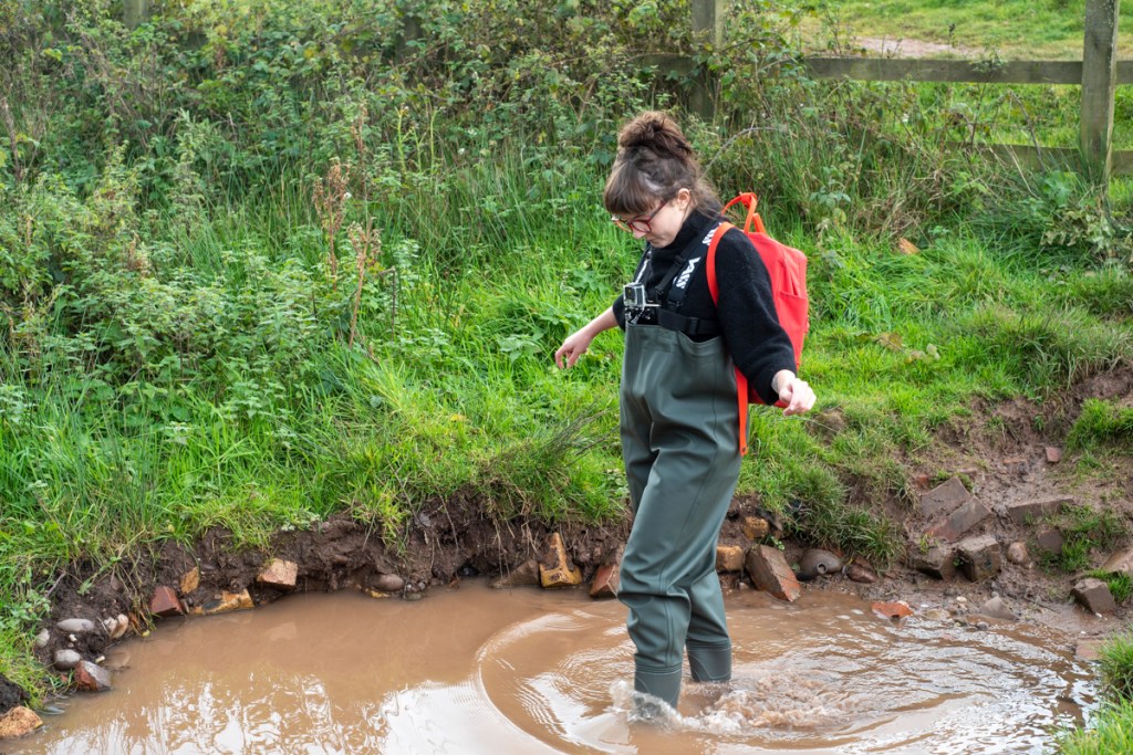
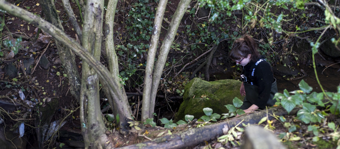
The Rea consists of a number of minor streams for a kilometre or so before coalescing into the river proper. Megan chose the most visible and headed off, looking for a gap in the fence.

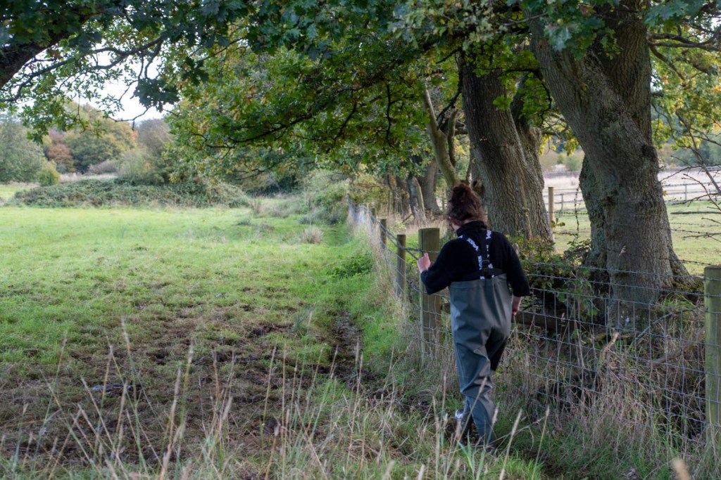
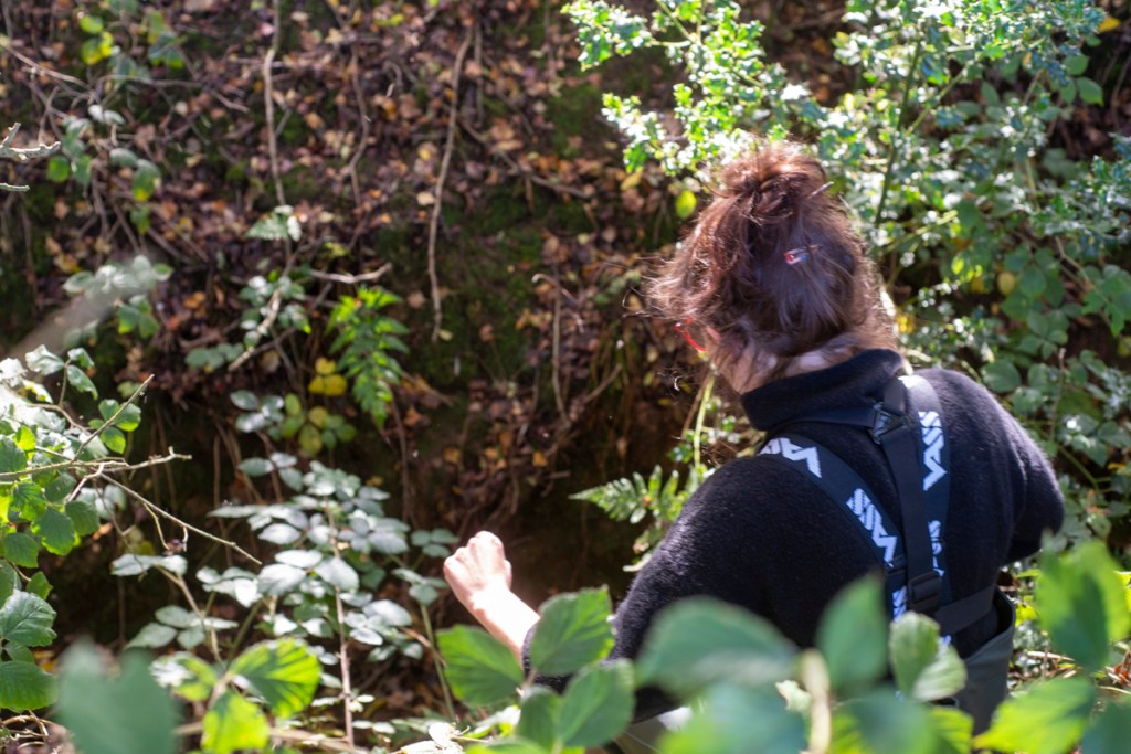
After battling brambles, branches and the odd barbed wire, the stream passed into suburbia corralled between houses and roads.

Although there was the occasional patch of boggy marsh.

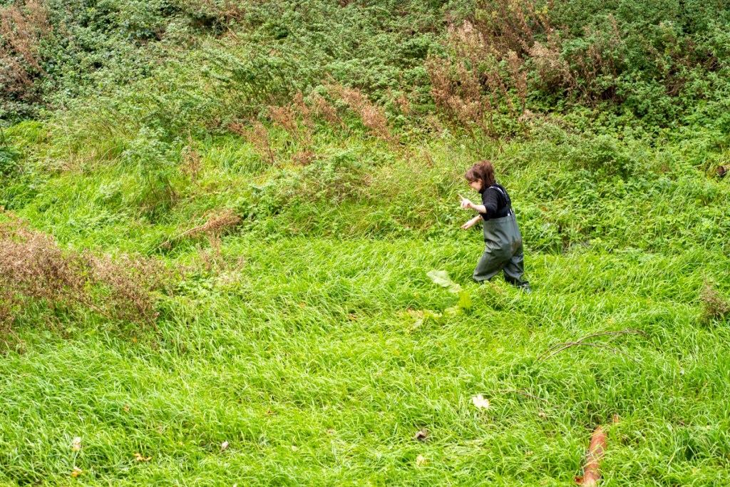
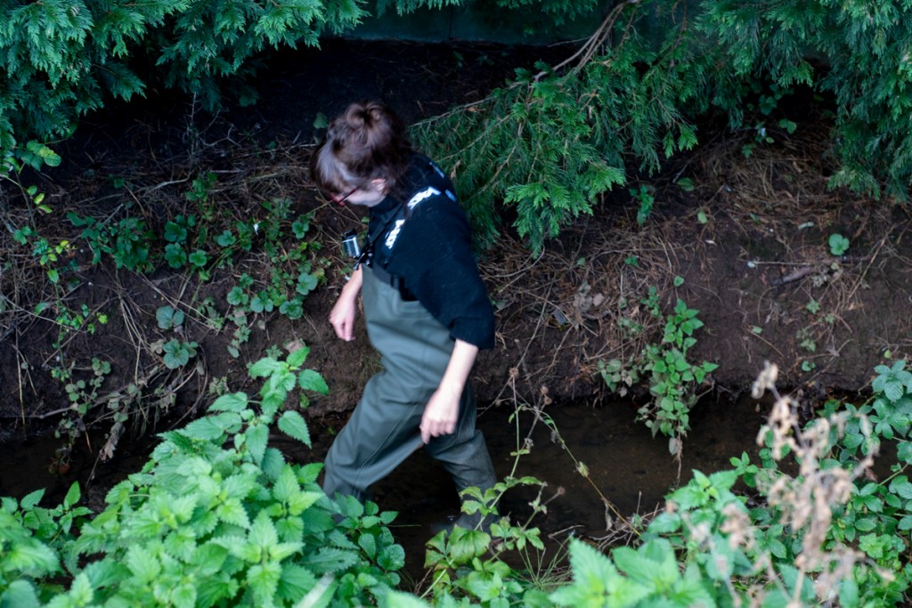
On the whole it was slow work through overgrown brambles, though as the stream headed into Rubery it slowly became more river-like, especially around the bridges.

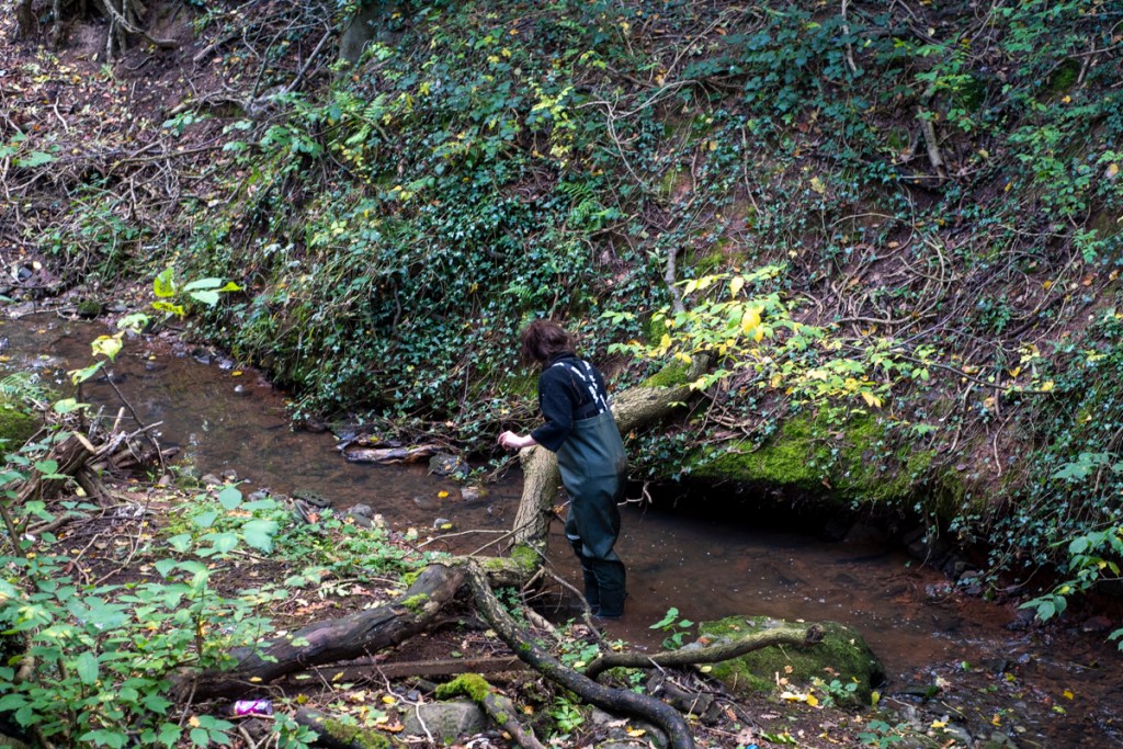
And very soon the tunnels under the roads became large enough to pass through.

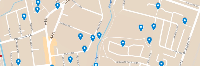
After two hours we had made it to Balaam Wood, just shy of Rubery Great Park, where it seems the multiple Reas becomes one. Weather permitting Megan will continue from here later this week, aiming to reach Kings Norton park.

Categories
Projects

A Figure Walks – the Rea in October

A Figure Walks is the title of Megan Henebury’s walking art-practice. During October, Megan will be walking the course of the River Rea from its source at Waseley Hills though the city of Birmingham to its confluence with the Tame under the M6 motorway.

Rather than strictly following the disjointed walkways and roads of the city, she will walk in the waters of the Rea for as much of the route as possible.

The Rea is Birmingham’s founding river, upon which the mills of the first Birmingham settlement were built. It has seen the rise of an industrial powerhouse supplying colonial expansion, the social revolutions of the 20th century, and the ravages of neoliberalism.

Throughout this history of demolition and rebuilding, the Rea has continued to carve its journey to the Tame – a rare constant in a city whose obsession with reinvention betrays a culture of self-loathing.

By walking in the river itself Megan will experience Birmingham from a perspective unfamiliar to most residents, where echoes of a long-lost pre-capitalist state might be heard, albeit muffled by the culverting and corralling of the river in the service of industry.

She hopes that these echoes will help reconnect us to the ground we live on and, in the age of capitalist realism, climate breakdown and global pandemics, renew our capacity for cooperation and self-sufficiency in our wider community.

For more information email megan.henebury@gmail.com.

All Walkspace posts on this project are here.

Categories
Films Projects Upcoming Events

Walkspace at the 4WCOP

This weekend (Sept 4-6) is the 4th World Congress of Psychogeography. Usually it’s held in Huddersfield but due to you-know-what it’s happening online for 2020. Pete, Fiona and Andy submitted a talk about the Mapping Stirchley which takes the form of a video essay.

There are a number of talks, essays and short films going live on the 4WCOP website on Friday, though you’ll need to register (free) to access them. Once you’ve done this you can also join the discussions and panels. Our panel, The Same Place Through Different Eyes, is on Saturday at 11:30am. Please join us!

Update: The panel happened and was recorded. Watch it here:

This video marks a line in the sand for Walkspace. After our plans were scotched by lockdown we’re now ready to try this art-walking collective malarkey again. Watch for ways to get involved, or just drop us a note.

Categories
Projects

Mapping Stirchley

Note: This project has been a success and is now ongoing! Please visit Mapping Stirchley for updates.

Everyone currently involved in Walkspace lives in the Birmingham suburb of Stirchley and the lockdown has made us keenly aware of our immediate surroundings. Walking the same routes again and again means we’re noticing things for the first time and figuring out new routes to perambulate along.

So we’ve started mapping things-of-note. It’s currently just a Google map, because they’re easy to manage, but in time we’d like it to be something more interesting on OpenStreetMap data, maybe like that excellent Tree Talk service that builds walks around its database of trees in London.

But before we get there we need the data.

Here’s our map:

Right now it’s just got stuff from the four of us, and that’s not good enough. If you’re also from Stirchley (and we know at least 20 of you are because you came on our pre-lockdown night walks!) and would like to contribute a thing-of-note, there are two ways.

Send us a pin

In your mapping app of choice, drop a pin where the thing-of-note is. Look for the Share button (usually a box with an arrow leaving it) and email it to walkspace.uk@gmail.com. Make sure you include at least a title and feel free to provide more context. Your name won’t be put on the map but we’ll keep a record in case we want to credit people in the future. (We won’t use your email for anything else, promise.)

Make your own map

If you’re a regular explorer of Stirchley and have loads of pins to send it’s probably easier to just make your own map. That way you also have your own map! Google Maps is probably the easiest but any service that lets you export the data will do.

To create a Google Map go to google.co.uk/maps on your desktop browser and click on the menu bar in the top right. Look for Your Places and click on that.

You should see four tabs, Labled, Saved, Visited and Maps. Click on Maps and then, at the bottom, click on Create Map. You can now drop pins on the map and label them. Feel free to write descriptions or link to pages with more info. Photos are also great.

Once you’ve made your map, click on the Share button and figure out how to copy a link that means anyone with that link can view the map. (Google keep changing how to do this). Send that link to walkspace.uk@gmail.com.

Phew! Anyone would think Google don’t want you to make your own maps! But once you get through the setup it’s all really simple. If you need help, drop us a line.