Inspired by the long running ‘Walking the Stirchley Skull‘, the Shrewsbury Skull has been devised by members of Walkspace’s Shropshire contingent as a spooky walk within the historic setting of Shrewsbury Town Centre.
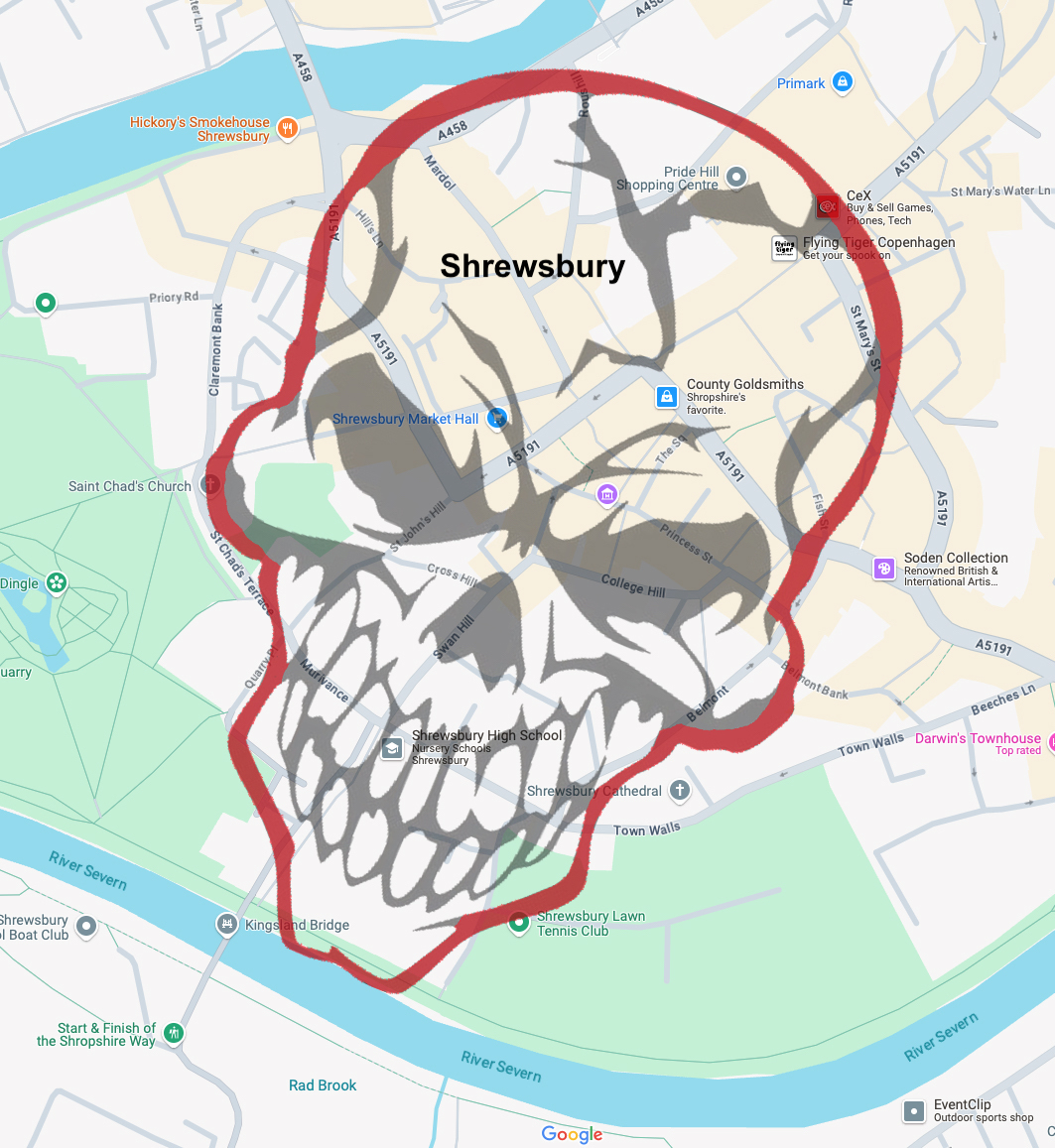
The Shrewsbury Skull was created by Paul Wakelam and Andrew Howe by superimposing a skull image on a map of the town centre, within the course of the River Severn, and then walking the outline in the real world on Halloween night last year. This year they’re ready for company.
The walk will take place on Friday 31st October at 7:30pm and will start and finish outside St Chad’s Church, a 13 minute walk from the train station. The walk is free to attend and open to both locals and those from further afield. Costumes are entirely optional but if you wish to bring a skull-themed object or mask you are very welcome to do so.
Please book your place by emailing: walkspace.uk@gmail.com
This is a circular walk of approximately 2 and a quarter miles, mostly over pavement, with some moderately steep inclines and one set of steep steps. Toilets are available in pubs along the route. The walk will last around 90 minutes with the option of retiring to one of Shrewsbury’s many fine pubs for a de-spook.
Please note, the original Stirchley Skull walk will NOT be taking place this year. We are officially passing the torch. If you wish to organise your own skull walk with friends, you can do so wherever you live by following these instructions.
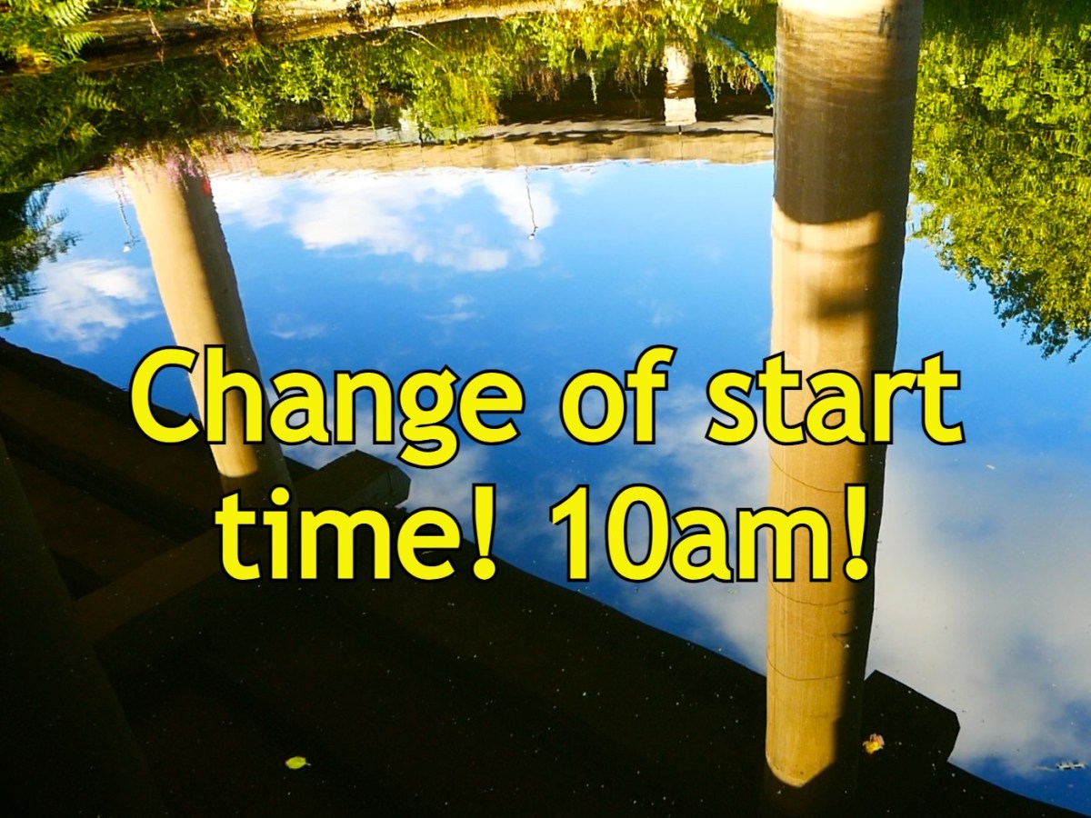
PLEASE NOTE: This walk starts at 10am NOT 11am as previously advertised. This is to avoid the hottest hours of what will be a very hot day. RESPECT THE SUN! If you wish to attend you MUST email: walkspace.uk@gmail.com
Three years ago we led a pilgrimage to Spaghetti Junction to celebrate its 50th birthday. We explored some of the ways the famous motorway interchange could be considered a sacred site, a “confluence of confluences” and a gateway to the underworld. Great as it was, this walk barely scratched the surface and so we’re making a return visit for this year’s Summer Solstice. We hope you’ll join us to honour the Great God Interchange.
In recent years the artist and writer Jen Dixon has joined the ranks of Walkspace and her work reveals new layers of sacred significance to the site now known as Spaghetti Junction. Her INTERCHANGE field guide posits the site at Gravelly Hill as not merely a motorway junction, but a place of “physical and spiritual interchange over hundreds, if not thousands, of years.”
Jen will be joined by Andy Howlett to help untangle the watercourses, crossings, caverns and megaliths that come together to form this utterly unique environment. Discover the Hawthorn Brook. Cross the ancient ford. Enter the Dwarf Holes. Honour the Holy Oak. Draw back the thin veil between worlds and leave your offering.
The pilgrimage will begin at 10am in Chamberlain Square, central Birmingham on Saturday 21st June. Meet Andy and Jen beside the fountain. From here we will make our way down to the Birmingham and Fazeley Canal which we shall follow all the way to Spaghetti Junction along the towpath – a distance of about 3.5 miles. After observances round and about the Interchange, we’ll aim for a picnic lunch at around 12:30-1pm beside Aston Reservoir.
To book please email: walkspace.uk@gmail.com
Bring a packed lunch, plenty of water, sun cream and wear sturdy shoes. The terrain is mostly pavement and towpath with some uneven and sloping sections, cobbles and narrow tunnels. Buses 65, 66, 67 and 68 all take you back to Birmingham and can be caught on Lichfield Road. Aston Station is also a 10-15 minute walk from the walk’s finishing point. For your evening festivities we heartily recommend Acid Solstice in Digbeth.
Amazingly it’s been five years since three friends in Stirchley decided to start a walking-art collective. Walkspace has come a long way since then but to mark this anniversary we’ve decided to return to our roots by reimagining one of the first public walks we ever did. We hope you can join us on 14th March to renew the magic for another 5 years.
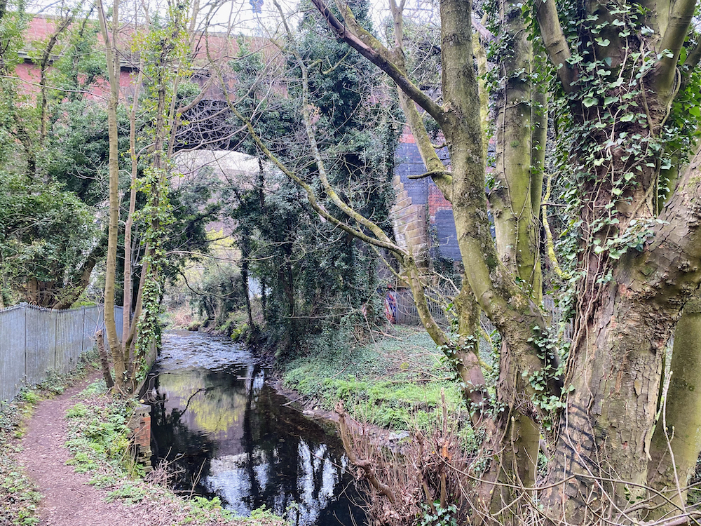
Full Moon Walking took place on 8th March 2020 and was described as a “bewitching – if slightly scary – group walk around the lunar-charged waterways of Stirchley and Lifford.” It was a spirited combination of local history, folklore and magic, with contributions from each of the early members. Our experiments in collective walking were soon to be cut short by the pandemic but the overwhelming response to that early walk convinced us to hang in there and weather the storm.
This time around we shall be walking the same route but with fresh ideas, 5 years of walk-leading experience, and with invaluable input from newer members. Join us on the night of the full moon, Friday 14th March, 7pm at Fordhouse Lane at the pedestrian crossing by the River Rea bridge, Stirchley. To book your place please email: walkspace.uk@gmail.com
This water-themed walkabout is a circular route along riverside paths, woodland trails, reservoirs and canals. It features uneven surfaces, slippery bits, tunnels and steps. Please wear appropriate clothing and footwear for a nighttime winter walk and please bring a torch. This event is for adults only.
The walk will last 1.5 – 2 hours, finishing up back at the starting point, from which there will be the option to retire to a pub. The power of the full moon is unaffected by the weather so we shall not be deterred by clouds or showers. In the event of truly unpleasant weather however you shall be notified by email of any changes or cancellation.
You can relive those early days of Walkspace with this short film by Andy which opens with an account of the original full moon walk.
PLEASE NOTE THIS WALK HAS BEEN POSTPONED TO 15TH DECEMBER. IT WILL NO LONGER GO AHEAD ON THE 8TH.
Dudley might not be the first place people associate with hiking and outdoor adventure. It is predominantly an urban area best known for its zoo, museum and out-of-town shopping centre, but there is a wilder, rockier side to the borough too. Dudley’s geography is overwhelmingly shaped by a dramatic hill range spanning over 6 miles from Sedgley Beacon in the north to Rowley Regis in the south.
Reaching heights of over 250 meters above sea level, this rocky ridge contains an abundance of green space amongst the commercial, cultural and residential districts. It’s an extremely rich and biodiverse landscape that does indeed lend itself to the type of outdoor adventuring more associated with national parks and mountain ranges.
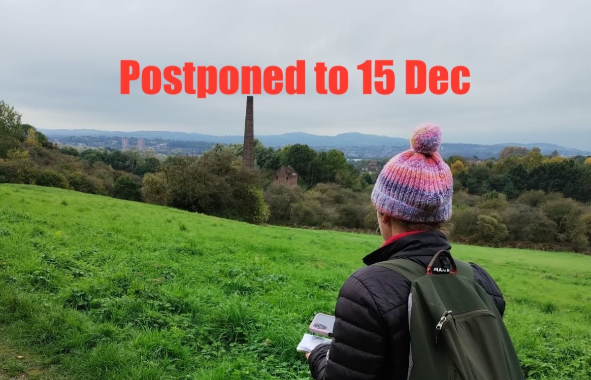
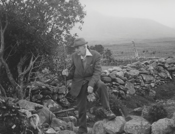
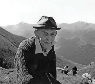
For this public walk, artists Daniella Turbin and Andy Howlett will be demonstrating creative ways of exploring the southern half of the Rowley/Dudley hill range. They’ll be drawing on Daniella’s experience as a long-distance walker and rock climber, and they’ll be taking inspiration from the adventures of Dudley-born mountaineer and peace campaigner Bert Bissell, AKA “God’s Mountaineer”. Please note: no mountaineering experience required! Just a good pair of walking boots.
“God’s Mountaineer” Bert Bissell on Ben Nevis
The artists will draw on their creative practices to explore how the remarkable geology of the hills determines so much about the landscape including what sort of plants can grow, how the land is used, what animal species can make their homes here, and even which directions the local rivers flow. They’ll demonstrate the intrigue to be found in the urbanised areas as well as the green spaces and they’ll explore some unexpected connections to other locations such as Ben Nevis, the Humber Bridge and Ancient Rome.
Join Andy and Daniella at 10am on Sunday 15th December (postponed from the 8th) at the Wolverhampton Road entrance to Bury Hill Park in Oldbury, B69 2BJ. The walk is about 5.5 miles long, finishing up at the market place on Dudley High Street at around 3:30pm. The walk is free to attend but booking is essential.
The terrain includes roads, pavements, rocky footpaths, grassy areas, stiles, steps and considerable inclines. Please dress accordingly for a winter walk and be prepared for some muddy sections. Bring a packed lunch as we’ll be stopping for a break at Bumble Hole nature reserve. Toilet facilities can be found at The Lakeside pub/restaurant near the start of the walk (if you ask nicely), at Bumble Hole visitor centre at the half way point, and in various establishments in Dudley town centre at the end.
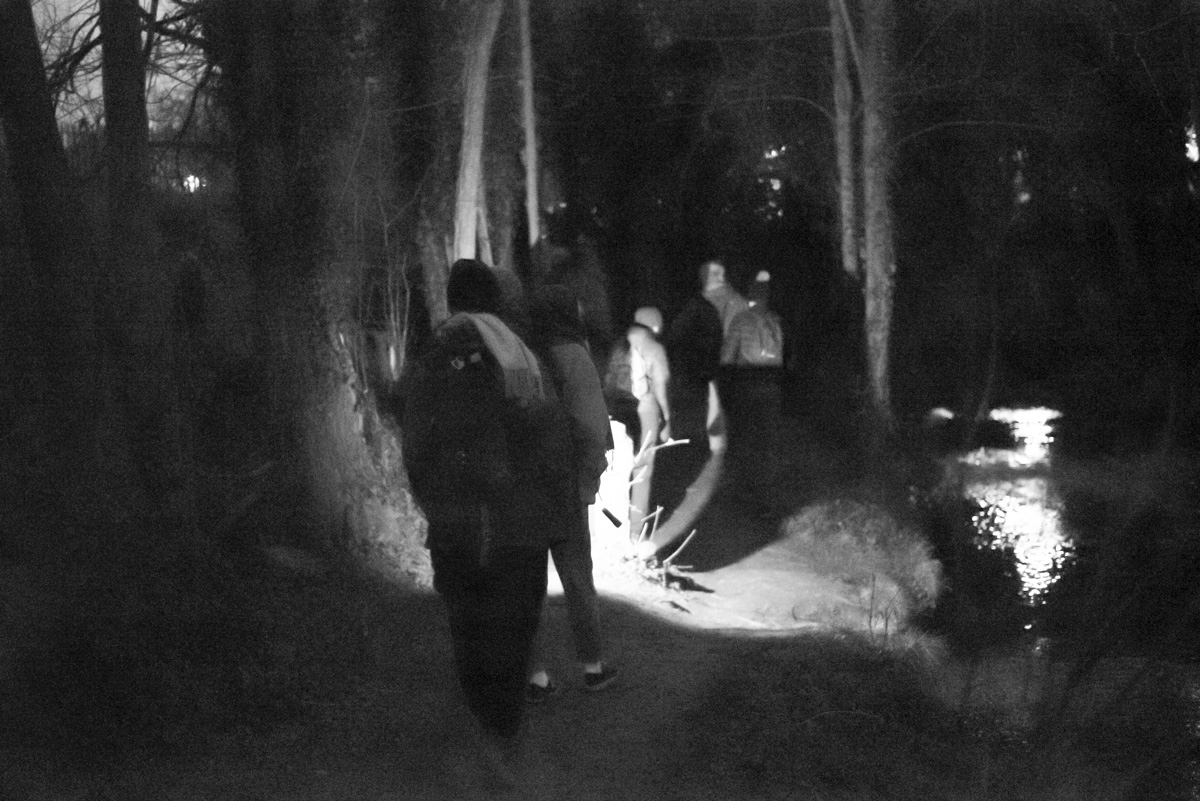
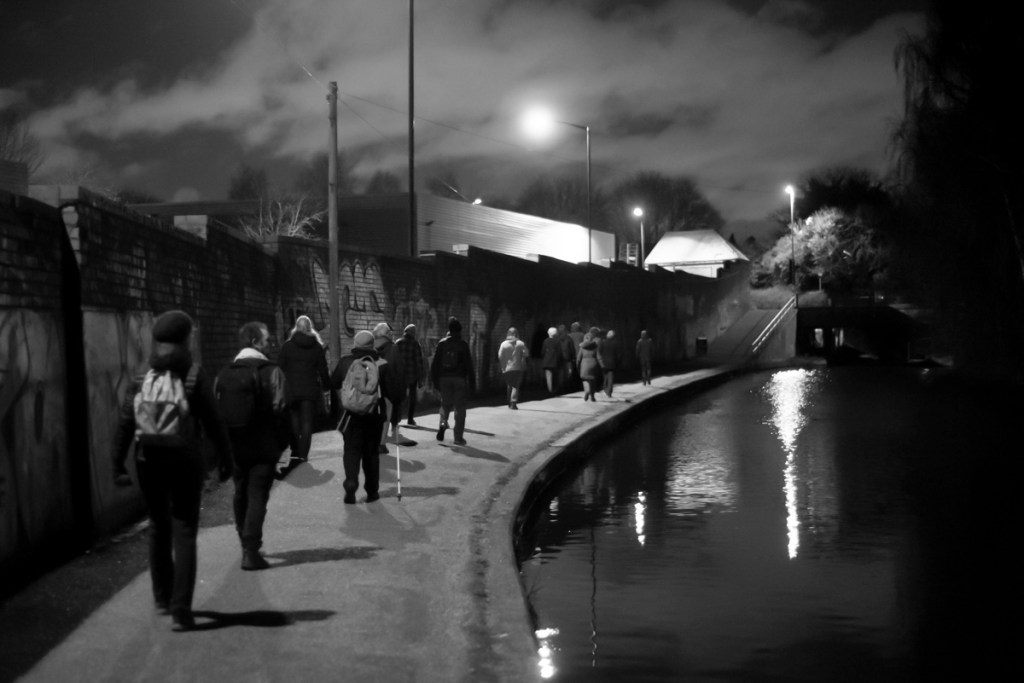
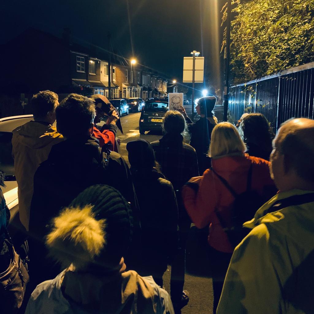
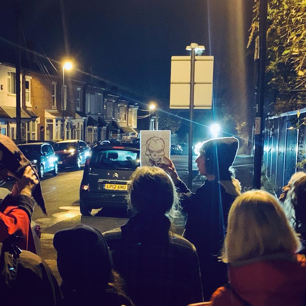
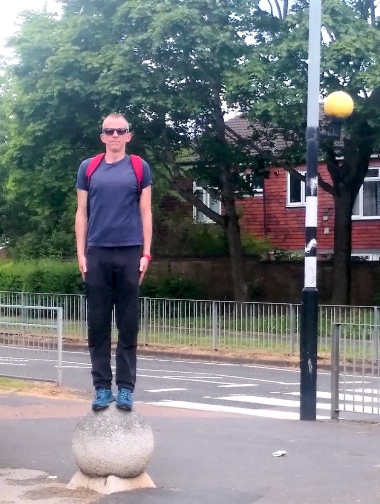
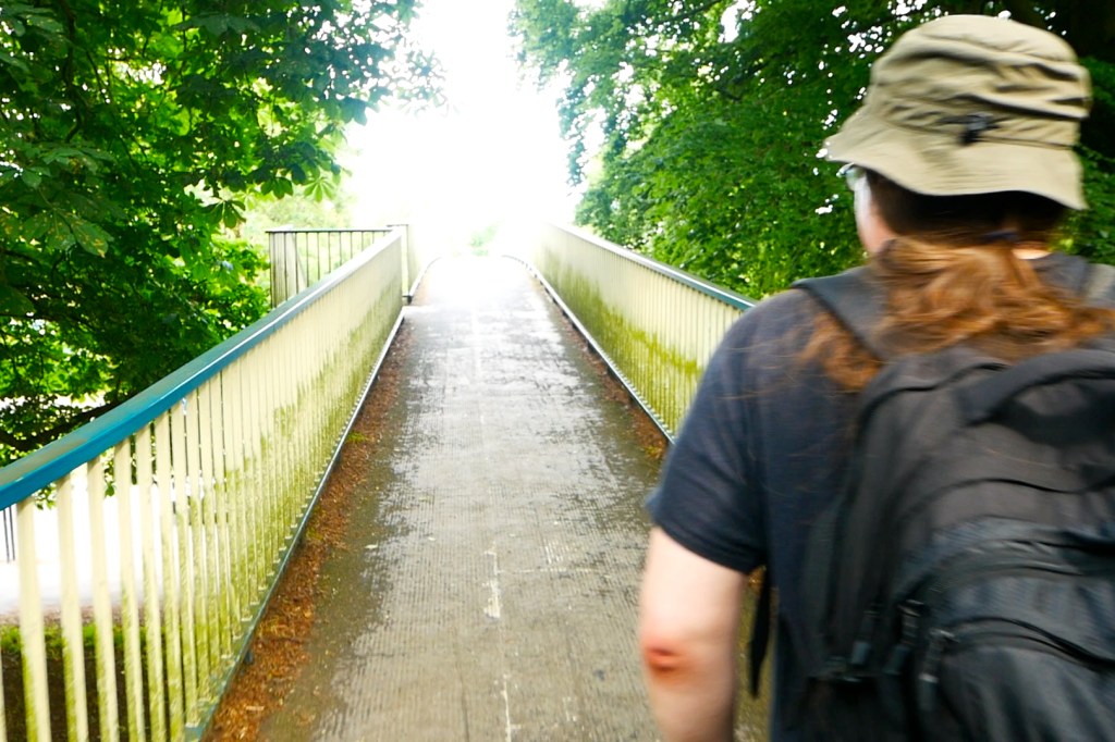
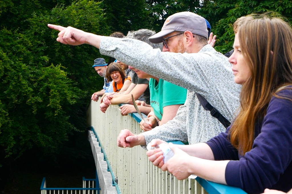
Autumn has definitively arrived and with it comes the beginning of night walking season. For four years now we at Walkspace have marked the transition into the dark half of the year by walking the Stirchley Skull on Halloween night. The Stirchley Skull was created by superimposing a skull image on a map of the neighbourhood and then walking the outline in the real world. Last year we mixed things up by walking “widdershins” and this year we’re doing something different again.
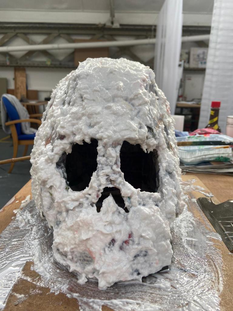
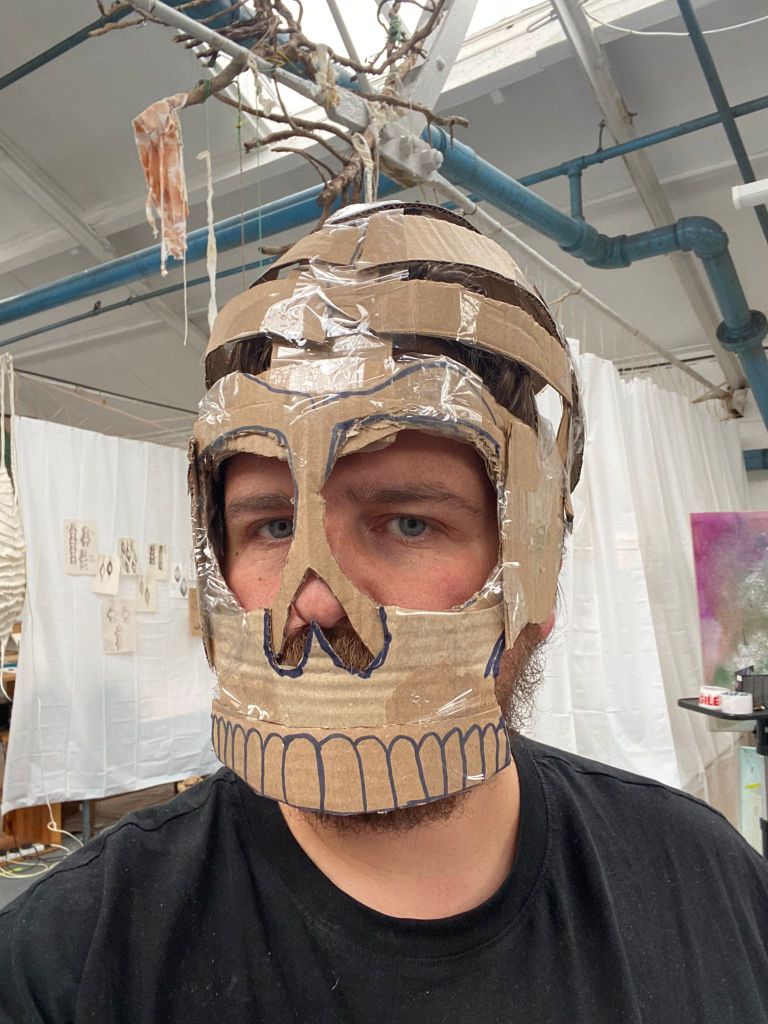
We are thrilled to be teaming up with visual arts duo Hipkiss and Graney who will be leading a skull mask decorating workshop the weekend before the walk. Participants will get to design their own skull mask to wear on the walk and to keep for future skull walks. Hipkiss and Graney are famed throughout the realm of Mercia for their inventive and colourful community events inspired by folklore, nature and magic, and we couldn’t think of better collaborators for this spooky celebration. See below to book your place.
As ever the walk itself is open to all whether you take part in the workshop or not. Join us on Thursday 31st October at 7:30pm outside Stirchley Library on Bournville Lane. This is a gentle circular route lasting no more than 90 minutes. The terrain will mostly be pavement and roads, with a bit of grass and a gravelly track. Prepare for muddy conditions and the first gales of winter. The walk will go ahead whatever the weather. The walk is a free event with no need to book.
The skull mask workshop takes place on Saturday 26th October at 3pm. If you’d like to attend please email: hipkissandgraney@outlook.com to book your place. The workshop costs £5 and takes place at South Birmingham Studios, 29B Maryvale Road, Stirchley, Birmingham, B30 2DA.
Bonus Skulls!
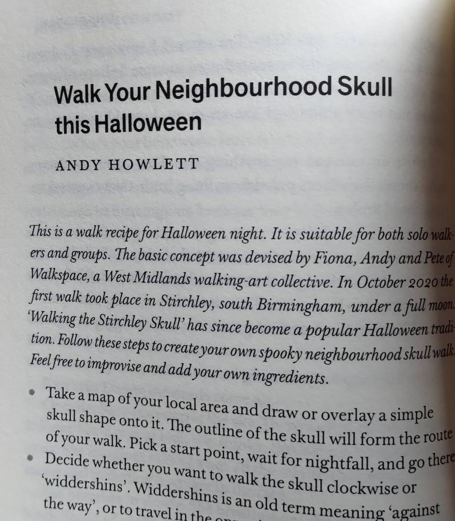
If you can’t make it to Stirchley on the 31st then you can always create your own neighbourhood skull walk wherever you happen to live. In fact “Walk Your Neighbourhood Skull This Halloween” has just been published as a walk recipe in the fantastic new collection “Night Time Economy” by Floodgate Press.
In this all-new collection of work from some of the West Midlands’ leading writers, you’ll find stories of forlorn 3am hopes and of nocturnal revelations. Of celebrations and hauntings. Of the lost and the found. Of the urban and the urbane. Of the all too real And the all too unreal.
As well as the skull walk recipe by Andy Howlett, the collection also features Walkspace member Josh Allen’s “At the Dog and Partridge” about a notorious lost pub in Selly Oak, along with lots of great short fiction and creative non-fiction. It’s a fantastic collection and the perfect Halloween gift.
Coventry is a place of striking architectural contrasts where different historical periods collide. This is well known in the city centre where medieval timber framed buildings rub shoulders with Brutalist monoliths, but it’s also true in some of the less visited areas outside of the ring road. The area surrounding Charterhouse just southeast of the city centre is a case in point: a landscape of monuments both ancient and modern where layers of history pile up and overlap.
Charterhouse itself is a recently restored 14th Century monastery and just over the road is a Victorian “garden cemetery” and arboretum built on the site of a former quarry. In stark contrast to these is the hyper-modern Technology Park with its pristine lawns and the colossal waste disposal centre with its belching chimney. Residential estates occupy the sites of former car factories and a Victorian viaduct stands ignored in the woodland.
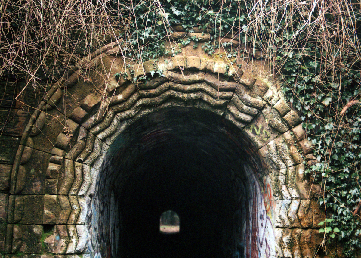
The landscape tells the story of a rapidly expanding city with ever evolving land requirements. Snaking its way through the confusion is the River Sherbourne and an intriguing network of woodland pathways and tunnels; portals between the different worlds. It’s rich pickings for urban walkers and it’s in this spirit of curiosity that you are invited to come and experience a different side of Coventry.
Walkspace members Adele Mary Reed and Andy Howlett have devised some creative walking prompts to guide the group’s exploration of this fascinating area. The prompts will draw attention to the changing ambiences and unexpected juxtapositions by focusing on different senses and breaking out of our habitual ways of walking.
Meet at Coventry Train Station’s Visitors Centre at 13:30 on Saturday 28th September. The distance is approximately 3 miles and we’ll finish up at the Anglican Chapel for refreshments in London Road Cemetery at roughly 15:30.This is a ticketed event commissioned by Historic Coventry Trust. Tickets are £10 for adults, £5 for under 18s. Walkspace members get a 50% discount (contact Andy or Adele for discount code). Ticket price includes juice, biscuits and hot drinks at the end.
The terrain will be pavement, lawn and woodland with some uneven paths and moderate inclines. Steps will be avoided. This event is suitable for age 12+. Anyone under 18 must be accompanied by an adult. Toilets are available in Coventry Station at the start of the walk and the Anglican Chapel at the end.
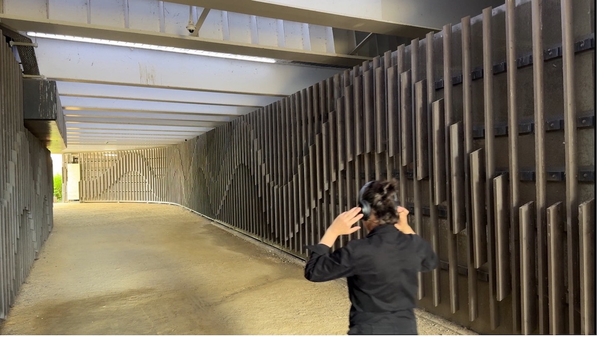
“One day you notice the birds aren’t singing anymore and you realise it’s the end of summer. I look daily to check the swifts are still there, squealing and soaring in the galleries above. Soon I will glance skywards to see they have left for the season, I might see some contrails and realise, just as I didn’t notice the birds stop calling, I didn’t hear the plane either. As cadence is withdrawn from the landscape what does it sound like as we approach autumn and a winter calendar?”
I seek out places to experiment with sound and resonance made by movement and gesture, engaging in a dialogue with those spaces. As an urban resident I am sensitive to sonic disturbance: some sounds have made me avoidant, others I am particularly drawn to. I have been fascinated by the sounds others don’t appear to hear, tiny drones and hums lost in the volume of the everyday, and equally surprised how we fail to hear, or become accustomed to larger noises. I have been inspired by the “deep listening” practice of Pauline Oliveros, and I would cite Fiona Cullinan’s concept of “extreme noticing” as a prompt for specifically devising a listening walk.
I invite people to walk with me and participate in an active listening walk on the last afternoon of the summer holidays. There will be experimentation with sound and listening en route with stops for the following 3 interludes:
Active listening ‘speed date’ format with prompts
Guided listening session
Listening for radio using an open wave receiver inspired by Shortwave Collective and built using their instructions
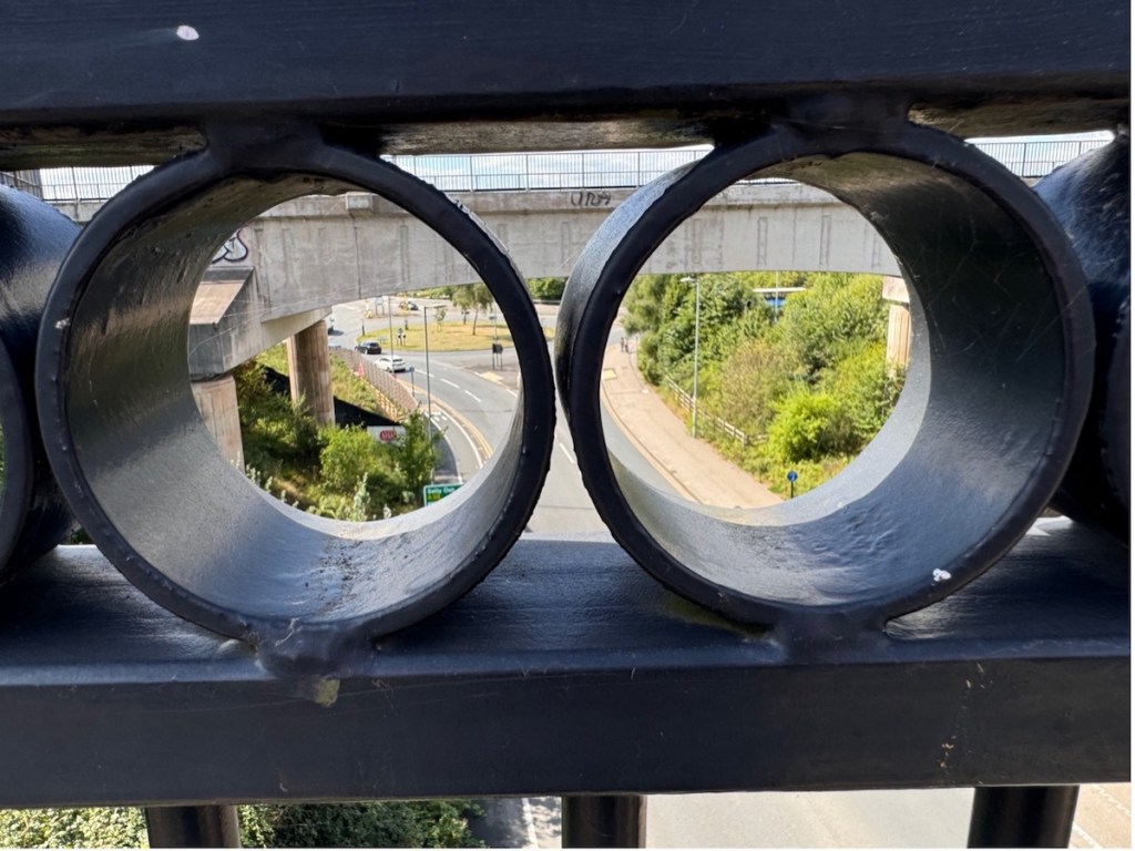
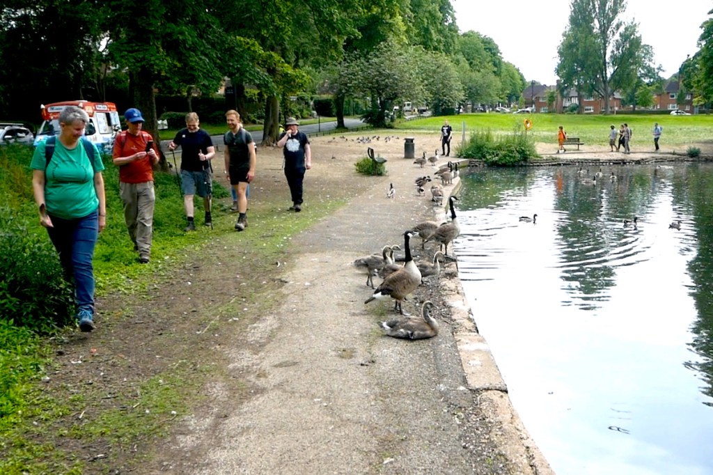
Meet on the Worcester and Birmingham Canal at the seating area behind Sainsbury’s, Selly Oak (B29 6SJ) at 11am on Sunday 1st September. This walk is approximately 3.5 miles long, mostly along canal towpath but also taking in a student village, an upmarket shopping centre, an aqueduct, a motorway flyover and the busiest railway station outside of London. We aim to be finished in Birmingham city centre by 1pm. No need to book, just turn up! The walk will go ahead whatever the weather.
The terrain includes paving, well maintained gravel canal towpath, a small canal bridge with ramp access, steps through Mailbox and entrance to station (lifts available). Please note the route crosses the viaduct over Aston Webb Boulevard which is high up and may feel exposed.
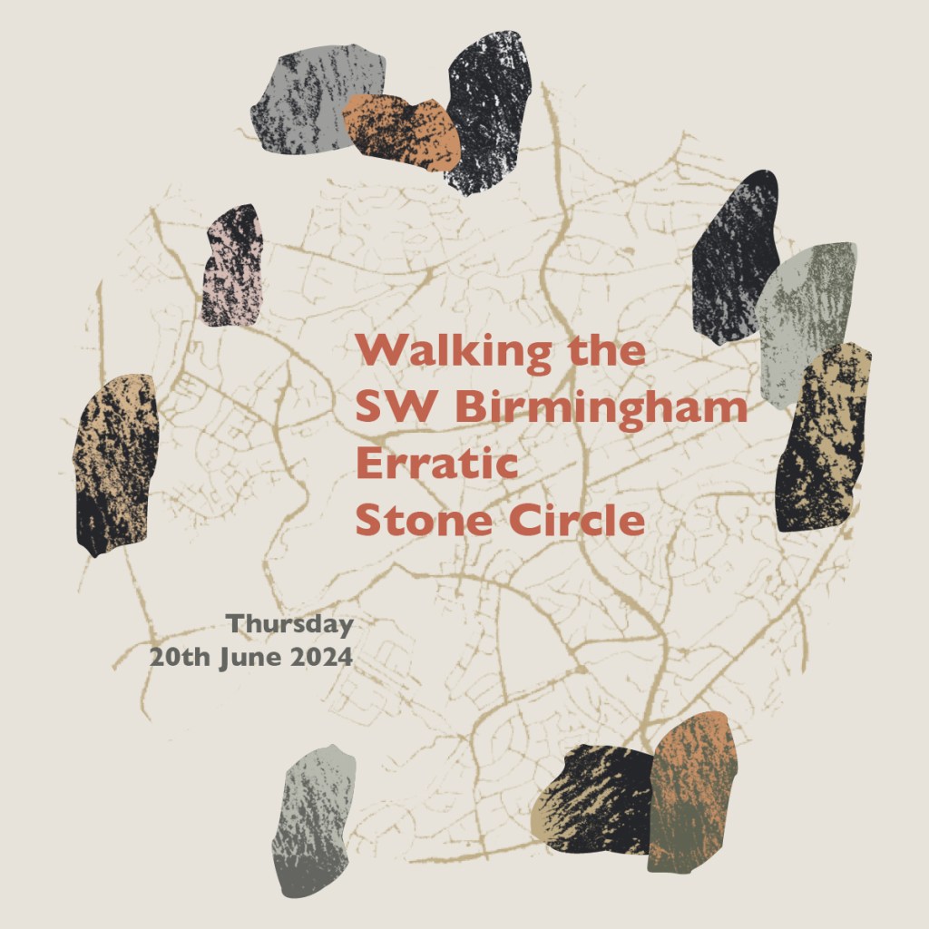
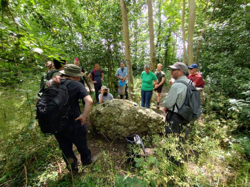
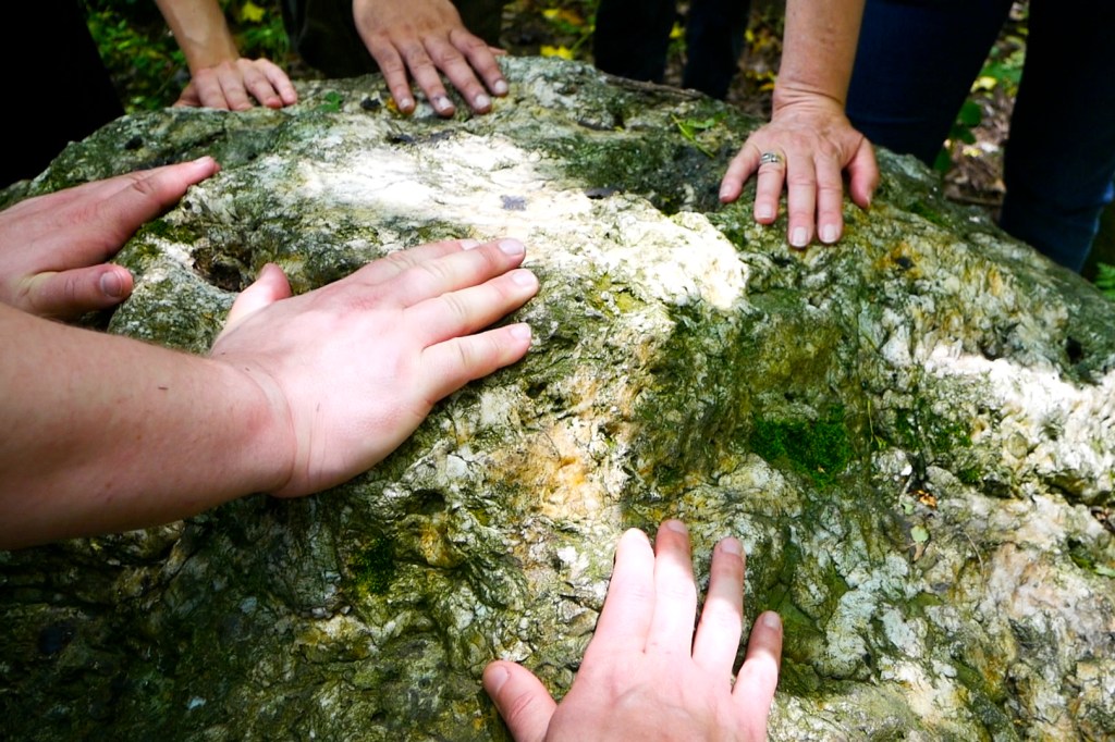
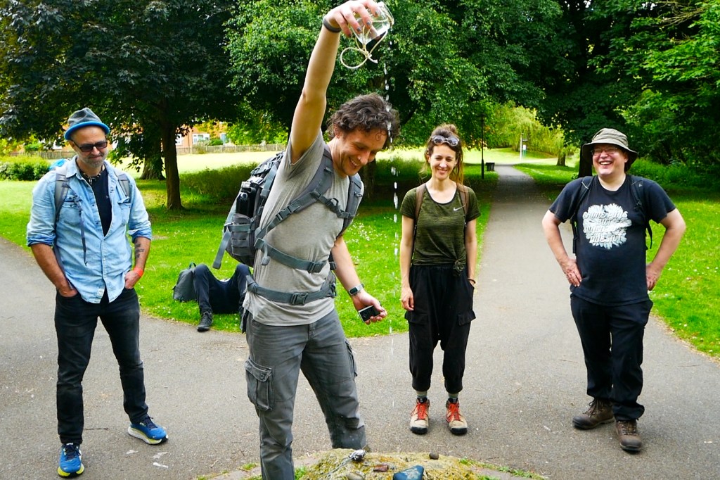
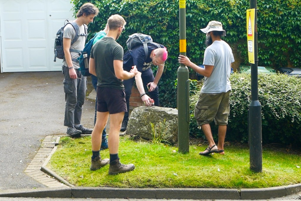
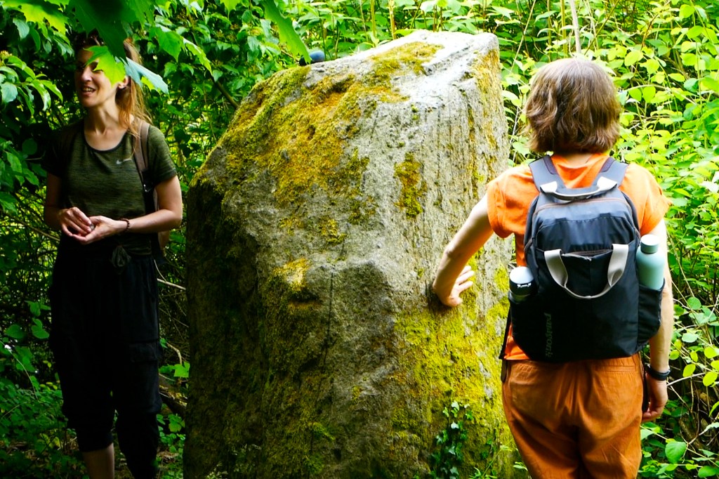
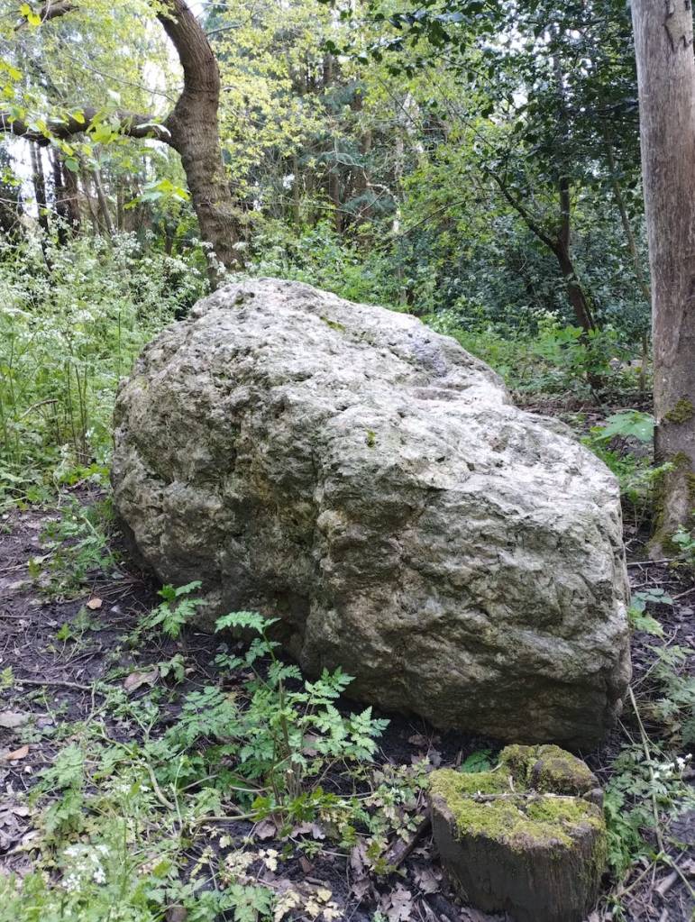
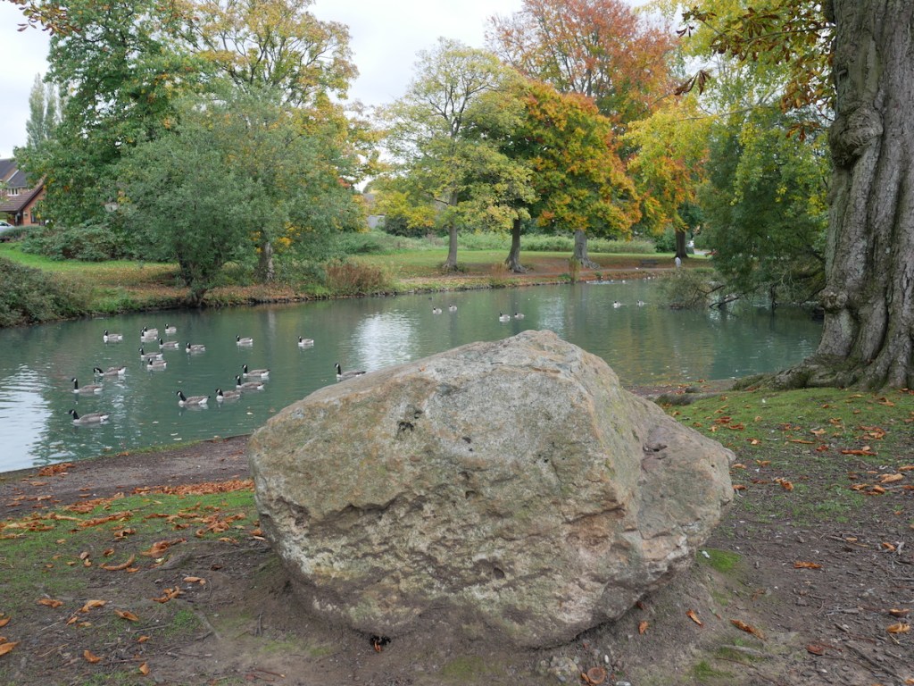
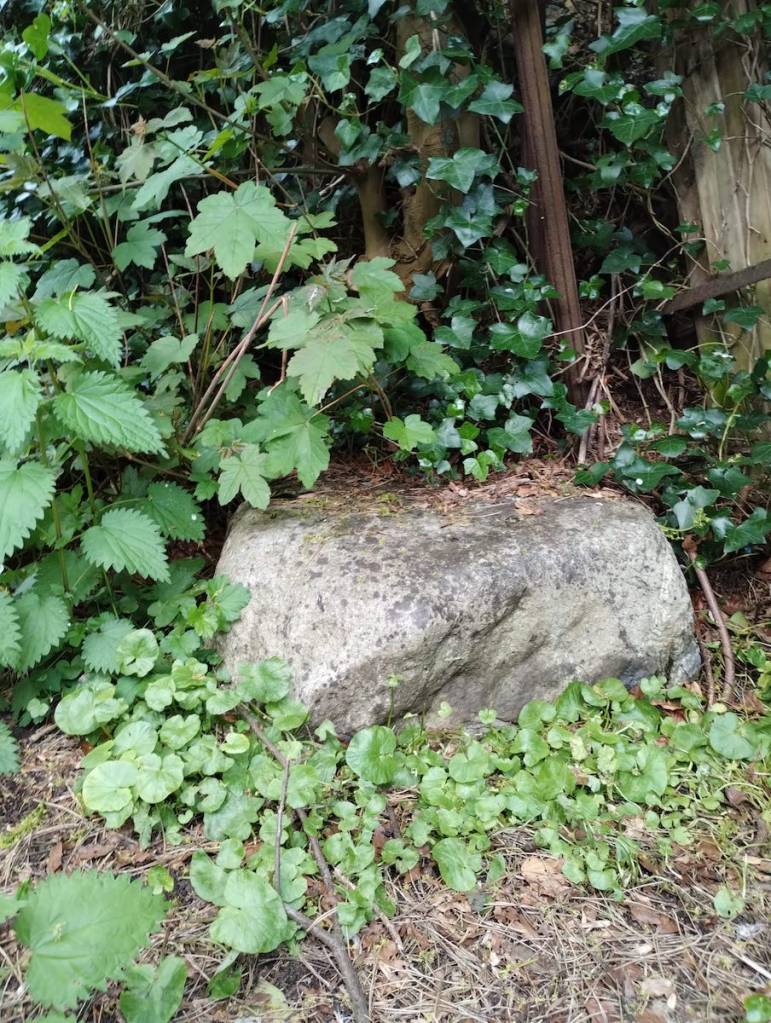
To celebrate the Summer Solstice we walked a new stone circle into existence. The West Midlands may not be as blessed with megalithic monuments as other parts of the country but we DO have an abundance of another type of ancient rock: the glacial erratics which travelled here from North Wales on an ice sheet.
Thanks to the mapping efforts of the Erratics Project we can see that several of these boulders can be joined up in a giant circle. In order to activate this newly discovered ancient monument (several hundred thousand years older than Stonehenge), we walked the entire 13 mile circuit, anointed each boulder and took turns reading aloud The Stone Monologues by Alyson Hallett. We were honoured to be joined by Alyson herself who took a detour on her journey back from Scotland to spend the day with us.
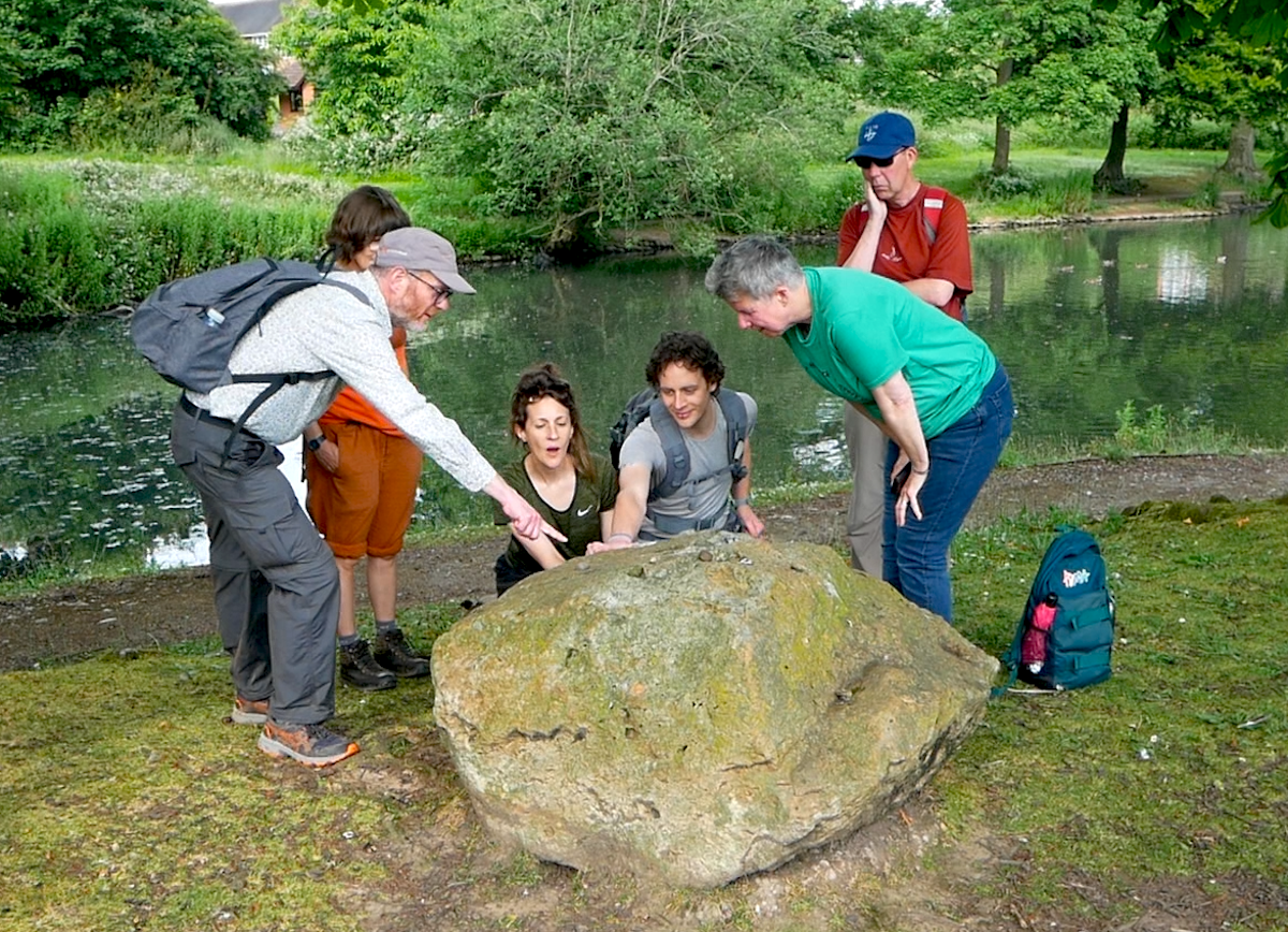
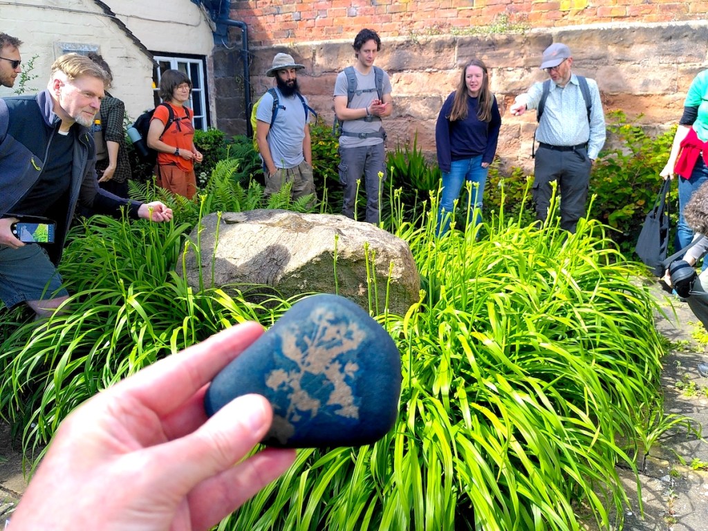
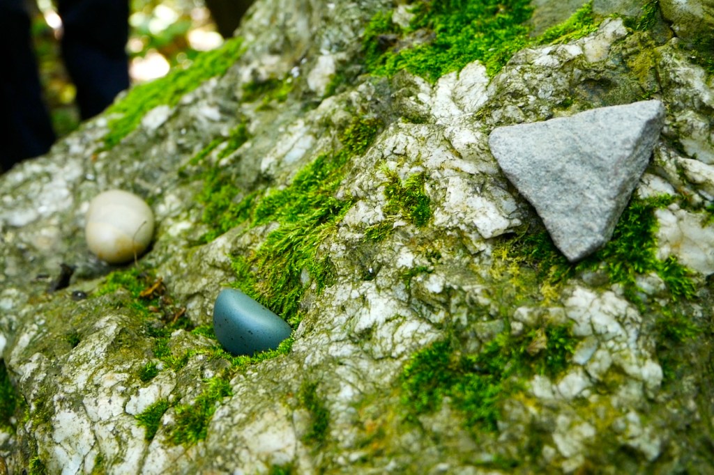
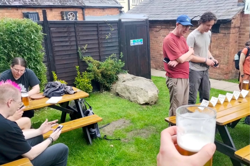
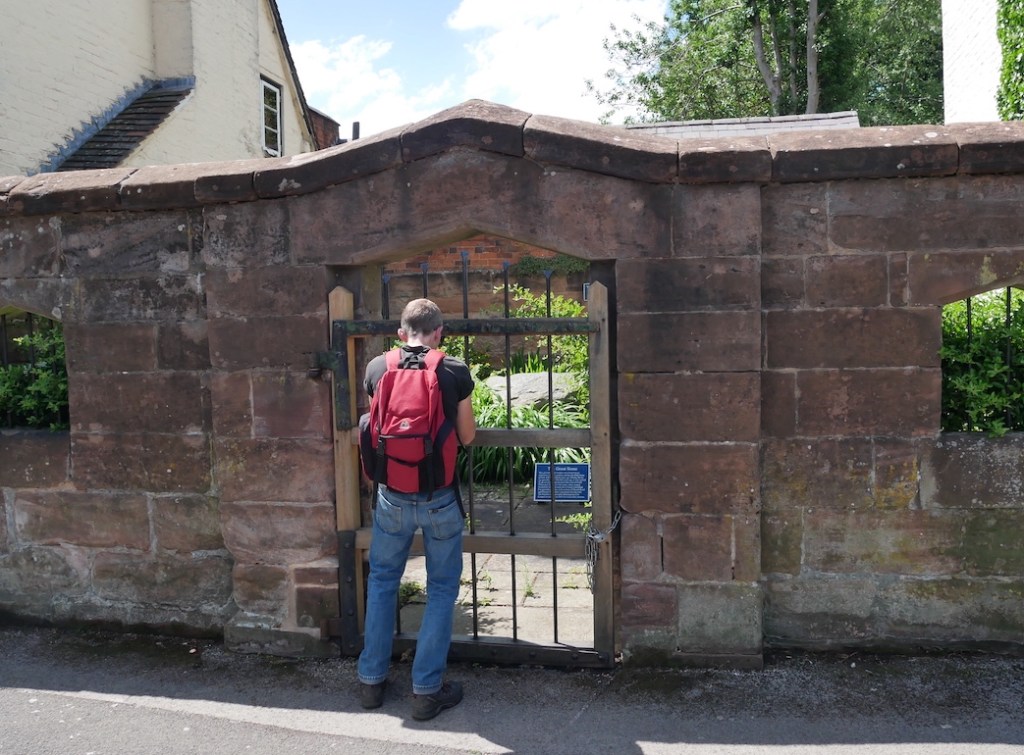
The walk started and finished at The Great Stone Inn in Northfield. This historic pub is custodian of not one but two erratic boulders and the landlady kindly granted us access to the 17th Century village pound which contains the titular Great Stone itself. Participants were asked to bring along a pocket-sized stone of their own and we opened proceedings by placing the stones at our feet, creating a miniature stone circle around the Great Stone erratic.
The walk took us close to the Bartley and Frankley Reservoirs, the home of Birmingham’s drinking water. This water also travels here from Wales, in this case from the colossal reservoirs of the Elan Valley. The water makes the 73 mile journey through a huge pipe called the Elan Aqueduct, powered only by gravity. Welsh tap water to anoint the Welsh stones.
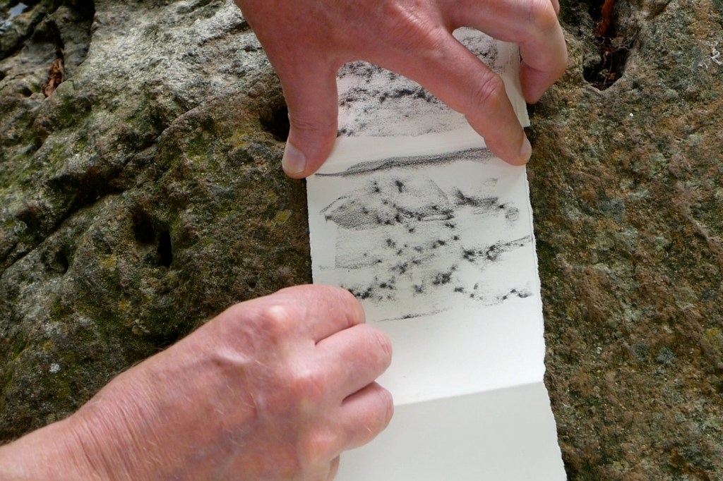
The Stone Monologues is a ten part poem written from the perspective of an erratic boulder. Alyson Hallett wrote the monologues after encountering an erratic on Cader Idris and becoming obsessed with travelling stones. Since then she has taken five migrating stones on journeys around the world. The stones have a line of her poetry carved into them and are sited in Scotland, England, USA and Australia. A sixth stone is destined for Ukraine. On all her travels Alyson says she has never known anywhere so abundant with erratics as Birmingham.
Particles of myself ride the wind into homes and hands of strangers. Rain washes me into the earth and the earth’s fast running rivers. I record the touch of a hand, step of a fly, scud of clouds. I have small pockets that catch words from a walker’s lips, light from the moon’s bright lyre.
We walked for seven and a half hours in the midsummer heat, arriving back at The Great Stone exactly as the church bell struck 6 o’clock. Pleasingly the final stone sits in the pub beer garden. By then we were ready for a pint. Alyson summed up the day nicely: “it was ceremonial, sacred, fun and I met amazing people. Days like this allow me to experience how poems can come into the communities of more-than-human beings and expand the cosmic soul. Happy Solstice to everyone.”
The West Midlands isn’t very well served for ancient monuments or stone circles. Those wishing to mark the solstices at such sites might have to travel out to the Rollright Stones on the Oxfordshire/Warwickshire border or Mitchell’s Fold on the far side of Shropshire. But what about those of us in the urban centres unable to make such trips? One option is to make use of the municipal stone circles and megaliths which adorn many of our public parks, such as the stunning Bordesley Henge in Birmingham. This is something we’ve done in the past, but this summer we’re going to try something different.
Suburban Birmingham may not be famed for its neolithic sacred stones, but it does contain an abundance of another type of ancient rock. We are of course referring to the erratic boulders which were deposited here by glacier 450,000 years ago. These lumps of volcanic rock travelled from the mountains of North Wales during a severe ice age and now litter the parks, gardens, churchyards and roadside verges of 21st Century suburbia. (For our previous boulder walks see here and here)
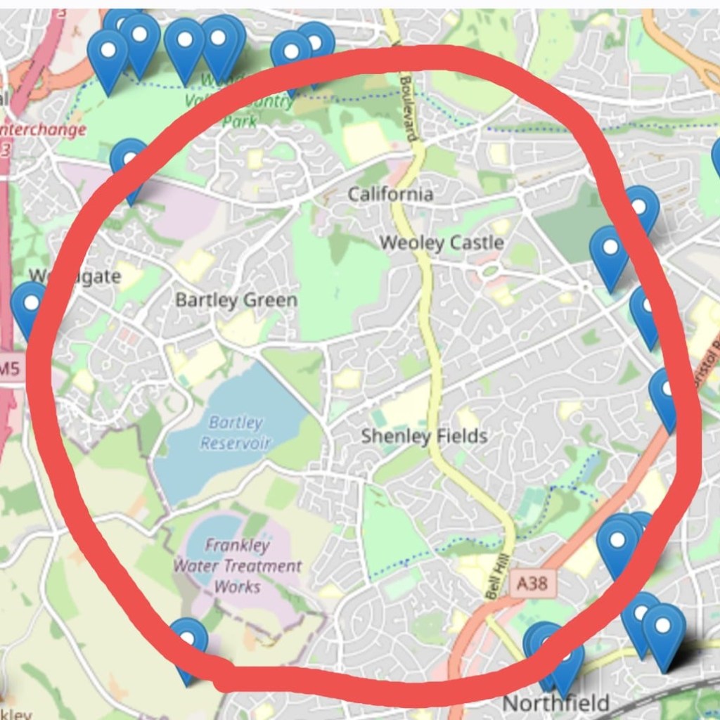
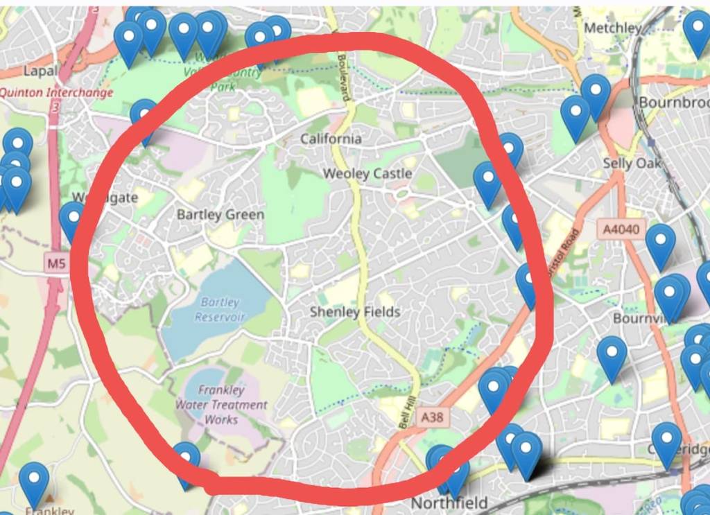
Thanks to the efforts of the Erratics Project, the boulder locations have been plotted on a handy online map. From this we can see that some of the boulders of the western suburbs are arranged in something of a circular formation, albeit spread across many miles. And there we have it. The West Midlands DOES have a stone circle, completely unique and several hundred thousand years older than Stonehenge.
To activate this newly discovered ancient monument we shall walk the entire circuit, anoint each of the 16 stones and read aloud from Alyson Hallett’s “Stone Monologues”. We’re very grateful to the Great Stone Inn in Northfield for granting us access to the historic village pound, home of The Great Stone itself, the first erratic boulder of our walk. The 17th Century village pound was formerly used to hold stray animals but it’s now used for stray boulders and we can’t think of a better place to begin this momentous walk.
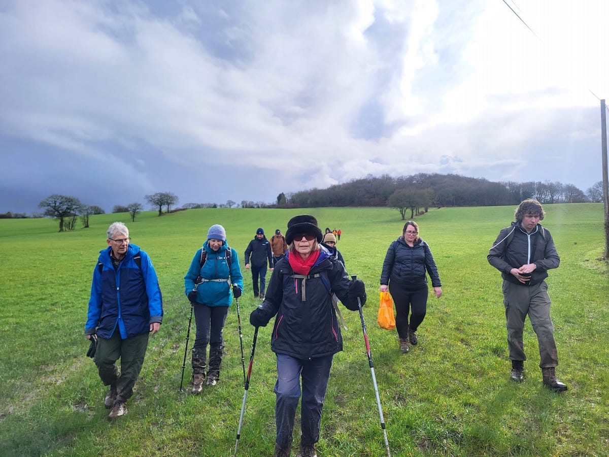
At 13 miles this is the longest public walk we’ve ever done so it’s just as well the Solstice happens to fall on the longest day of the year. The walk takes us out to the far western fringes of the city with great views of rural Worcestershire. As well as the historic stones, the route also takes in the Frankley Reservoirs, home of Birmingham’s drinking water; a ruined castle; a holy well; the Severn/Trent watershed; a 12th Century church, and some spectacular views of the M5. We encourage you to bring along a pocket-sized stone of your own for the journey.
Meet outside the Great Stone Inn in Northfield at 10am, Thursday 20th June. We aim to finish back at the Great Stone by 6pm for refreshments and a much needed sit down. Wear your sturdiest walking boots and come prepared for a 13 mile trek through suburbs, country parks and some semi-rural terrain. There will be stiles, steps and some moderate inclines. Bring sunscreen, a packed lunch and PLENTY of drinking water. Please don’t underestimate the challenges of an all-day walk on a summer’s day. Public restrooms are next to non-existent so we recommend walkers of all genders have strong bladders and/or be comfortable finding somewhere to go discretely in the wooded sections.
Book
Please let us know you’re coming by emailing: walkspace.uk@gmail.com
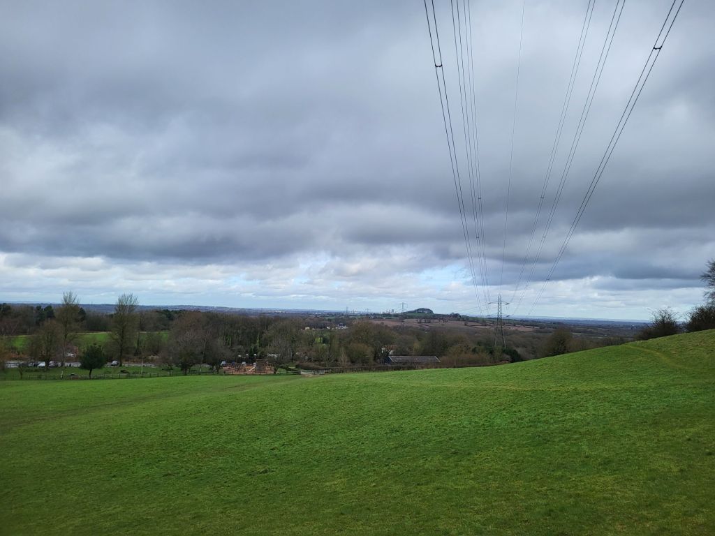
Looking south from Windmill Hill (287 metres above sea level) in the heart of the Waseley Hills Country Park you can see Bredon, Malvern and Abberley, the three great ridges which dominate the otherwise gently hilly landscape of Worcestershire.
To the north and east inside West Midlands county sprawls the raised metropolis of Birmingham and the Black Country up upon the Midlands plateau. Due north of Windmill Hill the towers of Birmingham city centre align closely with the curve of the M5 motorway and the patch of woodland, Frankley Beeches, above a hill straight ahead. To the east lies the craggy boundary between urban West Midlands and rural Worcestershire that are the Lickey Hills. While on the western horizon the towns of the southwestern Black Country, Rowley Regis, Blackheath, Halesowen, Old Hill, Cradley, Lye and Stourbridge, cluster like the names of calling points a railway carriage or express double decker’s passenger information screen. Running up the slopes of Turner’s Hill, the vulcanised limestone, communications masts bedecked, highest point in West Midlands.
Atop Windmill Hill, the toposcope that illustrates all of this in engraved form, was the first calling point of Walkspace’s Severn/Trent Watershed Walk for Terminalia Festival 2024. Occurring on the 23rd of February each year Terminalia is a transnational festival inspired by a Roman god which explores boundaries in all their myriad, fluid, culturally contingent, forms.
Why Walk the Watershed?
This year, in conjunction with Andy Howlett (filmmaker, artist and Walkspace Co-founder), I was pleased to deliver Walkpace’s contribution to the event, which celebrated the Severn/Trent watershed, one of the Midland’s most important and defining geographical features. I have written before about how in broad terms the Severn/Trent watershed marks the boundary between the southern and west parts of the Midlands in the Severn catchment area which are considered more bucolic, even mystical, than the modern modern, industrial and postindustrial, heavily populated River Trent basin. It was this which encouraged Andy to reach out to me about co-producing Walkspace’s Terminalia Festival 2024 walk as he was keen to explore the watershed. Though whilst the walk was initiated and developed by Andy and I, many members of the Walkspace Collective contributed to the event on the day.
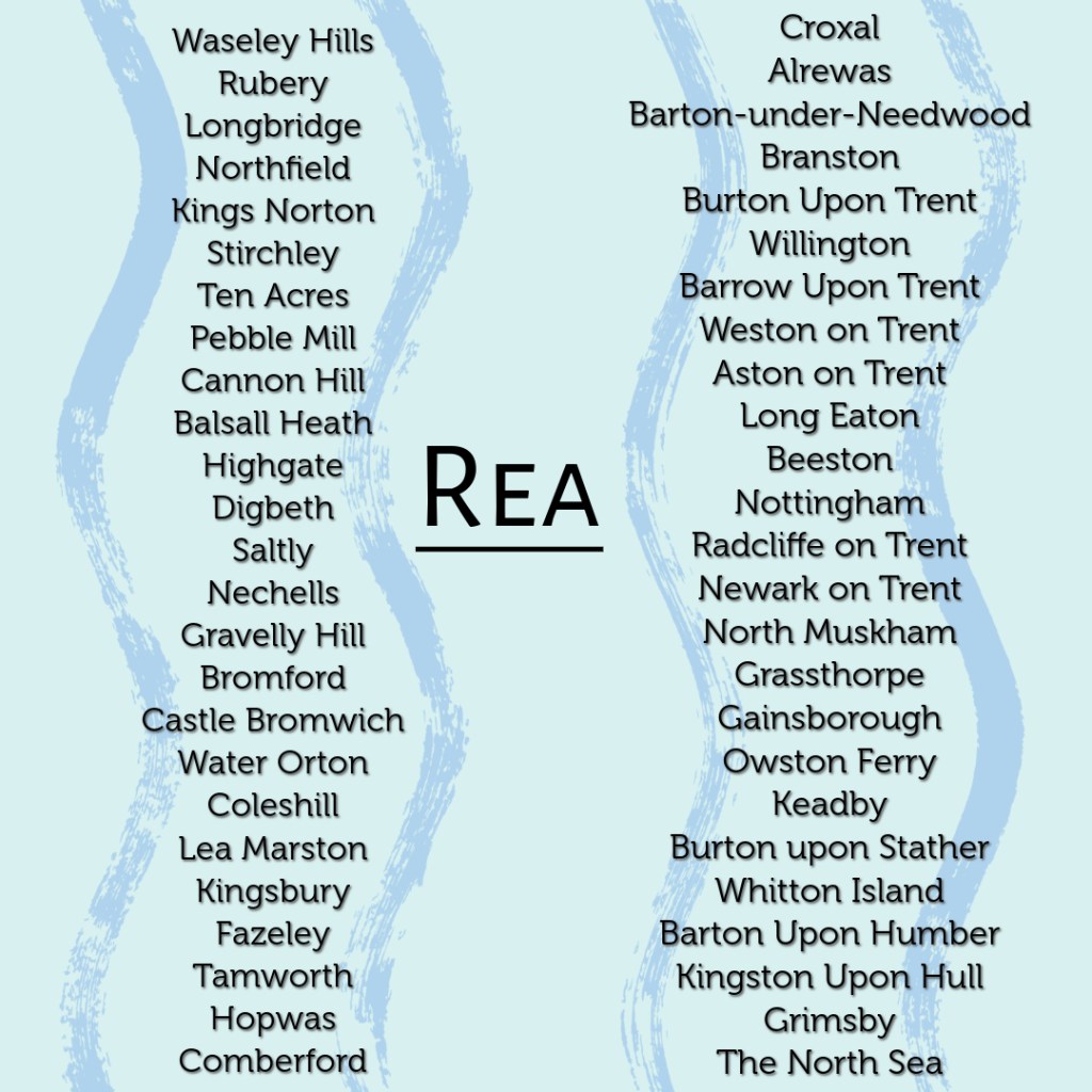
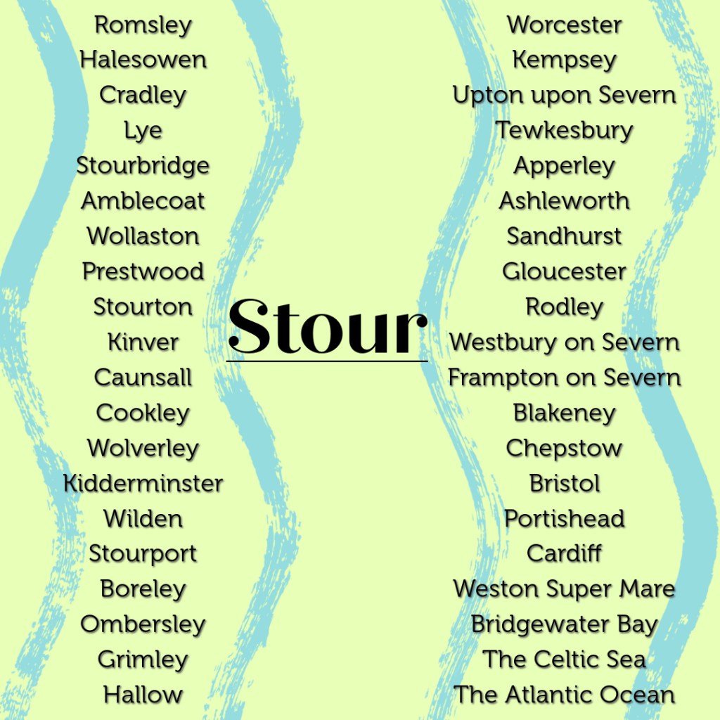
Walking between the two river’s starting points requires a short, but intense, amidst the muddy late-February conditions, hike across quite hilly ground. Rising only two and a half miles apart the River Rea flows north across Birmingham to the Tame, which in turn runs in a northeasterly direction to its confluence with the River Trent, through which it eventually flows out past Kingston-upon-Hull to the North Sea. While from a well behind St. Kenelm’s Church the River Stour trickles forth and commences its journey, wending its way across the southwestern Black Country and out into the Staffordshire and Worcestershire countryside, through Kidderminster and into the River Severn at Stourport. From there the water flows on and out into the Celtic Sea via the Bristol Channel.
The contrasting myths and histories associated with the rivers brilliantly illustrate the contrasting perceptions of the southern and western Midlands versus the north and eastern parts of the region. The Rea is feted as an industrial river. Its waters turned the mill wheels and cooled the metal which drove Birmingham’s growth and expansion as the Midland’s major metropolis. An expansion which led with a certain degree of irony, indicative of Birmingham’s utilitarian unsentimental character, to the Rea being culverted and covered over for large stretches of its course through Birmingham. By contrast, the Stour, flowing through some of the leafier parts of the Black Country and then down through mixed rural and urban terrain in northern Worcestershire, is chiefly associated with the mystical, allegorical, medieval Chrisitan myth of the murdered Merican boy king St. Kenelm. A tale which sounds like it would be more at home in the depths of rural Cornwall, Wales or Ireland, rather than on the skirts of the urban West Midlands.
Windmill Hills’ toposcope handily aligns with the Severn/Trent Watershed. As a cultural and historical appreciator of watersheds, rather than a geographical, geological and hydrological one, I had naturally assumed that crudely speaking water falling on the southern flank of Windmill Hill would eventually run into the Severn via the Stour. While water falling on the northern slope would flow via the initial conduit of the Rea into the Trent. As Walkspace member Robson observed things are not so simple, rather both the Rea and the Stour initially flow north, albeit one towards the east into Birmingham and the other to the west through the southwestern Black Country.
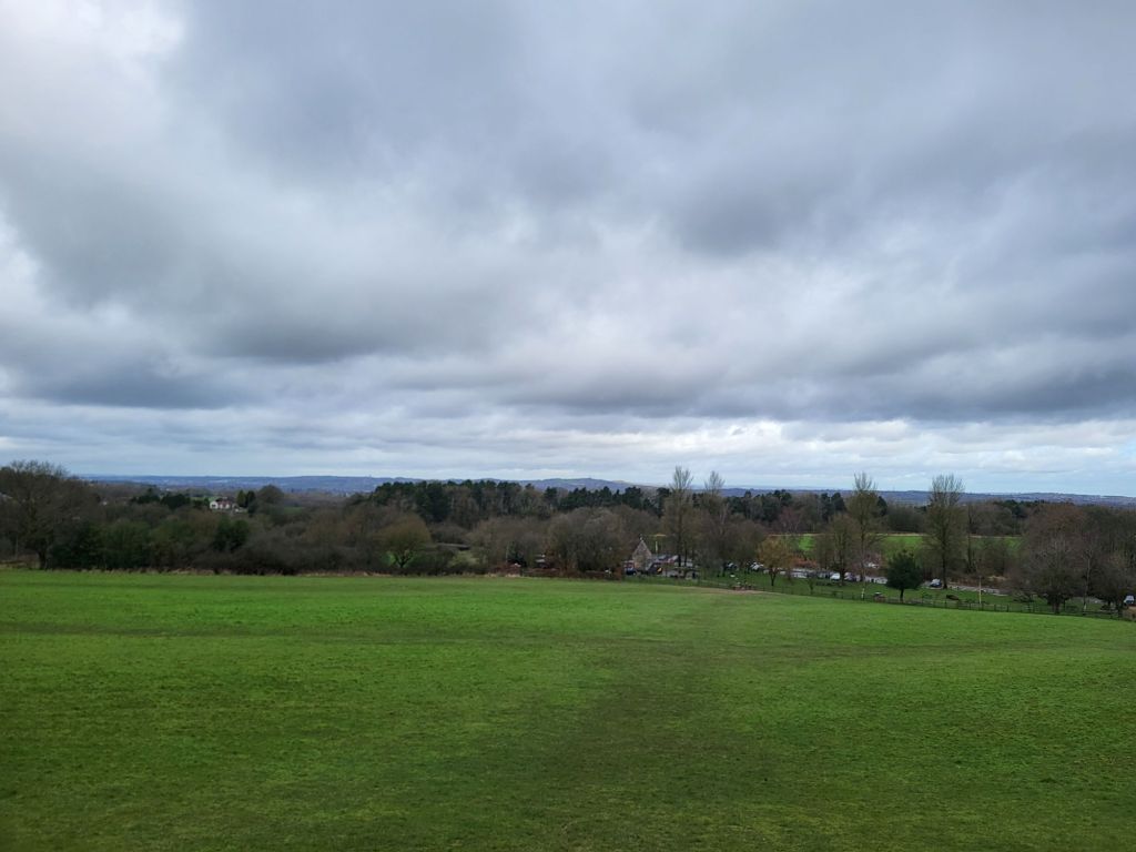
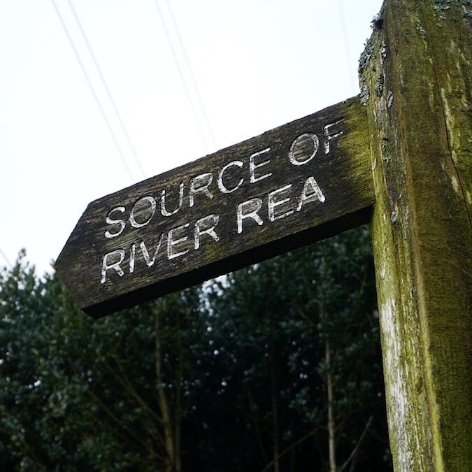
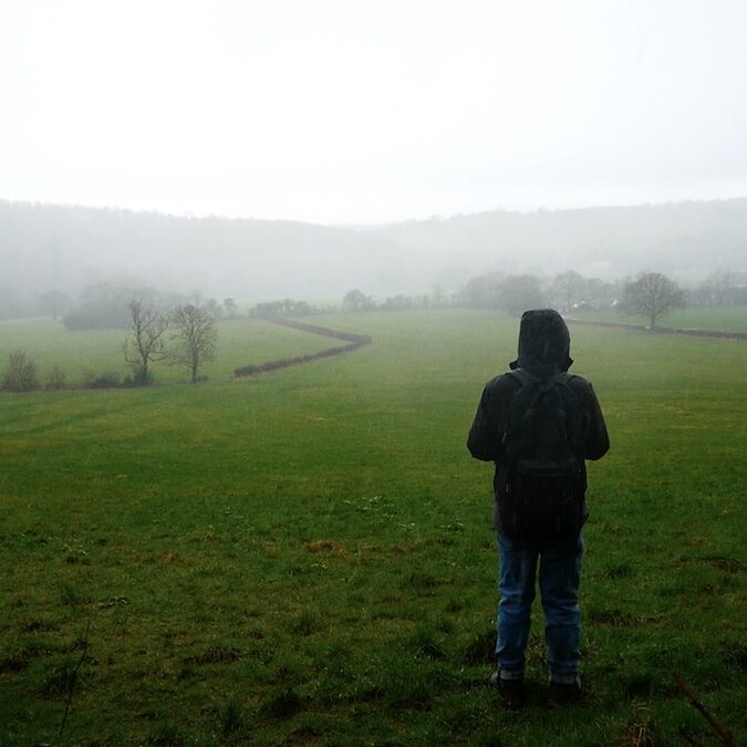
Having clambered down Windmill Hill, the fourteen of us in the party, Walkspace members, and members of the public alike, made for the Source of the River Rea, another of Waseley Hills Country Park’s attractions.
After a brief psychogeographical ceremony and a poetic recital by Andy, resembling in parts a rural North Midlands version of the KLF’s“It’s Grim Up North”, of many of the settlements along the Rea, Tame and Trent which the water would flow enroute to the North Sea, the party set-off to head west leaving Waseley Hills Country Park to cross the M5 into rural Worcestershire.
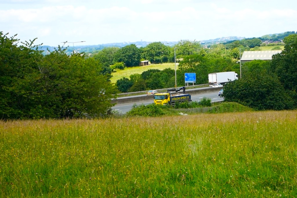
As many on the walk noted, the M5 is an important barrier in its own right. Indeed if Environment Agency maps are to be believed it runs quite close, even in parallel with the Severn/Trent watershed. Perhaps West Midlands residents are conditioned to associate the M5 with escape through years of West Country holidays? However, there can be no doubt that the majesty and thunder of the river of cars flowing beneath the motorway bridge aside, that the massive road does mark a barrier, both psychological and physical, between the West Midlands conurbation and the rural north Worcestershire countryside.
Beyond the M5 the walking party moved into open countryside. Heading downhill towards Dowery Dell then turning left to head up to the hilltop village of Romsley. It is simultaneously a freestanding ancient hilltop village and a suburbanised exurb of Halesowen and the rest of the leafy southwestern Black Country fringe.
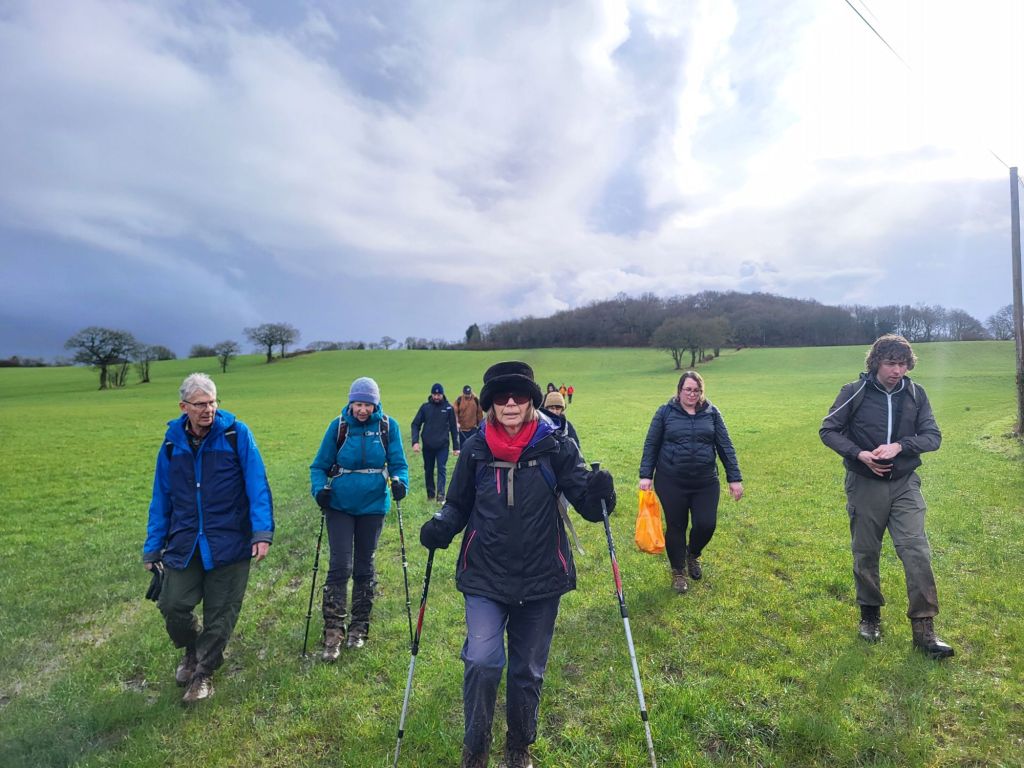
It being February progress was slow across waterlogged fields. Little surprise in a part of the country with rich claggy soil that is the genesis for so many rivers. Then the hail started. A brief pause was made in the car park of the Swallow’s Nest pub, patrons scurrying between the hostelry and their cars eyeing the group with a mixture of respect and pity, before setting up again even further uphill to the southern edge of the village.
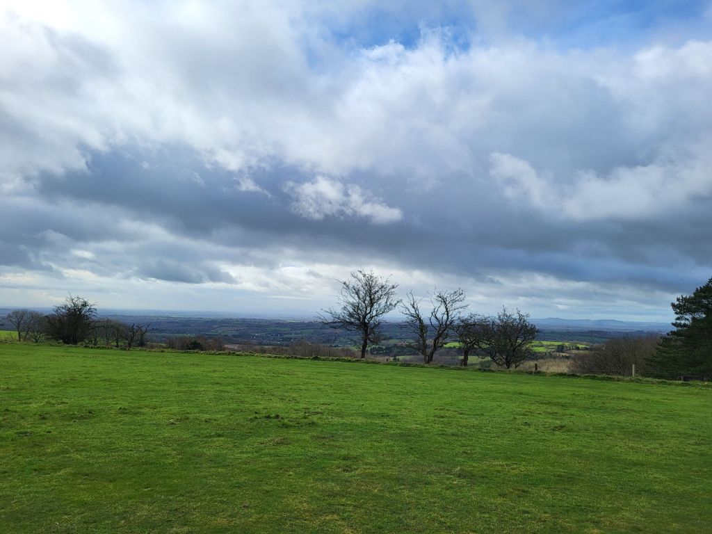
Romsley is high up as large villages in England go. The Swallows Nest where we paused stands 241 metres above sea level. Reaching the edge of the village and making good time, despite the mud and the weather, it being the coldest day for at least three weeks, we climbed to nearly 275 metres and the top of Romsley Hill.
Here something went a little bit awry with a footpath not adhering to the right of way, a common problem on the edge of settlements, where villagers tend to carve their own folkways. This lack of local knowledge occasioned a quick scramble across a couple of fields, down into a pretty valley ringed with trees opposite the Clent Hills, and then escape back into human settlement via gaps in a hedge onto a campsite shut for the winter.
Hastily getting back to where we should have been via the campsite’s access road, having deftly navigated a gate, swift progress the rest of the way to St. Kenelm’s Church was made. The walking route was mostly along the capillary thread of bucolic lanes which skirt the Clent Hills.
Reaching woodland beneath the larger of the Clent Hills spectacular views of the hilly southwestern edge of the Black Country came into view to the right. Handily the sun came out just at this point illuminating the varied urban, industrial, yet also highly green fringe of West Midlands county. Pleasingly most of the final stretch of the walk to St. Kenelm’s Church and the well which is the source of the River Stour was across a field with spectacular views towards the nearby conurbation.
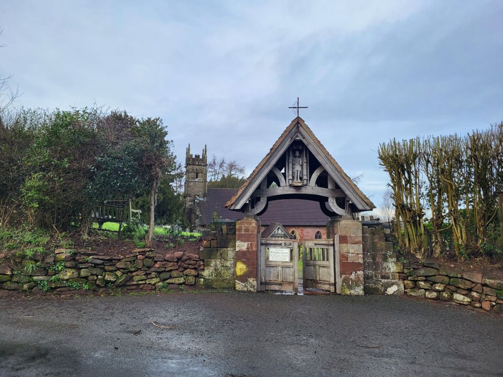
St. Kenelm, a Midlands saint subject of a popular quasi-religious legend during the middle ages, can be glimpsed in a lovely, characterful carving on the front of the lychgate into the churchyard.
The church itself is ancient and evidently much added to over the years. Today St. Kenelm serves the parish of Romsley and the surrounding villages, the current building evidently Victorian in part, but with lots of far older components and embellishments. If Wikipedia can be believed the little church’s crypt is formed from the remains of a shrine which lay at the heart of the pre-Reformation cult of St. Kenelm.
After a late lunch, Andy recounted the legend of St. Kenelm outside the church’s porch, before the watershed walking party made its way down to the well behind the church which is the source of the River Stour. Here there was another psychogeographical ceremony, featuring a sheep skull (providentially discovered in a tree during the walk), spreading of flowers, and a recital of the names of the settlement which the water bubbling from the well would flow through on its way to the sea. A jar half filled with water from the River Rea was dipped into the well to capture water destined for the Stour too.
This event was the closing ceremony for Walkspace West Midlands’ Terminalia Festival 2024 watershed walk. Signifying the boundary between the Trent and the Severn had been well and truly crossed.
Here most of the party continued walking straight downhill in the shadow of the Clent down towards Halesowen and private cars, buses and taxis home. Along the way we passed through scuzzy, almost heath-like countryside on the northernmost edge of Worcestershire. This included skirting the fringe of Uffmoor Wood, a scrap of ancient woodland, surviving in the greenbelt just outside the Black Country. The footpath runs close to the gathering watercourse of the River Stour. This contributed to it being very wet under foot. Soon we reached the dual carriageway on the edge of Halesowen and were rapidly absorbed back into the West Midlands conurbation beyond.