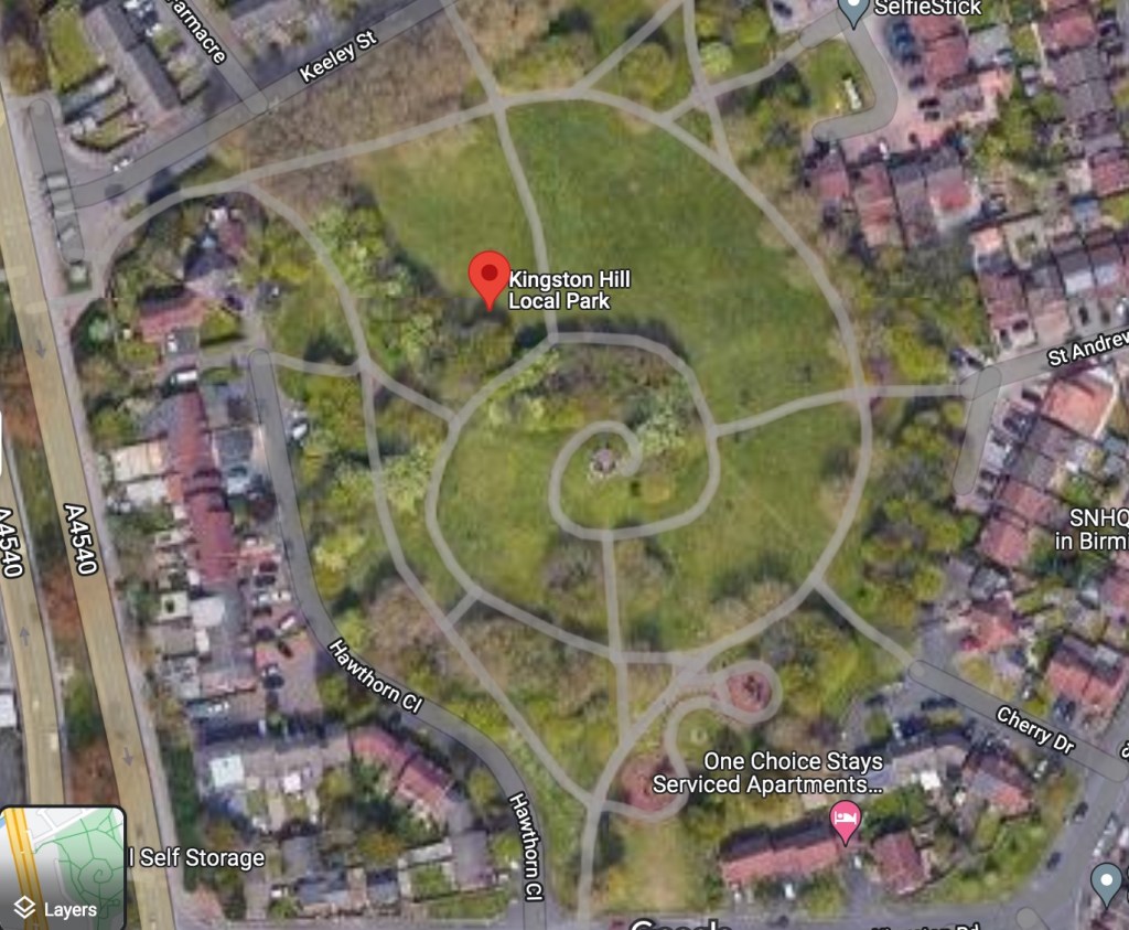
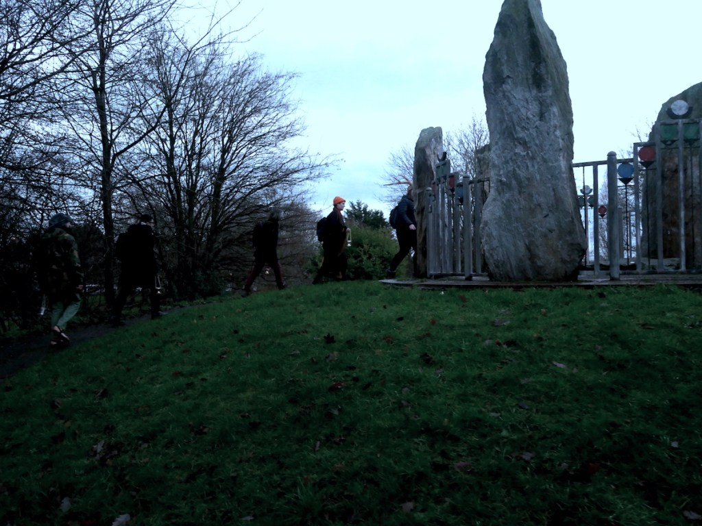
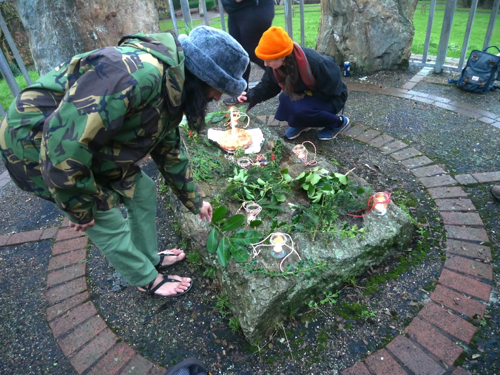
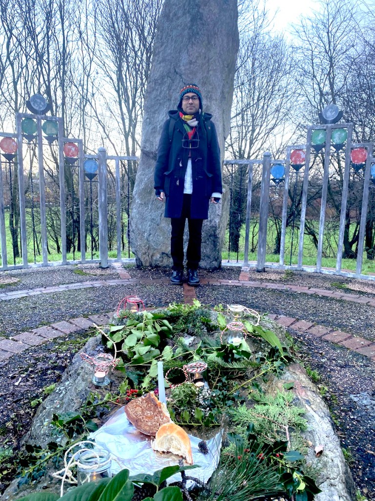
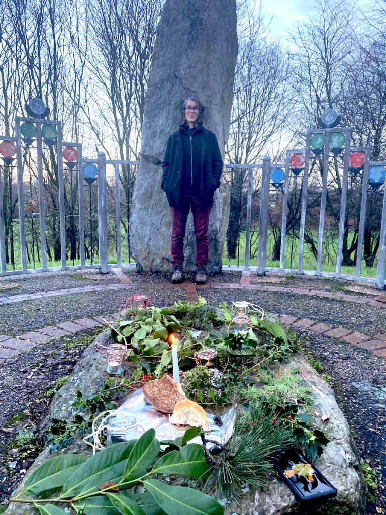
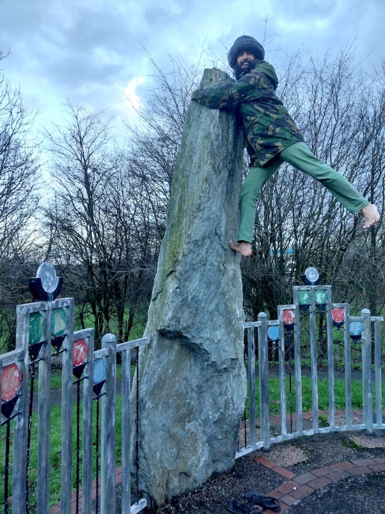
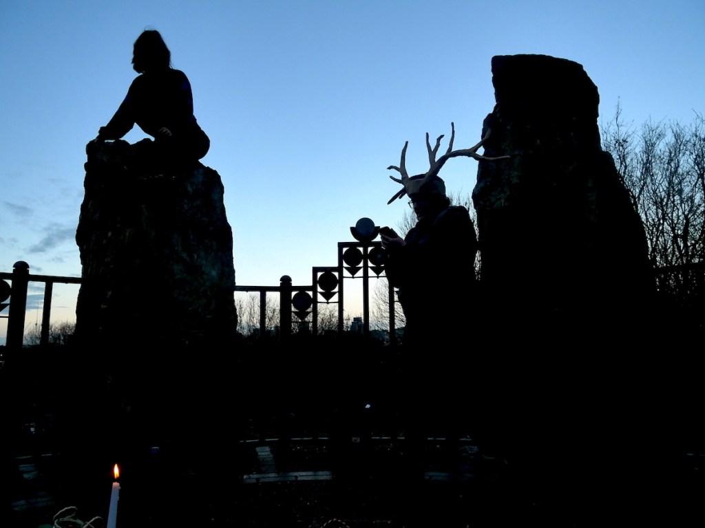
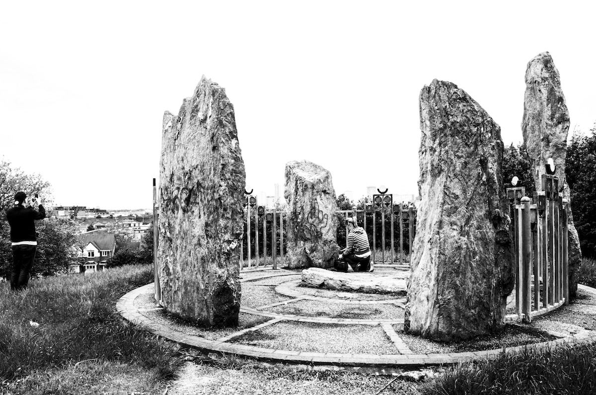
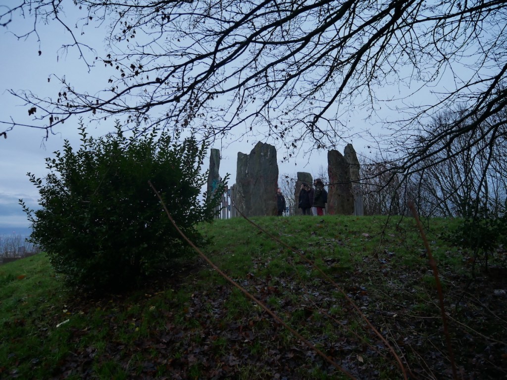
For the final Walkspace Erratic of 2022 we visited Bordesley Henge in Birmingham to mark the Winter Solstice. Bordesley Henge is a municipal stone circle situated in Kingston Hill Park and is believed to date back to the 1990s. Six standing stones form a ring on top of a mound, up which a spiral footpath winds its way from the park’s entrance just off the A4540 Middleway. The park is the very definition of a hidden gem and from above it looks like a giant ammonite.
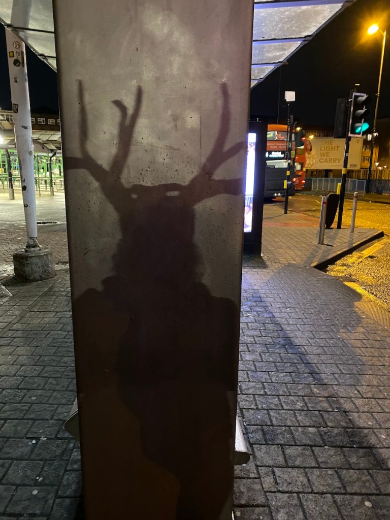
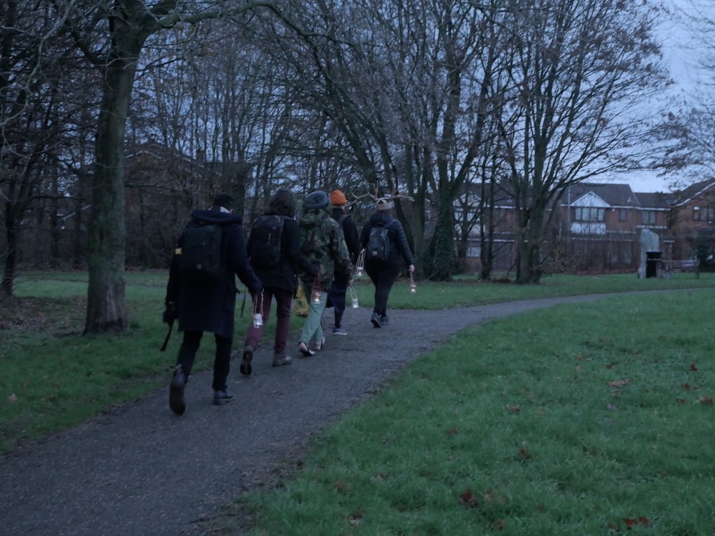
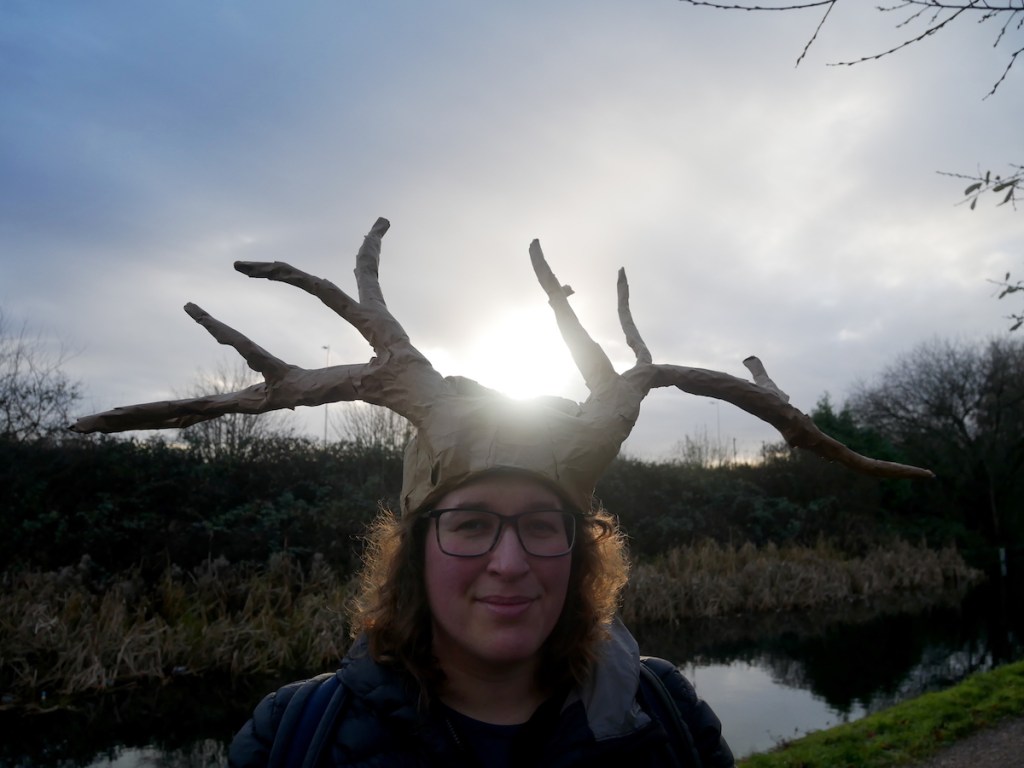
Andy first piloted this walk three years ago in the days before Walkspace but this time around he was joined by Charlie who helped flesh-out the idea with a lamp-lit procession and Yule Altar. Being a sunrise walk we weren’t at all sure how many people to expect but we were delighted to be joined by some friendly faces including the Deer Mother and Holly King.
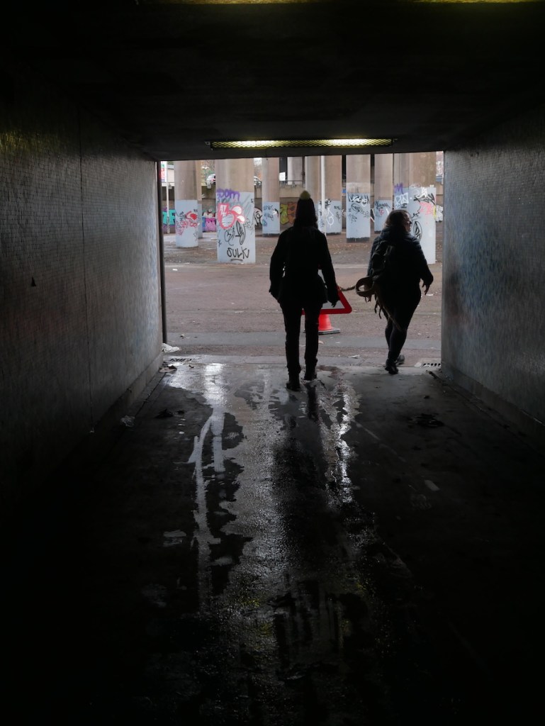
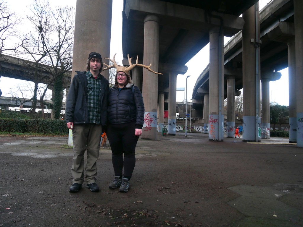
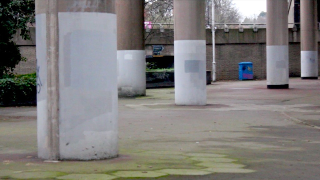
After making our offerings at the altar and enjoying an impromptu singalong, some of us made our way onto the Grand Union Canal and followed the towpath north to Spaghetti Junction for a cup of tea in Salford Circus – a very different type of stone circle.
We hope you enjoy these pictures from the day and here’s to many more Erratics in 2023. It gets lighter from here!
The Winter Solstice is the midnight of the year: the point at which the sun is furthest away and daylight hours are at their lowest. It’s the shortest day, the longest night but it also marks the beginning of lighter days to come. In the cycle of the year, it’s a time between death and rebirth and so is a time for rest, reflection and dreaming.
The clamour and strain of city living can make it difficult to feel connected to these cosmic cycles but fortunately Birmingham does provide some unorthodox sacred sites that suit the purpose. One of these is the council-commissioned stone circle at Kingston Hill Park in Bordesley Village, believed to date back to the 1990s. This is where we will welcome the sunrise with a silent, lantern-lit procession up the spiral footpath to the stones. Here we will create a Yule altar* and watch the first of the sun’s rays hit the city skyline.
From there we will make our way onto the Grand Union Canal towpath and head north through Saltley towards Gravelly Hill. We’ve already spoken about the significance of Spaghetti Junction as a confluence of confluences and it is here that we shall end our walk with a visit to some very different standing stones: the concrete columns of Salford Circus. If we’re lucky with the weather then the sun will provide us with a natural light show across this mighty colonnade and the surrounding scenery.
Meet Andy and Charlie outside The Rainbow pub on Bordesley High Street at 7:45am, Wednesday 21st December.
The route is three miles long and will likely take upwards of two hours including the procession. For those who just want to come for the sunrise but not the towpath walk you are welcome to do so – we’ll be finished at the Bordesley stones by 8:30. For those carrying on to Spaghetti Junction there are regular trains back from Aston Station and buses into town from Lichfield Road.
The route will mostly be pavement and towpath with some steep and uneven sections. Steps will be avoided. Wear sturdy footwear and wrap up warm. We recommend bringing bottled water and something to snack on. No need to book, just turn up. The walk will go ahead whatever the weather.
*You are welcome to bring a contribution for the Yule altar eg. holly, mistletoe, pinecones, candles etc.
This piece by Andy Howlett was originally written in April 2021 and appeared in Back to the Future, “a forward looking journal about past-futures, modernism, architecture, and town-planning in Birmingham.” Upon learning of the death of the pop-artist sculptor Nicholas Monro it seemed fitting to repost it here in tribute. Every word of it is true and like all great stories it started with a walk…
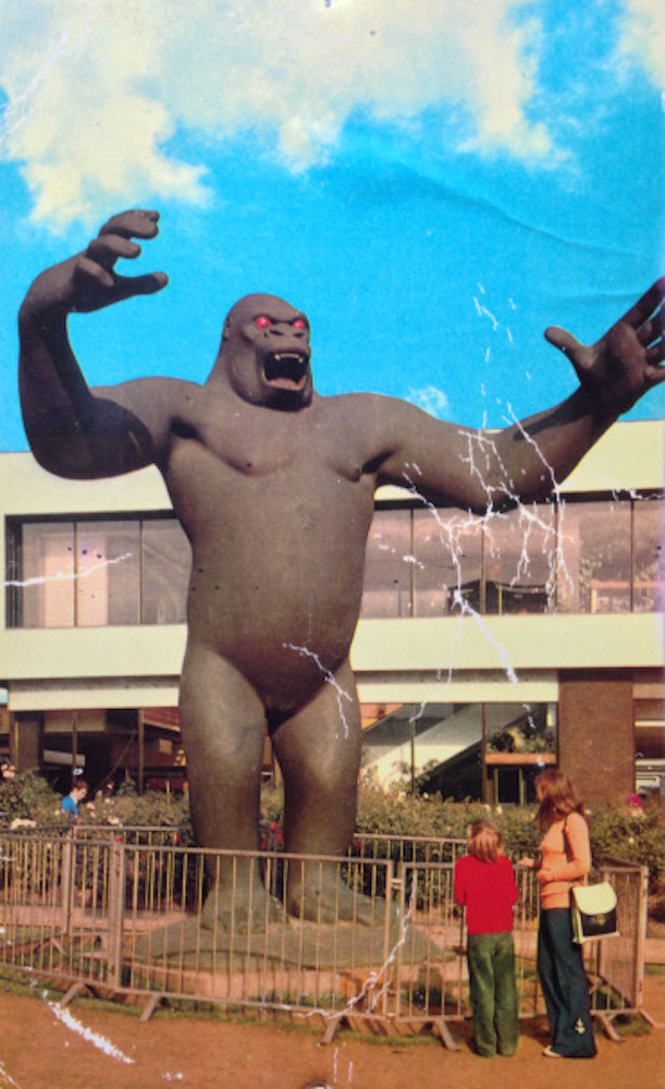
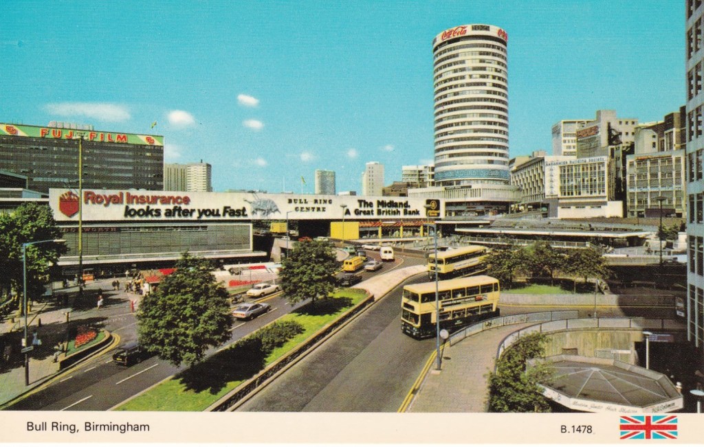
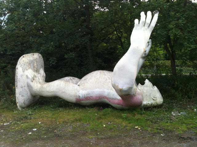
Anyone who’s seen the film King Rocker will know that for a brief time in the early ‘70s, a giant fibreglass gorilla lorded it over the grounds of the Bull Ring shopping centre in central Birmingham. The previous two decades had seen the city rebuilt from the rubble of World War Two in the image of what was then considered the future: soaring flyovers, concrete monoliths, traffic island beauty spots, heroic multi-storey car parks.
“What Birmingham does today, the world does tomorrow”
King Kong watched over this futurescape from the shadow of the Rotunda, encircled by the rumbling flow of the gyratory new road system.
Guardian Spirit
City (dis)oriented
Eighth Wonder of the World
The mighty Kong’s reign however was short-lived. After six months Birmingham City Council sold him off to a second-hand car dealer down the road at Camp Hill. The “City of the Future” swiftly degenerated into a concrete wilderness: the once radiant surfaces became sullied by petrol fumes, pedestrians came to resent their second-class status, and the much vaunted inner ring-road earned itself the nickname “The Concrete Collar”.
After his stint in second-hand car dealership, King Kong found his way to Scotland, was painted bright pink and displayed in a market, only to be later left abandoned and vandalised in a car park in Penrith.
Fast-forward half a century. It’s a sunny May afternoon in suburban Birmingham, the country is in the grips of a deadly pandemic, and I receive a text from my mum:
“You’ll never believe this but I think I met the sculptor of King Kong on a walk in the Dorset countryside this afternoon!!! Tony and I were out walking and we came across this remote cottage and we couldn’t tell if it was inhabited or derelict. Then we walked round and saw this elderly man working on a strange object in a half covered shed. He said his name was Nicholas and talked a while with Tony about his invention. Then we came across the local farm shop and they said he had been a sculptor. We looked him up when we got back and are pretty sure he is Nicholas Monro and that one of his creations was King Kong!! How amazing is that.”
I look up from my phone and regard the King Rocker poster on my wardrobe door. The great ape returns my gaze through a pair of fiery red orbs.
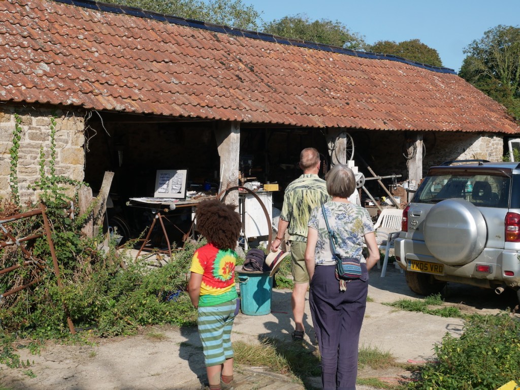
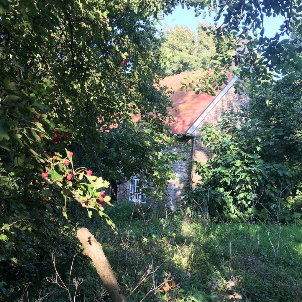
Fast-forward four months. We are walking along a dusty track through the lush Dorset countryside, the site of a lost medieval village. We don’t know if he’ll be home but I have a printed picture of the Kong statue and a sharpie pen, just in case. Anticipation grows as we descend the gentle valley and proceed through a corridor of foliage. Various farm buildings loom up either side of the path, the immense steel and wooden structures swallowed by ivy.
Then we reach the shed; a sturdy structure of stone and wood with a wavy red-tiled roof. One side is open to the world and the contents spill out onto the weed-ridden yard. The vibe is somewhere between a junkyard and a workshop: upturned wheelbarrows, assemblages of rusted machinery, tripod-mounted sculptures including a spindly figure of wire and bone. Other than a lolling tabby, there’s no one here.
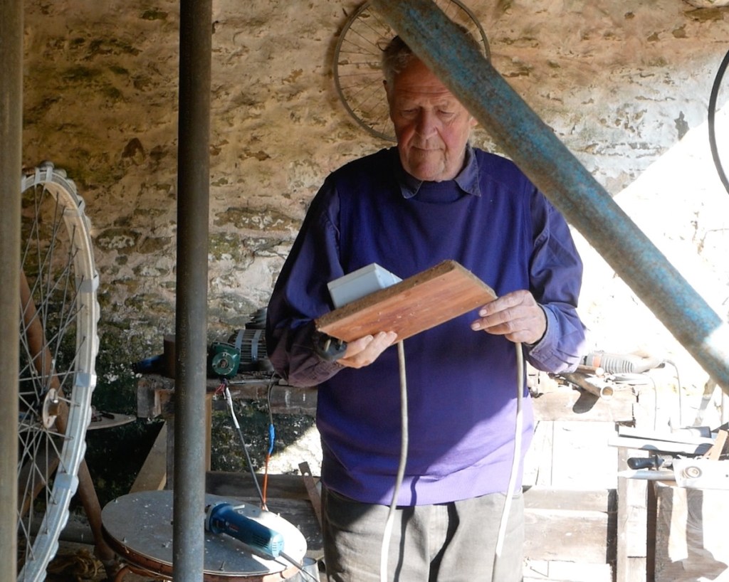
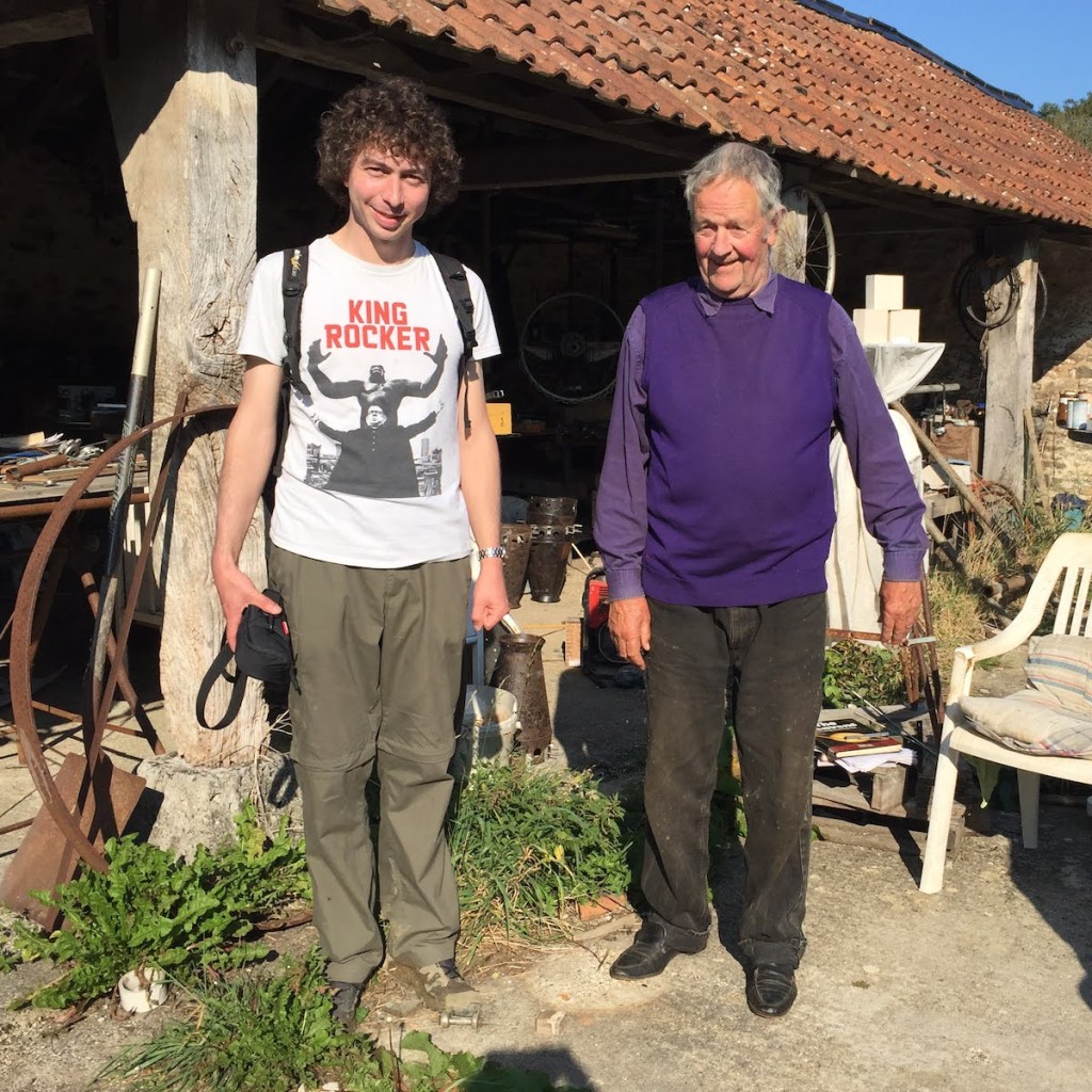
We wait with bated breath, the cottage just visible beyond a sprawling garden. We consider knocking but then he emerges from a track beside the shed in a striking purple jumper and matching long sleeve shirt. We’ve interrupted his afternoon glass of wine but we’re a welcome interruption. He remembers Tony and my mum and is delighted to see that this time they’ve brought company: a ragtag audience. He’s even more delighted and not a little astonished to learn that we know who he is. He sees my King Rocker T-shirt and his eyes light up in recognition of his famous simian creation.
The makers of the film had looked into contacting Monro for an interview but couldn’t get an address and were told he lived off-grid, reachable only by payphone. He tells us about the Kong statue’s critical reappraisal in recent years, how it was rescued from the car park, restored to its original condition and displayed in the Henry Moore Institute in Leeds, star attraction of the City Sculpture Projects 1972 exhibition. He says he wishes he’d known that we were interested because then he could’ve told us about the show.
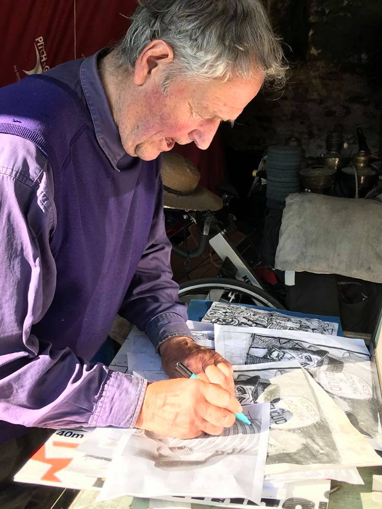
I take the printout from my pocket and ask if he could sign it for me. This clearly isn’t a situation he’s familiar with – how should he address it? “Dear” sounds too personal.
He takes us into the studio-shed and shows us some of his latest ink drawings: a series of comic-book style scenes based on puns of his own invention: “Here’s looking at Euclid”, “Vermeer to Eternity”. He’s considered approaching the art shop in the nearby market town but hasn’t mustered the courage yet.
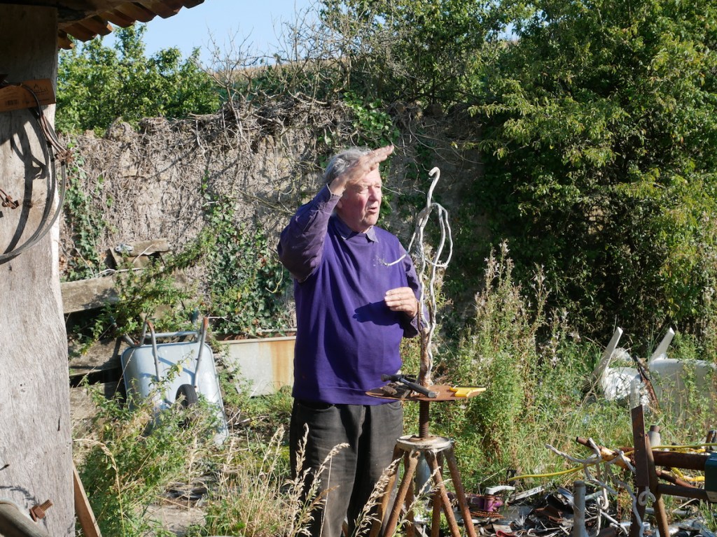
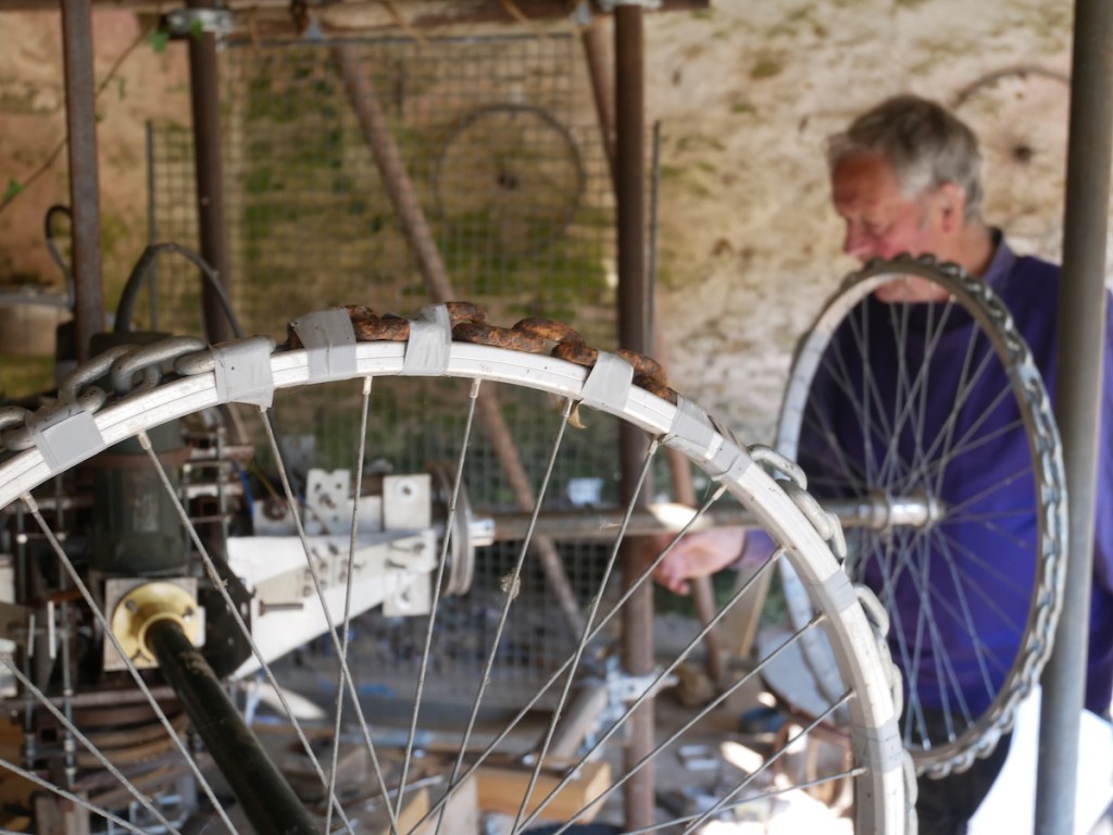
He leads us away from the work-desk towards the grand centrepiece: a work-in-progress he refers to as “The Contraption”. A curious apparatus of scaffolding, breezeblocks and bicycle parts, assembled in a radial configuration with a motor at the centre. It’s immediately clear that this is his true passion project, as he excitedly offers to give us a demonstration.
The generator is located in a small outhouse adjacent to the workshop. He disappears behind the door, starts it up and re-emerges with a makeshift control pad. He turns a dial and The Contraption jumps into life, the bicycle wheels rotating around a central axle in a centrifugal motion, gradually picking up speed. We all take a step back.
He’s at pains to stress that this isn’t the finished thing but more like a prototype. He points to a pile of physics textbooks and explains how when he’s got it just right, the component parts will rotate in such a way and at such a velocity that the known laws of physics will break down and The Contraption will defy gravity. Yes, Nicholas Monro is building a flying machine. Once the basic principle has been demonstrated he’s confident that it will revolutionise the aviation industry, put an end to our fossil fuel dependence, and make flying cars a reality.
He says that while he’s done his best with the skills he has, what he really needs is an engineer and some decent kit. He’s contacted the physics departments of different universities to tell of his innovation but none have been willing to take him seriously. “They think I’m a charlatan,” he tells me, “I don’t mind really but given the choice I’d rather be thought of as a fool than a charlatan.”
By now The Contraption has picked up quite a bit of speed and the youngest member of our group asks excitedly, “is it going to fly?” to which Nicholas replies with a chuckle, “no it won’t now but it will someday… because I say it will.” Following the demonstration he bids us farewell and tells us we can come and visit any time we like. We promise we will and continue our walk in the scorching late summer sun.
It’s 2021 now; King Rocker has premiered on Sky Arts to great acclaim and Birmingham tentatively looks ahead to a post-pandemic reality. In a time of such uncertainty, when so much has been lost and so much may never return, it’s comforting to know that somewhere in deepest rural Dorset, a kindly elder is keeping the future alive.
It’s that time of year again. The nights are drawing in, the leaves are falling and the earth quietens as we prepare to enter the dark half of the year. It’s now become a Walkspace tradition to mark this point in the calendar with a Halloween walk around the Stirchley Skull and we hope you can join us.
We created the Stirchley Skull two years ago in the midst of the plague by overlaying an image of a skull onto a map of Stirchley and then walking it into existence under the light of a full moon. We carried jar lanterns to ward off evil spirits and ate soul cakes for sustenance.
A year later our second skull walk was nearly thwarted by an early winter tempest but fortunately the howling gales and horizontal rain were short-lived and the walk was able to go ahead, albeit without the lanterns. Minus the protection of the lanterns we were subjected to many incursions from the Otherworld, this being the time of year when the veil between the physical world and world beyond is at its thinnest. Fortunately we still managed to complete the circuit without losing anyone along the way. Will we be as fortunate this time?
Join us on Monday, October 31st at 7:30pm, outside Stirchley Library on Bournville Lane. This is a gentle circular route lasting no more than 90 minutes with the option of going to the pub after to de-spook. The terrain will mostly be pavement and roads, with a bit of grass and a gravelly track. Prepare for muddy conditions and the first gales of winter. No need to book, just turn up. A number of jar lanterns will be provided, weather permitting, but if you’d like to bring your own please do so.
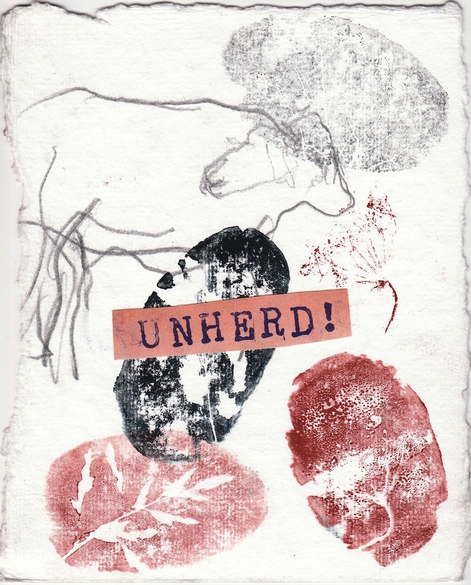
A group of artists and writers gather together for Unherd! Walking the Land events to explore themes of land ownership/access, climate change, community resilience, rewilding, growing, justice and indigenous culture through walks, creative activities, mapping, discussion and research in the landscape around the Marches Mosses and Rural Art Hub close to the Welsh-English border in North Shropshire.
This is an inclusive group enabling artists to follow their individual artist practices or to find ways to collaborate. We are working together to develop longer term plans for a funded project involving the local community, creating both audiences and activists, raising awareness and much-needed hope of arriving at a collective manifesto.
All are welcome to join our events. For more information email Andrew at: andrew@andrew-howe.com
Next Events
The next event Digging Words is scheduled for Friday October 7th 2022 starting at the Rural Art Hub, 10am.
For Digging Words participants will be invited to pause on different stages of the walk and respond to a range of provocations and instructions which will invite play with words used commonly to describe the experience of the rural. These improvised texts – both writings and readings, sonic and visual – will accumulate to form the basis for a final collective performance-installation at the end of the walk. No experience necessary. All welcome.
Each event has a different theme with walking and or creative activities devised and led by one or more artists. Please consider making a donation on a “pay what you can” basis to contribute towards paying artists/event leaders, Rural Art Hub hosting, general events co-ordination and planning and potentially building towards future projects and community engagement.
The last Unherd! event of 2022 is scheduled for Friday 25th November
Values.Voices.Action.
Unherd! emerged from conversations started by Andrew Howe with other artists about extending the Mosses and Marshes project and it has opened out to link with other ventures. We are picking up on some of the themes explored during the Mosses + Marshes international discussion panel in November 2021 which led to the Values. Voices. Actions. initiative. Read more
Unherd! is:
breaking away from fixed, established narratives in the rural landscape to reveal more nuanced stories
hosted by the Rural Art Hub, itself bringing new creative life and perspectives to a former dairy farm, home to the Willenhall herd
seeking to give voice to those less heard from across the local community and further afield
Previous Events
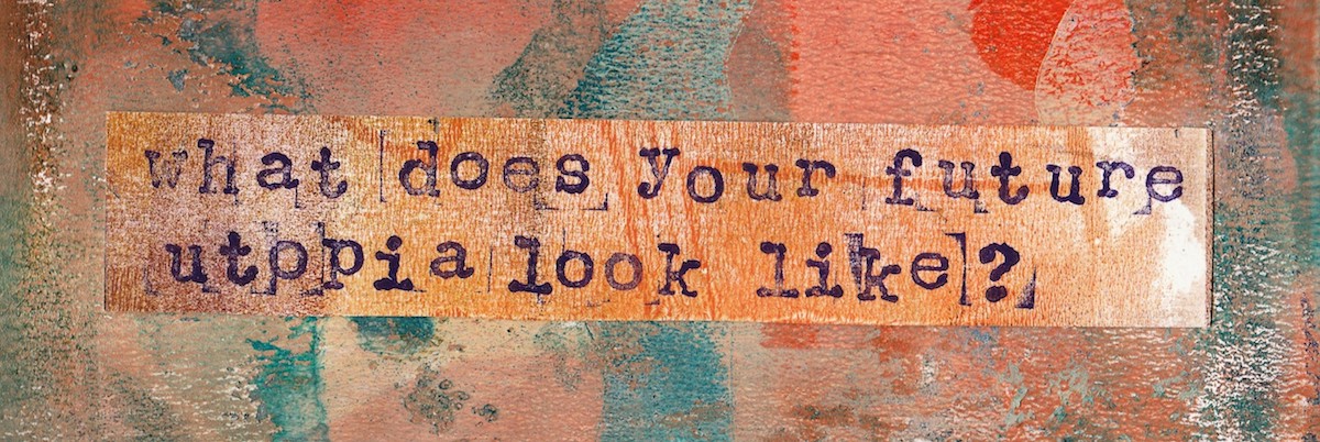
Previous events have investigated historic timelines and themes of access to land and justice, rural utopias and deep time.
Walking the Land
Led by Andrew Howe, this circular walk of just over 6 miles to Bettisfield Moss, traversed a timeline rich with stories of Iron Age/Bronze Age bog bodies, land seizure by Norman lords, Turbary rights, Land Enclosures, contentious construction of canal and railways, wind powered and steam powered corn mills, fine churches built by local aristocracy, target practice and bombing during two World Wars, industrial peat extraction, forest clearance and finally peat bog restoration and natural resurgence.
We walked with the themes of access to land and justice in mind and returned to the Mothershippon studio at the Rural Art Hub to make creative responses.
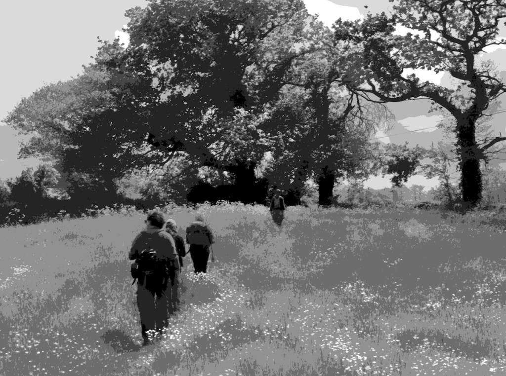
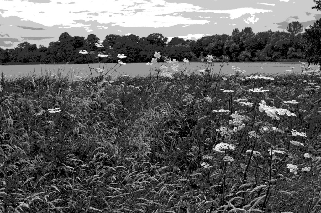
Rural Utopias – A walk towards Hanmer Mere led by Andrew Howe and creative activities in Hanmer village.
The 6 mile circuit took us from the Mother Shippon to the edges of Bettisfield Park and the epicentre of the Hanmer estate which has had such an influence on the Mosses and surrounding landscape for many centuries. The family descends from an officer of Edward I, and later a supporter of Owain Glyn Dwr – descendants included Tory MPs, high ranking lawyers, local benefactors and they were one of the main instigators of the Enclosure Act which led to large scale peat extraction at the Moss.
During the walk we reflected on what would be different in our rural utopia – for example, if there was reduced demand for meat production, there would be less need for secure boundaries for holding livestock, and land could become more accessible and potentially open to other public uses.
Deep Time
Julie Harrison led this 4 mile walk through the landscape of Fenns Moss, describing some of the geological history of Shropshire and evolution of the Earth through a 4.6km section of the walk. This walk was inspired and based on the work of Dr Stephan Harding, whose own Deep Time Walk is available to download as an app www.deeptimewalk.org
Resources and maps for others to follow these routes and make creative responses are available.
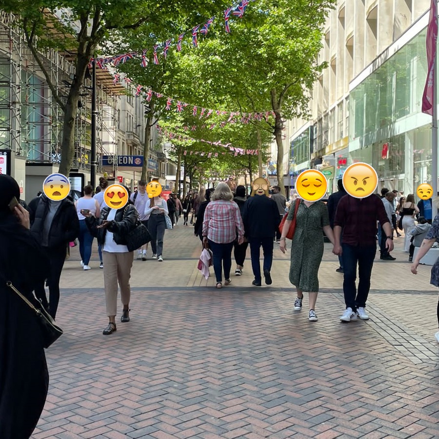
With an increased emphasis on the need to reconnect with nature, to escape the city and restore ourselves in greenery, what happens if we attempt to flip this? What if instead we escape to the city? What if we try to reconnect with the urban and restore ourselves amongst the grey?
Join our newest member Dan Gutteridge on September 18th for a walk through the hyper-urban streets of Birmingham. Rather than simply rushing through the concrete to get from A to B, we’ll take time to see and think about these busy pedestrian streets differently; investigating the emotional influence they have on all who pass through and inhabit them.
As we drift we will use ’emoji mapping’ to unfold how we see and feel in various sections and consider how these spaces might bring new experiences to us. Being away from nature, can we connect to the urban in ways that generate similar emotions to those we feel amongst the green?
The walk will be a playful attempt to unpack how and why we feel the way we do in the city. Using an empty map of the streets and some emoji stickers we’ll have a go at mapping our emotions (positive and negative) using the stickers as starting points for discussions. Whether you love or hate walking in the city, you’re sure to come away with a fresh perspective.
Meet in Victoria Square at the bottom of the stairs by the fountain at 11am on Sunday 18th September. We’ll then set off down New Street for a 90 minute walk, finishing off back where we started. The terrain will be pavement with only slight inclines and no steps. No need to book, just turn up. The walk will go ahead whatever the weather so check the forecast and dress appropriately.
Those who wish to bring their own cameras/notepads/pens are encouraged to do so but this is not a requirement as all materials needed for the mapping will be provided. After the walk there will be the option of retiring to a pub or cafe to chat further over beverages.
Dan is currently undertaking research on walking in hyper-urban environments for his Masters dissertation. The emoji mapping of New Street will help contribute to this. For more information on this ahead of the walk email Dan on s2104925@uni.cumbria.ac.uk
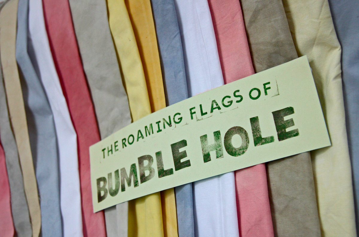
The Roaming Flags of Bumble Hole concludes on Saturday 13th August with a colourful parade featuring music, readings, rites and of course, flags. The parade will celebrate the miraculous transformation of the site now known as Bumble Hole Local Nature Reserve, from a blackened hive of extractive industry into a teeming haven of natural abundance. Our observances will ensure the continued thriving of nature on this land for many years to come.
This is a participatory event and the more people who take part, the stronger the magic will be so please do come along and bring a friend (or several). There will be enough flags for everyone. The cotton flags have been coloured with natural dyes and were decorated by the participants of our previous event in July. Now that we’ve created the flags it’s time to fly them.
The procession of the flags will take us on a tour of many of the reserve’s finest features including winding canals, shady woodland, hilltop vistas, an industrial ruin and into the mouth of a pitch-black tunnel. Musical accompaniment will be provided by Beth Hopkins who will lead sing-a-long renditions of original and traditional folk songs drawn directly from the soil in which the flags will stand.
Inspired by Tibetan Prayer Flags, there are five different colours of flag, each representing a different element: blue for the sky, white for the air, red for fire, green for water and yellow for earth. Our procession will focus on each of these elements in turn and at different points on the route the flags will be fixed into the ground and strung across the waterways in spectacular displays.
Meet at 12pm outside the Bumble Hole Nature Reserve Visitor Centre, Windmill End, Dudley DY2 9HS. No need to book. Suitable for all ages. The event will last no more than two hours and will finish up back where it started. Refreshments and toilet facilities are available at the visitor centre but you may also wish to bring a packed lunch. For other queries please contact Andy.
This project is supported by Creative Black Country as part of Arts Council England’s Creative People and Places National Portfolio programme, Dudley Metropolitan Borough Council (DMBC) and support from CoLab Dudley.
This walk is inspired by the Norse concept of Warden Trees – central trees in towns and villages thought to be bringers of luck and guardians of the people. In return for their protection, locals made offerings (often beer), and they were considered non-human figures in the community.
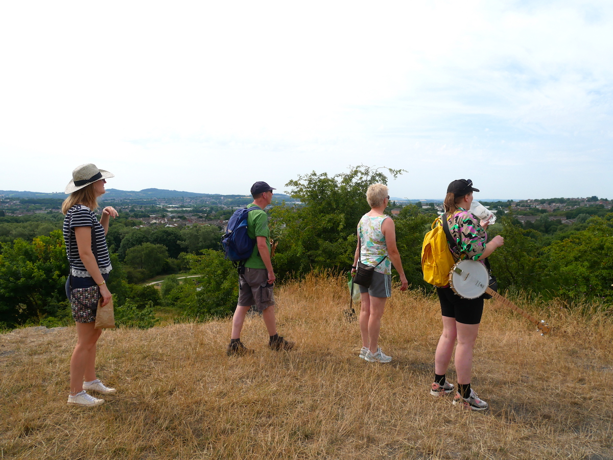
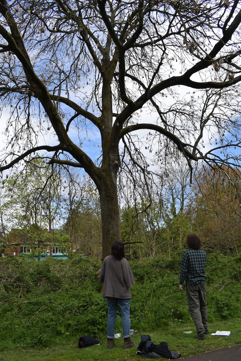
Join Walkspace members and tree enthusiasts Roo and Katy on Sunday 7th August. As a group we will consider and explore what and where those Warden Trees might be in our neighbourhoods, and what that two-way act of care might look like. Taking two neighbourhoods for this initial walk – Cotteridge and Stirchley.
We’d like you to think about a tree that is, or was, special to you – perhaps in childhood*. What memories do you have of it? How did you treat it, and how did it treat you?
Did a tree keep you company during the lockdowns? If it’s nearby, perhaps we can visit it.
Meet at Hazelwell Park, Stirchley under the lovely large oak tree at the far eastern edge of the park (see pics below) at 2pm, Sunday 7th August. The tree stands at the highest point of the park and has a bin next to it. The walk will last around two hours, finishing up in Stirchley Park (next to Morrisons) where you are welcome to join us for a picnic. No need to book, just turn up.
The terrain will mostly be pavement, grass and roads with some reasonably steep inclines. Steps will be avoided. Please bring with you memories of trees, a suitable offering**, and a preparedness to wander about.
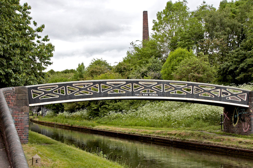
Bumble Hole nature reserve in Dudley may appear to be an idyllic natural setting but in reality it’s a landscape shaped almost entirely by industrial activity. 150 years ago it was a site riddled with coal pits, coke furnaces, boatyards, boiler works, brick kilns, clay pits and spoil heaps. Not to mention the constant chug of materials being transported by water and rail. Today though the contrast couldn’t be greater – this former hive of extractive industry is now a peaceful haven for wildlife, waterfowl, insects, flora, grassland and trees.
This event, led by Walkspace members Andrew Howe, Beth Hopkins and Andy Howlett, will celebrate the reclamation of this land by nature with a sensory guided walk followed by a flag-making workshop. Join us on Sunday 17th July to tune in to nature and get creative.
We will visit some of the key points of interest around the reserve using a series of fun prompts to connect with the landscape. We will use the walk to generate ideas and inspiration for the flag-making activities which will follow the walk, taking place outside the visitor centre.
The cotton flags will be in a range of sizes and styles and they will be pre-coloured with natural dyes made from plants found locally. There will be a range of stamps, stencils, inks and other materials for participants to experiment with in their designs. No artistic skills or experience is required.
This is the first event of our Roaming Flags of Bumble Hole project. The flags that we create will later be used in a public celebratory procession on 13th August, for which the workshop participants are welcome to return.
Book your place
This event will start outside the Bumble Hole visitor centre just off the Dudley Canal at 10am and will finish at the same place at around 2pm. It’s free but places are limited and booking is essential. Important details are on the event booking page. For other queries please contact Andy.
This project is supported by Creative Black Country as part of Arts Council England’s Creative People and Places National Portfolio programme, Dudley Metropolitan Borough Council (DMBC) and support from CoLab Dudley.
We are happy to announce that we’ve been commissioned by Creative Black Country to run two events celebrating the natural abundance, waterways and rich history of Bumble Hole nature reserve in Dudley.
The Roaming Flags of Bumble Hole will take place across the summer and will involve a sensory guided walk, a flag making workshop and a celebratory musical procession. The project is part of the Dudley Creates Summer of Creativity which will see art, colour and fun opportunities popping up in spaces and places across the Borough from June to September.
Our flags will be coloured with natural dyes made with plants found locally and the designs will be informed by participants’ responses to the sensory guided walk. Inspired by Tibetan prayer flags, we shall be using five different colours: blue, white, red, green and yellow to represent the five elements of sky, air, fire, water and earth. Rather than being an exercise in patriotic territory claiming, the flags will represent nature asserting its own stake in the land.
The project will culminate in August with The Earth Parade: a public ceremonial procession of the flags around the reserve in which participants will be able to show off their designs and celebrate their collective stake in nature’s abundance. The flags will be fixed into temporary installations around the reserve and strung across the waterways in a spectacular display. The parade will be accompanied by sing-a-long renditions of original and traditional folk songs drawn directly from the soil in which the flags will stand.
The Roaming Flags project is headed up by three members of the Walkspace collective: Andy Howlett, Beth Hopkins and Andrew Howe. Together they shall draw on their varied backgrounds in painting, printmaking, songwriting and the walking arts to create a truly participatory celebration of this magical area.
Key Dates
Sun 17th July, 10am – Sensory guided walk and onsite flag making workshop. Free but booking essential. Book here. No art skills or experience necessary. Ages 8+
Sat 13th August, 12pm – The Earth Parade: a celebratory Procession of the flags with musical and singing accompaniment. Free, no booking required. Suitable for all ages.
This project is supported by Creative Black Country as part of Arts Council England’s Creative People and Places National Portfolio programme, Dudley Metropolitan Borough Council (DMBC) and support from CoLab Dudley.