Categories
Uncategorized

Escaping suburbia – a walk from your sofa

This is an actual walk you can do if you print this post and follow the directions. It’s also a walk you can do from the comfort of your sofa, or if you live a long way away from Dorridge and are missing it and feeling nostalgic and just want to remember your favourite place (this might just be me).

Take the train to Dorridge. Leave the busy, tidy platform through the ticket office. Go ahead, past the car park, turn right. Past houses most folk would never be able to afford, not even renting, and go to the right down an alley between manicured gardens, through a cul-de-sac of starter homes and turn right.

Up a small slope roofed with the branches of scrawny sycamores and over the railway bridge, past six brick and slate houses facing each other in a gossipy circle, then left towards the trees.

Take a deep breath, feel suburbia drop off your shoulders, walk into the arboreal tunnel. A straight tarmac road one car wide, leads to an unknown destination. We do not go along it very far, that journey is not for us today.

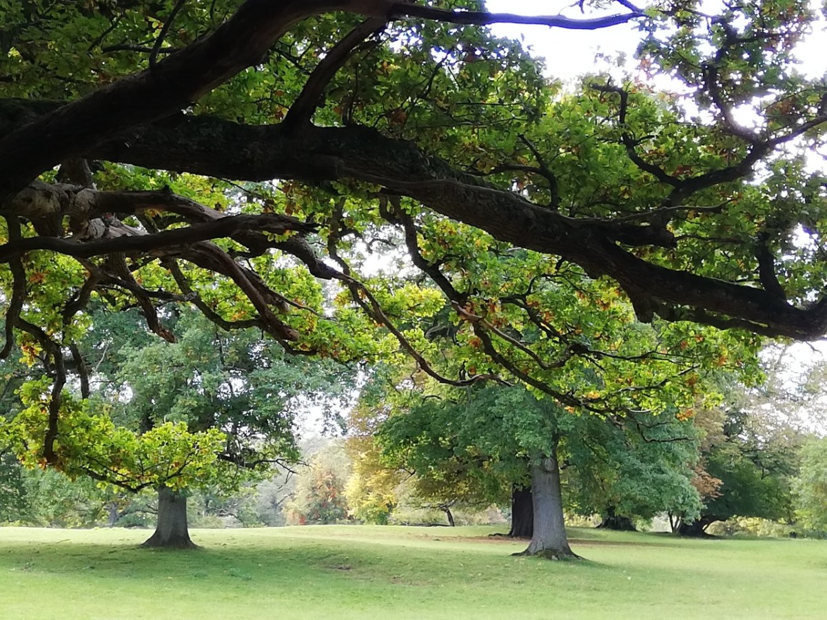
The road is lined with oak and beech and birch and roofed with fluttering leaves. It is always shadowed, even in winter. As soon as you are under the trees step to your right, away from the road, gingerly over the muddy verge and left into the wood proper.

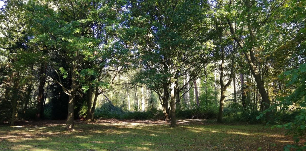
Woodpeckers knock. Jays swoop silently overhead. Blackbirds, robins, chiffchaff and wrens trill and chatter and warble. A muddy path winds beneath orange barked pines, around dark hollies, between scrawny birches riddled with plates of fungi. In autumn toadstools burst from stumps and mossy logs; push through leafmould burnished by beech leaves.

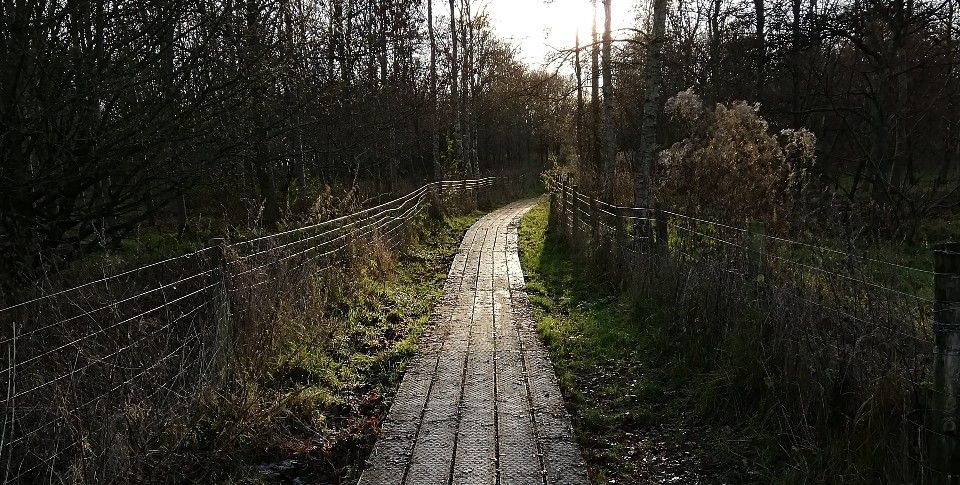
Now you leave the wood, come out into the park, heading south west across shaved grass encountering happy dogs and cheerful owners. Go past the dead oak, pale and sculptural, down to the shallow stream burbling bright and clean under the bridge where there might be trolls, then step along a rising boardwalk to the narrow lane.

Image © …kruse

Cross the lane into a coppice of teenage oaks, deeply muddy at the wrong time of year. The path is pockmarked here with boot prints and paw prints and sometimes the half moons of a small pony’s shod hooves. Come out into fields, take a left skirting the crops, keeping to the hedge, and take another left after passing through an ungated gateway, past trees that began life when this was still Shakespeare’s Arden Forest.

A curved iron kissing gate is next, then we walk down a lane between mansions. Ten foot high yew and laurel hedges on each side of us hide a barking dog.

“Go away” say the high hedges, the fancy iron gates, the barking dog.

Imagine for a moment the stress of holding on to all that wealth, the work it requires. Maybe not hard work, like that which farmers, cleaners, nurses do, but effort; hiring staff to trim the hedges and walk the dog, making sure the alarms are on when you’re out, paying insurance and keeping up appearances. Take a deep breath and let any envy transform into the joy and freedom of the welcoming path and turn right onto a little country road.

A few hundred yards on, turn right at the triangle of grass, a rural roundabout serving only two tractors and seven cars the whole day, and go left over the wobbly wooden stile. It’s hard on the hips because it was made for tall men.

Walk across three fields, one, two, three. Sometimes there are sheep, sometimes flowers, once a startled detectorist. Fields one and two go down to a streamlet, over another troll bridge, one person wide and only five feet long. A small troll then.

Field three rises to a road. On your right a church, a manor, a moat, oddly melancholy, dark with ghosts. We turn left at another kissing gate, rusty and squeaking. We take a right along a road towards the big house, busy with day trippers. Beautiful gardens and a noisy cafe, and a good place for tea and scones.

You walk the straight road that cuts through the estate. On your left a field and a long straight track, centuries old, bordered with oaks and grazing sheep. To our right the big house, a lake, roses and flower beds, ancient yews, ravens and sparrowhawks, specimen trees of ravishing beauty.

Go on past this magical place, dense with stories of Puritans and ancient feuds, of a sad man long dead putting all his unrequited love into objet d’art and not the lad he really wanted. The house is a reliquary of loves and tragedies and agonies and joys untold. An archive of the edge folk; women, servants, the poor and queer. Only the stones know all, and they are not speaking.

Walk on past the house and on down a road straight as a Roman, to a dangerous corner as it joins a busier thoroughfare. A short, but tense walk beside this busy road, sharply noisy, picking your way along the rutted grass verge.

At another corner, dangerous with rushing SUV’s turn left onto a stony track. Only pedestrians and the owners of the farm at the end are allowed here. It’s quiet again. It looks like a place where there should be owls.

At the end of the track turn right to the canal, past the red brick lock-keepers cottage, busy with flowers in pots, and scattered buckets and timber, all the stuff of countryside living.

Follow the canal east. Seven locks. Ducks in the reeds. After the seventh, cross over the water and continue east. At the bridge take the steps up onto a narrow road and turn left over the ancient, humpback bridge.

Walk on a quiet country lane. More raven calls and jackdaw, robin, wren and goldfinch and the gunfire crack of startled pigeons bursting from the hedges. An Elizabethan house half hidden behind brick and wrought iron. The road rises a little and we lean in a little.

Half hidden among trees and the hedgerow, on the other side of the lane, another kissing gate, wooden, green with lichen. Three very beautiful very old oaks stand sentinel alongside the field boundary. Take the little path through this field and the next, both rich with flowers and wild grasses. Butterflies and horseflies, beauty and the beasts, dance here in summer. In winter the bottom of the field is sodden, in spring, bluebells paint the banks with sky.

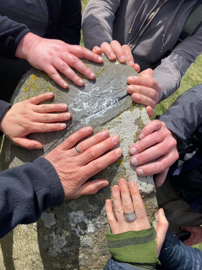
Right at the stile, broken and rickety and suddenly, steps! Metal steps, a second railway bridge, postered with kind entreaties from a mental health charity. Step down onto the quiet platform. Take a bench and sit in peace among the songbirds, waiting for the train to fetch you back to the city.

Image © …kruse

Find out more about …kruse and their work at https://www.krusework.info/

Categories
Posts Walk Reports

Mitchell’s Fold manoeuvre

On 3 May 2025, a bright but windy spring day, several Walkspace members undertook a walk around Stapeley Hill and Corndon Hill in Southwest Shropshire, close to the Welsh border near the village of Priest Weston.

The walk centred on Mitchell’s Fold stone circle and the myths that gather around this ancient monument. Conceived as a members-only event, it was also structured so that it could be repeated as a guided walk open to the public.

I designed the walk as a manoeuvre: a form of guided walk devised in the 1990s by the artist Tim Brennan, with whom I have collaborated on several projects. Brennan describes a manoeuvre as a walk built out of quotations which are recited to the group at stations along a predesigned route” (Brennan, 2017).

A group of walkers gather around a shoulder-height standing stone against a moorland backdrop
Photo © Paul Wakelam

Alongside documented folklore and historical sources, I introduced a series of invented quotations – what I think of as neo-myths. These were attributed to fictional authors through what I call pseudo-references. The intention was not to deceive, but to mirror the ways authority, myth, and landscape are often braided together in accounts of ancient sites, where scholarship, oral tradition, and imaginative speculation coexist and overlap.

The Mitchell’s Fold manoeuvre followed a predefined route, with readings delivered at specific locations. These combined well-known folklore, historical commentary, and the neo-myths written for the walk.

From the car park, we headed north, directly into a stiff north-westerly wind, much as others might have done before us. The route across Stapeley Common runs alongside a holloway: a sunken lane formed by centuries of traffic, scoured out by drovers moving livestock between pastures or on towards market.

Mitchell’s Fold

The first station reached was the Bronze Age stone circle of Mitchell’s Fold (also referred to as Medgel’s Fold and Medgeley’s Fold). The name may derive from the Old English micel or mycel, meaning ‘big’. Fifteen stones remain, though it is thought that there may originally have been around 30.

“The peasantry of the neighbourhood tells us that this district, without being more fertile, was once more populous than it is at present, and that the population was kept from starvation by a benevolent being which came nightly, in the shape of a white cow, and abundantly supplied the inhabitants with milk. A condition, however, was attached to the comparative happiness of the people, and this was, that if the cow were milked dry, which it appears could not happen so long as each person took only a pailful at a time, she would disappear for ever, and the people would be reduced to extreme misery.

Now, there lived at the same time a malevolent old witch, who was envious of the flourishing condition of the people of this neighbourhood, and meditated continually on the means of overthrowing it. Her name was Mitchel. One night she went with the others, apparently one of the peasantry of the neighbourhood, but carried a pail with a sieve for the bottom. The milk, of course, passed through this, and the cow, who always allowed herself to be milked by each person until the pail was full, let Mitchel go on milking until at last she became dry. The condition was immediately fulfilled, and the population of this now solitary district all died miserably for the want of their usual food; but Divine vengeance fell upon the wicked hag, who was turned to a stone on this lofty hill, and the circle of stones was raised to imprison her. Hence it is called Mitchel’s Fold.’”(Wright, 1862).

Cow Stone

Continuing northeast along the ancient route, the next station reached was the Cow Stone, also known as the Dead Cow. The name derives from its resemblance to a reclining cow and is clearly linked to the legend of Mitchell’s Fold (Burnham and Pearson, 2018, p.133).

“They say the Cow Stone was once a living beast – gentle, broad-backed, and endless in her giving. Each morning she wandered the slopes of Stapeley Hill, offering milk to any who were hungry. But a witch, greedy for more, tricked her with a cursed pail. Realising the betrayal, the cow bellowed once and fled, her hooves cracking stone, her body stiffening mid-stride. She stands there still, turned to rock by sorrow. The wind, on certain days, moves around her like breath.” (Ellis, 2014).

The Hoarstones

From here we headed towards the Hoarstones, the second stone circle on the walk. This part of the route carried an element of uncertainty. During a reconnaissance walk, I had attempted to follow directions from an old printed guide, Stapeley Hills Historic Sites. On the ground, however, the described paths no longer aligned with fencing or access points, and after some effort I abandoned the search.

My intention on the day had been to stop at a particular point and tell a story about a missing stone circle. In the event, one of the participants knew the route, and we crossed a fence marked ‘Private – Keep Out’ to reach a circle of 37 small stones.

“The Hoarstones are marked clearly in the old guide – precise in distance, confident in direction. But on the ground, nothing held. Paths faded, landmarks changed, and the stones themselves seemed to withdraw. Some say they sink deeper with each decade, tired of being sought. Others suggest the map was never right to begin with. Older still is the tale of six fairesses who danced there on moonlit nights, their footsteps circling into the ground until stone rose to meet them. Now, the ring hides itself. In this landscape, absence is not an error, but a kind of message.” (Darnley, 1958).

Four walkers rest on the ground in long grasses
Walkspacers resting amongst the Hoarstones. Photo © Paul Wakelam

Stapeley Hill Cairn

From the Hoarstones we began the ascent of Stapeley Hill, a saddle-backed rise with expansive views across Shropshire and into Wales. At its summit lies a ring cairn.

“The cairn on Stapeley Hill rests like a spine beneath the sky. Some say it marks a place where the world thinned – where the old ones stepped between sky and soil. Walking here feels like entering a sentence left unfinished. The cairn does not offer answers, only presence.” (Hallet, 2001).

Cromwell’s Trench

Walking south from the cairn, we approached Cromwell’s Trench: a series of scooped hollows dug as test pits in the search for minerals, a reminder of the lead-mining heritage of south-west Shropshire (Shropshire’s Great Outdoors, 2013).

“Cromwell’s Trench lies folded into the side of Stapeley Hill – an interrupted rhythm of hollows and scoops, dug by hands chasing minerals through shale and silence. The ground here feels restless, worked over, as if thought itself had been quarried. It’s a place of absences: ore not found, labour long vanished, names forgotten. And yet the trenches remain – cuts in the skin of the hill that still hold weather, lichen, and the slow return of stillness.” (Carver 1994).

A group of walkers gather around a cairn in the Shropshire landscape
Photo © Paul Wakelam

Re-storying the landscape

Continuing south, we passed further cairns, stone rings, a Bronze Age ring barrow, and a network of linear earthworks before beginning the steep ascent of Corndon Hill. From the summit, the landscape opened out into a wide, circling view – fields, ridges and borders unfolding in every direction.

By this point, the quotations had accumulated. Voices – some historical, some imagined – had been laid into the land, not to explain it, but to thicken it. The manoeuvre did not resolve the myths of Mitchell’s Fold so much as redistribute them, allowing them to cling to stones, paths, absences and weather.

In future iterations, the quotations and their attributions may shift, disappear, or be replaced – treated as materials rather than fixed texts, responsive to route, weather and the particular group walking them.

If the walk achieved anything, it was to suggest that these landscapes are not fixed by archaeology or story alone. They are continually re-made through movement, speech, and attention: each step a small act of re-inscription, each pause a moment where the ground might speak back.

Close-up of six walkers' hands placed on a standing stone
Photo © Paul Wakelam
References

Burnham, A. and Pearson, M. P. (2018) The Old Stones: A Field Guide to the Megalithic Sites of Britain and Ireland. Watkins.

Brennan, T. (2017) Manoeuvre: Discursive Performance. Available at: https://www.timbrennanartist.co.uk/projects-fieldworks-performances/the-manoeuvre/manoeuvre-discursive-performance (Accessed: 26 December 2025).

Carver, I. (1994). Steps to the Sky: Notes on Walking and Vertical Mythology. Oswestry.

Ellis, R. T. (2014). Beasts that Became Stone, in Where the Hills Speak: Oral Tradition and Living Myth along the Anglo-Welsh Border. Hereford.

Darnley, I. (1958). Standing Stones and Straying Paths: A Rambler’s Guide to Forgotten Circles. Oswestry.

Hallet, M. (2001). Margins of Stone: Landscape, Memory, and the Mythic Borderlands. Ludlow.

Wright, T. (1862). Shropshire’s Great Outdoors (2013) Stapeley Hill’s Historic Trails. Leaflet. ‘On the Local Legends of Shropshire’, Collectanea Archaeologica, 1(1), pp. 50–66.