Suburban Birmingham might not be the first place that comes to mind for visiting ancient stones but maybe it should be.
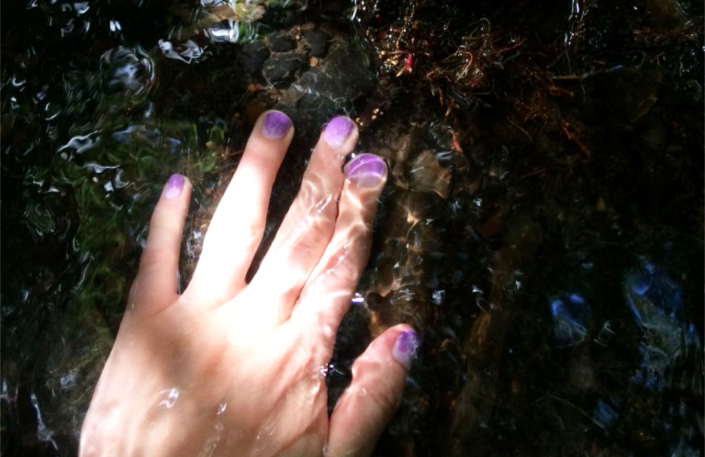
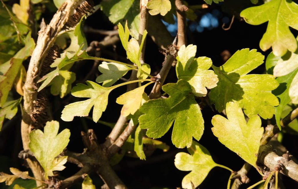
450,000 years ago an ice sheet carried thousands of lumps of volcanic rock from the mountains of North Wales and deposited them in the English Midlands. These “erratic” boulders can now be found lurking in the parks, gardens, graveyards and roadside verges of 21st Century suburbia. The word “erratic” comes from the Latin errare meaning to wander, roam or stray.
Join Walkspace members Andy and Bharti for a short tour of the wandering rocks of Bournville and Cotteridge. We’ll be paying tribute to the boulders by pouring from water jars (Birmingham’s tap water also comes from Wales) and reading aloud from Alyson Hallett’s “Stone Monologues”. We also invite you to bring along a pocket sized stone of your own.
Meet outside the Bournville Lane entrance to Bournville Station, B30 1LG, at 11am, Sunday 22nd February. The walk is 1.5 miles long, finishing at Kings Norton Station with the option of continuing into Kings Norton to find a cafe or pub after. Terrain is mostly tarmac and paving with optional forays onto the grass. Some moderate inclines but no steps. Toilets are available in The Shed cafe in Cotteridge Park.
To book please email: walkspace.uk@gmail.com
Terminalia is a festival of walking, space, place and psychogeography on and around 23rd Feburary. Terminalia was the festival of Terminus, Roman god of boundaries and landmarks! Events have been run on this day since 2011.
Where the ravens nest? And the blackbird sings and lays her eggs?
Where the water runs off the land and where she sits still in pools?
Where the soil runs thick with clay and where sand proliferates?
Where the Ash grow and the Beech woods are?
You are the guardian of your land. You are the warden, the protector, the knower, the innkeeper, the watcher.
This ancient role is one you stepped into (pun intended) on your daily walks to help your mind find ease. You unintentionally, by repeatedly walking the same pathways and hedgerows, and streams, and meadows and field edges, became the knower of this land, one who hears and sees deeply, one who knows where the birds call home, where the rabbits live, where the fox scats and the badger dens.
You dream deeply this land, your land, you are deeply held by this land as now she is a part of you, and you of her.
You drink and dream with rosehip, collected from the bushes, let to grow thick and tall. Wild Rose softens your heart and sharpens your claws, discernment is what you’ve learnt from her.
You were born in this body and delivered to this land for a reason. Together you share and grow and learn of each other. She wants to know you as deeply as you want to know her, she receives your own wild water from your body as an offering, an act of sharing, knowing.
This connection has saved you, a thousand times over. She holds you in the womb of a hollow oak tree as you bleed out your grief of what it may mean to leave and move to the other side of the world. Even with her permission you decide you are not ready, or wanting, to leave the land of your ancestors, you still have so much left you want to learn.
Walking, walking, walking.
Your wellies in the mud, the deepening and thickening of the land in the dark of the winter days, deep knowing fills you, the essence of the land is potent when everything rests.
You love the summer, and yet the winter brings her own magic, a deeper, richer flavour. You found yourself when you let yourself rot down among the leaves and be born anew. Your bones picked clean and refreshed by this very land, your roots ever deeper grew.
You wish to help others find this within themselves, convinced if we all had this connection to our spaces, we would find ways through our problems with climate change, finding our roots, our centre.
You admit perhaps it may look different for others, they may find their salvation elsewhere. Maybe this is for you alone. Your own connection, your own space. Each to their own. Maybe this is the gift you bring to this world, profoundly you-flavoured, a gift no one else can share. Words meant to come from your mouth alone. By living it, you may inspire others to find their own path.
This post contains mentions of supernatural activity, historic deaths, execution and suicide.
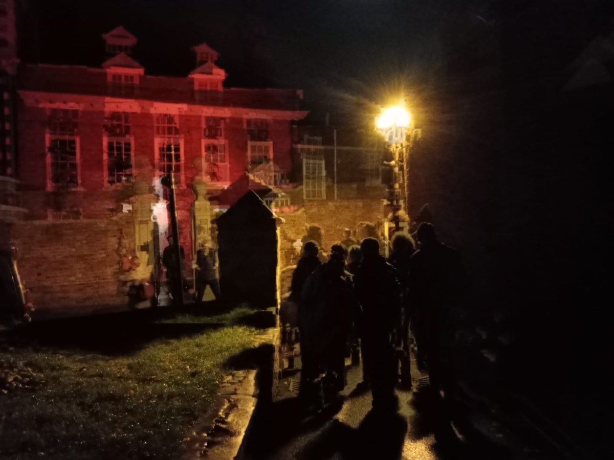
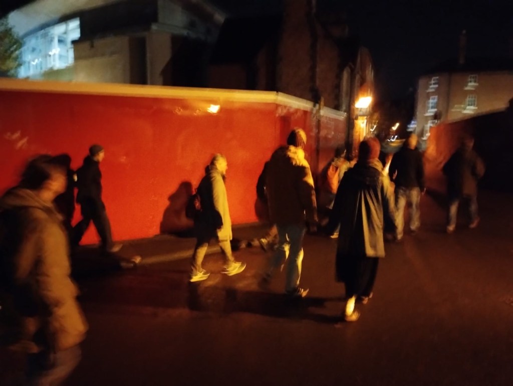
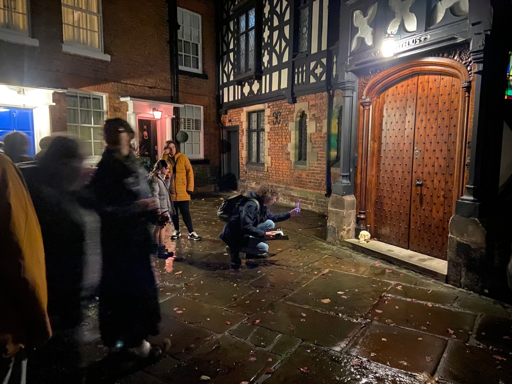
On 31st October 2025, a cool but luminous Halloween evening, the Shrewsbury Skull walk was launched as a public walking event. The light was already thinning by late afternoon, the sky clear but brittle, and by the time dusk arrived the town felt poised – streets holding their breath, shadows gathering in corners and alleyways.
For five years previously, Walking the Stirchley Skull, devised by Walkspace members Andy Howlett, Fiona Cullinan and Pete Ashton, had taken place as an annual event. In his essay ‘Walk Your Neighbourhood Skull this Halloween’, written for the book Night Time Economy published by Floodgate Press, Andy articulated a loose but evocative recipe for the skull walk: a blend of psychogeography, ritual, storytelling, and embodied attention, mapped onto the outline of a skull traced through familiar streets.
The Shrewsbury Skull came about when I moved to Shrewsbury in October 2024. Unable to join the Stirchley walk that year, I decided instead to create an alternative version, adapting the skull to a new town and terrain. This was done with the assistance of Andrew Howe (not to be confused with Andy Howlett), another Walkspace member already resident in Shrewsbury, whose local knowledge proved invaluable in shaping the route.
The first Shrewsbury Skull walk, held in 2024, was deliberately modest: a limited event with only a small group of invited guests taking part. It functioned primarily as a recce – an exploratory walk intended to test whether the skull could be convincingly mapped onto the town and whether the rhythm of the route held together at night. The intention from the outset, however, was that it would eventually become a public event.
For the 2025 walk, the event was advertised across social media and through The Shrewsbury Scoop, a new local listings platform. At 7pm, fourteen intrepid explorers gathered outside the Grade I listed St Chad’s Church. The church is believed to have been originally founded by King Offa, and its circular churchyard sits slightly apart from the bustle of the town centre, already lending the meeting point a ritual quality. St Chad’s graveyard also contains the grave of Ebenezer Scrooge – a former prop from the 1984 television adaptation of A Christmas Carol, starring George C. Scott. Sadly, due to vandalism, the churchyard itself is not accessible in the evenings, and so we stood outside its railings, peering in at the darkened paths and headstones.
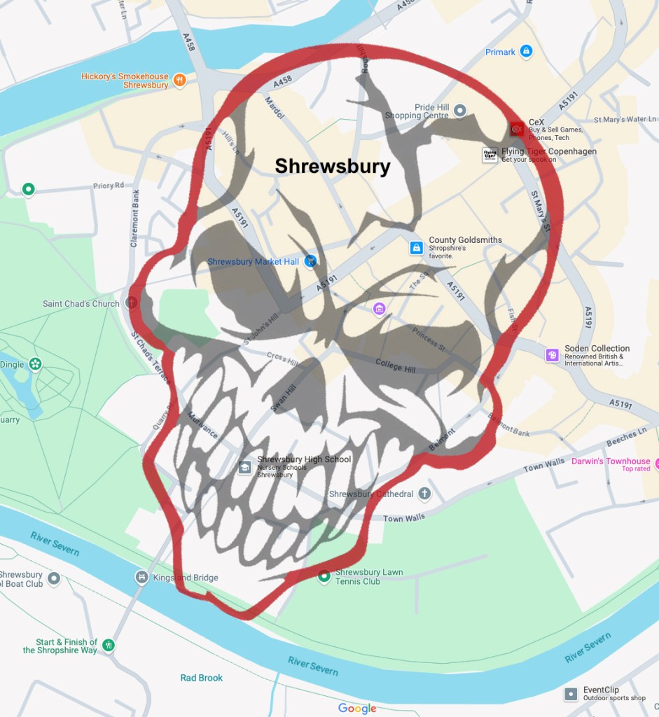
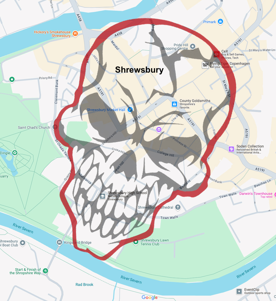
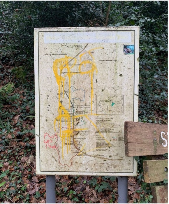
Map of the Shrewsbury Skull
Although the route had been planned in advance, one decision still had to be made: whether to walk the skull clockwise or ‘widdershins’. Widdershins is an old term meaning ‘against the way’ or to travel in the opposite direction to the sun’s course, and as Andy Howlett writes, “this can be an effective way of invoking darker energies” (Howlett, 2024). Given the date, the hour, and the appetite of the assembled walkers, this method was unanimously selected.
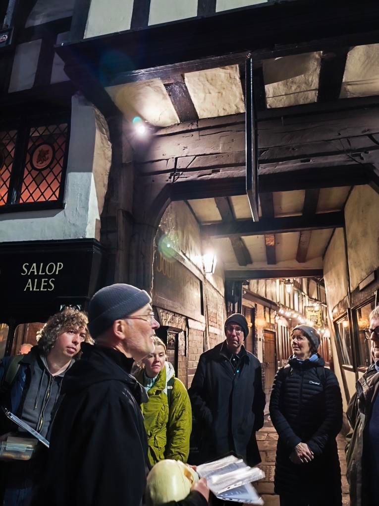
Shrewsbury is particularly well-suited to a night-time walk. Its medieval street plan remains largely intact, with half-timbered buildings leaning over narrow streets and numerous alleyways known locally as ‘shuts’ threading between them. At night, these shuts compress sound and light, amplifying footsteps and fragments of conversation, making it easy to imagine other presences moving just out of sight.
As we walked, various stories were recounted: tales of historic figures such as Captain John Benbow, who switched sides during the Civil War and was executed by firing squad, his grave now lying in the Old St Chad’s churchyard; and Ludovick Carnavon, after whom Carnarvon Lane (one of Shrewsbury’s many shuts) is named, a route that dates back at least to 1460. Alongside these were stories of visitors from the ‘other side’, including repeated sightings of men milling about Barracks Passage, thought to be soldiers killed at the Battle of Bosworth Field who returned to Shrewsbury because they had been warmly welcomed there in life.
From Barracks Passage we wandered up Wyle Cop (from villa-coppa, the town on the hill), a street with a long and bloody history. H. T. Timmins captured this past in a rhyme recalling the mutilatory executions once carried out there:
They hew and they hack and they chop, And to finish the whole they stick up a pole In the place that’s called Wylde Coppe, And they pop your grim, gory head on top.
Partway up Wyle Cop stands The Nags Head, a pub reportedly haunted by the ghost of a coachman who hanged himself there in the 17th century. Footsteps, crashing noises, and the sound of heavy breathing are said to mark his presence – details which felt especially vivid as we passed beneath its darkened windows.
At The Parade, once the site of the town infirmary, further hauntings were noted. These include a figure thought to be a former visitor to the soup kitchen that operated in the basement during the 1700s, as well as the infamous ‘grey lady’. She was reportedly seen at the foot of patients’ beds, who by morning had passed away (Wood, 1979, p.79).
At various points we consciously leaned into the structure of the skull itself. As Andy Howlett suggests, it is possible to “turn the walk into an anatomy lesson: when you reach the point on the skull where the ear would be, tune in to the soundscape of the night by walking in silence. When you come to the mouth why not get out some tasty treats?” (Howlett, 2024). Accordingly, when we reached the ‘mouth’ we paused to indulge in offerings that included ‘soul cakes’ served from a skull, before continuing on. Later, upon reaching the ‘ear’, we walked the final stretch in complete silence, attending closely to the scrape of shoes on stone, the distant hum of traffic, and the occasional burst of laughter drifting from unseen streets.
The walk concluded back at St Chad’s Church. Before dispersing to the Admiral Benbow for drinks, we were encouraged to “consider the transformation that has been enacted tonight. Stand for a moment with the ghost of your former self. These streets will never look at you in the same way again” (Howlett, 2004). On Halloween night, with the town dimmed and subtly altered, this felt less like metaphor and more like a simple statement of fact.
Do keep an eye on our public walk announcements here on the Walkspace blog and in our newsletter over 2026.
References
Howlett, A (2024) ‘Walk Your Neighbourhood Skull’ in Night Time Economy, Birmingham, Floodgate Press.
Timmins, H.T. (1899) ‘Nooks and Corners of Shropshire’ cited in Palmer, R. (2004) The Folklore of Shropshire p35, Almeley, Logaston Press.
Wood, M (2007) Haunted Shrewsbury, Stroud, Tempus Publishing.
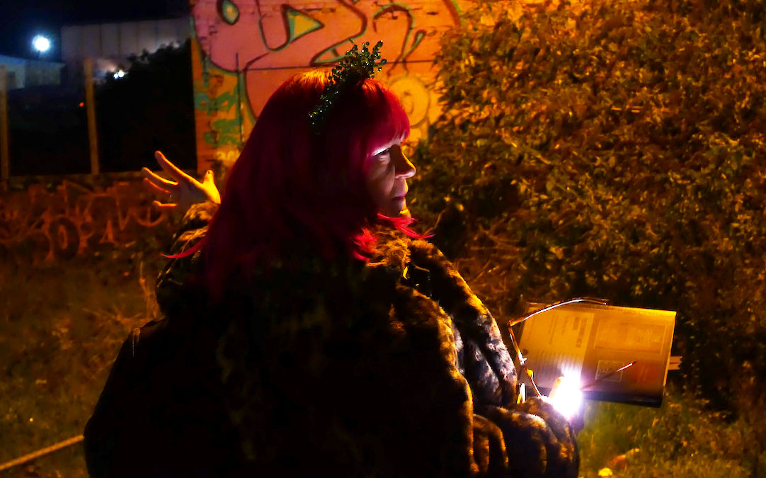
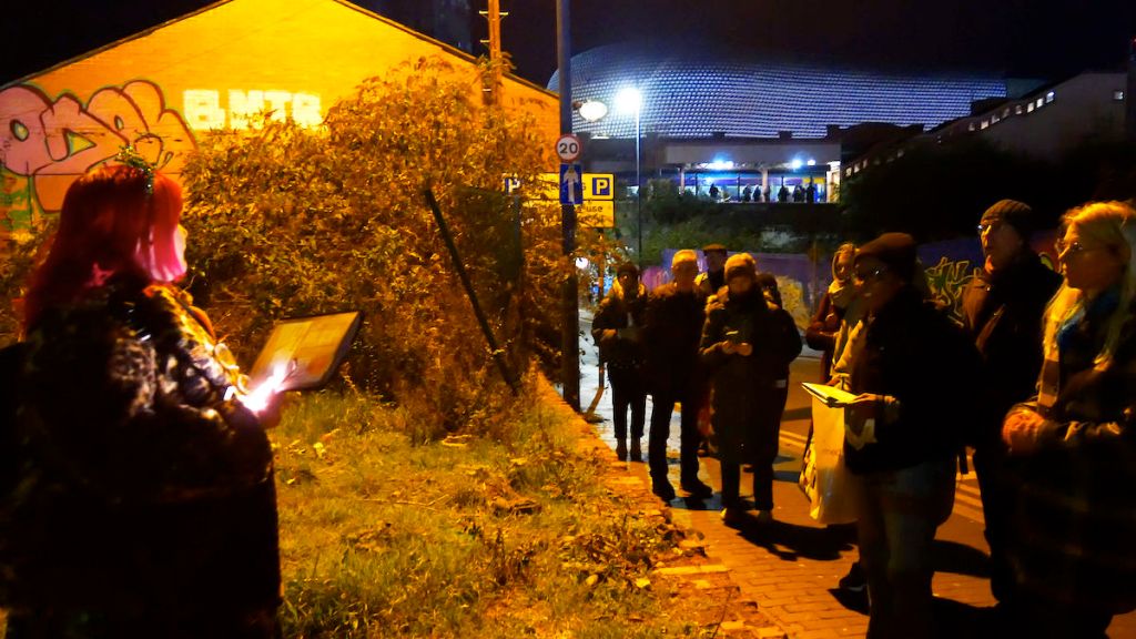
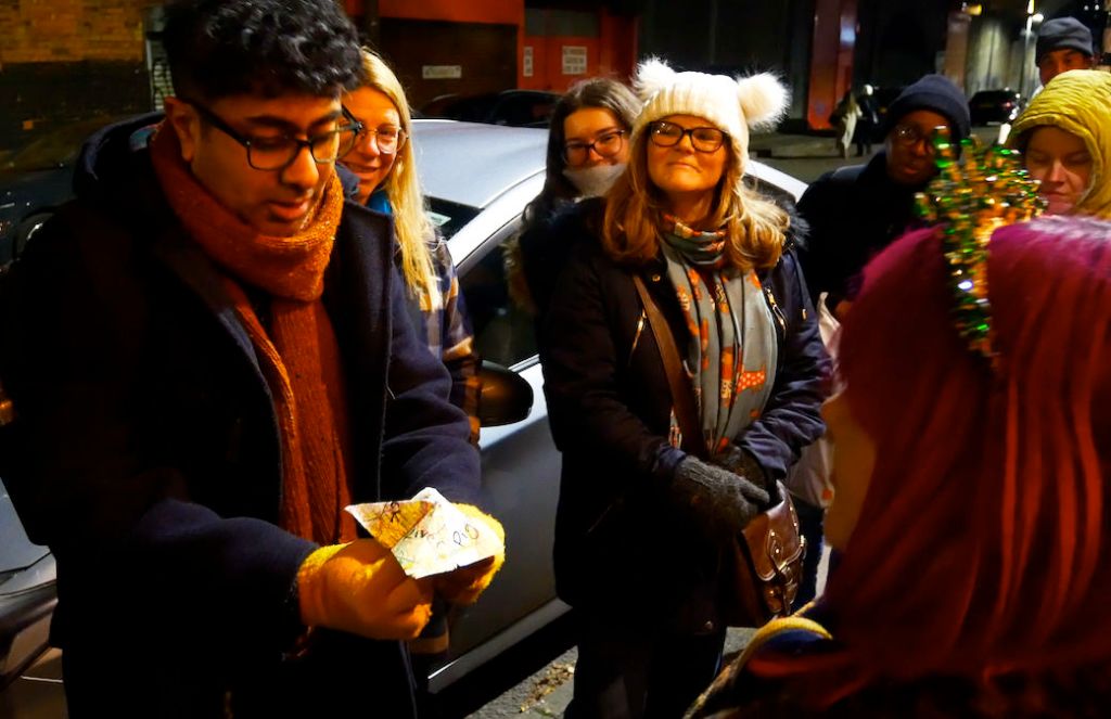
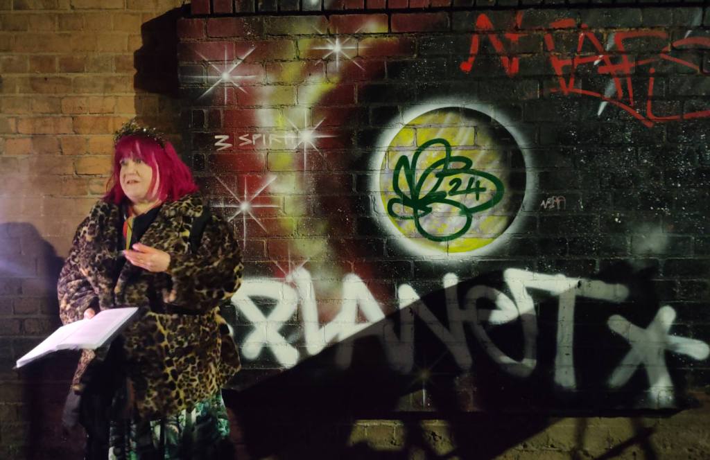
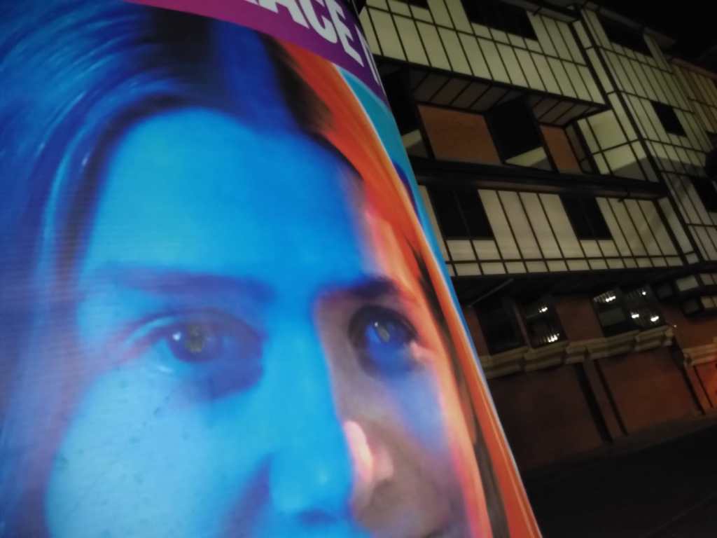
Close your eyes for a few moments, and take a walk in your mind. Wandering urban backstreets and city corners, you pause at a piece of graffiti where a woman with bright pink hair is speaking into the night beneath a spray-painted cosmos of planets and stars. A group of curious-looking people in warm coats stand around her, listening intently. To the average passer-by, we are an intriguing collection of oddballs standing around, loitering on an almost freezing November night. They would be right.
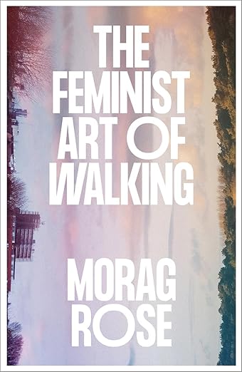
We gathered on that chilly evening for a book launch with a difference. Morag Rose, author of The Feminist Art of Walking, led us on a walk around the streets of Digbeth before her launch event at Voce Books. We stayed close to the bookshop for the duration, doing more loitering than walking whilst Morag gave several readings from the book. As founder of the Loiterer’s Resistance Movement (LRM), Morag is accustomed to reclaiming the art of loitering with intent. A Manchester-based not-for-profit collective of artists, activists and urban wanderers, the activities of the LRM form a radical context for much of this unique publication.
“I am a loiterer because I am curious, I want to explore and ask awkward questions.” – Morag Rose
Rose claims the mantle of anarcho-flaneuse, alongside performance artist and part-time lecturer in Geography at The University of Liverpool. Her new book is based partly on a PhD thesis about women walking the city, as well as LRM activities and her lived experience. She actively campaigns for better-designed public spaces to make walking and belonging easier for those living with disabilities and from marginalised groups. Rose points out that the “assumption that walking is simple: one foot in front of the other, easy does it, primal, instinctive. This assumption is a fallacy that all bodies are alike and walking comes ‘naturally’ to all”.
As for many creatives, the pandemic offered opportunities to say new things about walking and how we get around (or don’t). The Walking Publics/Walking Art: Walking Wellbeing and Community During Covid-19 initiative was an AHRC-funded project by Rose and her collaborators, which explored the potential of the arts to sustain, encourage and more equitably support walking during and following the pandemic. Our lockdown months were when I reoriented my own work towards walking art, having received an Arts Council development grant, which led to a PhD in landscape and inclusion. As a researcher in this field, I can confidently say that walking art is no longer the terrain of lone, white male artists, but an inclusive field nurtured by collectives such as Walkspace. As Rose writes, walking provides “an opportunity for multi-sensual exploration and a deep connection with space, place and communities”. Through the medium of creativity, these opportunities are extended far and wide.
Tracing our footsteps back to the book, Rose builds particularly on feminist perspectives to explore the act of walking in an inclusive and intersectional way. Integrating queer and disabled perspectives, the book also outlines issues around privilege. The Feminist Art of Walking makes assertive strides into questions of where we walk and who public space is for. Taking the reader on a journey through several locations, Rose examines mostly urban locations, with references to the rural. Beginning in Manchester, the book meanders through Liverpool, Sheffield, Eastbourne and smaller communities. The Eastbourne chapter pinpoints the start of Rose’s journey in thinking about how women walk, and the fear-based narratives that inform so much of women’s wayfinding. Rose writes of learning her ‘gender limits’ in younger life, through all-too-common experiences of harassment and intimidation. She asserts that women’s need to protect themselves is “embedded in our daily routine”, a narrative that the LRM attempts to undo. As Rose writes: “I am a loiterer because there are places I feel scared to go alone”. Most chapters in The Feminist Art of Walking are set in England, except for a spin through Ebbw Vale and Rose’s Welsh ancestry. As a resident of Cymru, I particularly enjoyed this chapter and the author’s comments on connections to place and ancestry.
“There wasn’t an actual photograph in my pocket in Ebbw Vale as I feared a relic would get crumpled or put though the wash. I don’t think I need it – the dialogue is in my head. If I do fancy a visual nudge, there’s a galaxy of images on my phone. We all walk with ghosts, ancestors and descendants wherever we go, it’s whether we choose to let our imaginations tune into them that determines the conversations we have (…) Wherever I walk now, my mother and nan are here, in my genes, my dreams, my wayfinding and my wonky footprints”.
After the official launch at Voce books (co-organised by Walkspace) our group of temporary loiterers disbanded, all the wiser and a little bit more at home in the world. This is a book about belonging on a deep level, and sharing experiences of what it means to be here. Rose reminds the reader that “you belong here and if that is not obvious then create your own welcoming committee”. Using the metaphor of desire lines, Rose asserts that a path made through intuition may well be walked by others, deepening the grooves and creating bolder paths.
The Feminist Art of Walking does just that, encouraging people of all genders and expressions to move in resistance and solidarity. What strikes me most about this book is the potentiality within its pages, and the power inherent within a simple, everyday walk. As Rose writes, walking is a source of belonging and community, solace and standing up for what we believe in; all within a passing hour, or as Rose puts it “everything and nothing written with our feet”.
Morag Rose and Digbeth graffiti. Photo Emily Wilkinson
The Feminist Art of Walking is available at Voce Books (online, or if you’re in Birmingham) for £16.99, from bookshop.org or your usual bookseller.
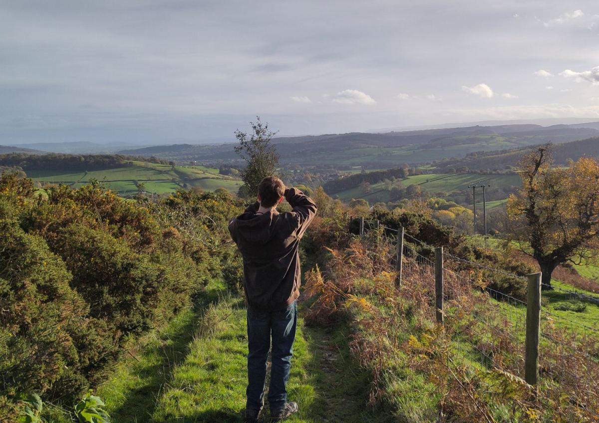
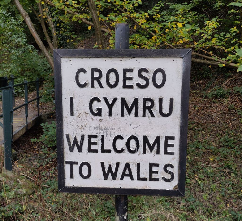
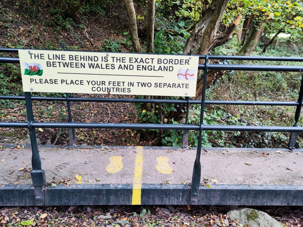
A few weeks after moving from Birmingham to Knighton in Powys, my son and I walked from the town to neighbouring Presteigne and back along the Offa’s Dyke Path. In the mist and drizzle of the morning, the ancient earthwork guided our steps as we crossed fields and old drovers’ lanes as it must have done for countless others over the centuries. That walk, with its mix of history, landscape and companionship, reminded me that paths are more than routes on maps: they are threads stitching together people, places and stories. That walk has since framed some thoughts on what Knighton has taught me about community.
Knighton sits exactly on the English-Welsh border. Its Welsh name Tref-y-Clawdd or ‘The Town on the Dyke’, is a reminder of a layered history. The town is beautiful: hemmed in by wooded, rolling hills and criss-crossed by ‘the narrows’, higgledy-piggledy lanes that run between houses replete with gnomes, stone lighthouses and pot plants on steps. Yet beneath the charm lies a demographic reality: Knighton has a predominantly older population. Like many rural areas, it attracts retirees, while younger people often move away for education and work. The result is a community rich in heritage but stretched thin when it comes to energy and resources.
Within weeks of arriving, I jumped into local cultural life. I became the social media coordinator for the Knighton & District Concert Society, joined the committee for the Knighton Festival, and was invited to join the Tourism Committee. These groups are small, powered by volunteers who have carried the load for decades. They are the beating heart of Knighton’s cultural scene. Their resilience and dedication are remarkable, but they also need fresh energy to sustain the work.
Fabric of rural social life
Rural communities are more than geographic clusters; they are patchworks of relationships, trust, and shared meaning. When those ecosystems weaken, everything else – economic resilience, mental health, public services and possibly even democracy – begins to fray. Sustaining them requires people willing to do unglamorous work: attend evening meetings, open bank accounts, put up posters, bid for grants, deal with contractors, make sandwiches, and give up evenings and weekends. This is the work of belonging. And while it is demanding, it also brings rewards: time given freely builds bonds that money cannot buy.
Compared to cities, rural ties often run deeper. Family networks, neighbourly reciprocity, and shared traditions create a closeness that urban life with their promise of anonymity (and the quick tempers that it facilitates) can sometimes lack. I left Birmingham after the third time I was assaulted – this time when someone threw a brick at my head. It is commonplace for younger people to move away to the economic opportunities of cities, but those who remain, and those who return, need to balance the fabric of loyalty and care without feeling smothered.
Why social capital matters
Social capital isn’t just a warm idea. Communities with strong social ties cope better with crises, innovate more effectively, and offer richer lives to their members. In rural areas, where formal services are often thin, social capital is the safety net. It’s the neighbour who lends you logs for the stove in winter, the one who grits the shared walkway, lends you tools, or leaves cooking apples on your doorstep. It’s the volunteers who coach the junior rugby team, and the committee that keeps the arts alive. Here, volunteers just about keep the Offa’s Dyke Centre and the Knighton Museum open.
But social capital doesn’t happen by accident. It is built through participation, common endeavour and trust, and through the slow, sometimes frustrating work of showing up, listening, compromising, and creating together. People need to know that their efforts will be rewarded and reciprocated before they start. In game theory, this is known as “tit-for-tat plus” – or “giving the benefit of the doubt’ in simpler terms. If we think we’ll never see the other person again, why bother saying hello?
Culture as a connector
Henry Hemmings, in his book Together, argues that shared experiences are the glue that binds us. Festivals, concerts, and community arts aren’t luxuries; they’re lifelines. They create spaces where people of different ages, backgrounds, and beliefs can meet – not as avatars, but as neighbours.
Knighton’s concert society and festival are perfect examples. They bring world-class music and vibrant ideas to a small town. The Talland Quartet from the Royal Northern College of Music, who performed the first of this season’s concerts, were brilliant: young, energetic, and committed to bringing culture to far-flung corners of the country. Behind the scenes, volunteers juggle budgets, marketing, logistics, and online payment software. It’s hard work, but without it, the cultural life of the town would wither. We look with admiration to chi-chi Presteigne (Llanandras in Welsh) and smile wryly at the global renown of Hay-on-Wye (Y Gelli Gandryll), but Knighton’s efforts are no less vital.
The moral imperative
Jonathan Haidt’s The Righteous Mind reminds us that morality isn’t just about abstract principles; it’s about the foundations that allow us to live together. One of those foundations is loyalty: not blind tribalism, but a commitment to the groups that sustain us. In an age of unseeing digital tribes and their blinkered acolytes, we need to rediscover loyalty to our real-life communities. Try burning a digital log on your stove in December.
Social media can be a double-edged sword. While it can atomise and distract, it also helps rural communities connect and discover what’s happening in towns just down the road. The challenge is to use it as a tool for connection, not a substitute for presence.
Lessons from Knighton
My short time in Knighton has taught me this: community doesn’t just happen. It is forged through effort, through resisting the pull of doomscrolling, through the willingness to give more than you take. Rural life is complex and demanding, but deeply rewarding. I’ve made more friends in six weeks here than in twenty years in Birmingham.
When I sit in a committee meeting, surrounded by people who have been doing this for decades, I feel a sense of continuity that no algorithm can replicate and no amount of secret spite or can compensate. When I see a packed hall for a concert, I see the payoff of countless unseen hours. This is what sustains a town. Shared endeavours and human interactions are what sustain us: not digital likes and ‘followers’.
Walkspace: Turning paths into possibilities
Knighton isn’t just a place on the map – it’s a landscape alive with stories. The Black Hill of Bruce Chatwin’s On the Black Hill is nearby, and the Radnor Hills rise in the distance. Walking here is part of the culture: besides the Offa’s Dyke Centre, Knighton even has its own walking festival. When we walk these paths, we’re not only tracing ancient routes walked by sheep drovers of old, Owain Glyndwr and King Offa; we’re part of something much bigger.
This is where Walkspace comes in. Walkspace isn’t just a website or a WhatsApp group. It’s a cooperative of artists and walkers, powered by volunteers and guided by a shared vision. Every walk, every photograph, every reflection adds to a collective tapestry. As members, we’re not just participants but co-creators of a community with extraordinary potential.
Knighton reminds us why this matters. Its paths, lanes and narrows (and miniature nautical statuary) invite us to slow down, to notice, to connect not only with nature but with each other. Walkspace and other community groups are more than platforms; they are movements. Rare spaces where creativity and community meet.
Knighton is teaching me that the work of community is never finished. But it matters more than ever. In a fractured, polarised and increasingly isolated world where most people would rather stare at a phone than smile or talk to each other, the simple act of turning up and helping people can be genuinely radical. Choose effort over convenience, togetherness over isolation. Our communities, services and maybe one day even democracy, depend on it.
Inspired by the long running ‘Walking the Stirchley Skull‘, the Shrewsbury Skull has been devised by members of Walkspace’s Shropshire contingent as a spooky walk within the historic setting of Shrewsbury Town Centre.
The Shrewsbury Skull was created by Paul Wakelam and Andrew Howe by superimposing a skull image on a map of the town centre, within the course of the River Severn, and then walking the outline in the real world on Halloween night last year. This year they’re ready for company.
The walk will take place on Friday 31st October at 7:30pm and will start and finish outside St Chad’s Church, a 13 minute walk from the train station. The walk is free to attend and open to both locals and those from further afield. Costumes are entirely optional but if you wish to bring a skull-themed object or mask you are very welcome to do so.
Please book your place by emailing: walkspace.uk@gmail.com
This is a circular walk of approximately 2 and a quarter miles, mostly over pavement, with some moderately steep inclines and one set of steep steps. Toilets are available in pubs along the route. The walk will last around 90 minutes with the option of retiring to one of Shrewsbury’s many fine pubs for a de-spook.
Please note, the original Stirchley Skull walk will NOT be taking place this year. We are officially passing the torch. If you wish to organise your own skull walk with friends, you can do so wherever you live by following these instructions.
Walkspace is delighted to be contributing to A Dudley Day Out, a day-long celebration of Dudley’s green spaces featuring guided walks, a buffet lunch and creative collage. This event is the culmination of the Dudley’s Path to Nature Recovery project by Birmingham & Black Country Wildlife Trust.
Walkspace artists Daniella Turbin and Andy Howlett will be facilitating one of the day’s four walks. We hope you will join us!
Taking inspiration from local landscapes, overlooked heights, and the legacy of Dudley’s own “God’s Mountaineer” Bert Bissell, this walk will explore how the dramatic geography of the Black Country has long inspired journeys of imagination and endurance.
Drawing on Daniella’s background in long-distance walking and rock climbing, and Andy’s practice of walking-as-art, this journey will launch a playful black box treasure trail, featuring postcards hidden across the hills with original artworks and writings that connect Dudley’s peaks to far-flung places like Ben Nevis, the Humber Bridge, and the Ural Mountains.
Along the way, participants will take part in a gentle water ritual at the Severn/Trent watershed line, build a miniature “peace cairn” in honour of Bissell, and design their own postcards inspired by the landscape and lore.
The walk ends at a venue in Dudley Town Centre, where a buffet lunch will be served and there’ll be time to reflect, connect, and contribute to a collective collage on the project so far.
Please note, this walk is not suitable for under 16s due to health and safety.
Meeting Point: Bury Hill Park, Oldbury further details will be shared upon booking
Arrival Time: From 9:50am, setting off at 10am
Duration: Approx. 2-4 hours
Terrain: The ground is variable, including roads, rocky paths, grassy areas, stiles, steps and significant inclines that some may find difficult. Wear sturdy footwear, dress appropriately for the weather, and bring plenty of drinking water, snacks, and sun cream.
Toilets: Available at The Lakeside pub near the start and venue at the end
This event is part of Dudley’s Path to Nature Recovery, a project launched in 2024 by Birmingham & Black Country Wildlife Trust, thanks to support from their funders. The project connected local communities to nature across Dudley’s rich landscape of hills through five interlinked strands: conservation work, community engagement, citizen science, partnership development, and the creation of new walking routes.
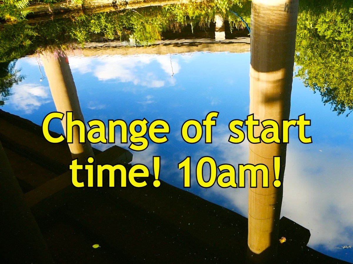
PLEASE NOTE: This walk starts at 10am NOT 11am as previously advertised. This is to avoid the hottest hours of what will be a very hot day. RESPECT THE SUN! If you wish to attend you MUST email: walkspace.uk@gmail.com
Three years ago we led a pilgrimage to Spaghetti Junction to celebrate its 50th birthday. We explored some of the ways the famous motorway interchange could be considered a sacred site, a “confluence of confluences” and a gateway to the underworld. Great as it was, this walk barely scratched the surface and so we’re making a return visit for this year’s Summer Solstice. We hope you’ll join us to honour the Great God Interchange.
In recent years the artist and writer Jen Dixon has joined the ranks of Walkspace and her work reveals new layers of sacred significance to the site now known as Spaghetti Junction. Her INTERCHANGE field guide posits the site at Gravelly Hill as not merely a motorway junction, but a place of “physical and spiritual interchange over hundreds, if not thousands, of years.”
Jen will be joined by Andy Howlett to help untangle the watercourses, crossings, caverns and megaliths that come together to form this utterly unique environment. Discover the Hawthorn Brook. Cross the ancient ford. Enter the Dwarf Holes. Honour the Holy Oak. Draw back the thin veil between worlds and leave your offering.
The pilgrimage will begin at 10am in Chamberlain Square, central Birmingham on Saturday 21st June. Meet Andy and Jen beside the fountain. From here we will make our way down to the Birmingham and Fazeley Canal which we shall follow all the way to Spaghetti Junction along the towpath – a distance of about 3.5 miles. After observances round and about the Interchange, we’ll aim for a picnic lunch at around 12:30-1pm beside Aston Reservoir.
To book please email: walkspace.uk@gmail.com
Bring a packed lunch, plenty of water, sun cream and wear sturdy shoes. The terrain is mostly pavement and towpath with some uneven and sloping sections, cobbles and narrow tunnels. Buses 65, 66, 67 and 68 all take you back to Birmingham and can be caught on Lichfield Road. Aston Station is also a 10-15 minute walk from the walk’s finishing point. For your evening festivities we heartily recommend Acid Solstice in Digbeth.
15th December 2024. Wolverhampton. I meet Clive outside The Sunbeam pub, a Greene King lacklustre lounge, where, according to a subtitle as you hover on google maps, ‘a warm welcome awaits you.’ I wonder aloud to Clive whether this is something the company boasts of all their chains or is a specific, solar play on words meant to delight the locals of this city. He doesn’t respond particularly to this, either because he is embarrassed for me by my attention to this dull detail, giving the first inkling of missteps in our badinage as the day will progress, or because he hasn’t yet had any breakfast. If I had known, I suppose I could have brought his attention to the association of the name ‘Sunbeam’ to the car industry in the area, but then I have, uncharacteristically, not done my research.
Nevertheless, I want to hang the day on something, and I will attempt to talk and walk with Clive around the theme of ‘things being re-purposed, and who gets to decide why and how.’ He’s come over to this territory at my behest, and the latest main seam in our rich friendship has passed from football, books, and boozing to walking. I’m not sure how this happened, but the Black Country has had something to do with it.
We go inside in search of a cheap full English and are not disappointed, at least by the price. Where we sit, mock-ups of Sunbeam car manuals are noticeable on the walls above Clive’s head, similar in form to the Volkswagen car manual T-shirts racked up in supermarket ‘fashion’ sections, hoping soon to be stretched over the belly of a man with no practical working knowledge of cars. Whether someone is supposed to look up from their rubbery pork and take pride in the fact that Wolverhampton once made vehicles such as The Sunbeam 1000hp (the first to break the 200mph speed barrier at Daytona Beach in Florida in 1927) is unclear.
What is noticeable, stacked at the lectern facing the door, (to which no member of staff goes anywhere near), are white laminated signs with wadges of blu-tack in the corners, and the badge of Wolverhampton Wanderers Football Club in the middle. Bold Times New Roman underneath this states, ‘Home Supporters Only’. Anything like this makes you feel immediately sorry for the staff. It suggests that at some point in the recent past there must have been conflict amongst the patrons of The Sunbeam along football-tribal lines, alcohol seeping through the pores of men unable to put aside their performed differences for the sake of a £4.99 breakfast, and transmuting itself as the fuel for threats vague or specific, possibly precisely underneath where the ‘elf on the shelf’ figurines now dangle from the ceiling, next to the ‘fancy an extra sausage?’ signage.
How far this all is, a sanguine onlooker might think, from the diligent workers on the Daytona Beach project, competing healthily with their American rivals to get to the speed record first. A recent appeal by The National Motor Museum and the local Express and Star newspaper sought to find family members of those who helped build The Sunbeam 1000hp. It seems unlikely in 100 years that any organisations will be looking for relatives of those who worked behind the bar of The Sunbeam on matchdays, but who knows? ‘We’d love to uncover and record memories before they fade’ John Murden of The National Motor Museum states. Indeed.
The football club and the adjacent university compete for dominance in Wolverhampton, kept apart by a 1970s ring road referee. Both today will have occasion to haunt my own experiences of the city, as I share them with Clive. They are polished new-ish builds in bold colours that contrast with the discarded shell, picked over by various migratory birds, that characterises the built environment of the rest of the city centre. Walking through it, you feel that if the town had a taste, it would be of a cardboard toasted panini that you bought in desperation but regret immediately and don’t want to finish. Which is how, as a student here in the mid-2000s I often felt about my undergraduate degree.
Out of the underpass and wandering around the edge of Molineux stadium, a jarring, much earlier memory lodges; of being in a stand behind one of the goals at around 15 years old. It is late summer, late 1990’s and I am with my dad, and two of his mates from work. My dad and I are Villa fans, and the tickets are pre-season friendly freebies from these mates of his. Prior to this outing, my dad has shared an anecdote about one of them, who has sold his recently deceased mum and dad’s Wolverhampton house. He had apparently gone out of his way to assure his late parents’ neighbours that he would not be selling their house ‘to an Asian person.’
It’s half time, and this mate asks me, nodding towards the pitch, ‘What do you think then?’ I assume that, as it is my first time at his home team’s stadium, rather than get my tactical assessment of the first half action, he means what I think of the building’s aesthetics, and I point out how much I like the orange stanchion areas jutting into the sky at each corner of the ground. I remember the laughter, the incredulous faces, and the pensive look of my dad, who must have felt like he had brought a young Denton Welch to the game. The memory still frustrates (I like football; I just struggle when discussing tactics). What would those two mates of my dad think of our walk today? If I try hard, maybe I can convince myself that my walks in the last year or two have rejected the moral of this story, the idea that you’re not meant to look up at places, buildings, things at the expense of the more obvious ‘present’ action. Have they been in part exercises at re-training myself to notice what might mean more than, say, a pre-season friendly? Bit of a stretch, maybe. But, for today at least, we are just wanderers.
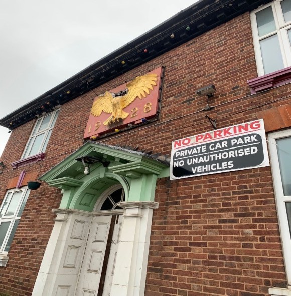
We head northwest out of the city centre looking for the Hordern Road. Halfway along Hordern, in Tettenhall, The Golden Eagle pub sits at the junction with Court Road. It’s square, stocky, brick façade features an arched double doorway that has a large red plaque above it bearing the date 1928. Perched atop the date is the eponymous animal in gold, wings aloft, with a gaping hole reaching far back into the brickwork where its head should be. A similar sized but much younger sign to the right of the doorway bears the imperatives ‘NO PARKING. NO UNAUTHORISED VEHICLES.’ This sign hints at the more recent history of this public house building, which was in the local news for being repurposed as a mosque without the proper planning permission. Reports on this ‘misuse’ included quotes from residents complaining of ‘chocablock’ traffic on Fridays. One unidentified Tettenhall resident swore that they had no problem with the building being used as a mosque, ‘as long as it was done through the proper channels’’. In tribute perhaps to the 16th Century English Reformation and its rejection of requiring the assistance of the proper channels to access salvation, the number of cars parked outside the building and on the pavement on the day Clive and I walk past suggest that the following of local council rules and regulations is still not the primary concern of the current patrons.
In recent Wolverhampton news prior to our walk there has been soul searching in the city over the fate of its most famous brewery, Banks’, whose final closure was apparently on the cards as soon as they were sold to international majority shareholders The Carlsberg Group a few years ago. Perhaps this is a money-spinner that was overlooked, leasing the empty public houses on the outer edge of the ring road as repurposed places of worship for the current working class of the city. But of course, something would have to have been done about that Friday traffic. There’s something about the Golden Eagle building and the contradictions about its use and reuse, permissions granted, refused or ignored.
Not far from here in Whitmore Reans is West Park Primary School, infamously alluded to in an alarmist speech (not that one) by Enoch Powell in the late 1960s in which he wrongly stated that it had only one white child on its registers. Powell himself recently (2018) fell afoul of the planning permission politics of local government when the Civic and Historical Society of Wolverhampton refused calls from some quarters for a blue plaque to be placed in the city honouring his status as a famous local MP. One of the difficulties, other than the obvious apparently, was finding a suitable place to locate the thing. Perhaps using it to paper over the gaping hole of this beheaded Golden Eagle, or even adding an Enoch bust to the bird, so that he could stand guard over this holy place and prevent ‘unauthorised access’ being ignored in perpetuity? Later on this same day we will stop at a ‘desi pub’, The Firs in Castlecroft which forms a nice contrast to the fate of the Golden Eagle. You can continue operating as a pub and sell food that tastes of things, it seems to say, but don’t bring your God into our sacred buildings. And please ensure you have ample parking.
Clive reacts well to a brief history of The Eagle, his eyes really lighting up for the first time today, and he starts taking photos. I immediately become aware of being watched while he does this; fearing questions from furtive looking local residents, I try and move us on a bit further only to be confronted by The Suncentre, surely one of the oddest-looking buildings ever to be repurposed as a tanning salon. It is a barn like brick shed, quite long, with an obvious lack of possible entry points for any natural sunlight. To add to the visual unease, it has a Wicker Man-esque smiling sun logo. These uncontroversial pagan worship spots crop up on many local high streets in the Black Country and are always irresistible to eyeball, hoping to catch a glimpse of the orange proprietor or find out just who the hell can be using them. Clive gets snapping and he’s really enjoying himself now as we amble down the road past a man waiting at a bus stop who gives us a good stare. I feel self-conscious and embarrassed that we are seen laughing at the area this man may call home, even though I can be fairly confident he’s not either the small business owner of the tanning salon or worshipper at the covert mosque. I need some of Clive’s confidence and ease, he’s a more seasoned flâneuric piss-taker with a purpose than I.
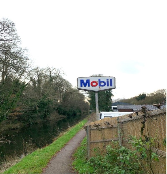
We are finally at the point where we can access the old railway line, by following the canal along Hordern Road Bridge. After some faffing about trying to get down onto the canal, I feel we need to push on and make progress with daylight hours against us. Clive though, is just getting warmed up, his senses awakened by the Suncentre and its surrounds. He wants to stop and do a reading and pulls from his backpack a copy of Anne Dillard’s ‘Pilgrim at Tinker Creek’. After noting how rare it is for him to read a book that carries a recommendation from former Archbishop of Canterbury Rowan Williams on its back cover, he proceeds to read from a section entitled ‘The Present.’ What exactly constitutes the present action, how to decide what is most deserving of your noticing? This is exactly the struggle we are having today, me looking for where I can interject my histories, Clive wanting to take the walk Dillard-like as it comes. I wasn’t present enough at the time of the reading, again casting timid looks up and down and over the canal, too concerned with what people in Whitmore Reans think of Pulitzer Prize prose being read aloud on the towpath.
The canal is the terrain the walk needs at this point. As repurposed places they are hard to beat, perhaps because of how democratically this has happened. They can be approached in the same spirit as Dillard’s thoughts on the present, as ‘a freely given canvas’. No planning permission required. However, I’m in danger of causing its constant ‘ripping apart and washing downstream’, as I’ve come with an over-eager agenda today and its theme starts to persist in the forefront of my mind.
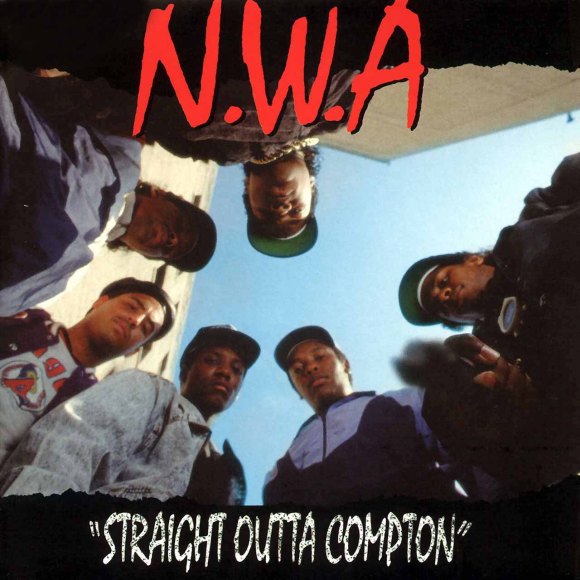
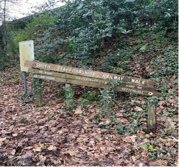
We access the old railway line via an arched bridge, passing a grandad, father and son playing with toy guns. The father is slumped convincingly motionless in the middle of the bridge, and I initially suspect alcohol or madness rather than the play acting of a street shootout. I should have known; we are about to head through the suburb of Compton. While at university in Wolverhampton I remembered the name of this area as it held part of the campus (a business school). I now recall the incongruity of the more famous name of N.W.A.’s LA home associated in my mind with the ‘scream bar’ cosseted culture of my new labour university experience, when I used to crave some sort of transgressive authenticity. I know this Compton campus has long since closed and want to see some evidence of what the building has become. The walk doesn’t want me to go there, and the old railway line affords us no such viewing point. We head straight out of the area.
With university rearing its head, we have entered the dangerous territory of my virginal past, very blank and one dimensional. Not unlike the physical route we take today. Much as we will discover of this path at the end of the walk; we’ll stay on it too long and it won’t want to give us up, golden glow on the horizon, to reality. An unintentional loss of time. We will have to circuitously get back to where we’re supposed to be.
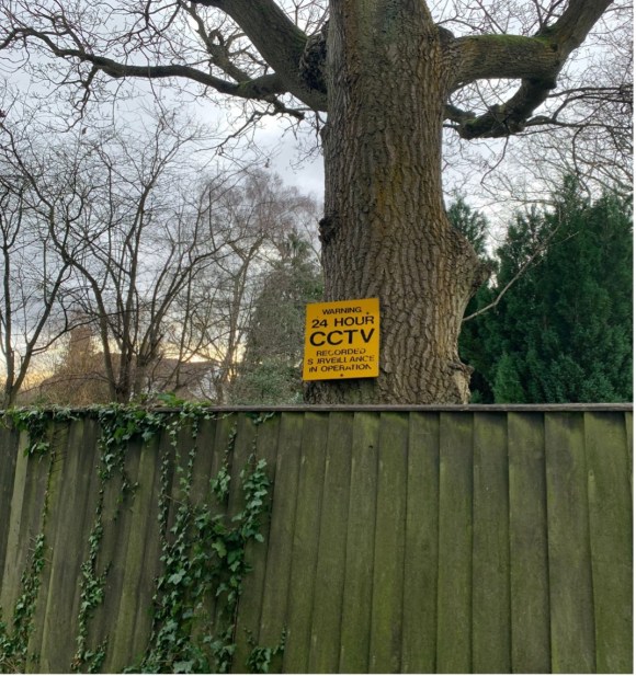
Post-Compton, at this point we come off the line and investigate Castlecroft Gardens to admire (if that is the right word) the work of Major Kenneth Hutchison Smith, who repurposed buildings in the 19th Century from other rural counties in the West Midlands in the hope of creating a utopian ‘village green’ type living quarter in this area west of the industrial city. We count less than five buildings that could remain from this period, so it is clear his project did not get very far. However, the spirit of his idea vampirically lives on amongst the current residents, who live in sizeable dwellings aping the mock Tudor ‘black and white with beams’ aesthetic of the Hutchison originals. Whilst Kenneth may have been originally seeking to set up a golden ticket salve to the realities of industrial working-class life in his lofty ambitions for Castlecroft Gardens, the present atmosphere is a long way from usefulness or industry, being one of pure preservation of exclusivity and bought privilege. Walking through, we would be disappointed not to find that nailed to various old trees are signs such as 24 HOUR CCTV RECORDED SURVEILLANCE IN OPERATION. YOUR ACTIONS ARE BEING RECORDED. In fact, an expansive balcony surveying the garden of one property finds me scanning the scene for Ralph Fiennes as Amon Goth, patrolling Castlecroft with his rifle.
What is the point of this preservation society and what type of life are they protecting? In other words, ‘What’s the frequency now, Kenneth?’ Since I lived in fairly central Birmingham for most of my life before moving to the Black Country around 5 years ago, the ubiquity of these ‘managed’ estates in the satellite town areas of major cities was something I had hitherto failed to notice. They speak so specifically of being ‘a prophylactic tunnel to the isolation zone’ and I worry myself that my young family, by being in proximity to their dangerous radiation, is living a sort of ‘half-life’. I pass through them en-route to work or with my son at weekends with a malignant blankness in my throat. Uncomfortably numb. I don’t drive an Isuzu though, maybe this is where I am going wrong.
After several more miles on the route Clive and I reach the last residential area that our walk passes through, the M Night Shyamalan infused (whatever the horror twist is, it would surely be McGuffined by the arrival of the first Deliveroo McDonalds breakfast) village of Wombourne. It’s no coincidence that here is the only place along the walk that one of the old train stations has been repurposed as a kitschy café. This town is really going in for something earnestly inauthentic, and whatever it is culturally approximates to a cross between David Cameron emerging from his shepherd’s hut, memoirs written, and Ruth Madoc popping to the post office in a scene from ‘Oh Doctor Beeching’.
I return to take a proper look at this example of ‘village life from which the villagers have long been expelled’ on the Sunday before Christmas. The high street is stretched around a large, green, square space with room for tennis courts, cricket pitch and pony. The first sign of life is a lad who can’t be more than 17-18 parking a 4×4 then walking with his girlfriend into ‘Farmer & Friends’ coffee shop. They may well be meeting with pals once inside, but by the look of the sunglasses he wears and the pontiff-like whiteness of the soles of his trainers, I doubt he is an agricultural labourer. The high street brand names which have a presence here also know the audience they are performing for: the ‘Boots Chemist’ sports a wooden swinging board above its shop window with the legend ‘since 1845’, a contrast to the neon-lit stratosphere of a retail park.
Unsurprisingly, through street signage I discover that there is a Wombourne ‘Best Kept Village Committee’, the most notable contribution of it being the ‘Arbour Tree’, planted by the side of the road on the edge of the green centre in 2008: ‘to replace the original Old Tree which stood at this road junction for over a hundred years.’ What happened to this ‘Old Tree’? Maybe the clue is in the phrase ‘road junction.’ I suspect some Cronenberg’s ‘Crash’ influenced local youngster got sick of the cleanliness of their trainer and ploughed into it at speed. It speaks of the odd collective attempt at nostalgia on constant display here that you would want, via committee, to plant a tree to replace one that’s uniqueness was that it was the oldest standing tree in the village. And draw attention to this with a plaque. A ‘Trigger’s broom’ approach to a deliberately artificial hauntology.
The busiest place on that quiet Sunday morning was the butchers, which had a quite spectacularly long queue snaking its way around the corner shopfront. Patrons waited patiently in the cold for the produce, showing to all how discerning they are in who they buy meat from and how the animal they consume has been treated. Is it too fanciful to imagine that if you were to listen closely you might hear someone turn to the next in line and say, ‘have you heard about that pub in Wolverhampton being used as a mosque?’
Getting back to the main route, and for the final part of the old railway Clive and I are by now moving with silences stretched out; the constant hum of traffic and bursts of birdsong bringing down the gloaming. The path is interrupted by a series of short, deep-cut bridges, the most infamous of these known as the ‘Wombourne Bridge’. It is this I am looking for to facilitate our departure from the line and bring the day to a close. The sides of those we pass under are covered in forgettable graffiti, but this caused enough of a concern locally for former South Staffordshire and Boris Johnson cabinet MP Gavin Williamson to be photographed in the news next to these daubs, as part of a campaign to protect the ‘Best Kept Village’ reputation. In contrast, no politician has thus far been photographed next to the racist slogans that often appear on the aforementioned ‘Wombourne Bridge’, not hidden below it but put boldly on the sides facing oncoming traffic. In the last year this has meant drivers on the A449 have passed daily under directives such as ‘White Lives Matter’, until they are washed over by the council. I play detective on two fronts for a while, not only keeping an eye out for the bridge itself but speculating if any of the very few people we come across could be the culprit, popping out to walk the dog with a can of (obviously) white paint in the back pocket.
At one point in a small layby, we pass one of those square, silvery, nondescript vehicles, covered in ash and full of bric a brac, that become metal furniture on overgrown driveways. Today though, this one has made an ill-advised journey. The bonnet is up and a fat man who looks a bit like Pavarotti in a worn-out Millets fleece waddles purposefully around the side, adding something from a bottle to one of the apertures in the engine. Could this be the phantom bridge sprayer? In addition, if passionate dog owners can start to look like the breed of the animal they are devoted to, perhaps in the Black Country drivers can take on the appearance of their cars? The ubiquitous half oval peaks of the headgear on speeding cruisers echo spoilers, and there is definitely something reflected back at the Pavarotti man by the shabby coat and squat build of his vehicle. He seems to know what he is doing with the engine though, and we leave him to it, the legacy of expertise of the Sunbeam engineers receding in the distance in the dying daylight.
Not long after, we notice the path isn’t curving towards the road as the OS map suggests it will, and the sky grows ever darker. We give up and google only to find we have missed the racist bridge terminus after all. I want to retrace our steps, but Clive won’t have it, once again his greater confidence in the moment coming through. We plod on, frustrated and sore, hoping the path will release us further up. Eventually, and in almost total darkness, we can make out a fly tipping site that causes Clive to exclaim, with the authority of a millennial Ernest Shackleton: ‘if a car has brought that up, there must be a way down.’ Sure enough, we find here an alternative exit to the one I had planned, a spot which locals have chosen to repurpose as a dumping ground for used household items, rather than for regurgitated xenophobia.
Before we join up with our main road destination for Clive’s Uber back to Birmingham, we pass through a silent industrial estate where large opaque trucks, detached from their cabs, loom out at us like alien objects from the blackness. It’s difficult to know whether this space and many others like it in the region would be any more active in tomorrow’s daylight, or we have just seen it in its permanent ghost-state. Uncertain black belt land. Static haulage, empty receptions.
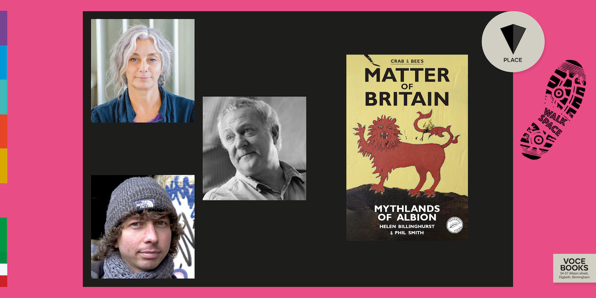
Walkspace is delighted to be teaming up with Voce Books to welcome walking artists and performance makers, Phil Smith (Crab) and Helen Billinghurst (Bee) on the launch of their new book “Matter of Britain: Mythlands of Albion“.
Helen and Phil will be joined by Walkspace co-founder Andy Howlett for an evening of conversation, performance and readings from their new work of re-enchanted & hallucinatory landscapes.
Crab & Bee have been gathering the ‘old stories’ for their new Matter of Britain, using the map of their own instincts, travelling on foot, and always ‘being there’.
These are not the stories of the medieval manuscripts, or their nationalist retellings for the BBC or the readership of the Times. This is how the old stories tell themselves these days, in their own places, the places where their genii loci dwell.
Matter of Britain is a banishing spell against nostalgia and a magical working for the remaking of the Matter in the ruins of the present, from the treasures of the past, speaking into the bodies of weird future.
Join us on Thursday 22nd May, 7pm at Kilder Bar, 5 Shaw’s Passage, Digbeth, Birmingham.
This is one of Voce’s PLACE events, taking drifts, detours & derives with writers exploring the contemporary practices of psychogeography, hauntology, creative walking & our relationship with the places & spaces that make us.