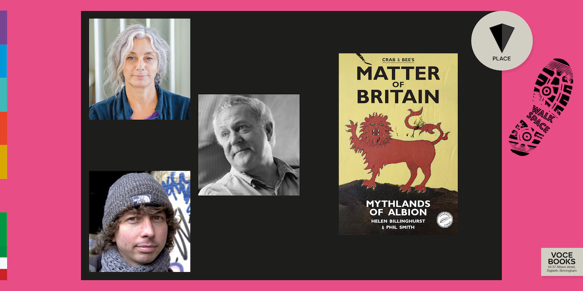
Walkspace is delighted to be teaming up with Voce Books to welcome walking artists and performance makers, Phil Smith (Crab) and Helen Billinghurst (Bee) on the launch of their new book “Matter of Britain: Mythlands of Albion“.
Helen and Phil will be joined by Walkspace co-founder Andy Howlett for an evening of conversation, performance and readings from their new work of re-enchanted & hallucinatory landscapes.
Crab & Bee have been gathering the ‘old stories’ for their new Matter of Britain, using the map of their own instincts, travelling on foot, and always ‘being there’.
These are not the stories of the medieval manuscripts, or their nationalist retellings for the BBC or the readership of the Times. This is how the old stories tell themselves these days, in their own places, the places where their genii loci dwell.
Matter of Britain is a banishing spell against nostalgia and a magical working for the remaking of the Matter in the ruins of the present, from the treasures of the past, speaking into the bodies of weird future.
Join us on Thursday 22nd May, 7pm at Kilder Bar, 5 Shaw’s Passage, Digbeth, Birmingham.
This is one of Voce’s PLACE events, taking drifts, detours & derives with writers exploring the contemporary practices of psychogeography, hauntology, creative walking & our relationship with the places & spaces that make us.
An invitation landed in the Walkspace inbox that was too good to pass up:
“I’m writing to bring your attention to an event – the launch of a pamphlet of writing about walking – that might be of some interest to your members. I’m told there aren’t many tickets left, but there’ll doubtless be walk-ups.”
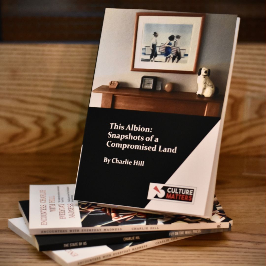
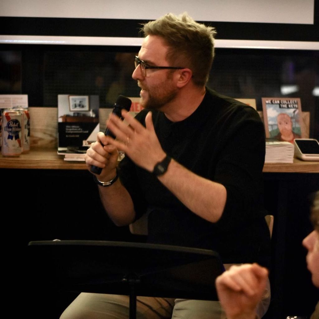
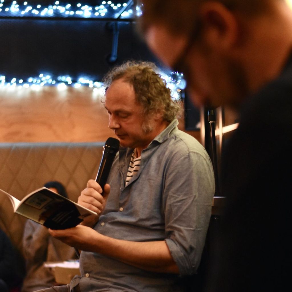
The event was hosted by Voce Books and the pamphlet was “This Albion: Snapshots of a Compromised Land” by Charlie Hill, an author once described as Birmingham’s answer to Franz Kafka. Curiosity piqued, a group of us headed out to Digbeth on a bitter November evening to see what Birmingham’s Kafka had to say about walking.
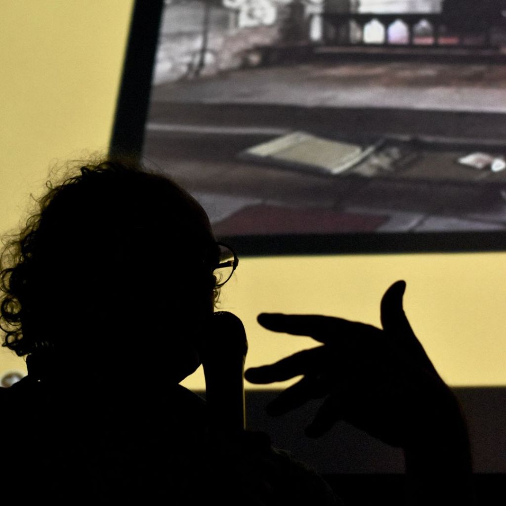
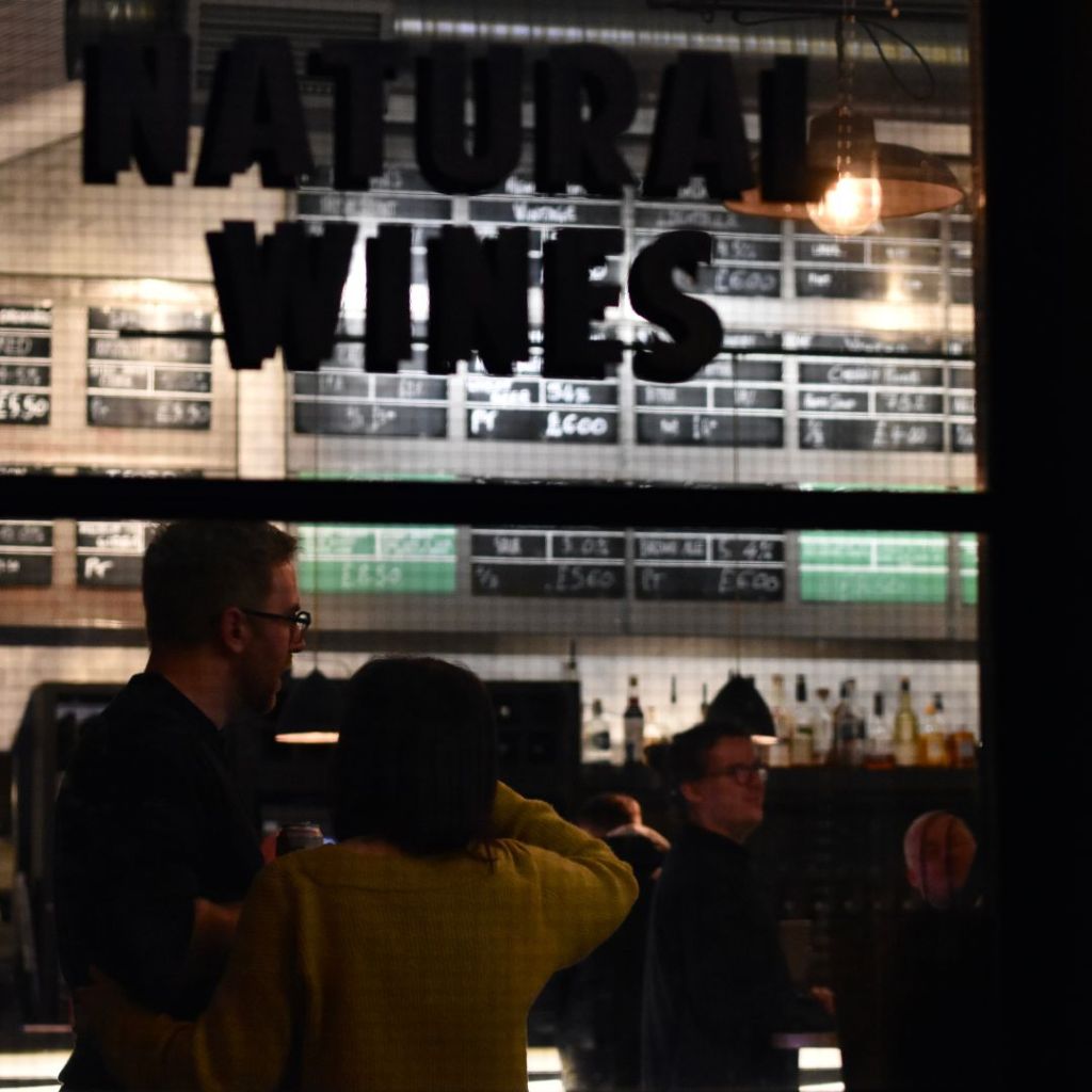
In the last two years Digbeth has become a hub of Birmingham’s literary scene with the arrival of Voce Books and the founding of Floodgate Press. Between them these two have done invaluable work in championing and showcasing homegrown talent, revealing just how much great writing there is going on in the city. Stepping into the railway arches that house Kilder Bar for one of Voce’s events, you can feel the buzz in the air, and this night is no different.
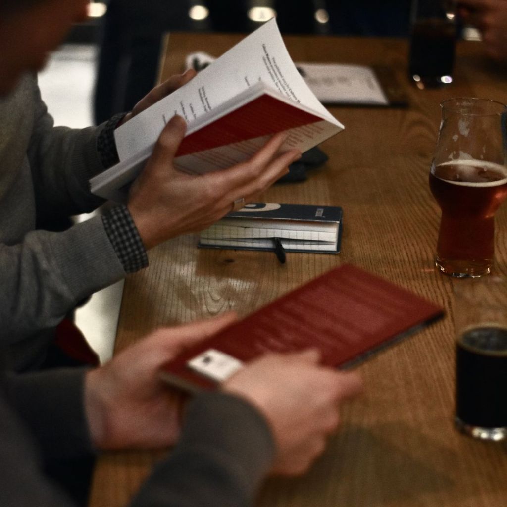
Another sell-out event, we fight our way to the bar and then take the only seats left, right at the front, within sniffing distance of the author. The night unfolds as a casual back-and-forth between Hill and Voce Books co-owner Clive Judd, riffing off some of the themes explored in the book such as authenticity, “champing” (church camping), the joy of Premier Inns and the overuse of the term “edgelands” in contemporary place-writing. Photos from the book appear onscreen behind them; literal snapshots from Hill’s travels, demonstrating his eye for the absurd within the mundane.
The book itself is an offbeat travelogue and part memoir that is by turns poignant, sardonic, world-weary and compassionate. Over the course of its modest 47 pages we visit 21 locations across England, Wales and Scotland and are treated to Hill’s observations and musings about second-hand bookshops, old pubs, Victorian cemeteries and the etiquette of countryside walking. His writing is direct and concise, sometimes very funny and he has a way of crafting a final sentence that reframes all that’s come before, landing a real emotional punch.
With the subtitle “Snapshots of a Compromised Land” this easily could have been a lot of sneering from another grumpy old man but mercifully that’s not the case. Don’t get me wrong, Charlie Hill IS a grumpy old man but his grumpiness stems from a long-simmering rage and sadness at the injustices and indignities of a land riven by inequality. There may not be much hope in these snapshots but there is plenty of humanity.
Charlie kindly shared with us this extract about the Birmingham to Worcester canal to give you a flavour of the work. If you like what you read do consider buying a copy through the link below.
…
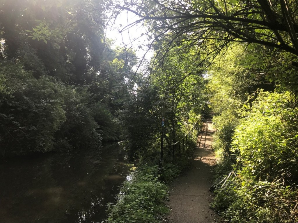
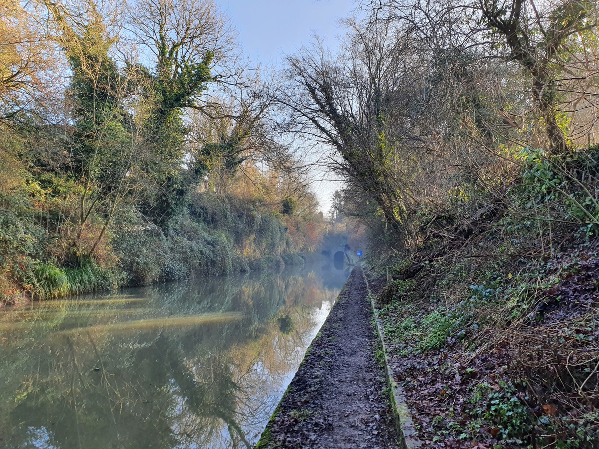
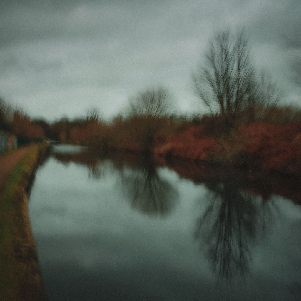
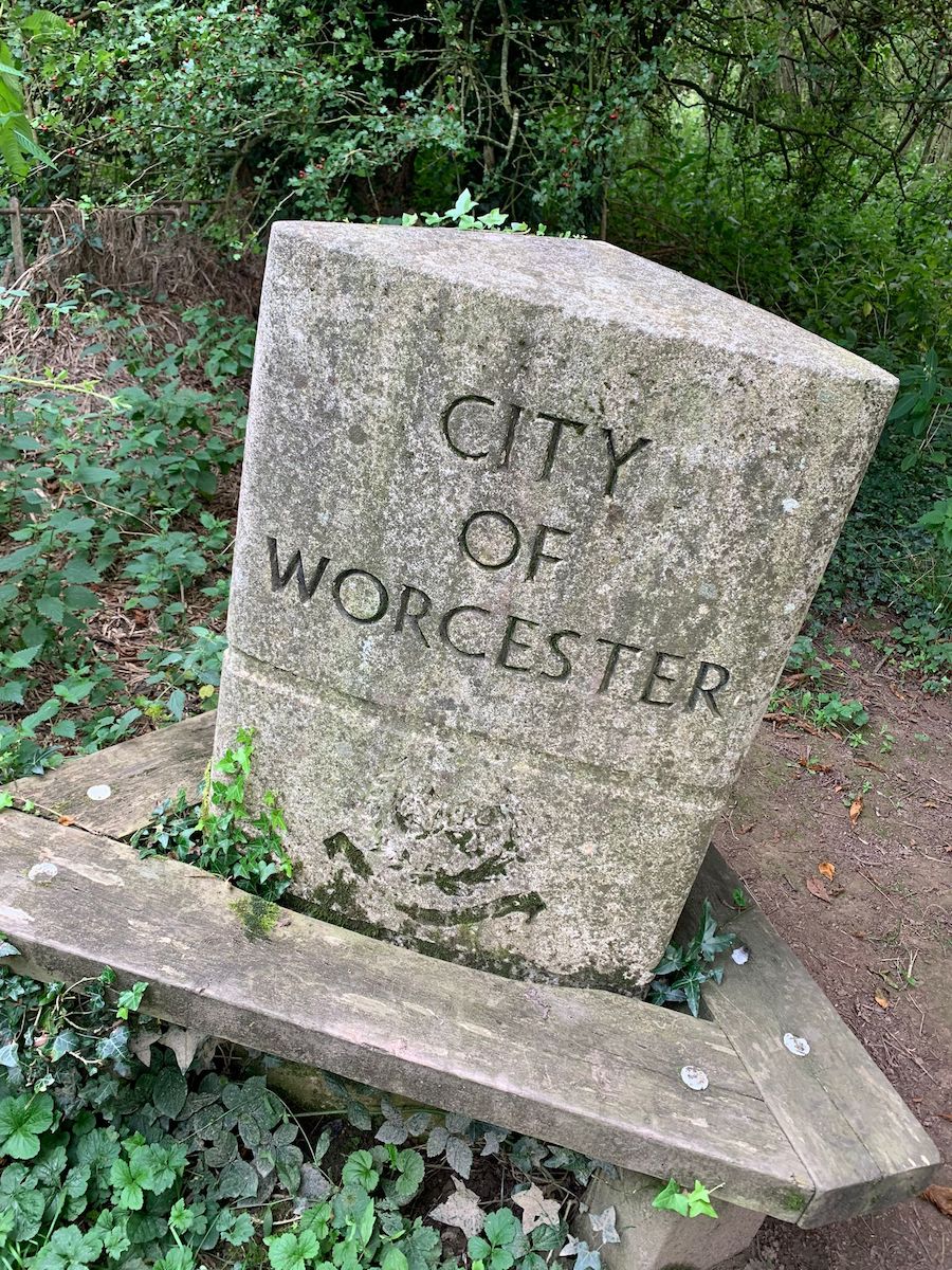
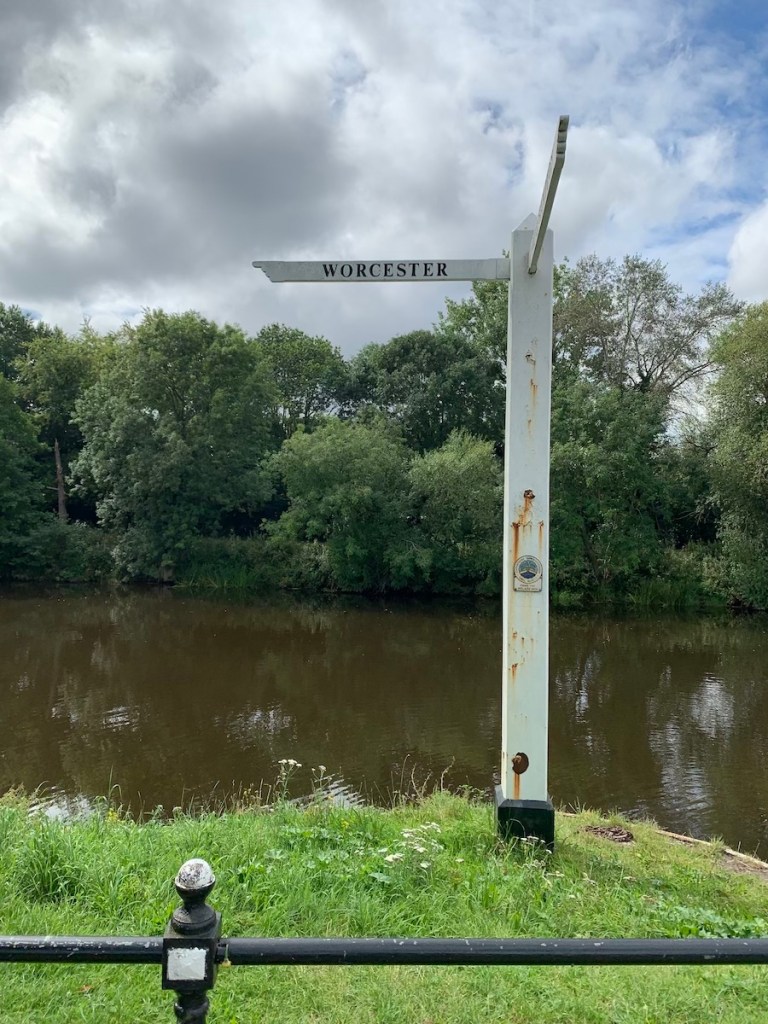
Birmingham to Worcester Canal
The canals of Birmingham – with their kingfishers and railway lines, their willow herb and jays and graffiti – exist outside the less obviously mutable suburbs they pass through: underneath too; the banks of the towpath are steep and dark and when you re-enter the city, you emerge blinking with surprise at where you are, and how different the light seems.
There’s a directness to walking the canals. Although they turn corners and curve, they feel like 18th century ley lines connecting factory yards, parks, churches, and other areas of communal ritual. The Birmingham to Worcester canal is like this. From the city centre it goes out past the commercial junctions of Five Ways, through the student accommodation and apple trees of the Vale, past the university itself to Bournville, where the station is done out in Cadbury purple and the air smells of chocolate. You might see egrets here.
Just beyond Kings Norton is Wast Hills tunnel. It’s a mile and a half long. Kings Norton is a parish that used to be in Worcestershire, outside the city’s boundaries. There is no towpath through the tunnel and walkers are sent up and onto the Hawkesley estate, in the overground outskirts of the suburbs. Once I tried to find the other end of the tunnel, setting off past a canalside cottage and a large secondary school in the direction a heron might fly.
I didn’t find it. Roads sweep through Hawkesley but it’s warren-like in places too, with shortcuts as criss-crossed as the towpaths seem straight. There are discarded shopping trollies in this closely-knit patchwork of social housing, twisting alleyways and shin-high picket fences, there are desire paths, and deep scarlet haws in confusions of undergrowth. It’s easy to project, to romanticise this anti-burb, this liminal space, this neither-one-thing-nor-the-other-ness, and that of the waterway that has created an underworld beneath the estate; the entrances to the tunnel are called portals, and I found Yarrow Drive led to Harebell Gardens, which led to Bargehorse Walk. But it’s worth remembering that the canal was cut into the earth like an industrial wound, by working people who died in its cutting.
This Albion is available to buy at Culture Matters. Charlie Hill’s other published works can be browsed on his website.
About Charlie
Charlie Hill is an internationally-acclaimed author from Birmingham. He has written long and short form memoir, and contemporary, historical and experimental fiction. He has been described by Natalie Haynes as ‘the chronicler Birmingham needs’ and compared by his fellow writers to Kafka, Beckett and Georges M Perec. His second collection of short stories – Encounters With Everyday Madness – was shortlisted for the 2024 Edge Hill Prize.
Grand Union Canal cutting just north west of Hatton in Warwickshire. Authors Photo January 2022, all rights reserved
Just over two years ago I embarked on a voyage of discovery in a part of the UK where there is only one scrap of coastline. A project called Walk Midlands (NOTE: that this is distinct from Walkspace, of which I am a proud member). This sees me – usually on a Friday – embark on a walk somewhere in the English Midlands, which I then write-up and share with the world via the Walk Midlands website, social channels and in the form of a monthly digest via the Walk Midlands Newsletter.
The project is first and foremost a practical walking guide for those interested in day walks that they can do without a car in the English Midlands. It is also a kind of reflection upon how we live now, a means of telling stories from history and a mediation on the landscape and topography of the central part of England, that comprises the bulk of the mighty River Severn and Trent catchment areas.
River Trent in south Derbyshire looking east towards the disused cooling towers of Willington power station near Repton. Author’s photo March 2022, all rights reserved
It is a natural extension of my practice as a journalist and creative non-fiction writer as well as my commitment to a form of politics where, to improve the world around you, you first have to understand it. This comes through in the choice of walks, which provide routes for non-drivers to access historical sites, culture and beauty spots across the English Midlands. As well as in the introductions which frame the walks, short, accessible, magazine style texts which explore all manner and facets of the Midlands region.
It is these components which attracted me to Walkspace. If one thread unites the medley of walking artists and other creatives comprising the collective, it is an orientation, perhaps even a compulsion, towards using walking as a means of tilting the everyday world 90 degrees and looking at the familiar askance. Walk Midlands, I hope, does it in spades and provides all those who appreciate and are intrigued by the English Midlands with a new route to explore it every week.
Why walk the Midlands?
There is a story I have told many times about Walk Midlands’ genesis. Like many of the best stories it has the benefit of being true. It goes like this: in the summer of 2021, struck down with a bout of COVID-19, thankfully not very ill but having to isolate, as the days of quarantine passed so the desire to go out walking grew in my mind. While confined in this way a project swam into focus which would give me an excuse to go on walks each week; that project became Walk Midlands.
I set out on my first walk, a triangular shaped stroll from Kidderminster to Stourport-on-Severn and back via Bewdley as soon as my time in isolation ended seeking to walk off the effects of ten days confinement. This walk was undocumented, but convinced me the basic concept of a website with a new walk each week, somewhere interesting in the Midlands, doable by public transport, was viable.
View looking north along the Malvern Ridge, right on the boundary between Herefordshire and Worcestershire, with British Camp and The Beacon clearly visible. Author’s photo August 2021, all rights reserved
My next two walks, along the Malvern Hills ridge between Ledbury and Great Malvern, and tracing the route of the “Lost Lapal Canal”, followed soon after. Looking back at those early walks now – and other ones created near the start like Halesowen to Tipton – it is readily apparent that I had not quite got the style right. Interestingly, I think that it first came together when I segued to the East Midlands and out into bits of the rural West Midlands which I did not know very well, if at all. It was the experience of discovering the feel, stories and what is interesting about places like Wirksworth or its neighbour Cromford (for instance) which I knew only from web pages before visiting, which taught me how best to structure the individual posts. Making them effective in terms of what would be useful to have photographs of, how to write the walk notes, and explain regarding the public transport connections, etc. It is fair to say that voyaging in more “distant” parts of the region taught me how to write about more familiar places.
I had several reasons for wanting to get to know the Midlands region and help others do so too. The most simple was basic curiosity. Having got into walking, I was keen on getting to know the “near abroad”. A concept writer, filmmaker and retired restaurant critic Jonathan Meades has spent the best of three decades exploring, making many BBC TV series, consisting of taking off-kilter deep dives into provincial England along the way.
The late, lamented The Crooked House pub, located just inside Staffordshire on the edge of the Black Country. It features prominently at the start of Jonathan Meades’ “Get High” (BBC2, 1994). Author’s photo March 2022, all rights reserved
And there was also a political motivation, rooted in the politics of the late 2010s, shaped as it was by the Brexit vote and the wildly different electoral outcomes of the 2017 and 2019 Parliamentary General Elections. Like many people this whirlwind, and the onslaught of COVID with all the separation that induced, left me wondering how much I actually knew about the country which I had now inhabited for a whole generation’s worth of time. This led me, returning to the concept of “near abroad”, to decide that given there is no way anybody can get to know as tightly packed, variegated and fissiparous a country as Britain in its entirety, that instead I should strive to better understand nearby parts of the country. Albeit beyond the archipelago of southern and central Birmingham, other regional city centres, and university campuses which I broadly consider my usual habitat.
Walking and storytelling
A third motivation, also political in character, relates to the walks on Walk Midlands themselves. Each walk is preceded by a contextual essay, typically pretty short and to the point, but in other instances more expansive. These usually take the form of a story, typically historical in nature. My primary intention with these is a form of light infotainment for readers. Hopefully they get enjoyment from reading the pieces and finding out a bit about facets of places, probably not too far from where they live, which they could visit on foot.
View from the top of Kinder Scout in northern Derbyshire looking south and west. Author’s photo April 2022, all rights reserved
And there is a serious component to this exercise too. Browsing Walk Midlands you will encounter stories about the role of extractive industries, the factory system, and the industrial revolution in the creation of the modern Midlands. As well as those like the followers of the (probably fictional) General Ned Ludd, who purportedly hailed from Anstey just north of Leicester, who have challenged capitalism since it emerged fully fleshed in the 18th Century. Alongside an older, yet also highly contemporarily resonant history of resistance and rebellion to the privatisation and enclosure of public space, from the “Midlands Revolt” of 1607, through 1932’s Young Communist-led Mass Trespass of Kinder Scout, to 1992’s 40,000 strong Castlemorton Common Rave. This is not to say stories associated with some of the Midland’s famous monuments to aristocratic, ecclesiastical and capitalist wealth and power are not told. They are present and correct, their stories narrated from the standpoint of the people whose labour – whether in the Midlands or overseas – generated the resources and wealth which made their construction, and ongoing upkeep possible.
View across Castlemorton Common west towards the Malvern Hills. Author’s photo May 2022, all rights reserved
Perusing the walks and getting out on foot to visit key locations, gives readers a better sense of the extractive and exploitative processes which have shaped the contemporary Midlands over millennia. Regimes of power which have damaged ecologies and the regulatory systems of our planet alike, while also restricting freedom and ensuring material want amongst the majority of people. Through the decidedly middlebrow medium of a local walking website, Walk Midlands helps readers discover how this is played out in their region. While also, more positively showing how people in the Midlands, whether individually or collectively, have always come together and resisted.
Walking the Midlands without a car
Another unabashedly political facet of Walk Midlands is the fact all the walks are doable without a car.
There is a practical reason for this which relates to the fact that I possess neither a driving licence nor a car. This was one of the practical drivers of the project. For years there were places in the Midlands which I had wanted to visit, but which due to my lack of a car or ability to drive seemed out of reach, meaning I was dependent upon talking automobile friends into accompanying me. Nearly a quarter of British households lack access to a car, so I figured that I was far from the only person who would like a website explaining how to get to far-flung sites and attractions by public transport and on foot.
Bus stop next to the village hall in Millthorpe, northern Derbyshire. Author’s photo October 2022, all rights reserved
Underneath Spaghetti Junction between Aston and Gravelly Hill in north Birmingham. Author’s photo April 2022, all rights reserved
Decisions about how we get about and the transport technologies our society is constructed around are political. Fundamentally determining whose needs and interests lie at the heart of decision making, whose needs are subsidised and whose are ignored. My lack of ability to drive and access to a car is simultaneously due to a learning disability I possess, which would make it pretty tricky for me to learn to drive, and a personal choice: a conscious decision to reject the polluting and atomising impacts of personal automobility.
In this way Walk Midlands’ inherent bias against the driving and driver-centric way in which so much of our society is organised becomes political. How could questions about access and the distribution of resources not be? Just contrast the vast resource in terms of tracts of land given over by the National Trust and English Heritage at their properties and beauty spots with the intensely squeezed financial resources local councils have to subsidise patchy, often to the point of non-existent, bus services outside major urban areas.
What I have discovered walking the Midlands
One of the key things of course, when I embarked upon the Walk Midlands project, was getting to know the region better, and on the most straightforward of levels I feel that I have been repaid in spades.
Looking north towards Staffordshire’s Weaver Hills. Widely accepted to be the base on the Pennine range which run for over 300 miles from the English Midlands to southern Scotland. Author’s photo June 2023, all rights reserved
Earls Barton parish church in southern Northamptonshire. The tower pre-dates the Norman conquest. My Grandma’s family lived in the village for generations as did she till her 18th year. My Grandma and Grandpa married there in 1951. Author’s photo February 2022, all rights reserved
Other discoveries relate to the varied fabric of the region. The difference between the culturally vibrant centres of Birmingham, Coventry, Leicester, Nottingham, Derby and their hinterlands. Hinterlands which are a mixture of incredibly affluent, seriously in need and very everyday in terms of how they feel to a visitor passing through. Whether in Wirksworth, Ledbury, Edwinstowe, Upton-upon-Severn or Ironbridge the small towns of the Midlands can also be vibrant, sometimes quirky, but in a very different way to the major cities, or lively small ones like Worcester or Shrewsbury.
Side street in Wirksworth mid-Derbyshire, the town is the county’s ancient lead mining capital and home to a major annual arts festival. Author’s photo November 2021, all rights reserved
Rural parts of the region are now distinguished in my mind by the quality of their walking infrastructure and the amenities in their villages. Worcestershire has copious footpaths and is a patchwork of little villages; it is one of the most scenic, deeply mythical and interesting of the Midlands counties, but its network of stiles, waymarks and footbridges across the county’s copious ditches are often very poorly kept. Neighbouring Shropshire, Warwickshire and Herefordshire are far better on this score.
Most of Worcestershire’s villages are now utterly lacking in amenities; by contrast little Herefordshire next door, far more sparsely populated, tends to have tiny community shops dotted here and there serving locals and passing walkers alike.
It is a similar story with public transport. Despite the horrendous cuts of the last decade some counties like Derbyshire, Nottinghamshire and Warwickshire have managed to retain fairly comprehensive, reasonably frequent networks. Shropshire, Herefordshire, Staffordshire and Northamptonshire present a very mixed picture, while Worcestershire, again, seems to now be largely without buses outside of Worcester and the larger towns.
Walking watersheds and administrative regions
Individual local attractions and the quality of public infrastructure and amenities in the era of public austerity and internet capitalism aside, perhaps the most incisive thing I have discovered walking the Midlands is a stronger sense of how the region should be chunked up.
There is a certain logic to the traditional division, crystallised by the creation of government regional offices in the 1990s, but in practice dating back at least as far as the Norse Invasions in the 10th and 11th Centuries, of talking about the East and West Midlands as distinctive entities. However, I have in writing up Walk Midlands walks chosen to present readers with the hazier, less definitive, unofficial sounding “eastern Midlands” and “western Midlands”.
Footpath waymark in the Wye Valley just south of Ross-on-Wye (well over 20 years old) bearing the name of the short lived Hereford and Worcester County Council. Author’s photo February 2023, all rights reserved
Administrative divisions are a useful frame of reference and explain a little bit about the provision, or lack of provision, of public amenities. However, they’re ultimately just lines on a map. A mixed inheritance that is the uneasy marriage of Medieval landlordism and the modern bureaucratic desire to create easy to file units. One Walk Midlands walk, an admittedly relatively lengthy and at times circumlocutious 11 miles from Tamworth in Staffordshire to Moira in Leicestershire, passes through four counties, and crosses a regional boundary, twice.
Moira Furnace in north western Leicestershire near the heart of the National Forest. It only briefly operated as an iron furnace in the early 19th Century, but survived and was restored along with a short stretch of canal in the 1980s. Author’s photo February 2022, all rights reserved
Far more important I now feel is the division between the land comprising the Trent watershed and that where rainfall ends up in the River Severn. Crudely speaking the Trent and Severn watersheds comprise respectively the more northern and eastern and the more southern and western halves of the area commonly considered the English Midlands.
As a rule the counties which drain into the Severn, such as Herefordshire, Shropshire, Warwickshire and Worcestershire, are more sparsely populated and agricultural in terms of both their traditional and contemporary cultures. By contrast the land drained by the River Trent comprising counties such as Nottinghamshire, Staffordshire, Derbyshire, Leicestershire and the vast majority of the West Midlands conurbation, is more industrial and urban in terms of past and present alike.
Of course this is a crude schema, Shropshire has a long history of coal mining, while the Midlands section of the Pennines is firmly in the centre of the Trent catchment area. Lincolnshire, however, offers a case in point, being a sparsely populated agricultural county drained partly by the Trent, albeit one where agriculture is perhaps more mechanised and industrial in terms of its scale than anywhere else in the UK.
Contours of Banburyshire, Greater Nottingham and the conurbations bookending Staffordshire
Exploring the Midlands slowly and meticulously on foot also leads to other schemas materialising for dividing up the region. The jokey local name “Banburyshire” for the uplands, partly in the Cotswolds, in the far south of Warwickshire, south western Northamptonshire and northern Oxfordshire, turns out to have a lot of grounding in topographical fact.
Likewise, Nottingham is officially only the fourth largest city in the Midlands, despite having the feel of a far larger place. This discrepancy is explained by the fact that the city lies at the heart of a decentralised conurbation, sprawling to the north of the city and west into Derbyshire, which in practice is actually home to around 700,000 or 800,000 people.
Rainborough Camp near the southwestern most tip of Northamptonshire. Firmly part of the “Banburyshire” topographical region embracing the northern Cotswolds, north Oxfordshire and south west Northamptonshire. Author’s photo December 2022, all rights reserved
Being from the eastern half of West Midlands county it is easy to read, hear and consume visual media about just how varied the Black Country is while seldom experiencing it. However, whenever I go out and about on foot, I am always amazed by the sheer plethora of Black Country sub-regions. Dudley’s green fringe is very different from the tightly wound towns of north Sandwell, southern Wolverhampton and Walsall, which in turn are quite unlike the semi-rural area to the north of Walsall.
Yet they are all equally Black Country, as are Bearwood and Smethwick, which almost feel like they should be in Birmingham, and nearly were, yet are very distinct places in their own right. Stoke-on-Trent and its surrounds, underappreciated yet utterly brilliant, at the far end of historical Staffordshire from the Black Country, bizarrely also feel like they’d be at home nestling somewhere above Wolverhampton and Willenhall. Yet they are also their own place, Midlands and northern, much as Derbyshire’s High Peak District or the areas around Chesterfield, Bolsover and Worksop are.
Walsall Canal Basin looking towards Walsall New Art Gallery. Author’s photo January 2023, all rights reserved
Where next?
In truth after two years of walking the Midlands, heading out at least once a week pretty much every week unless I have been away, there is nowhere I have visited I wouldn’t go back, nowhere without its charms, fascinating quirks and lovable character. Nor do I have any favourites, though there have been places where I have been keen to devise further routes so that I can get to know them better.
I hope to keep walking the Midlands and sharing the routes I devise and the stories I am drawn to for a long time to come. Hopefully I am not jinxing it but I have relatively few tales of scrapes to impart. Walking to Croft Castle from Leominster I was chased across a field by a herd of marauding piglets. The last bus (at 15:38…) out of Upton-upon-Severn once failed to turn up, necessitating a taxi ride back to Malvern with a friendly cabbie who was keen to talk about the brilliantly bonkers Monarch’s Way.
I got lost once, in the early days before I had invested in the Ordnance Survey Explorer app, trying to find the ruins of the Dowery Dell Viaduct, but luckily stumbled upon the Elan Valley pipeline and used it as navigational aid to get back to near the M5. More recently I slipped over repeatedly in the mid-March snow at the top of the spectacular, deeply underappreciated Bardon Hill, but there again that is what waterproof trousers are made for.
Looking south from Bardon Hill in northern Leicestershire on the western edge of Charnwood Forest. From the top of Bardon Hill you can see into every Midland county. Author’s photo March 2023, all rights reserved
There’ll be some hopefully interesting individual walks and monthly themes coming up in the near future. And I have a longform writing project planned for 2024, which will extend what I have been doing with Walk Midlands over the last couple of years, as well as opening up some new directions. Don’t hit backspace on your browser.
I am walking Brum’s oldest known road, a Roman Salt-way, Icknield Street (also called Ryknild). From the city’s southern margins to its northernmost reaches, I am tracing the route of this ancient track in three sections. This first walk is from Hawkesley in the south, through to the Roman camp at Metchley, the earthworks of which lie on high ground in the surroundings of the Queen Elizabeth Hospital in Selly Oak.
I begin on Icknield’s darkest stretch, amidst the old hills of north Worcestershire near the auspiciously named Grimpits Farm in Wythall. I spent a lot of my teenage years hanging with friends around these parts, drinking, smoking, larking about like many a youth, hazy days, when the world seemed brighter and everything was possible. The road here is narrow and sinuous, snaking its way up the rising escarpment like a primordial serpent, wreathed by ancient hedgerows and forgotten histories.
It’s easy to lose yourself down here. I find myself drifting through the happiest memories, wandering uphill as the sun glimmers through unkempt hedgerows and nervous thickets populated by blackthorn, hazel, ash, and oak. The outskirts of Hawkesley lie yonder on Primrose Hill. I fall into conversation with a local, fishing for attention, he’s a metal detectorist and conspiracy theorist it seems. He speaks enthusiastically of the Roman coins he’s found here, stamped with the imperious profiles of Marcus Aurelius and Hadrian. His aspect darkens as he details his attempts to get permission to gain access to local fields that flank this stretch of the salt-track, he suspects they may harbour secrets of a lost Anglo-Saxon waystation. He mutters darkly about landowners not wanting people prying on their land, sniffing out their illicit greenhouse crops. “It’s an ill weed that blows”, he grins toothily, waggling his detector like a spliff.
Along this darkened road, I’m taking blurry, slow-shutter photos of scenes that I encounter. I hope this reflects how the route and our collective memory of the road has been lost, worn away by the footsteps of time. This erosion of memory has personal echoes, this road is drift through my own personal history, the roots of Icknield Street run deep in my family. Time moves unerringly onward, discarding the transient, making the permanent seem ephemeral. This journey is important to me, a pilgrimage of sorts, touching the heart of what I’ve lost. The solidity of my world was shaken asunder when my Dad, Patrick, passed away suddenly last year. He was born and grew up in one of back-to-back courts, just off a stretch of Icknield Street, where the memory of it surfaces (allegedly) in Ladywood, central Birmingham.
I cross the City limits into Hawkesley, where the road suddenly forgets itself, becoming Walkers Heath and then Broadmeadow Road, sashaying along the southern ridgeline toward Kings Norton. These rough edgelands, a mix of golf courses, care villages and catteries, wash up against the white cliffs of concrete tower blocks, the road cutting between like a scar. Like the Anglo-Saxon God of War, it’s a bit Grim, threadbare nature in an unwinnable conflict against the dissolutions of Man.
A ramshackle assembly of farm buildings, tucked in behind the council cemetery, long derelict and abandoned, someone set fire to it last week. The guy who lived there was (long rumoured to be) an SAS commando back in the day, he was one of the soldiers who stormed the Iranian Embassy back in ’81, “grenade!”. He would watch his amply stocked fishponds like an avid hawk, eager to make a killing off the locals by charging for fishing access, whilst menacing those who didn’t pay with eager fists and a sawn-off shotgun. I don’t linger long, this area’s rep’ makes me twitchy, and there are strange noises emanating from that burnt-out barn……
The Road crosses over the top of Parson’s Hill, becoming Lifford Lane at the back end of Kings Norton, where industrial units bump gums against gnashing rows of terraced housing, jostling for primacy, gasping for air…… Breathing my beloved in, Breathing, breathing her nicotine, breathing, Breathing the fall-out in…….. You can smell the council tip long before you see it, the air around the road feels chewy with particulates. These conflicting edges, imposed by us are dirty and fascinating, gleaming allotment greenhouses glare uneasily across the ever-busy road at the noisome dump. The irradiated air is thick with Ravens and Gulls, eager to take their pick of the leavings.
At the brow of Lifford Lane, Icknield Street once flowed beneath, it’s under here somewhere, beneath the road, beneath the old rail line and the canal, the salt track is here, I can feel it! The northerly route that I’m following is a best-guess, an approximation of where Icknield Street once tracked, based on the oft-disputed opinions of eminent historians and local diarists. I’m looking for a road that may not even be there, following a likelihood, listening for topographic rumours hidden amidst unreliable texts and tucked in somewhere beneath my feet.
The road loops over the old rail and canal bridge on what was Stirchley Street, now the Pershore Road. The traffic is heavy and boorish as more memories flood my senses. It’s a bittersweet nostalgia for dead shops, old friendships and departed family, a lost Stirchley from my childhood. My Dad used to walk us up here on Saturdays, visiting the cake shop before strolling up through Cadburys to watch model yachts and steamships bobbing about on the lake. These days Stirchley is shabby chic, popular with the hipsters in their denim aprons and tote bags. I don’t have much truck with it, but the beer’s alright.
The ghosts of Icknield Street draw me close to Dad’s house and his old haunts, the Co-op where he shopped (now a Morrisons) or the café where he breakfasted, supping weak tea as he did his bingo. I’m a bit windswept and misty eyed, I find walking induces a kind of hypnotic reverie, where memory, dreams and misremembered stories, blend like the confluence of many rivers. Memories of my Dad flow like his laugh into his stories of people and places that have been lost or that I’ve never seen, giving room for imagination. Much like the route of the road, the stories of Dad’s early life have become fragmented in the re-telling and as I have gotten older, I’ve found to my cost that over time even my ‘memories are uncertain friends’.
I turn onto Umberslade Road, heading up hill. There was a huge dairy here when I was a kid, it’s a car park these days, much like everything else it seems. The road climbs sharply towards the Studentville of Selly Oak, past Muntz Park and the old Dell where I had my first kiss, her mushy lips tasted like cola cubes…. I’m a stone’s throw from Dad’s old house. I did a paper-round up here, Cherrington and Gristhorpe Roads, always good for Christmas bonuses and chocs. Most of the roads around here are populated with Edwardian terraces, parallel lines of tightly knit red brick homes, huddled like limpets on the landscape.
I wonder if patrolling legionnaires felt something akin to me as they neared home, at the junction with what is now Raddlebarn Road, a clearing through the gathered woodland there would, perhaps, have afforded views across the valley to the fires of home burning bright at Metchley Camp. Below them, a wide fertile prospect of arable fields and grazing livestock. Today, Heeley Road offers the most likely alignment of the Roman road, edging downhill into central Selly Oak, glad-handing with the A38 by the Bristol Pear. These days it teems with different crops, wheelie bins lined up in cornrows around rusty skips full of undergrad cast-offs, HMOs for the herds, the livestock guzzling their San Miguels down the Goose.
Dad’s absence hangs heavy over me around here, memories of his presence are palpable everywhere I look. Grief is complicated and fractured, full of one-sided conversations and unrequited wishes. His adherence to Catholicism and my own rejection of it was the source of many disagreements. But still, as I walk, I find myself softening, my eyes drenched in those places that remind me of him and his story. Dad was well known around the Parish, Nuns were always at our door, beatific foot soldiers of the Legion of Mary, brandishing her statue like a holy weapon. They terrified me, do they even have feet??? He was Pat the Painter, 50 years a decorator, man and boy. The homes and tower blocks he worked on, the churches he worshipped in, the shops he favoured, the memories he inhabited, they’re all here, looking back at me as I walk the Road. My reasons for tracing the roman route have belied this deeper need within me, I suppose. Deeper than merely documenting a lost road, I’ve ended up taking a final journey, hand in hand along a darker route, the ghost road guiding my way.
To get across to Metchley Camp, from what is now the A38 Bristol Road, the route of Icknield Street would likely have cut straight through Selly Oak, beneath what is now the railway and canal embankments. Any evidence of the road has been lost here, long ago. I am forced to choose a slightly longer route, crossing over the railway line through Selly Oak station, over the road and then down on to the Worcester Canal towpath. This is home turf for me, familiar skin, I live just up the road. The Titanic Caff, the epitome of the greasy spoon truck stop Café, used to hang off the edge of the bridge here, in corpulent defiance of gravity and land hungry developers. For decades it fed weary factory workers from the Birmingham Battery and a plethora of local industries that once thrived around here. Industry and greasy spoons have been washed away, replaced with sky-high factory dorms, pine fresh battery farms brim-full of spoon-fed students. This is the way we live now.
The canal remains, a gentle if sullen companion along the towpath as I leave the road behind me. There the old Dingle runs down to the water’s edge, where drunks and ne’r-do-wells once loitered after closing time, fumbling in the shadows, Friday night knee-tremblers threppence a go. The noise of it all falls away, memories flow into the waters below, washing away such nostalgia. This towpath is a favourite haunt, part of my morning commute. Its familiarity is part of its charm, a quiet corridor of nature and calm. The weather veers between sunshine and showers as I traipse slowly onward in mindful contemplation, a penitent sinner on the pilgrim’s way to Metchley.
On the stairs up to the road by University train station, a disembodied voice proclaims, “alight here for the Queen Elizabeth hospital”. I’ve arrived at last, Metchley Camp. Off Vincent Drive, surrounded by birch trees and covered by meadow grass, the earthworks of Metchley lie quiet, lost in reverie. Passers-by pay little mind to its antiquity, there’s places to go and things to do. I walk through the long grass, taking it all in to stand within its walls, listening for buried echoes as the rain falls. The grass is the deepest of greens.
You wouldn’t know there was something ancient, old, buried here. There’s too much else going on. Modern infrastructure dominates the view, there’s the hospital, a medical school, the train station, cranes, construction and the ever busy road dividing the site. The Roman camp was excavated on several occasions during the 19th and 20th centuries, documenting the remains of a once sizable garrison and trading outpost that was, in relative terms, quite short-lived. Later the site was covered over and gently re-landscaped, preserving it for future generations.
A shabby footpath here, which has seen better days, bisects the site at ninety degrees, close to the University bus-stops. It marks the approximate location of Metchley’s main street, the Via Accampamento, perhaps. Today it’s a popular spot for staff and students dining al-fresco on long sunny days, blithely intermingling with the sounds of Roman revelry echoing down through the years.
I kneel, a penitent son, pressing my hands against the path’s surface, a moment of quiet reverence for the road, lost but now found, at Metchley. Standing at last, my knees crackle and pop like Rice Krispies. We made it this far Dad, in nomine patris. As the rain starts to fall, my cheeks are wet in the breeze.
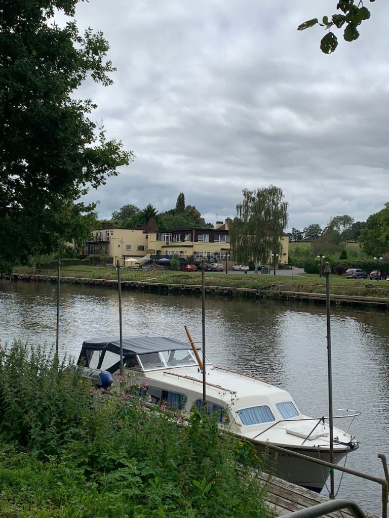
In late-August 2022, I took a walk with my good friend James Glover from Worcester to Stourport-on-Severn. The twelve-mile walk replicated the Saturday bus journey I would take each week as a kid with my mom and my brother to visit my grandparents. A year to the date, I decided I would close the loop by walking in the opposite direction, taking the pathway from the amusement park in Stourport and along the Severn Way in the direction of the city. The following is an extract of a new piece inspired in some part by that walk.
Taking another photo, now, of a sign pointing confidently in the opposite direction to the orange horizon image still on my phone from last year, and to the Bewdley walk I took only two weeks ago. I drop the image into the Walkspace WhatsApp group.
–Stourport to Worcester along the Severn Way. Dodgy knee has decided to make an appearance but hoping it holds up.
Strike out, buoyed by the returning messages, best wishes and good lucks, from the members of the collective. I have only recently joined and it’s the first time I’ve thrown one of my walks into the chat. I am also flying solo. No James to rely on with his astute way of nudging a narrative out of a landscape, a necklace of interconnected stories and historic points of interest. No Ben either to lean ideas against, emotional ballast against the spectres of the past. I’ll have to do it myself.
Beyond the lock at Stourport, and the first small indication of the crude potential of this walk. A wall, where a series of bricks have been marker pen inked, a kind-of mind map of contemporary conspiracy theory, with accompanying links to YouTube. I take the customary photo and send it on to Ben.
–Good start to the walk, eh?
The Severn rolls its way along to my right, a thick brown soup boiling a watery pathway between two muddy verges. I dip under a canopy of trees, leaving in my wake an old factory which would once have been the operational headquarters of one ‘T. P. Activity Toys’, manufacturers of plastic slides and playhouses and other colourful pre-school play equipment. Now though, the name of this former fun provider is in a state of manic disarray, its erratic pattern of letters arranged along the river facing flank, giving the overall impression of someone having shaken up a bag of Scrabble squares and thrown an indeterminate handful at the wall. ‘Countdown’ for the Late-Capitalist.
Half hour in and I hit the first in a series of caravan parks, but where one might expect to discover flashy, gleaming static units, I find a graveyard of grubby, green and brown cuboids, their axles propped up by a tower of slate grey breeze blocks. The atmosphere of the place is rural-American. Ranch-like. It’s curiously unpeopled, too, like the abnormal pastoral landscape of the walking simulator ‘Everybody’s Gone to the Rapture’. I imagine a golden orb of light drawing me through this awkwardly arranged pop-up village to a site of past memory. Light striking into form. Human. Voices revealing themselves like ghosts in the air. I imagine being treated to some crucial crux point in the narrative, brief, charged, voices becoming light, fading away back into orbic form as Jessica Curry’s soundscape, all cello and oboe and choral verse and soaring, textured emotion transforms the landscape into something other, something peopled in an entirely new sense. I imagine peeling off back to the river’s edge in search of the next trace of the narrative jigsaw, piecing together the ‘what happened?’, the ‘why did everyone leave?’ and the ‘where the fuck did they go?’
There are more macabre tales that could be motioned toward in this place, too. Stories entirely in line with the current, insatiable desire for true crime documentary and podcast serial. I’m not immune to this either, capitulating to the mental ‘what if?’ of this already weird encounter with place. Three or four thrillers start writing themselves in my mind. Detective stories without a detective. Think Claudia Piñeiro in the rural English Midlands. Some sad bod searching for another lost soul. The criminal, the perp, or at the very least, the fingered suspect twitches a mucky net curtain, the ripples of their watch caught for a second by the protagonist, the (non) detective, as they tip-toe through the lush expanse now commandeered by whoever it is that has decided to construct a life here. We all have to get by, somehow? Don’t we?
When it comes to caravans, I perhaps know more than your common-or-garden member of the cos-playing middle-class. The haunted visage of these, now surely decommissioned-for-commercial-use dwellings takes me back to my teenage years, twelve to seventeen, living in a ‘mobile home’ on a retirement park for the over fifty-fives.
–We don’t live in a caravan, okay love? These are static homes. They don’t even have wheels.
Mom’s wrong. They do have wheels.
–You can’t take one of these on holiday, can you?
It’s this kind of tangled logic that I’ll spend the best part of the next twenty years attempting to unpick. Still, Matthew and I love this place. The Village of Mobile Homes. We’ve visited a few times, riding around the park on our bikes with the only other kid to have found himself ensconced in what is quite literally a post-work environment. We’ve been running through the fields flanking the (not) caravans, ever since New Year’s Day, nineteen-ninety-eight. The day after the incident in the Stourport branch of ‘Road User’ where my brother, nine-years-old, watched on as our mother’s partner chased some robbers down a busy High Street, diving into the open door of the getaway car like some sort of Midlands-based John McClane. The car accelerated away with this brave (or insane) retail worker sticking out of its side, his now dangling legs resembling those of the guy bitten off the bog by a Tyrannosaurus Rex in Jurassic Park. It all happens in a flash. The body of mom’s beau, spat out into oncoming traffic, and rolling his way down the road like an empty crisp packet. A brave (or insane) attempt to reclaim a hastily snatched handful of Blaupunkt stereos. Matthew’s seen it all through the window of the shop. He’s still holding the plastic shop phone in his hand, responding dutifully to the last instruction he’d been given.
–Call the police.
Pre-Millennium tension. Pre-teen dreams. Pre-the move to the (not) caravan park in Warwickshire. Alex dumps me after a four-week, whirlwind romance. Rumoured interest from Katy, the mad lass who climbed on the school roof for no other reason than why the hell not? Vague interest on my part in Carla, despite my best-mate Matt’s constant warnings that, in hisexperience, she’s ‘as coldas afridge’. And definite, confirmed interest from Siobhan who, due to her kindly nature and the fact she’s a tad taller than most of us lads, we have nicknamed ‘The Friendly Giant’. What complicates things here, is that Siobhan is Terri’s cousin. Terri who, here’s a theme, ditched me in the school holidays. Terri, who I’m still raging about, not because I’m particularly damaged emotionally at the age of eleven years old by her sudden uncoupling from our tryst, after all we did only kiss the once, and it wasn’t even really a kiss, more a brief coming together of faces, and after all we did only go for one lousy walk together in the summer holidays, and I stuttered and, uh, stumbled and, uh, spent most of the time unable to unfix my gaze from her, uh, not really any of that but more the fact that, due to getting together with Terri in the last few weeks before the move to big school, it meant that there could be no repeat of last summer’s end-of-school-year-barbeque-cum-disco where I danced all night with Lizzie, the true source of all the light in my life since that memorable day she arrived at the school, in Year One, and was forced to sit next to me and was weirdly confident and canny with a put down and didn’t really seem to like me at all. With Terri now on the scene, an ill-advised ‘yes’ in response to a question I’d never solicited, there was now little chance of finally revealing to Lizzie what, in hindsight, was clear all along. That despite her nascent relationship with Luke, the best footballer in our class, the lad who Keith, the manager of Worcester Juniors, had tried in vain to lure into the squad after he gave up playing for perennial champions Nunnery Wood, using me, a child, as a sort of go-between, to pass messages on to and to woo, and also despite that weird four year period in the mid-nineties where she, Lizzie, and every single girl in the entire fucking world was obsessed with that knobhead Robbie Williams, despite all of this I was still truly, madly, and very much deeply in love with her. And, come to think of it now, I would really like more opportunities to dance with Lizzie at the summer disco to UB40 and go fishing in Laugherne Brook like that time when Luke and the rest of the crew I hang out with (mainly in trees) had gone home, leaving us, Lizzie and I, in worryingly close proximity, crouched on the bank and peering into the crystal clear water, spotting minnows and on the look-out for trout, that time we fished together for around two hours (in memory, let’s be honest it was probably ten minutes) and then walked back to the estate, me to two-forty, her onwards up to the new-builds by Grove Farm.
Night of the disco, and Lizzie runs up to me on the school field as the sun sets in the summer sky. She gives me a big hug and whispers, softly in my ear.
Sat in a coffee shop in May, Julia O’Connell, artist and co-artistic director of independent, Coventry-based cross-discipline performance company Theatre Absolute, propositioned me with a brand new commission for their new work Project:Public.
I don’t know about other artists, but when I’m offered a new commission my entire being floods almost instantly with nerves and self-doubt. I tried not to show that. I think you learn to trust that, actually, those feelings are natural, and are your body’s way of protecting itself from something challenging. You hide it and push through so you can grow.
Julia asked me to consider what it is right now that I’m obsessed with, what I can’t stop thinking about, what’s at my core.
Project:Public is their first work post-venue. Coventry City Centre South is a redevelopment plan that has pushed long-term independent businesses out of an entire swathe of the city centre. Julia, with co-artistic director and photographer Chris O’Connell, have been seeking new ways of making work.
I’ve been a member of Walkspace West Midlands for a good couple of years. I once led a walk around central Coventry for some amazing artists from the collective. It’s a rich collective. I took part in the group show at Artefact this year, but other than that, I just don’t seem to get the time to join for any of the fascinating wanders, erratics, adventures and exploratory research trips. I feel a bit rubbish about that but nonetheless, I admire the group and themes, and am endlessly inspired and propelled artistically by the subject matter of creative walking.
In the proposed commission, I found an opportunity to hurtle into creative walking – performative walking – conversational walking – disruptive walking. I hoped the Walkspace group would be proud. [We are! – Ed]
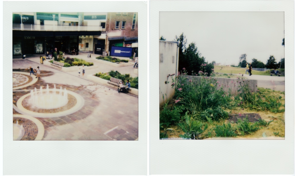
And so, being unable to resist an alliteration, Polaroids, Podcasts and Perambulation was born. Bringing together, as it says on the tin, instant photographs of the city with podcasts recorded whilst perambulating.
We recorded two in July – one walking on Hearsall Common with Julia:
The other walking around Ball Hill and Stoke with Chris:
We used a set of prompts for topics to discuss while talking – moving between many varied themes relating to the arts, from notions of time, pace, pressure, randomness, histories, play, funding, collaboration, getting lost, being reactive, being sensitive, and of course, public space and walking.
They are 47 and 57 minutes long, and published on Soundcloud. You can find all the content – prompts, polaroids and podcasts – at this link. You can also find lists of references of people, things, projects and histories mentioned.
Please do listen and share any thoughts if you’d like to. My email is adelemreed@yahoo.co.uk and my website is here.
Still Walking has been a big influence on many of us at Walkspace with its unusual and highly creative approach to the walking tour format so we’re very excited for its return over May and June. This edition features Sherlock Holmes, Shibboleths and Satan. Book onto the walks now.
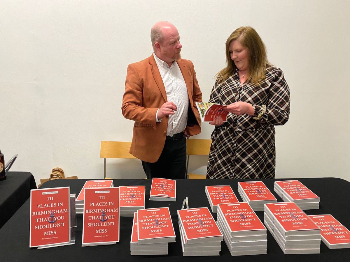
As for the book, here are some words from the publisher:
‘111 Places…’ books are known for side-stepping a city’s best known places, instead highlighting the lesser-known— or wholly overlooked— features that more candidly reveal the city’s identity. Ben takes this approach on his guided tours with Still Walking… walks informed by posing the question ‘what would guided tours look like if they weren’t about sight-seeing?’
The aim of the book was to tell Birmingham’s story through its art, architecture, music, industrial history and cultural diversity; showcasing the city’s triumphs while embracing its gritty side. Accordingly, there’s an intriguing mix of urban oddities, micro-museums, sacred sites, epic landscapes, industrial remnants (bridges, tunnels, engines) and a handful of ‘survivors’ from the pre-Revolution Birmingham.
Pictures from the book by Janet Hart
A few of us went along to the book launch at Ikon gallery earlier in the month and listened to Ben in conversation with Andrew Kulman. The talk was full of fascinating insights but it was especially interesting to hear about all the things that for one reason or another didn’t make it into the book.
The book was several years in the making and in typical Birmingham fashion a number of the places originally due for inclusion were demolished before it went to print. Perhaps we can expect a follow-up volume: “111 Places in Birmingham You Shouldn’t Have Missed”.
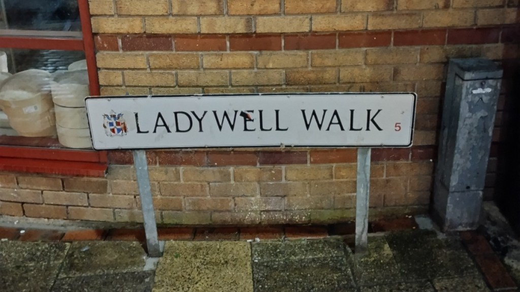
Another reason for some places not being included were the difficulties in obtaining permission to photograph private property. Ben told us of the case of the Lady well, “Birmingham’s answer to Leicester’s Richard III car park discovery“.
Buried underneath the car park of the Ibis hotel in Chinatown is a holy well, probably once dedicated to the Virgin Mary, that provided water for domestic and industrial purposes until the mid 19th Century. The site of the well is marked only by a concrete square built into the ceiling above.
Ben enquired to Ibis for permission to photograph the sacred site but found himself entering a Kafka-esque, bureaucratic nightmare, being passed from department to department with no one being able to give him a clear answer. Alas, the Lady well doesn’t feature in the book. This story was just too tantalising though so immediately after the book launch three of us decided to schlep over to the other side of town in the pouring rain to investigate.
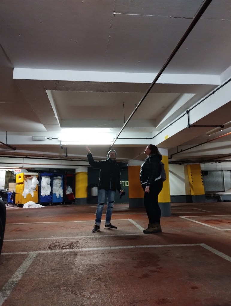
The first clue is in the name of the road that the hotel is on: Ladywell Walk. The car park can only be accessed through the hotel reception so we stepped inside, approached the receptionist and said that we had come to see the site of the holy well. Somewhat perplexed by this request, she told us to take a seat while she went to consult a with colleague.
A few minutes later the colleague came and acknowledged the existence of the well but warned us that there wasn’t much to see. She offered us a keycard to get down there and told us about reported ghost sightings associated with the well. Unperturbed we thanked her and made our way down.
This is a taster of the sort of unexpected discoveries and urban adventures that Still Walking and “111 Things…” offer up to the curious city dweller. For the tenth edition of the festival, Still Walking has crafted a special programme of eleven walks inspired by the new guidebook. Head over to the website where you can order a signed copy of the book to collect when you attend any of the walks for the discount price of £12.
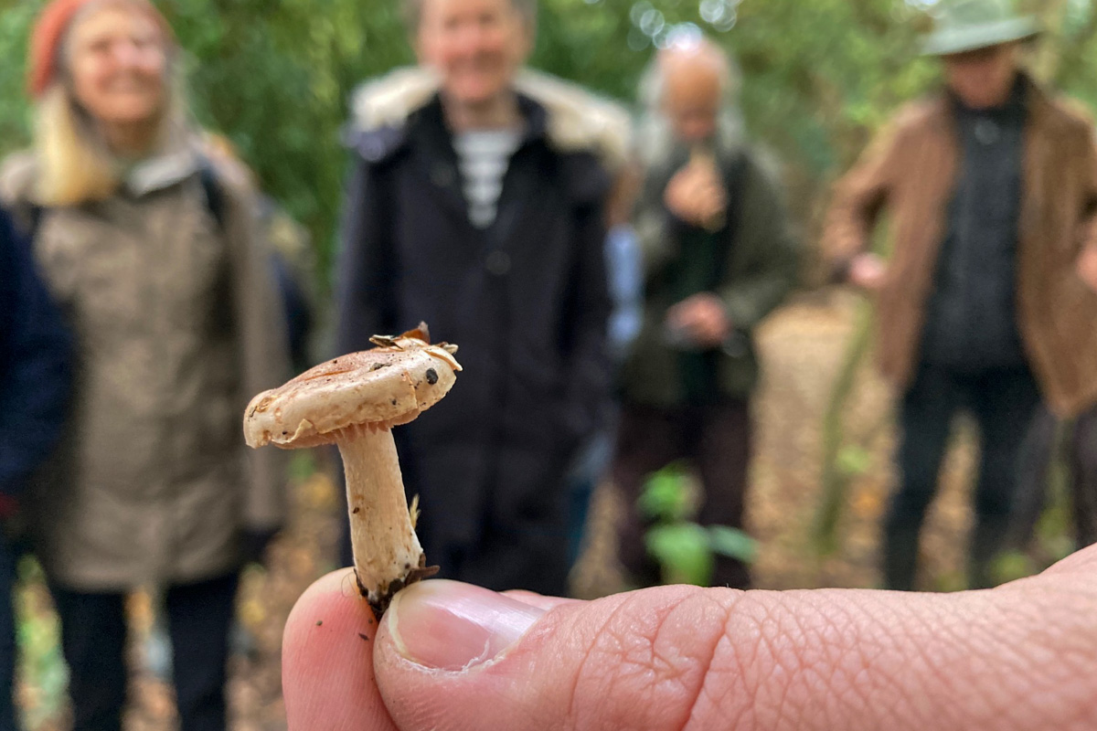
To be fair, I could have picked any of the names to headline today’s two-hour, ‘sold out’ Lukas Large fungi walk around Moseley Bog. But Dead Man’s Fingers were one of my favourite’s with their pointy black protuberances that look nothing like what anyone would imagine a mushroom to be.
There was also:
The amethyst deceiver, which changes colour, almost like camouflage.
The white saddle or elfin saddle, a convoluted spore shooter that looks a bit like a biology book diagram.
Clustered brittlestem – which grows in clusters with er brittle stems.
Brown roll-rim – the only fungus known to have killed a mycologist (someone who studies fungi). Julius Schaeffer died after eating it. Apparently it can cause an allergic reaction which leads the body to kill own blood cells. “Eating one is a bit like Russian roulette,” says Lukas.
Trooping funnel – which grows in troop lines or rings.
Birch brackets – which grow on birches and have lots of medicinal properties.
Apricot clubs – a lovely yellow coral fungus.
Sheathed woodtufts – shiny!
Inkcaps – I think these were the ones that were highly poisonous if alcohol is consumed a few days before or after.
I think the photo below is of the red cracked bolete – which drops spores out of pores instead of gills on the underside…
Candlesnuff – because that’s what it looks like.
Hairy curtain crust which commonly grows on oaks.
Shaggy inkcap aka lawyer’s or judge’s wig.
Green elf cups – although some walkers thought it was blue. Maybe teal? Anyway, this vivid coloured small mushroom also discolours the decomposing wood it grows on.
From what I can gather, the 2021 ‘mushroom season’ (Sept-Nov or until the first severe frost) is a good one. Certainly once we started looking in the Moseley Bog nature reserve they were everywhere, popping their heads above ground, on trees, in mud in order to spread their spores.
There are 15,000 species in the UK, all running on a limited number of describable characteristics – shape, size, colour, texture, gills, tubes, webbing, caps, cups, smell, sap, relationship with nearby trees. Even Ray Mears doesn’t fully trust his fungus ID skills when eating in the wild.
Or as someone said at the start: “All mushrooms can be eaten once, not all can be eaten twice…”
Thanks again to Lukas Large, Natural Sciences Curator at Birmingham Museums, who led the walk. You can check out his Flickr stream for some great photos.
We found out about him from fellow Walkspace member Jacob Williams, who led one of our members walk on a journey to the Centre of the Earth and urged us to look out for Lukas Large’s next walk. Follow him on Twitter @lukaslarge.
Or just get out there and look. But as Lukas says: “If you want to go foraging for fungi, please do it ethically. Many of our nature reserves and country parks are the last fragments of nature in a sea of people and agriculture, so the fungi there are precious and should be left for wildlife and other people to enjoy.”
All photos: Pete Ashton (except for amethyst deceiver and white saddle by Fiona Cullinan)
As an Australophile, I enjoyed watching Beau Miles video, ‘The Commute: Walking 90km to work‘, in which he ditched his car and walked to Monash University in Melbourne to deliver a lecture about adventuring. Fresh from the adventure, so to speak. Or not so fresh given the nature of the commute.
It was recommended to me so I’ll recommend it on to Walkspacers.
Beau Miles (bit of nominative determinism there) is a modern-day explorer who is trying to resurrect that feeling of adventure without having to fly half way around the world to do it. “I walked 90km to work a bunch of years ago to see if a stripped-back adventure could give me the kind of buzz that far away, exotic, heavily planned expeditions have given me over the years. It did.”
For the walk he appears something of a jolly swagman, setting off with no food, water or shelter, and living off the stuff that people throw away or inadvertently lose to the roadside. Part of the fascination is seeing what he will find and what he will stoop to eat… it is sometimes horrifying to watch him eat old food or half-empty plastic bottles of pop. He must have a stomach of iron or a carefully honed sense of smell for decay.
But he is not a hobo, not poor and not an itinerant in need of work – and therein lies a different distaste for some. It’s not that he sets out to be a swagman – and yet it clearly forms part of the rules of the walk in order to generate adventure.
It created a lot of discussion and debate in our household around the privileged nature of the walk and the filming vs the insights gained, issues highlighted and human challenge overcome.
Personally I was interested to see what thoughts that walking for two days with no funds, fuel or food would bring. About walking and humanity and philosophy and plastic littering and the basics of survival. There are things you get to thinking about when you push yourself this way that wouldn’t occur to you otherwise.
A few quotes that struck me:
“If there is one thing that is rhythmical it is walking. You know. It is so repetitious … You really just become a metronome.”
The paradox of being anti-littering but living off the litter that he hates: “First sit down. Quite serendipitous when someone throws away a couch. Bastards.”
Why do this at all? “It’s about putting value on such a thing, much like baking your own bread or taking karate lessons. I think that experiences like this are the essence of being human, which to me is our ability to question everything we do.”
But also there is the personal development: “Everything changes you. You cannot take away what just took place. That is now with me, it is part of me, it part of the fabric of Beau, it it my world view, it’s how I teach, it’s how I see the world, it’s how I see that road from that point on, and yes a lot of it will filter away as I get further from the walk, but it’s still there.”
Check out Beau Miles’ YouTube channel: He does a lot of crazy stuff from sleeping 30ft up a 100-year-old gum tree to seeing if he can build a cabin for his wife during the pandemic without her knowing.
On Christmas Eve I met up with local podcaster and author of At Walking Pace, Nyla Naseer for a walk around Highbury Park. Nyla captured some of the walk and conversation on video for her walking-themed YouTube channel. Part interview, part impromptu tour of some of the park’s curios (including an “Angry Wall” and a Twin Peaks-style tree circle), we hope you enjoy this little wintertime jaunt.
We recently published an extract of Nyla’s book which you can read here.