On 3 May 2025, a bright but windy spring day, several Walkspace members undertook a walk around Stapeley Hill and Corndon Hill in Southwest Shropshire, close to the Welsh border near the village of Priest Weston.
The walk centred on Mitchell’s Fold stone circle and the myths that gather around this ancient monument. Conceived as a members-only event, it was also structured so that it could be repeated as a guided walk open to the public.
I designed the walk as a manoeuvre: a form of guided walk devised in the 1990s by the artist Tim Brennan, with whom I have collaborated on several projects. Brennan describes a manoeuvre as “a walk built out of quotations which are recited to the group at stations along a predesigned route” (Brennan, 2017).
Alongside documented folklore and historical sources, I introduced a series of invented quotations – what I think of as neo-myths. These were attributed to fictional authors through what I call pseudo-references. The intention was not to deceive, but to mirror the ways authority, myth, and landscape are often braided together in accounts of ancient sites, where scholarship, oral tradition, and imaginative speculation coexist and overlap.
The Mitchell’s Fold manoeuvre followed a predefined route, with readings delivered at specific locations. These combined well-known folklore, historical commentary, and the neo-myths written for the walk.
From the car park, we headed north, directly into a stiff north-westerly wind, much as others might have done before us. The route across Stapeley Common runs alongside a holloway: a sunken lane formed by centuries of traffic, scoured out by drovers moving livestock between pastures or on towards market.
Mitchell’s Fold
The first station reached was the Bronze Age stone circle of Mitchell’s Fold (also referred to as Medgel’s Fold and Medgeley’s Fold). The name may derive from the Old English micel or mycel, meaning ‘big’. Fifteen stones remain, though it is thought that there may originally have been around 30.
“The peasantry of the neighbourhood tells us that this district, without being more fertile, was once more populous than it is at present, and that the population was kept from starvation by a benevolent being which came nightly, in the shape of a white cow, and abundantly supplied the inhabitants with milk. A condition, however, was attached to the comparative happiness of the people, and this was, that if the cow were milked dry, which it appears could not happen so long as each person took only a pailful at a time, she would disappear for ever, and the people would be reduced to extreme misery.
Now, there lived at the same time a malevolent old witch, who was envious of the flourishing condition of the people of this neighbourhood, and meditated continually on the means of overthrowing it. Her name was Mitchel. One night she went with the others, apparently one of the peasantry of the neighbourhood, but carried a pail with a sieve for the bottom. The milk, of course, passed through this, and the cow, who always allowed herself to be milked by each person until the pail was full, let Mitchel go on milking until at last she became dry. The condition was immediately fulfilled, and the population of this now solitary district all died miserably for the want of their usual food; but Divine vengeance fell upon the wicked hag, who was turned to a stone on this lofty hill, and the circle of stones was raised to imprison her. Hence it is called Mitchel’s Fold.’”(Wright, 1862).
Cow Stone
Continuing northeast along the ancient route, the next station reached was the Cow Stone, also known as the Dead Cow. The name derives from its resemblance to a reclining cow and is clearly linked to the legend of Mitchell’s Fold (Burnham and Pearson, 2018, p.133).
“They say the Cow Stone was once a living beast – gentle, broad-backed, and endless in her giving. Each morning she wandered the slopes of Stapeley Hill, offering milk to any who were hungry. But a witch, greedy for more, tricked her with a cursed pail. Realising the betrayal, the cow bellowed once and fled, her hooves cracking stone, her body stiffening mid-stride. She stands there still, turned to rock by sorrow. The wind, on certain days, moves around her like breath.” (Ellis, 2014).
The Hoarstones
From here we headed towards the Hoarstones, the second stone circle on the walk. This part of the route carried an element of uncertainty. During a reconnaissance walk, I had attempted to follow directions from an old printed guide, Stapeley Hills Historic Sites. On the ground, however, the described paths no longer aligned with fencing or access points, and after some effort I abandoned the search.
My intention on the day had been to stop at a particular point and tell a story about a missing stone circle. In the event, one of the participants knew the route, and we crossed a fence marked ‘Private – Keep Out’ to reach a circle of 37 small stones.
“The Hoarstones are marked clearly in the old guide – precise in distance, confident in direction. But on the ground, nothing held. Paths faded, landmarks changed, and the stones themselves seemed to withdraw. Some say they sink deeper with each decade, tired of being sought. Others suggest the map was never right to begin with. Older still is the tale of six fairesses who danced there on moonlit nights, their footsteps circling into the ground until stone rose to meet them. Now, the ring hides itself. In this landscape, absence is not an error, but a kind of message.” (Darnley, 1958).
From the Hoarstones we began the ascent of Stapeley Hill, a saddle-backed rise with expansive views across Shropshire and into Wales. At its summit lies a ring cairn.
“The cairn on Stapeley Hill rests like a spine beneath the sky. Some say it marks a place where the world thinned – where the old ones stepped between sky and soil. Walking here feels like entering a sentence left unfinished. The cairn does not offer answers, only presence.” (Hallet, 2001).
Cromwell’s Trench
Walking south from the cairn, we approached Cromwell’s Trench: a series of scooped hollows dug as test pits in the search for minerals, a reminder of the lead-mining heritage of south-west Shropshire (Shropshire’s Great Outdoors, 2013).
“Cromwell’s Trench lies folded into the side of Stapeley Hill – an interrupted rhythm of hollows and scoops, dug by hands chasing minerals through shale and silence. The ground here feels restless, worked over, as if thought itself had been quarried. It’s a place of absences: ore not found, labour long vanished, names forgotten. And yet the trenches remain – cuts in the skin of the hill that still hold weather, lichen, and the slow return of stillness.” (Carver 1994).
Continuing south, we passed further cairns, stone rings, a Bronze Age ring barrow, and a network of linear earthworks before beginning the steep ascent of Corndon Hill. From the summit, the landscape opened out into a wide, circling view – fields, ridges and borders unfolding in every direction.
By this point, the quotations had accumulated. Voices – some historical, some imagined – had been laid into the land, not to explain it, but to thicken it. The manoeuvre did not resolve the myths of Mitchell’s Fold so much as redistribute them, allowing them to cling to stones, paths, absences and weather.
In future iterations, the quotations and their attributions may shift, disappear, or be replaced – treated as materials rather than fixed texts, responsive to route, weather and the particular group walking them.
If the walk achieved anything, it was to suggest that these landscapes are not fixed by archaeology or story alone. They are continually re-made through movement, speech, and attention: each step a small act of re-inscription, each pause a moment where the ground might speak back.
Carver, I. (1994). Steps to the Sky: Notes on Walking and Vertical Mythology. Oswestry.
Ellis, R. T. (2014). Beasts that Became Stone, in Where the Hills Speak: Oral Tradition and Living Myth along the Anglo-Welsh Border. Hereford.
Darnley, I. (1958). Standing Stones and Straying Paths: A Rambler’s Guide to Forgotten Circles. Oswestry.
Hallet, M. (2001). Margins of Stone: Landscape, Memory, and the Mythic Borderlands. Ludlow.
Wright, T. (1862). Shropshire’s Great Outdoors (2013) Stapeley Hill’s Historic Trails. Leaflet. ‘On the Local Legends of Shropshire’, Collectanea Archaeologica, 1(1), pp. 50–66.
This post contains mentions of supernatural activity, historic deaths, execution and suicide.
On 31st October 2025, a cool but luminous Halloween evening, the Shrewsbury Skull walk was launched as a public walking event. The light was already thinning by late afternoon, the sky clear but brittle, and by the time dusk arrived the town felt poised – streets holding their breath, shadows gathering in corners and alleyways.
For five years previously, Walking the Stirchley Skull, devised by Walkspace members Andy Howlett, Fiona Cullinan and Pete Ashton, had taken place as an annual event. In his essay ‘Walk Your Neighbourhood Skull this Halloween’, written for the book Night Time Economy published by Floodgate Press, Andy articulated a loose but evocative recipe for the skull walk: a blend of psychogeography, ritual, storytelling, and embodied attention, mapped onto the outline of a skull traced through familiar streets.
The Shrewsbury Skull came about when I moved to Shrewsbury in October 2024. Unable to join the Stirchley walk that year, I decided instead to create an alternative version, adapting the skull to a new town and terrain. This was done with the assistance of Andrew Howe (not to be confused with Andy Howlett), another Walkspace member already resident in Shrewsbury, whose local knowledge proved invaluable in shaping the route.
The first Shrewsbury Skull walk, held in 2024, was deliberately modest: a limited event with only a small group of invited guests taking part. It functioned primarily as a recce – an exploratory walk intended to test whether the skull could be convincingly mapped onto the town and whether the rhythm of the route held together at night. The intention from the outset, however, was that it would eventually become a public event.
For the 2025 walk, the event was advertised across social media and through The Shrewsbury Scoop, a new local listings platform. At 7pm, fourteen intrepid explorers gathered outside the Grade I listed St Chad’s Church. The church is believed to have been originally founded by King Offa, and its circular churchyard sits slightly apart from the bustle of the town centre, already lending the meeting point a ritual quality. St Chad’s graveyard also contains the grave of Ebenezer Scrooge – a former prop from the 1984 television adaptation of A Christmas Carol, starring George C. Scott. Sadly, due to vandalism, the churchyard itself is not accessible in the evenings, and so we stood outside its railings, peering in at the darkened paths and headstones.
Map of the Shrewsbury Skull
Although the route had been planned in advance, one decision still had to be made: whether to walk the skull clockwise or ‘widdershins’. Widdershins is an old term meaning ‘against the way’ or to travel in the opposite direction to the sun’s course, and as Andy Howlett writes, “this can be an effective way of invoking darker energies” (Howlett, 2024). Given the date, the hour, and the appetite of the assembled walkers, this method was unanimously selected.
Shrewsbury is particularly well-suited to a night-time walk. Its medieval street plan remains largely intact, with half-timbered buildings leaning over narrow streets and numerous alleyways known locally as ‘shuts’ threading between them. At night, these shuts compress sound and light, amplifying footsteps and fragments of conversation, making it easy to imagine other presences moving just out of sight.
As we walked, various stories were recounted: tales of historic figures such as Captain John Benbow, who switched sides during the Civil War and was executed by firing squad, his grave now lying in the Old St Chad’s churchyard; and Ludovick Carnavon, after whom Carnarvon Lane (one of Shrewsbury’s many shuts) is named, a route that dates back at least to 1460. Alongside these were stories of visitors from the ‘other side’, including repeated sightings of men milling about Barracks Passage, thought to be soldiers killed at the Battle of Bosworth Field who returned to Shrewsbury because they had been warmly welcomed there in life.
From Barracks Passage we wandered up Wyle Cop (from villa-coppa, the town on the hill), a street with a long and bloody history. H. T. Timmins captured this past in a rhyme recalling the mutilatory executions once carried out there:
They hew and they hack and they chop, And to finish the whole they stick up a pole In the place that’s called Wylde Coppe, And they pop your grim, gory head on top.
Partway up Wyle Cop stands The Nags Head, a pub reportedly haunted by the ghost of a coachman who hanged himself there in the 17th century. Footsteps, crashing noises, and the sound of heavy breathing are said to mark his presence – details which felt especially vivid as we passed beneath its darkened windows.
At The Parade, once the site of the town infirmary, further hauntings were noted. These include a figure thought to be a former visitor to the soup kitchen that operated in the basement during the 1700s, as well as the infamous ‘grey lady’. She was reportedly seen at the foot of patients’ beds, who by morning had passed away (Wood, 1979, p.79).
At various points we consciously leaned into the structure of the skull itself. As Andy Howlett suggests, it is possible to “turn the walk into an anatomy lesson: when you reach the point on the skull where the ear would be, tune in to the soundscape of the night by walking in silence. When you come to the mouth why not get out some tasty treats?” (Howlett, 2024). Accordingly, when we reached the ‘mouth’ we paused to indulge in offerings that included ‘soul cakes’ served from a skull, before continuing on. Later, upon reaching the ‘ear’, we walked the final stretch in complete silence, attending closely to the scrape of shoes on stone, the distant hum of traffic, and the occasional burst of laughter drifting from unseen streets.
The walk concluded back at St Chad’s Church. Before dispersing to the Admiral Benbow for drinks, we were encouraged to “consider the transformation that has been enacted tonight. Stand for a moment with the ghost of your former self. These streets will never look at you in the same way again” (Howlett, 2004). On Halloween night, with the town dimmed and subtly altered, this felt less like metaphor and more like a simple statement of fact.
Do keep an eye on our public walk announcements here on the Walkspace blog and in our newsletter over 2026.
References
Howlett, A (2024) ‘Walk Your Neighbourhood Skull’ in Night Time Economy, Birmingham, Floodgate Press.
Timmins, H.T. (1899) ‘Nooks and Corners of Shropshire’ cited in Palmer, R. (2004) The Folklore of Shropshire p35, Almeley, Logaston Press.
Wood, M (2007) Haunted Shrewsbury, Stroud, Tempus Publishing.
15th December 2024. Wolverhampton. I meet Clive outside The Sunbeam pub, a Greene King lacklustre lounge, where, according to a subtitle as you hover on google maps, ‘a warm welcome awaits you.’ I wonder aloud to Clive whether this is something the company boasts of all their chains or is a specific, solar play on words meant to delight the locals of this city. He doesn’t respond particularly to this, either because he is embarrassed for me by my attention to this dull detail, giving the first inkling of missteps in our badinage as the day will progress, or because he hasn’t yet had any breakfast. If I had known, I suppose I could have brought his attention to the association of the name ‘Sunbeam’ to the car industry in the area, but then I have, uncharacteristically, not done my research.
Nevertheless, I want to hang the day on something, and I will attempt to talk and walk with Clive around the theme of ‘things being re-purposed, and who gets to decide why and how.’ He’s come over to this territory at my behest, and the latest main seam in our rich friendship has passed from football, books, and boozing to walking. I’m not sure how this happened, but the Black Country has had something to do with it.
We go inside in search of a cheap full English and are not disappointed, at least by the price. Where we sit, mock-ups of Sunbeam car manuals are noticeable on the walls above Clive’s head, similar in form to the Volkswagen car manual T-shirts racked up in supermarket ‘fashion’ sections, hoping soon to be stretched over the belly of a man with no practical working knowledge of cars. Whether someone is supposed to look up from their rubbery pork and take pride in the fact that Wolverhampton once made vehicles such as The Sunbeam 1000hp (the first to break the 200mph speed barrier at Daytona Beach in Florida in 1927) is unclear.
What is noticeable, stacked at the lectern facing the door, (to which no member of staff goes anywhere near), are white laminated signs with wadges of blu-tack in the corners, and the badge of Wolverhampton Wanderers Football Club in the middle. Bold Times New Roman underneath this states, ‘Home Supporters Only’. Anything like this makes you feel immediately sorry for the staff. It suggests that at some point in the recent past there must have been conflict amongst the patrons of The Sunbeam along football-tribal lines, alcohol seeping through the pores of men unable to put aside their performed differences for the sake of a £4.99 breakfast, and transmuting itself as the fuel for threats vague or specific, possibly precisely underneath where the ‘elf on the shelf’ figurines now dangle from the ceiling, next to the ‘fancy an extra sausage?’ signage.
How far this all is, a sanguine onlooker might think, from the diligent workers on the Daytona Beach project, competing healthily with their American rivals to get to the speed record first. A recent appeal by The National Motor Museum and the local Express and Star newspaper sought to find family members of those who helped build The Sunbeam 1000hp. It seems unlikely in 100 years that any organisations will be looking for relatives of those who worked behind the bar of The Sunbeam on matchdays, but who knows? ‘We’d love to uncover and record memories before they fade’ John Murden of The National Motor Museum states. Indeed.
The football club and the adjacent university compete for dominance in Wolverhampton, kept apart by a 1970s ring road referee. Both today will have occasion to haunt my own experiences of the city, as I share them with Clive. They are polished new-ish builds in bold colours that contrast with the discarded shell, picked over by various migratory birds, that characterises the built environment of the rest of the city centre. Walking through it, you feel that if the town had a taste, it would be of a cardboard toasted panini that you bought in desperation but regret immediately and don’t want to finish. Which is how, as a student here in the mid-2000s I often felt about my undergraduate degree.
Out of the underpass and wandering around the edge of Molineux stadium, a jarring, much earlier memory lodges; of being in a stand behind one of the goals at around 15 years old. It is late summer, late 1990’s and I am with my dad, and two of his mates from work. My dad and I are Villa fans, and the tickets are pre-season friendly freebies from these mates of his. Prior to this outing, my dad has shared an anecdote about one of them, who has sold his recently deceased mum and dad’s Wolverhampton house. He had apparently gone out of his way to assure his late parents’ neighbours that he would not be selling their house ‘to an Asian person.’
It’s half time, and this mate asks me, nodding towards the pitch, ‘What do you think then?’ I assume that, as it is my first time at his home team’s stadium, rather than get my tactical assessment of the first half action, he means what I think of the building’s aesthetics, and I point out how much I like the orange stanchion areas jutting into the sky at each corner of the ground. I remember the laughter, the incredulous faces, and the pensive look of my dad, who must have felt like he had brought a young Denton Welch to the game. The memory still frustrates (I like football; I just struggle when discussing tactics). What would those two mates of my dad think of our walk today? If I try hard, maybe I can convince myself that my walks in the last year or two have rejected the moral of this story, the idea that you’re not meant to look up at places, buildings, things at the expense of the more obvious ‘present’ action. Have they been in part exercises at re-training myself to notice what might mean more than, say, a pre-season friendly? Bit of a stretch, maybe. But, for today at least, we are just wanderers.
We head northwest out of the city centre looking for the Hordern Road. Halfway along Hordern, in Tettenhall, The Golden Eagle pub sits at the junction with Court Road. It’s square, stocky, brick façade features an arched double doorway that has a large red plaque above it bearing the date 1928. Perched atop the date is the eponymous animal in gold, wings aloft, with a gaping hole reaching far back into the brickwork where its head should be. A similar sized but much younger sign to the right of the doorway bears the imperatives ‘NO PARKING. NO UNAUTHORISED VEHICLES.’ This sign hints at the more recent history of this public house building, which was in the local news for being repurposed as a mosque without the proper planning permission. Reports on this ‘misuse’ included quotes from residents complaining of ‘chocablock’ traffic on Fridays. One unidentified Tettenhall resident swore that they had no problem with the building being used as a mosque, ‘as long as it was done through the proper channels’’. In tribute perhaps to the 16th Century English Reformation and its rejection of requiring the assistance of the proper channels to access salvation, the number of cars parked outside the building and on the pavement on the day Clive and I walk past suggest that the following of local council rules and regulations is still not the primary concern of the current patrons.
In recent Wolverhampton news prior to our walk there has been soul searching in the city over the fate of its most famous brewery, Banks’, whose final closure was apparently on the cards as soon as they were sold to international majority shareholders The Carlsberg Group a few years ago. Perhaps this is a money-spinner that was overlooked, leasing the empty public houses on the outer edge of the ring road as repurposed places of worship for the current working class of the city. But of course, something would have to have been done about that Friday traffic. There’s something about the Golden Eagle building and the contradictions about its use and reuse, permissions granted, refused or ignored.
Not far from here in Whitmore Reans is West Park Primary School, infamously alluded to in an alarmist speech (not that one) by Enoch Powell in the late 1960s in which he wrongly stated that it had only one white child on its registers. Powell himself recently (2018) fell afoul of the planning permission politics of local government when the Civic and Historical Society of Wolverhampton refused calls from some quarters for a blue plaque to be placed in the city honouring his status as a famous local MP. One of the difficulties, other than the obvious apparently, was finding a suitable place to locate the thing. Perhaps using it to paper over the gaping hole of this beheaded Golden Eagle, or even adding an Enoch bust to the bird, so that he could stand guard over this holy place and prevent ‘unauthorised access’ being ignored in perpetuity? Later on this same day we will stop at a ‘desi pub’, The Firs in Castlecroft which forms a nice contrast to the fate of the Golden Eagle. You can continue operating as a pub and sell food that tastes of things, it seems to say, but don’t bring your God into our sacred buildings. And please ensure you have ample parking.
Clive reacts well to a brief history of The Eagle, his eyes really lighting up for the first time today, and he starts taking photos. I immediately become aware of being watched while he does this; fearing questions from furtive looking local residents, I try and move us on a bit further only to be confronted by The Suncentre, surely one of the oddest-looking buildings ever to be repurposed as a tanning salon. It is a barn like brick shed, quite long, with an obvious lack of possible entry points for any natural sunlight. To add to the visual unease, it has a Wicker Man-esque smiling sun logo. These uncontroversial pagan worship spots crop up on many local high streets in the Black Country and are always irresistible to eyeball, hoping to catch a glimpse of the orange proprietor or find out just who the hell can be using them. Clive gets snapping and he’s really enjoying himself now as we amble down the road past a man waiting at a bus stop who gives us a good stare. I feel self-conscious and embarrassed that we are seen laughing at the area this man may call home, even though I can be fairly confident he’s not either the small business owner of the tanning salon or worshipper at the covert mosque. I need some of Clive’s confidence and ease, he’s a more seasoned flâneuric piss-taker with a purpose than I.
We are finally at the point where we can access the old railway line, by following the canal along Hordern Road Bridge. After some faffing about trying to get down onto the canal, I feel we need to push on and make progress with daylight hours against us. Clive though, is just getting warmed up, his senses awakened by the Suncentre and its surrounds. He wants to stop and do a reading and pulls from his backpack a copy of Anne Dillard’s ‘Pilgrim at Tinker Creek’. After noting how rare it is for him to read a book that carries a recommendation from former Archbishop of Canterbury Rowan Williams on its back cover, he proceeds to read from a section entitled ‘The Present.’ What exactly constitutes the present action, how to decide what is most deserving of your noticing? This is exactly the struggle we are having today, me looking for where I can interject my histories, Clive wanting to take the walk Dillard-like as it comes. I wasn’t present enough at the time of the reading, again casting timid looks up and down and over the canal, too concerned with what people in Whitmore Reans think of Pulitzer Prize prose being read aloud on the towpath.
The canal is the terrain the walk needs at this point. As repurposed places they are hard to beat, perhaps because of how democratically this has happened. They can be approached in the same spirit as Dillard’s thoughts on the present, as ‘a freely given canvas’. No planning permission required. However, I’m in danger of causing its constant ‘ripping apart and washing downstream’, as I’ve come with an over-eager agenda today and its theme starts to persist in the forefront of my mind.
We access the old railway line via an arched bridge, passing a grandad, father and son playing with toy guns. The father is slumped convincingly motionless in the middle of the bridge, and I initially suspect alcohol or madness rather than the play acting of a street shootout. I should have known; we are about to head through the suburb of Compton. While at university in Wolverhampton I remembered the name of this area as it held part of the campus (a business school). I now recall the incongruity of the more famous name of N.W.A.’s LA home associated in my mind with the ‘scream bar’ cosseted culture of my new labour university experience, when I used to crave some sort of transgressive authenticity. I know this Compton campus has long since closed and want to see some evidence of what the building has become. The walk doesn’t want me to go there, and the old railway line affords us no such viewing point. We head straight out of the area.
With university rearing its head, we have entered the dangerous territory of my virginal past, very blank and one dimensional. Not unlike the physical route we take today. Much as we will discover of this path at the end of the walk; we’ll stay on it too long and it won’t want to give us up, golden glow on the horizon, to reality. An unintentional loss of time. We will have to circuitously get back to where we’re supposed to be.
Post-Compton, at this point we come off the line and investigate Castlecroft Gardens to admire (if that is the right word) the work of Major Kenneth Hutchison Smith, who repurposed buildings in the 19th Century from other rural counties in the West Midlands in the hope of creating a utopian ‘village green’ type living quarter in this area west of the industrial city. We count less than five buildings that could remain from this period, so it is clear his project did not get very far. However, the spirit of his idea vampirically lives on amongst the current residents, who live in sizeable dwellings aping the mock Tudor ‘black and white with beams’ aesthetic of the Hutchison originals. Whilst Kenneth may have been originally seeking to set up a golden ticket salve to the realities of industrial working-class life in his lofty ambitions for Castlecroft Gardens, the present atmosphere is a long way from usefulness or industry, being one of pure preservation of exclusivity and bought privilege. Walking through, we would be disappointed not to find that nailed to various old trees are signs such as 24 HOUR CCTV RECORDED SURVEILLANCE IN OPERATION. YOUR ACTIONS ARE BEING RECORDED. In fact, an expansive balcony surveying the garden of one property finds me scanning the scene for Ralph Fiennes as Amon Goth, patrolling Castlecroft with his rifle.
What is the point of this preservation society and what type of life are they protecting? In other words, ‘What’s the frequency now, Kenneth?’ Since I lived in fairly central Birmingham for most of my life before moving to the Black Country around 5 years ago, the ubiquity of these ‘managed’ estates in the satellite town areas of major cities was something I had hitherto failed to notice. They speak so specifically of being ‘a prophylactic tunnel to the isolation zone’ and I worry myself that my young family, by being in proximity to their dangerous radiation, is living a sort of ‘half-life’. I pass through them en-route to work or with my son at weekends with a malignant blankness in my throat. Uncomfortably numb. I don’t drive an Isuzu though, maybe this is where I am going wrong.
After several more miles on the route Clive and I reach the last residential area that our walk passes through, the M Night Shyamalan infused (whatever the horror twist is, it would surely be McGuffined by the arrival of the first Deliveroo McDonalds breakfast) village of Wombourne. It’s no coincidence that here is the only place along the walk that one of the old train stations has been repurposed as a kitschy café. This town is really going in for something earnestly inauthentic, and whatever it is culturally approximates to a cross between David Cameron emerging from his shepherd’s hut, memoirs written, and Ruth Madoc popping to the post office in a scene from ‘Oh Doctor Beeching’.
I return to take a proper look at this example of ‘village life from which the villagers have long been expelled’ on the Sunday before Christmas. The high street is stretched around a large, green, square space with room for tennis courts, cricket pitch and pony. The first sign of life is a lad who can’t be more than 17-18 parking a 4×4 then walking with his girlfriend into ‘Farmer & Friends’ coffee shop. They may well be meeting with pals once inside, but by the look of the sunglasses he wears and the pontiff-like whiteness of the soles of his trainers, I doubt he is an agricultural labourer. The high street brand names which have a presence here also know the audience they are performing for: the ‘Boots Chemist’ sports a wooden swinging board above its shop window with the legend ‘since 1845’, a contrast to the neon-lit stratosphere of a retail park.
Unsurprisingly, through street signage I discover that there is a Wombourne ‘Best Kept Village Committee’, the most notable contribution of it being the ‘Arbour Tree’, planted by the side of the road on the edge of the green centre in 2008: ‘to replace the original Old Tree which stood at this road junction for over a hundred years.’ What happened to this ‘Old Tree’? Maybe the clue is in the phrase ‘road junction.’ I suspect some Cronenberg’s ‘Crash’ influenced local youngster got sick of the cleanliness of their trainer and ploughed into it at speed. It speaks of the odd collective attempt at nostalgia on constant display here that you would want, via committee, to plant a tree to replace one that’s uniqueness was that it was the oldest standing tree in the village. And draw attention to this with a plaque. A ‘Trigger’s broom’ approach to a deliberately artificial hauntology.
The busiest place on that quiet Sunday morning was the butchers, which had a quite spectacularly long queue snaking its way around the corner shopfront. Patrons waited patiently in the cold for the produce, showing to all how discerning they are in who they buy meat from and how the animal they consume has been treated. Is it too fanciful to imagine that if you were to listen closely you might hear someone turn to the next in line and say, ‘have you heard about that pub in Wolverhampton being used as a mosque?’
Getting back to the main route, and for the final part of the old railway Clive and I are by now moving with silences stretched out; the constant hum of traffic and bursts of birdsong bringing down the gloaming. The path is interrupted by a series of short, deep-cut bridges, the most infamous of these known as the ‘Wombourne Bridge’. It is this I am looking for to facilitate our departure from the line and bring the day to a close. The sides of those we pass under are covered in forgettable graffiti, but this caused enough of a concern locally for former South Staffordshire and Boris Johnson cabinet MP Gavin Williamson to be photographed in the news next to these daubs, as part of a campaign to protect the ‘Best Kept Village’ reputation. In contrast, no politician has thus far been photographed next to the racist slogans that often appear on the aforementioned ‘Wombourne Bridge’, not hidden below it but put boldly on the sides facing oncoming traffic. In the last year this has meant drivers on the A449 have passed daily under directives such as ‘White Lives Matter’, until they are washed over by the council. I play detective on two fronts for a while, not only keeping an eye out for the bridge itself but speculating if any of the very few people we come across could be the culprit, popping out to walk the dog with a can of (obviously) white paint in the back pocket.
At one point in a small layby, we pass one of those square, silvery, nondescript vehicles, covered in ash and full of bric a brac, that become metal furniture on overgrown driveways. Today though, this one has made an ill-advised journey. The bonnet is up and a fat man who looks a bit like Pavarotti in a worn-out Millets fleece waddles purposefully around the side, adding something from a bottle to one of the apertures in the engine. Could this be the phantom bridge sprayer? In addition, if passionate dog owners can start to look like the breed of the animal they are devoted to, perhaps in the Black Country drivers can take on the appearance of their cars? The ubiquitous half oval peaks of the headgear on speeding cruisers echo spoilers, and there is definitely something reflected back at the Pavarotti man by the shabby coat and squat build of his vehicle. He seems to know what he is doing with the engine though, and we leave him to it, the legacy of expertise of the Sunbeam engineers receding in the distance in the dying daylight.
Not long after, we notice the path isn’t curving towards the road as the OS map suggests it will, and the sky grows ever darker. We give up and google only to find we have missed the racist bridge terminus after all. I want to retrace our steps, but Clive won’t have it, once again his greater confidence in the moment coming through. We plod on, frustrated and sore, hoping the path will release us further up. Eventually, and in almost total darkness, we can make out a fly tipping site that causes Clive to exclaim, with the authority of a millennial Ernest Shackleton: ‘if a car has brought that up, there must be a way down.’ Sure enough, we find here an alternative exit to the one I had planned, a spot which locals have chosen to repurpose as a dumping ground for used household items, rather than for regurgitated xenophobia.
Before we join up with our main road destination for Clive’s Uber back to Birmingham, we pass through a silent industrial estate where large opaque trucks, detached from their cabs, loom out at us like alien objects from the blackness. It’s difficult to know whether this space and many others like it in the region would be any more active in tomorrow’s daylight, or we have just seen it in its permanent ghost-state. Uncertain black belt land. Static haulage, empty receptions.
To celebrate the Summer Solstice we walked a new stone circle into existence. The West Midlands may not be as blessed with megalithic monuments as other parts of the country but we DO have an abundance of another type of ancient rock: the glacial erratics which travelled here from North Wales on an ice sheet.
Thanks to the mapping efforts of the Erratics Project we can see that several of these boulders can be joined up in a giant circle. In order to activate this newly discovered ancient monument (several hundred thousand years older than Stonehenge), we walked the entire 13 mile circuit, anointed each boulder and took turns reading aloud The Stone Monologues by Alyson Hallett. We were honoured to be joined by Alyson herself who took a detour on her journey back from Scotland to spend the day with us.
The walk started and finished at The Great Stone Inn in Northfield. This historic pub is custodian of not one but two erratic boulders and the landlady kindly granted us access to the 17th Century village pound which contains the titular Great Stone itself. Participants were asked to bring along a pocket-sized stone of their own and we opened proceedings by placing the stones at our feet, creating a miniature stone circle around the Great Stone erratic.
The walk took us close to the Bartley and Frankley Reservoirs, the home of Birmingham’s drinking water. This water also travels here from Wales, in this case from the colossal reservoirs of the Elan Valley. The water makes the 73 mile journey through a huge pipe called the Elan Aqueduct, powered only by gravity. Welsh tap water to anoint the Welsh stones.
The Stone Monologues is a ten part poem written from the perspective of an erratic boulder. Alyson Hallett wrote the monologues after encountering an erratic on Cader Idris and becoming obsessed with travelling stones. Since then she has taken five migrating stones on journeys around the world. The stones have a line of her poetry carved into them and are sited in Scotland, England, USA and Australia. A sixth stone is destined for Ukraine. On all her travels Alyson says she has never known anywhere so abundant with erratics as Birmingham.
Particles of myself ride the wind into homes and hands of strangers. Rain washes me into the earth and the earth’s fast running rivers. I record the touch of a hand, step of a fly, scud of clouds. I have small pockets that catch words from a walker’s lips, light from the moon’s bright lyre.
We walked for seven and a half hours in the midsummer heat, arriving back at The Great Stone exactly as the church bell struck 6 o’clock. Pleasingly the final stone sits in the pub beer garden. By then we were ready for a pint. Alyson summed up the day nicely: “it was ceremonial, sacred, fun and I met amazing people. Days like this allow me to experience how poems can come into the communities of more-than-human beings and expand the cosmic soul. Happy Solstice to everyone.”
Looking south from Windmill Hill (287 metres above sea level) in the heart of the Waseley Hills Country Park you can see Bredon, Malvern and Abberley, the three great ridges which dominate the otherwise gently hilly landscape of Worcestershire.
To the north and east inside West Midlands county sprawls the raised metropolis of Birmingham and the Black Country up upon the Midlands plateau. Due north of Windmill Hill the towers of Birmingham city centre align closely with the curve of the M5 motorway and the patch of woodland, Frankley Beeches, above a hill straight ahead. To the east lies the craggy boundary between urban West Midlands and rural Worcestershire that are the Lickey Hills. While on the western horizon the towns of the southwestern Black Country, Rowley Regis, Blackheath, Halesowen, Old Hill, Cradley, Lye and Stourbridge, cluster like the names of calling points a railway carriage or express double decker’s passenger information screen. Running up the slopes of Turner’s Hill, the vulcanised limestone, communications masts bedecked, highest point in West Midlands.
Atop Windmill Hill, the toposcope that illustrates all of this in engraved form, was the first calling point of Walkspace’s Severn/Trent Watershed Walk for Terminalia Festival 2024. Occurring on the 23rd of February each year Terminalia is a transnational festival inspired by a Roman god which explores boundaries in all their myriad, fluid, culturally contingent, forms.
Why Walk the Watershed?
This year, in conjunction with Andy Howlett (filmmaker, artist and Walkspace Co-founder), I was pleased to deliver Walkpace’s contribution to the event, which celebrated the Severn/Trent watershed, one of the Midland’s most important and defining geographical features. I have written before about how in broad terms the Severn/Trent watershed marks the boundary between the southern and west parts of the Midlands in the Severn catchment area which are considered more bucolic, even mystical, than the modern modern, industrial and postindustrial, heavily populated River Trent basin. It was this which encouraged Andy to reach out to me about co-producing Walkspace’s Terminalia Festival 2024 walk as he was keen to explore the watershed. Though whilst the walk was initiated and developed by Andy and I, many members of the Walkspace Collective contributed to the event on the day.
Walking between the two river’s starting points requires a short, but intense, amidst the muddy late-February conditions, hike across quite hilly ground. Rising only two and a half miles apart the River Rea flows north across Birmingham to the Tame, which in turn runs in a northeasterly direction to its confluence with the River Trent, through which it eventually flows out past Kingston-upon-Hull to the North Sea. While from a well behind St. Kenelm’s Church the River Stour trickles forth and commences its journey, wending its way across the southwestern Black Country and out into the Staffordshire and Worcestershire countryside, through Kidderminster and into the River Severn at Stourport. From there the water flows on and out into the Celtic Sea via the Bristol Channel.
The contrasting myths and histories associated with the rivers brilliantly illustrate the contrasting perceptions of the southern and western Midlands versus the north and eastern parts of the region. The Rea is feted as an industrial river. Its waters turned the mill wheels and cooled the metal which drove Birmingham’s growth and expansion as the Midland’s major metropolis. An expansion which led with a certain degree of irony, indicative of Birmingham’s utilitarian unsentimental character, to the Rea being culverted and covered over for large stretches of its course through Birmingham. By contrast, the Stour, flowing through some of the leafier parts of the Black Country and then down through mixed rural and urban terrain in northern Worcestershire, is chiefly associated with the mystical, allegorical, medieval Chrisitan myth of the murdered Merican boy king St. Kenelm. A tale which sounds like it would be more at home in the depths of rural Cornwall, Wales or Ireland, rather than on the skirts of the urban West Midlands.
Windmill Hills’ toposcope handily aligns with the Severn/Trent Watershed. As a cultural and historical appreciator of watersheds, rather than a geographical, geological and hydrological one, I had naturally assumed that crudely speaking water falling on the southern flank of Windmill Hill would eventually run into the Severn via the Stour. While water falling on the northern slope would flow via the initial conduit of the Rea into the Trent. As Walkspace member Robson observed things are not so simple, rather both the Rea and the Stour initially flow north, albeit one towards the east into Birmingham and the other to the west through the southwestern Black Country.
Having clambered down Windmill Hill, the fourteen of us in the party, Walkspace members, and members of the public alike, made for the Source of the River Rea, another of Waseley Hills Country Park’s attractions.
After a brief psychogeographical ceremony and a poetic recital by Andy, resembling in parts a rural North Midlands version of the KLF’s“It’s Grim Up North”, of many of the settlements along the Rea, Tame and Trent which the water would flow enroute to the North Sea, the party set-off to head west leaving Waseley Hills Country Park to cross the M5 into rural Worcestershire.
As many on the walk noted, the M5 is an important barrier in its own right. Indeed if Environment Agency maps are to be believed it runs quite close, even in parallel with the Severn/Trent watershed. Perhaps West Midlands residents are conditioned to associate the M5 with escape through years of West Country holidays? However, there can be no doubt that the majesty and thunder of the river of cars flowing beneath the motorway bridge aside, that the massive road does mark a barrier, both psychological and physical, between the West Midlands conurbation and the rural north Worcestershire countryside.
Beyond the M5 the walking party moved into open countryside. Heading downhill towards Dowery Dell then turning left to head up to the hilltop village of Romsley. It is simultaneously a freestanding ancient hilltop village and a suburbanised exurb of Halesowen and the rest of the leafy southwestern Black Country fringe.
It being February progress was slow across waterlogged fields. Little surprise in a part of the country with rich claggy soil that is the genesis for so many rivers. Then the hail started. A brief pause was made in the car park of the Swallow’s Nest pub, patrons scurrying between the hostelry and their cars eyeing the group with a mixture of respect and pity, before setting up again even further uphill to the southern edge of the village.
Romsley is high up as large villages in England go. The Swallows Nest where we paused stands 241 metres above sea level. Reaching the edge of the village and making good time, despite the mud and the weather, it being the coldest day for at least three weeks, we climbed to nearly 275 metres and the top of Romsley Hill.
Here something went a little bit awry with a footpath not adhering to the right of way, a common problem on the edge of settlements, where villagers tend to carve their own folkways. This lack of local knowledge occasioned a quick scramble across a couple of fields, down into a pretty valley ringed with trees opposite the Clent Hills, and then escape back into human settlement via gaps in a hedge onto a campsite shut for the winter.
Hastily getting back to where we should have been via the campsite’s access road, having deftly navigated a gate, swift progress the rest of the way to St. Kenelm’s Church was made. The walking route was mostly along the capillary thread of bucolic lanes which skirt the Clent Hills.
Reaching woodland beneath the larger of the Clent Hills spectacular views of the hilly southwestern edge of the Black Country came into view to the right. Handily the sun came out just at this point illuminating the varied urban, industrial, yet also highly green fringe of West Midlands county. Pleasingly most of the final stretch of the walk to St. Kenelm’s Church and the well which is the source of the River Stour was across a field with spectacular views towards the nearby conurbation.
St. Kenelm, a Midlands saint subject of a popular quasi-religious legend during the middle ages, can be glimpsed in a lovely, characterful carving on the front of the lychgate into the churchyard.
The church itself is ancient and evidently much added to over the years. Today St. Kenelm serves the parish of Romsley and the surrounding villages, the current building evidently Victorian in part, but with lots of far older components and embellishments. If Wikipedia can be believed the little church’s crypt is formed from the remains of a shrine which lay at the heart of the pre-Reformation cult of St. Kenelm.
After a late lunch, Andy recounted the legend of St. Kenelm outside the church’s porch, before the watershed walking party made its way down to the well behind the church which is the source of the River Stour. Here there was another psychogeographical ceremony, featuring a sheep skull (providentially discovered in a tree during the walk), spreading of flowers, and a recital of the names of the settlement which the water bubbling from the well would flow through on its way to the sea. A jar half filled with water from the River Rea was dipped into the well to capture water destined for the Stour too.
This event was the closing ceremony for Walkspace West Midlands’ Terminalia Festival 2024 watershed walk. Signifying the boundary between the Trent and the Severn had been well and truly crossed.
Here most of the party continued walking straight downhill in the shadow of the Clent down towards Halesowen and private cars, buses and taxis home. Along the way we passed through scuzzy, almost heath-like countryside on the northernmost edge of Worcestershire. This included skirting the fringe of Uffmoor Wood, a scrap of ancient woodland, surviving in the greenbelt just outside the Black Country. The footpath runs close to the gathering watercourse of the River Stour. This contributed to it being very wet under foot. Soon we reached the dual carriageway on the edge of Halesowen and were rapidly absorbed back into the West Midlands conurbation beyond.
In late September 2023, eight Walkspace members took part in a micro-residency at the Elan Valley in Wales, the source of Birmingham’s drinking water. We undertook our journey in the manner of a pilgrimage, carrying with us a jar of Birmingham tap water to return to its source. We had thought we might respond to themes such as sustenance, displacement and extraction, but Dan Carins soon found there was something else bubbling up.Here Dan reflects on day one of our visit and the walk from Rhayader.This trip was made possible with the support of Elan Links.
We would walk from Rhayader to the bunkhouse not far from the top reservoir of the Elan Valley: approximately eight miles through beautiful Mid Wales countryside. We’d be there by the late afternoon and the others would go on ahead by car with our bags and the food we’d just bought. On a mild, sunny day in late September there would be plenty of daylight – there’d also be a kitchen, hot showers, wine and beds with pillows. There didn’t seem much else to worry about.
We five follow the path along a disused railway keeping a brisk pace, and we talk. The conversations skip and jump back, finding grooves of common interest among the frequency of observations. We spot a slow worm (or is it a grass snake?), a face in the front of a church made of windows and the door, maybe that’s a kite circling over a field. Someone runs off to take a picture of a river – a proper river! – and to scrump a couple of the largest pears we’ve ever seen. There are giant mushrooms growing on straight, tall trunks. Lambs’ ears growing alongside the path. There are pines – although we can’t agree on which species they are. I opt for Loblolly, only for the word; later I’ll conclude they’re Scots Pines. I say I’ll point one out when I see one.
I don’t see many, and the few that I spot were probably planted ornamentally – they appear at the end of large back gardens of the houses on the edge of town. Pines used to cover Britain from top to toe, but now I associate pines with Greece or Rome, after Respighi no doubt but I distinctly remember being struck by a row of majestic pines, dark green against a brilliant blue Roman morning sky, probably on the way to the forum – unless that’s the name of a TV sitcom that was old when I was young. With the other fruity chap who wasn’t Kenneth Williams. I spot another pine where the former railway disappears into a tunnel. Maybe it grew there naturally, left alone by farmers and protected by the ghosts of a Beeching line.
The halfway point will be the visitor centre at the first reservoir. We head past the car park straight for the dam further along the valley. It’s here we see the first water and begin to piece together the first blocks of understanding the significance of the trip. The valley below the dam wall, the water above it. The scars cut into the rock on the steep valley sides, the bulk of the dam wall. The sluice at the bottom of the dam, the mass of the reservoir behind it. The broadleaf woods we walked past on the valley floor, the firs high up in the hills behind the reservoir. Two old blokes in flat caps talk quietly nearby as they look out across the sun-dappled water.
A couple try to arrange a picnic on a table whilst their young child, wrapped up warm in a pink puffer suit, attempts to gain their attention. She tugs on her dad’s coat as he pours from a flask. The water in the reservoir makes another persistent tug, relentlessly lapping against the top of the dam wall. The sluice thunders below.
Screenshot
From here, it all looks serene and entirely natural: God’s in his heaven – all’s right with the world. Isn’t that Robert Browning? I once set that poem to music: I was proud of it. No – that was Porphyria’s Lover: the preceding poem in my Penguin Poetry Library paperback from 1992. On a plinth, we read the list of numbers and dimensions from the construction of the reservoir and agree that there’s a lot of water behind the dam, and a lot of men and horses moved a lot of earth and stone to build it. We realise we should make a move if we want to keep to our timetable.
I relax more as the walking begins to feel monotonous. We follow a narrow road around the edge of the reservoir, which stretches out far into the distance. The firs I’d seen from the car park have huge scars carved through them: they’re plantations, of course. Suddenly a raven flaps above, making its ridiculous croak: I thought ravens only lived in the Tower of London, and it turns out I’ve been completely wrong for the 12 years since I took my son there. We spot a small white wooden box marked “FISHING RETURNS” on a gate and speculate as to its purpose. There are few people about. Did Fishing ever leave? Who was she? Thoughts like these pop in and out of my head: they’re welcome distractions. I imagine synapses lighting up as we spark from one subject to another.
When I’m walking alone, I find that the more interesting thoughts quickly bubble to the surface once I’ve stopped worrying about work and daily life admin. The same applies when I’m doing the washing up, or cooking – but walking is much more fun. I can make a walk last much longer. Walking in a group doesn’t have the same effect: either there’s no time for the bubbles to rise to the surface, or I remain guarded and awkward. Or: too many ravens. It makes me realise the sheer weight of the daily life admin, and the pervasiveness of my work. I wonder what might have been: what could I have discovered if I hadn’t wasted half my life thinking about employment numbers of now obsolete companies, or how I could have encouraged them to invest? Too late. My brain now feels sluggish, reliant on the vim at the surface of my memory – whatever’s most recent is what sparks my contributions to the conversation. I get by this way. I feel I never dive down deep and really submerge myself these days. It’s probably why I keep talking about the same things, telling the same stories, and mentioning the same books or music or events. There must be some shockers down at the depths.
We approach a bridge that crosses between two reservoirs, past the green cupola of what we call “the plughole”. It’s in the distinctive and unique Birmingham Gothic style, straight out of a Wes Anderson film: not quite British, not quite Austro-Hungarian; not quite fin-de-siecle, not quite anytime else. It reminds me of the Palais de Justice in Brussels, not necessarily because of its style, but more its incongruity: its oddness visible for miles around.
I learn afterwards that this bridge runs atop a submerged dam: it makes sense now, but at the time it simply felt like a footpath built for our convenience: so much infrastructure, so little time to appreciate it. I make a mental note to talk to the others at some point about heuristics, my new reductionist Answer To Everything. On the other side, however, I’m interrupted by a more immediate indicator of what used to be below the water: a small church built to replace the one now submerged on the valley floor. Maybe because it’s slightly elevated from the road, or maybe because it’s a building with a dedicated purpose rather than a more general road. Or maybe because there’s a panel by the road explaining the church’s history. Either way, we stop to ponder and think for a while about what may lie beneath. Apparently, Shelley’s uncle owned a property down there. I think of the plughole, and now this becomes a very tangible and probably very concrete, connection between here and all the way back home. It looks tiny as we begin to walk uphill. It’s covered in a metal grille.
I start to think about the monsters in that Douglas Adams novel that think if they close their eyes, they can’t be seen. Which book was it? What were they called? I hate the way my brain instantly tries to shut down gaps in detail and memory, rather than focus on the problem in hand. I’m worried about what lies beneath, not about The Restaurant at the End of the Universe. Bingo! That’s the one. If we can’t see a submerged church, is it still there? Is it still a church? What was lost – for them, or for us? I see a reservoir below me. Before, it wasn’t there, and instead people would have seen a wooded valley either side of a river. Would they have had the same thoughts? Or would they be thinking about getting to church on time, and whether their bonnet was fastened securely enough? We don’t think much about what might have been, but we think a lot about what might be: ask anyone objecting to a planning application for new houses on greenbelt who lives in a house that was built on greenbelt. Ask National Trust members: preserving a particular point in history, rather than what was there before it. It’s called loss aversion – finding a £ in the underground generates less excitement than the annoyance we feel when we lose a £. We keep walking, and I keep my eyes peeled for pine trees.
Screenshot
We speak about the project we’ve been asked to complete. I’m minded to prepare some drawings of the reservoirs and dams. Only, drawing water is incredibly difficult. Drawing moving water sounds impossible, especially since my drawing skills don’t extend far beyond buildings and trees. I think about inserting drawings of cross-sections into a model valley made from card, to create a sense of movement, place and scale. This quickly turns into a simple V-shaped structure once I realise how difficult making a paper model of a valley will be. I’ll worry about the purpose later: for now, I’m eager to think of what I can draw.
Pine trees feature highly, but I need broad vistas. I scout the horizon. I’m grateful for this: before I started drawing, I would look around, and up, but I’d be looking for the economics, the human geography. I’d be looking for the implications of public policy on the built environment. I’d be looking because of my work. Whilst interesting, it also feels remarkably limiting – or futile. So what if I notice the layouts of factories along the Colne Valley, or observe the customers of retail outlets in North Norfolk? They might help me relate to someone at an event or talking to consultants. But ultimately, no one cares. Meanwhile, I’m not paying attention to whoever I’m with because I’m too busy noticing the flows of stock or material, and observing people spending money they don’t have. Starting to draw gave me a different incentive to pay the same attention to detail, but with a far more modest and practical purpose: subject matter for sketches. At this point I’m less interested in aesthetics and composition, and more about whether I have the technical skill to draw places faithfully enough to resemble the real thing.
And so I look. After a while, it stops me thinking. And when I stop thinking, more thoughts rise to the surface. Different thoughts. Thoughts that were lying further beneath the surface and which haven’t seen the light of day for a long time. These in turn, give me new perspectives on what I’m looking at, which generate novel thoughts. There must be an awful lot buried down there.
I’ve been reading about how stress and trauma can alter the shape and form of our brains as we learn to obfuscate, ignore memories and associations, and try to skirt around the past or to ignore it altogether. What was past is past – how we remember it is plastic, as are our brains. We assume that the past is singular: that fact is fact, truth is truth and history is history, like we think time is precise and measurable against a universal constant. But if our brains change shape and form, then so must our memories, and so must our pasts.
Is their knocking relentless, those memories against my skull, but so quiet I don’t notice? Or do they remain silent, waiting to be unearthed? It often strikes me how memories can appear so suddenly, apropos of nothing – or so it seems. Had the “so it seems” always been there, a frantic semaphore, desperate to bag my attention? For how long? Does it get tired? Or had it in turn been triggered by something else? Do we knock holes into our brains by repeatedly ignoring memories: like the shapes eroded into tree canopies by dozens of buses passing each day – we grind them down until they disappear. But their outline will give them away, like how rain won’t fall underneath a man wearing a cloak of invisibility.
Screenshot
I’m sure dreams operate in a similar way: we create our dreams after we wake, grabbing memories from whatever is near at hand. This to me explains why some people’s dreams, when they recount them, last for ages: it strikes me as implausible that people were dreaming for this long. The silence of the surroundings lulls more and more memories from the depths as I walk. We’ve grown quieter now: possibly increasingly anxious of the lateness of the afternoon and how much further we still have to walk; possibly due to the seemingly endless stretch of regimented fir trees (they’re not Scots Pines, that much I know) creaking alarmingly in the breeze.
The reservoir narrows on our left as we continue. It’s not far now. I think of the volume of the water, the force this must exert on the dam walls, the calculations required, and the compasses and slide rules the clerks and engineers must have used in stuffy, gaslit offices back in Birmingham. Weight and mass and volume. Resistance. All of which must equal an opposite force = a lot of stone hewn from the valley walls, a lot of navvies and horses hewn from villages and towns. That gentle lapping now feels more mechanical: did they calculate for erosion and decay? How long will the dams endure?
We spot the others coming by car the other way. We realise how long we’ve been taking, and how bored they must be waiting for us: they’re off to try some bouldering. They tell us it’s only around the corner. My arthritic toe hurts.
Screenshot
I have a sense of what lies beneath. Or rather, I have a sense there must be something below the surface. I know there are leaks which erupt now and again. I know I have triggers, and I know there are topics of conversation that are taboo or make me tense. Maybe I was too young. Maybe I’ve created monsters that aren’t there, for lack of anything interesting to say. I think again of the grille covering that plughole, and of the void behind it: 70 miles of slime-covered pipes drawn up by dusty Leonard Bast clerks taking the water to my taps, or the black hole of trauma. Which could it be?
It turns out to be much further than “around the corner”, but we eventually arrive at the bunkhouse long before the sun sets. We cook. We eat. We sleep. We talk some more. Over the next day, those dam walls get bigger and bigger the further and further we walk up the valley.
I am walking Brum’s oldest known road, a Roman Salt-way, Icknield Street (also called Ryknild). From the city’s southern margins to its northernmost reaches, I am tracing the route of this ancient track in three sections. This first walk is from Hawkesley in the south, through to the Roman camp at Metchley, the earthworks of which lie on high ground in the surroundings of the Queen Elizabeth Hospital in Selly Oak.
I begin on Icknield’s darkest stretch, amidst the old hills of north Worcestershire near the auspiciously named Grimpits Farm in Wythall. I spent a lot of my teenage years hanging with friends around these parts, drinking, smoking, larking about like many a youth, hazy days, when the world seemed brighter and everything was possible. The road here is narrow and sinuous, snaking its way up the rising escarpment like a primordial serpent, wreathed by ancient hedgerows and forgotten histories.
It’s easy to lose yourself down here. I find myself drifting through the happiest memories, wandering uphill as the sun glimmers through unkempt hedgerows and nervous thickets populated by blackthorn, hazel, ash, and oak. The outskirts of Hawkesley lie yonder on Primrose Hill. I fall into conversation with a local, fishing for attention, he’s a metal detectorist and conspiracy theorist it seems. He speaks enthusiastically of the Roman coins he’s found here, stamped with the imperious profiles of Marcus Aurelius and Hadrian. His aspect darkens as he details his attempts to get permission to gain access to local fields that flank this stretch of the salt-track, he suspects they may harbour secrets of a lost Anglo-Saxon waystation. He mutters darkly about landowners not wanting people prying on their land, sniffing out their illicit greenhouse crops. “It’s an ill weed that blows”, he grins toothily, waggling his detector like a spliff.
Along this darkened road, I’m taking blurry, slow-shutter photos of scenes that I encounter. I hope this reflects how the route and our collective memory of the road has been lost, worn away by the footsteps of time. This erosion of memory has personal echoes, this road is drift through my own personal history, the roots of Icknield Street run deep in my family. Time moves unerringly onward, discarding the transient, making the permanent seem ephemeral. This journey is important to me, a pilgrimage of sorts, touching the heart of what I’ve lost. The solidity of my world was shaken asunder when my Dad, Patrick, passed away suddenly last year. He was born and grew up in one of back-to-back courts, just off a stretch of Icknield Street, where the memory of it surfaces (allegedly) in Ladywood, central Birmingham.
I cross the City limits into Hawkesley, where the road suddenly forgets itself, becoming Walkers Heath and then Broadmeadow Road, sashaying along the southern ridgeline toward Kings Norton. These rough edgelands, a mix of golf courses, care villages and catteries, wash up against the white cliffs of concrete tower blocks, the road cutting between like a scar. Like the Anglo-Saxon God of War, it’s a bit Grim, threadbare nature in an unwinnable conflict against the dissolutions of Man.
A ramshackle assembly of farm buildings, tucked in behind the council cemetery, long derelict and abandoned, someone set fire to it last week. The guy who lived there was (long rumoured to be) an SAS commando back in the day, he was one of the soldiers who stormed the Iranian Embassy back in ’81, “grenade!”. He would watch his amply stocked fishponds like an avid hawk, eager to make a killing off the locals by charging for fishing access, whilst menacing those who didn’t pay with eager fists and a sawn-off shotgun. I don’t linger long, this area’s rep’ makes me twitchy, and there are strange noises emanating from that burnt-out barn……
The Road crosses over the top of Parson’s Hill, becoming Lifford Lane at the back end of Kings Norton, where industrial units bump gums against gnashing rows of terraced housing, jostling for primacy, gasping for air…… Breathing my beloved in, Breathing, breathing her nicotine, breathing, Breathing the fall-out in…….. You can smell the council tip long before you see it, the air around the road feels chewy with particulates. These conflicting edges, imposed by us are dirty and fascinating, gleaming allotment greenhouses glare uneasily across the ever-busy road at the noisome dump. The irradiated air is thick with Ravens and Gulls, eager to take their pick of the leavings.
At the brow of Lifford Lane, Icknield Street once flowed beneath, it’s under here somewhere, beneath the road, beneath the old rail line and the canal, the salt track is here, I can feel it! The northerly route that I’m following is a best-guess, an approximation of where Icknield Street once tracked, based on the oft-disputed opinions of eminent historians and local diarists. I’m looking for a road that may not even be there, following a likelihood, listening for topographic rumours hidden amidst unreliable texts and tucked in somewhere beneath my feet.
The road loops over the old rail and canal bridge on what was Stirchley Street, now the Pershore Road. The traffic is heavy and boorish as more memories flood my senses. It’s a bittersweet nostalgia for dead shops, old friendships and departed family, a lost Stirchley from my childhood. My Dad used to walk us up here on Saturdays, visiting the cake shop before strolling up through Cadburys to watch model yachts and steamships bobbing about on the lake. These days Stirchley is shabby chic, popular with the hipsters in their denim aprons and tote bags. I don’t have much truck with it, but the beer’s alright.
The ghosts of Icknield Street draw me close to Dad’s house and his old haunts, the Co-op where he shopped (now a Morrisons) or the café where he breakfasted, supping weak tea as he did his bingo. I’m a bit windswept and misty eyed, I find walking induces a kind of hypnotic reverie, where memory, dreams and misremembered stories, blend like the confluence of many rivers. Memories of my Dad flow like his laugh into his stories of people and places that have been lost or that I’ve never seen, giving room for imagination. Much like the route of the road, the stories of Dad’s early life have become fragmented in the re-telling and as I have gotten older, I’ve found to my cost that over time even my ‘memories are uncertain friends’.
I turn onto Umberslade Road, heading up hill. There was a huge dairy here when I was a kid, it’s a car park these days, much like everything else it seems. The road climbs sharply towards the Studentville of Selly Oak, past Muntz Park and the old Dell where I had my first kiss, her mushy lips tasted like cola cubes…. I’m a stone’s throw from Dad’s old house. I did a paper-round up here, Cherrington and Gristhorpe Roads, always good for Christmas bonuses and chocs. Most of the roads around here are populated with Edwardian terraces, parallel lines of tightly knit red brick homes, huddled like limpets on the landscape.
I wonder if patrolling legionnaires felt something akin to me as they neared home, at the junction with what is now Raddlebarn Road, a clearing through the gathered woodland there would, perhaps, have afforded views across the valley to the fires of home burning bright at Metchley Camp. Below them, a wide fertile prospect of arable fields and grazing livestock. Today, Heeley Road offers the most likely alignment of the Roman road, edging downhill into central Selly Oak, glad-handing with the A38 by the Bristol Pear. These days it teems with different crops, wheelie bins lined up in cornrows around rusty skips full of undergrad cast-offs, HMOs for the herds, the livestock guzzling their San Miguels down the Goose.
Dad’s absence hangs heavy over me around here, memories of his presence are palpable everywhere I look. Grief is complicated and fractured, full of one-sided conversations and unrequited wishes. His adherence to Catholicism and my own rejection of it was the source of many disagreements. But still, as I walk, I find myself softening, my eyes drenched in those places that remind me of him and his story. Dad was well known around the Parish, Nuns were always at our door, beatific foot soldiers of the Legion of Mary, brandishing her statue like a holy weapon. They terrified me, do they even have feet??? He was Pat the Painter, 50 years a decorator, man and boy. The homes and tower blocks he worked on, the churches he worshipped in, the shops he favoured, the memories he inhabited, they’re all here, looking back at me as I walk the Road. My reasons for tracing the roman route have belied this deeper need within me, I suppose. Deeper than merely documenting a lost road, I’ve ended up taking a final journey, hand in hand along a darker route, the ghost road guiding my way.
To get across to Metchley Camp, from what is now the A38 Bristol Road, the route of Icknield Street would likely have cut straight through Selly Oak, beneath what is now the railway and canal embankments. Any evidence of the road has been lost here, long ago. I am forced to choose a slightly longer route, crossing over the railway line through Selly Oak station, over the road and then down on to the Worcester Canal towpath. This is home turf for me, familiar skin, I live just up the road. The Titanic Caff, the epitome of the greasy spoon truck stop Café, used to hang off the edge of the bridge here, in corpulent defiance of gravity and land hungry developers. For decades it fed weary factory workers from the Birmingham Battery and a plethora of local industries that once thrived around here. Industry and greasy spoons have been washed away, replaced with sky-high factory dorms, pine fresh battery farms brim-full of spoon-fed students. This is the way we live now.
The canal remains, a gentle if sullen companion along the towpath as I leave the road behind me. There the old Dingle runs down to the water’s edge, where drunks and ne’r-do-wells once loitered after closing time, fumbling in the shadows, Friday night knee-tremblers threppence a go. The noise of it all falls away, memories flow into the waters below, washing away such nostalgia. This towpath is a favourite haunt, part of my morning commute. Its familiarity is part of its charm, a quiet corridor of nature and calm. The weather veers between sunshine and showers as I traipse slowly onward in mindful contemplation, a penitent sinner on the pilgrim’s way to Metchley.
On the stairs up to the road by University train station, a disembodied voice proclaims, “alight here for the Queen Elizabeth hospital”. I’ve arrived at last, Metchley Camp. Off Vincent Drive, surrounded by birch trees and covered by meadow grass, the earthworks of Metchley lie quiet, lost in reverie. Passers-by pay little mind to its antiquity, there’s places to go and things to do. I walk through the long grass, taking it all in to stand within its walls, listening for buried echoes as the rain falls. The grass is the deepest of greens.
You wouldn’t know there was something ancient, old, buried here. There’s too much else going on. Modern infrastructure dominates the view, there’s the hospital, a medical school, the train station, cranes, construction and the ever busy road dividing the site. The Roman camp was excavated on several occasions during the 19th and 20th centuries, documenting the remains of a once sizable garrison and trading outpost that was, in relative terms, quite short-lived. Later the site was covered over and gently re-landscaped, preserving it for future generations.
A shabby footpath here, which has seen better days, bisects the site at ninety degrees, close to the University bus-stops. It marks the approximate location of Metchley’s main street, the Via Accampamento, perhaps. Today it’s a popular spot for staff and students dining al-fresco on long sunny days, blithely intermingling with the sounds of Roman revelry echoing down through the years.
I kneel, a penitent son, pressing my hands against the path’s surface, a moment of quiet reverence for the road, lost but now found, at Metchley. Standing at last, my knees crackle and pop like Rice Krispies. We made it this far Dad, in nomine patris. As the rain starts to fall, my cheeks are wet in the breeze.
In late-August 2022, I took a walk with my good friend James Glover from Worcester to Stourport-on-Severn. The twelve-mile walk replicated the Saturday bus journey I would take each week as a kid with my mom and my brother to visit my grandparents. A year to the date, I decided I would close the loop by walking in the opposite direction, taking the pathway from the amusement park in Stourport and along the Severn Way in the direction of the city. The following is an extract of a new piece inspired in some part by that walk.
Taking another photo, now, of a sign pointing confidently in the opposite direction to the orange horizon image still on my phone from last year, and to the Bewdley walk I took only two weeks ago. I drop the image into the Walkspace WhatsApp group.
–Stourport to Worcester along the Severn Way. Dodgy knee has decided to make an appearance but hoping it holds up.
Strike out, buoyed by the returning messages, best wishes and good lucks, from the members of the collective. I have only recently joined and it’s the first time I’ve thrown one of my walks into the chat. I am also flying solo. No James to rely on with his astute way of nudging a narrative out of a landscape, a necklace of interconnected stories and historic points of interest. No Ben either to lean ideas against, emotional ballast against the spectres of the past. I’ll have to do it myself.
Beyond the lock at Stourport, and the first small indication of the crude potential of this walk. A wall, where a series of bricks have been marker pen inked, a kind-of mind map of contemporary conspiracy theory, with accompanying links to YouTube. I take the customary photo and send it on to Ben.
–Good start to the walk, eh?
The Severn rolls its way along to my right, a thick brown soup boiling a watery pathway between two muddy verges. I dip under a canopy of trees, leaving in my wake an old factory which would once have been the operational headquarters of one ‘T. P. Activity Toys’, manufacturers of plastic slides and playhouses and other colourful pre-school play equipment. Now though, the name of this former fun provider is in a state of manic disarray, its erratic pattern of letters arranged along the river facing flank, giving the overall impression of someone having shaken up a bag of Scrabble squares and thrown an indeterminate handful at the wall. ‘Countdown’ for the Late-Capitalist.
Half hour in and I hit the first in a series of caravan parks, but where one might expect to discover flashy, gleaming static units, I find a graveyard of grubby, green and brown cuboids, their axles propped up by a tower of slate grey breeze blocks. The atmosphere of the place is rural-American. Ranch-like. It’s curiously unpeopled, too, like the abnormal pastoral landscape of the walking simulator ‘Everybody’s Gone to the Rapture’. I imagine a golden orb of light drawing me through this awkwardly arranged pop-up village to a site of past memory. Light striking into form. Human. Voices revealing themselves like ghosts in the air. I imagine being treated to some crucial crux point in the narrative, brief, charged, voices becoming light, fading away back into orbic form as Jessica Curry’s soundscape, all cello and oboe and choral verse and soaring, textured emotion transforms the landscape into something other, something peopled in an entirely new sense. I imagine peeling off back to the river’s edge in search of the next trace of the narrative jigsaw, piecing together the ‘what happened?’, the ‘why did everyone leave?’ and the ‘where the fuck did they go?’
There are more macabre tales that could be motioned toward in this place, too. Stories entirely in line with the current, insatiable desire for true crime documentary and podcast serial. I’m not immune to this either, capitulating to the mental ‘what if?’ of this already weird encounter with place. Three or four thrillers start writing themselves in my mind. Detective stories without a detective. Think Claudia Piñeiro in the rural English Midlands. Some sad bod searching for another lost soul. The criminal, the perp, or at the very least, the fingered suspect twitches a mucky net curtain, the ripples of their watch caught for a second by the protagonist, the (non) detective, as they tip-toe through the lush expanse now commandeered by whoever it is that has decided to construct a life here. We all have to get by, somehow? Don’t we?
When it comes to caravans, I perhaps know more than your common-or-garden member of the cos-playing middle-class. The haunted visage of these, now surely decommissioned-for-commercial-use dwellings takes me back to my teenage years, twelve to seventeen, living in a ‘mobile home’ on a retirement park for the over fifty-fives.
–We don’t live in a caravan, okay love? These are static homes. They don’t even have wheels.
Mom’s wrong. They do have wheels.
–You can’t take one of these on holiday, can you?
It’s this kind of tangled logic that I’ll spend the best part of the next twenty years attempting to unpick. Still, Matthew and I love this place. The Village of Mobile Homes. We’ve visited a few times, riding around the park on our bikes with the only other kid to have found himself ensconced in what is quite literally a post-work environment. We’ve been running through the fields flanking the (not) caravans, ever since New Year’s Day, nineteen-ninety-eight. The day after the incident in the Stourport branch of ‘Road User’ where my brother, nine-years-old, watched on as our mother’s partner chased some robbers down a busy High Street, diving into the open door of the getaway car like some sort of Midlands-based John McClane. The car accelerated away with this brave (or insane) retail worker sticking out of its side, his now dangling legs resembling those of the guy bitten off the bog by a Tyrannosaurus Rex in Jurassic Park. It all happens in a flash. The body of mom’s beau, spat out into oncoming traffic, and rolling his way down the road like an empty crisp packet. A brave (or insane) attempt to reclaim a hastily snatched handful of Blaupunkt stereos. Matthew’s seen it all through the window of the shop. He’s still holding the plastic shop phone in his hand, responding dutifully to the last instruction he’d been given.
–Call the police.
Pre-Millennium tension. Pre-teen dreams. Pre-the move to the (not) caravan park in Warwickshire. Alex dumps me after a four-week, whirlwind romance. Rumoured interest from Katy, the mad lass who climbed on the school roof for no other reason than why the hell not? Vague interest on my part in Carla, despite my best-mate Matt’s constant warnings that, in hisexperience, she’s ‘as coldas afridge’. And definite, confirmed interest from Siobhan who, due to her kindly nature and the fact she’s a tad taller than most of us lads, we have nicknamed ‘The Friendly Giant’. What complicates things here, is that Siobhan is Terri’s cousin. Terri who, here’s a theme, ditched me in the school holidays. Terri, who I’m still raging about, not because I’m particularly damaged emotionally at the age of eleven years old by her sudden uncoupling from our tryst, after all we did only kiss the once, and it wasn’t even really a kiss, more a brief coming together of faces, and after all we did only go for one lousy walk together in the summer holidays, and I stuttered and, uh, stumbled and, uh, spent most of the time unable to unfix my gaze from her, uh, not really any of that but more the fact that, due to getting together with Terri in the last few weeks before the move to big school, it meant that there could be no repeat of last summer’s end-of-school-year-barbeque-cum-disco where I danced all night with Lizzie, the true source of all the light in my life since that memorable day she arrived at the school, in Year One, and was forced to sit next to me and was weirdly confident and canny with a put down and didn’t really seem to like me at all. With Terri now on the scene, an ill-advised ‘yes’ in response to a question I’d never solicited, there was now little chance of finally revealing to Lizzie what, in hindsight, was clear all along. That despite her nascent relationship with Luke, the best footballer in our class, the lad who Keith, the manager of Worcester Juniors, had tried in vain to lure into the squad after he gave up playing for perennial champions Nunnery Wood, using me, a child, as a sort of go-between, to pass messages on to and to woo, and also despite that weird four year period in the mid-nineties where she, Lizzie, and every single girl in the entire fucking world was obsessed with that knobhead Robbie Williams, despite all of this I was still truly, madly, and very much deeply in love with her. And, come to think of it now, I would really like more opportunities to dance with Lizzie at the summer disco to UB40 and go fishing in Laugherne Brook like that time when Luke and the rest of the crew I hang out with (mainly in trees) had gone home, leaving us, Lizzie and I, in worryingly close proximity, crouched on the bank and peering into the crystal clear water, spotting minnows and on the look-out for trout, that time we fished together for around two hours (in memory, let’s be honest it was probably ten minutes) and then walked back to the estate, me to two-forty, her onwards up to the new-builds by Grove Farm.
Night of the disco, and Lizzie runs up to me on the school field as the sun sets in the summer sky. She gives me a big hug and whispers, softly in my ear.
For the second walk in our Wandering Rocks series we visited Birmingham city centre for more glacial boulders, geological curiosities and further examples of “beached heritage”.
The “wandering rocks” of the title refers to the erratic boulders which travelled to Birmingham from Wales on an ice sheet 450,000 years ago. The catalyst for this walk came when I discovered one of these peripatetic stones hiding out in my front garden beside the footpath.
After receiving confirmation of its erraticness from the experts at the Erratics Project, I met up with Robson in the pub and we started plotting the next walk. Taking after the artist Alyson Hallett who travels the world with large stones, we decided to take the garden erratic for a tour of its adopted home city.
Appropriately enough the walk started in the Jewellery Quarter, a place full of precious stones that have travelled from all over the world. Eleven people came to share this tiny chapter of our stone’s journey by taking a turn pulling the cart.
Our first stop was the War Stone which has given its name to the cemetery in which it now resides. An inscription reveals that it once marked the meeting point of the parish boundaries of Birmingham, Aston and Handsworth and that its name is a corruption of “Hoar Stone” meaning boundary stone.
It was an emotional reunion for the War Stone and its smaller cousin who for several millions of years would have been neighbours in the Arenig Mountains.
As is often the case on our Erratic walks, many of the best revelations came from our guests. On our visit to the Badger/Heap memorial in Cathedral Square (or “Pigeon Park”), Phil revealed that in funerary architecture a truncated column symbolises a life cut short. The monument commemorates John Heap and William Badger, two stone carvers who were killed by a falling truss during the construction of the Town Hall in 1833. It has since become a focus for International Workers Day to commemorate all workers killed in the workplace.
Curiously this monument isn’t the only “spare part” of the Town Hall to have strayed from its mother building and taken on a new function. In our first Wandering Rocks walk we visited Cannon Hill Park where two of the building’s capitals (the topmost part of a column) enjoy new lives as flowerbed ornaments. How many more architectural “erratics” are out there living incognito? Could you construct an entire building out of them?
In Counter-Tourism: The Handbook Crab Man introduces the concept of “beached heritage” to describe any sort of artefact that has travelled (geographically and/or temporally) and washed up on alien shores.
Birmingham’s most striking example of this is surely the Grazebrook Beam Engine of 1817. Built to the design of local inventor and Steam Age pioneer James Watt, the beam engine was used for blowing blast furnaces at the Grazebrook foundry in Dudley. It’s the largest steam engine ever built in the Birmingham/Black Country area and it remained in operation for close to a century. It now sits on a busy traffic island overlooking the Aston Expressway.
Screenshot
The engine is accessible via pedestrian subways but there is no information board to explain its historical significance. Its mute grandeur speaks volumes enough. Just over the way though is a shiny black plaque commemorating the Matalan development of 2001.
The traffic island itself, Dartmouth Circus, is something of a monument to Birmingham’s motorcity age when the planners reimagined roundabouts as sites for green space and relaxation. In fulfilment of this vision we stopped here for a picnic.
We visited several examples of public art: some for their nomadic history (William Pye’s Peace Sculpture), others for their geological intrigue (Vincent Woropay’s Wattilisk), but perhaps the most pleasing stop of this sort was the one we didn’t plan.
As we passed through Aston University campus one of our party (Phil again) spotted one of John Maine’s Aston Stones which he remembered from his time as a student there. Phil told us how originally there were five of these stones (we only saw one) positioned along two axes in the shape of a cross. They weren’t fastened to the ground though and if several drunk students put their backs into it, the stones could be manoeuvred around the campus in the middle of the night. This earned them the nickname “The Rolling Stones”.
Thank you for joining us on this journey, whether that was in person or by screen. If you’d like to join us on future walks and hear about other Walkspace activity please sign up to our mailing list.
For now I shall leave you with an on-theme poem from one of my favourite writers, Joel Lane:
Don't Go

You said, stone dies like us.
They knocked down that pub
off Deritend, close to the viaduct
that'll be the next thing to go.
I said, but stone doesn't live:

just sweats it day after day,
holding on, but not feeling,
slowly growing a coat of ash
while the lime drips from its pores.
You said, that's not living?
For the final Walkspace Erratic of 2022 we visited Bordesley Henge in Birmingham to mark the Winter Solstice. Bordesley Henge is a municipal stone circle situated in Kingston Hill Park and is believed to date back to the 1990s. Six standing stones form a ring on top of a mound, up which a spiral footpath winds its way from the park’s entrance just off the A4540 Middleway. The park is the very definition of a hidden gem and from above it looks like a giant ammonite.
Andy first piloted this walk three years ago in the days before Walkspace but this time around he was joined by Charlie who helped flesh-out the idea with a lamp-lit procession and Yule Altar. Being a sunrise walk we weren’t at all sure how many people to expect but we were delighted to be joined by some friendly faces including the Deer Mother and Holly King.
After making our offerings at the altar and enjoying an impromptu singalong, some of us made our way onto the Grand Union Canal and followed the towpath north to Spaghetti Junction for a cup of tea in Salford Circus – a very different type of stone circle.
We hope you enjoy these pictures from the day and here’s to many more Erratics in 2023. It gets lighter from here!
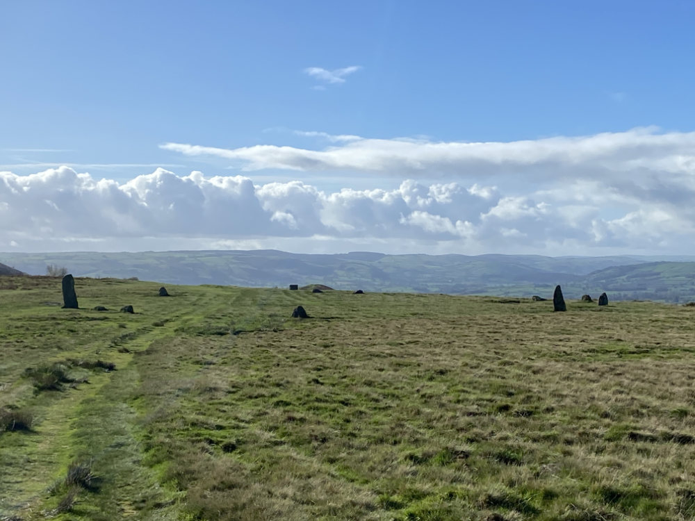
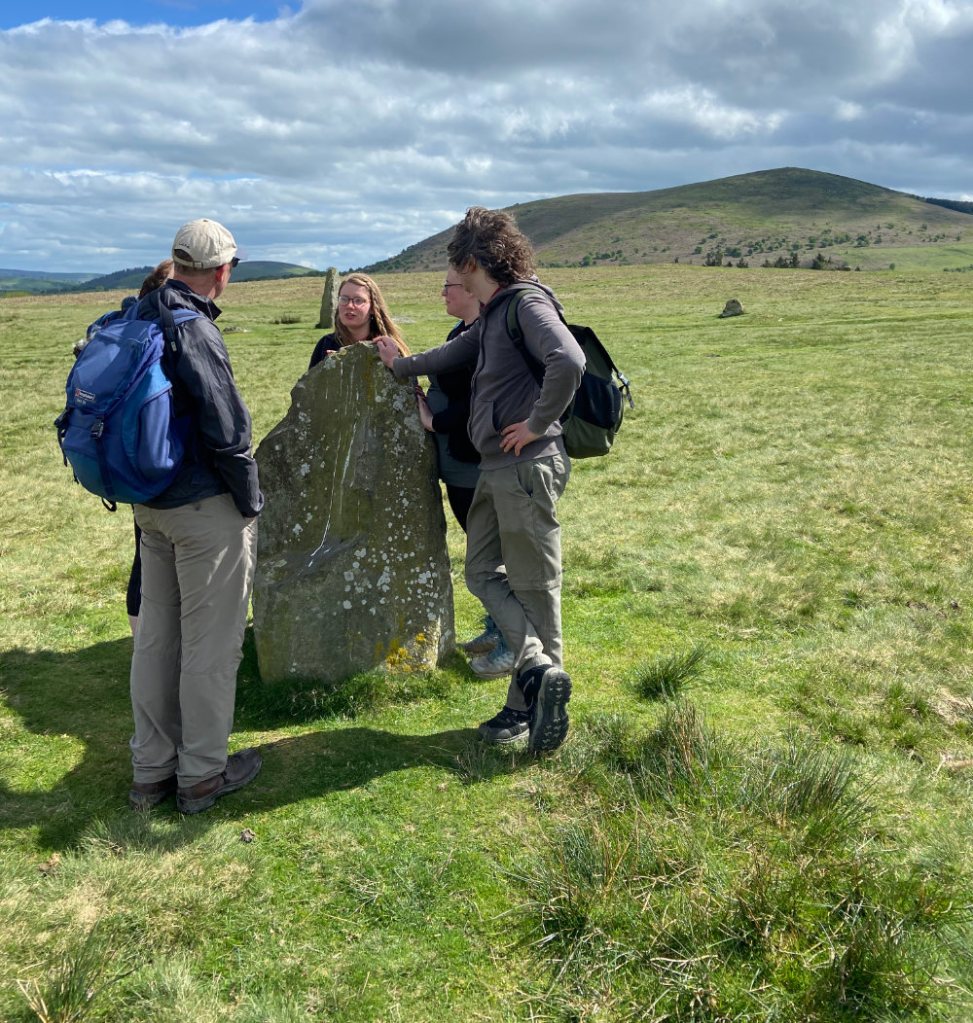
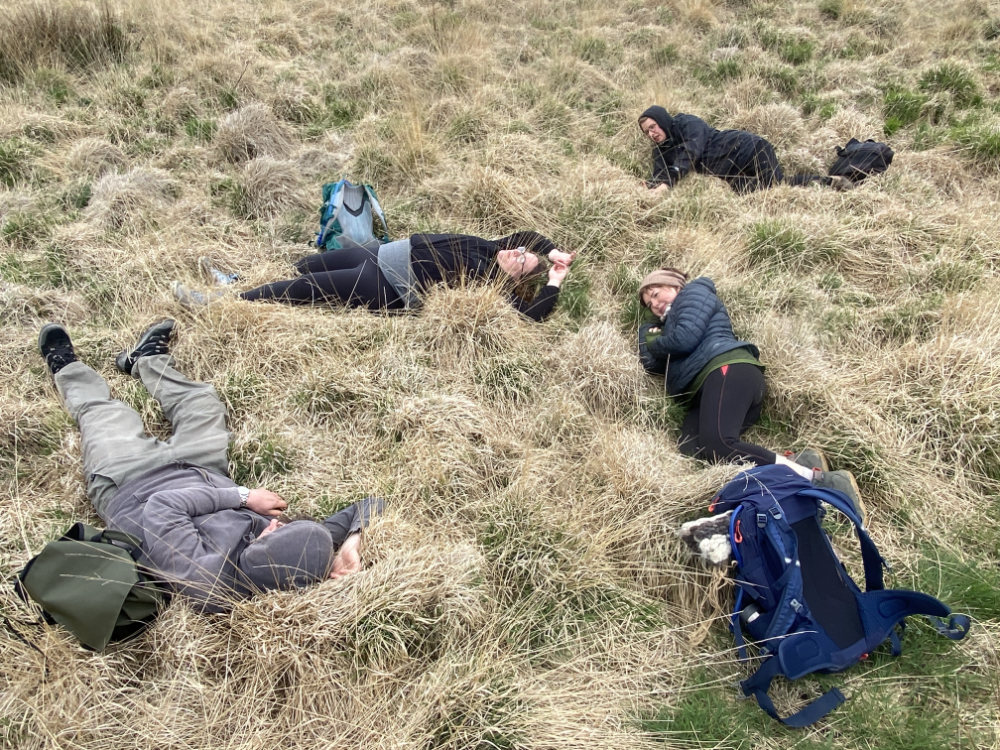
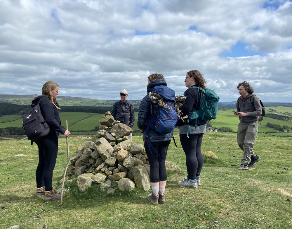
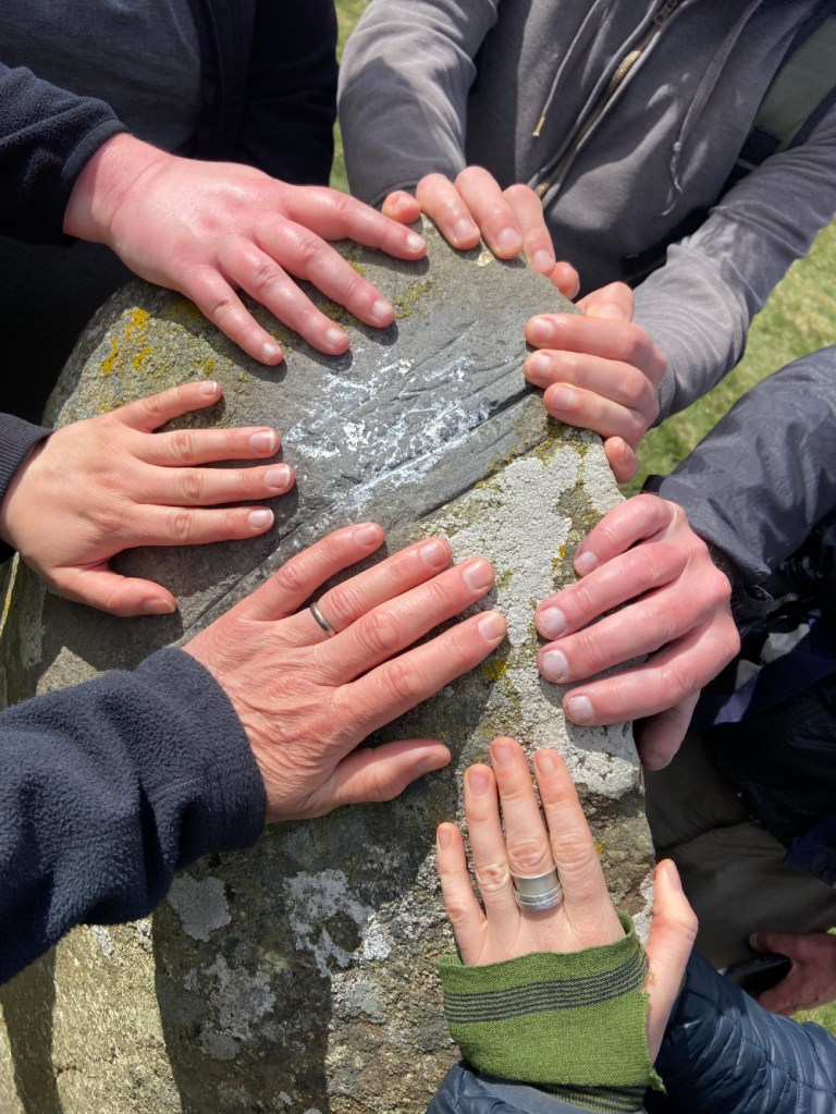
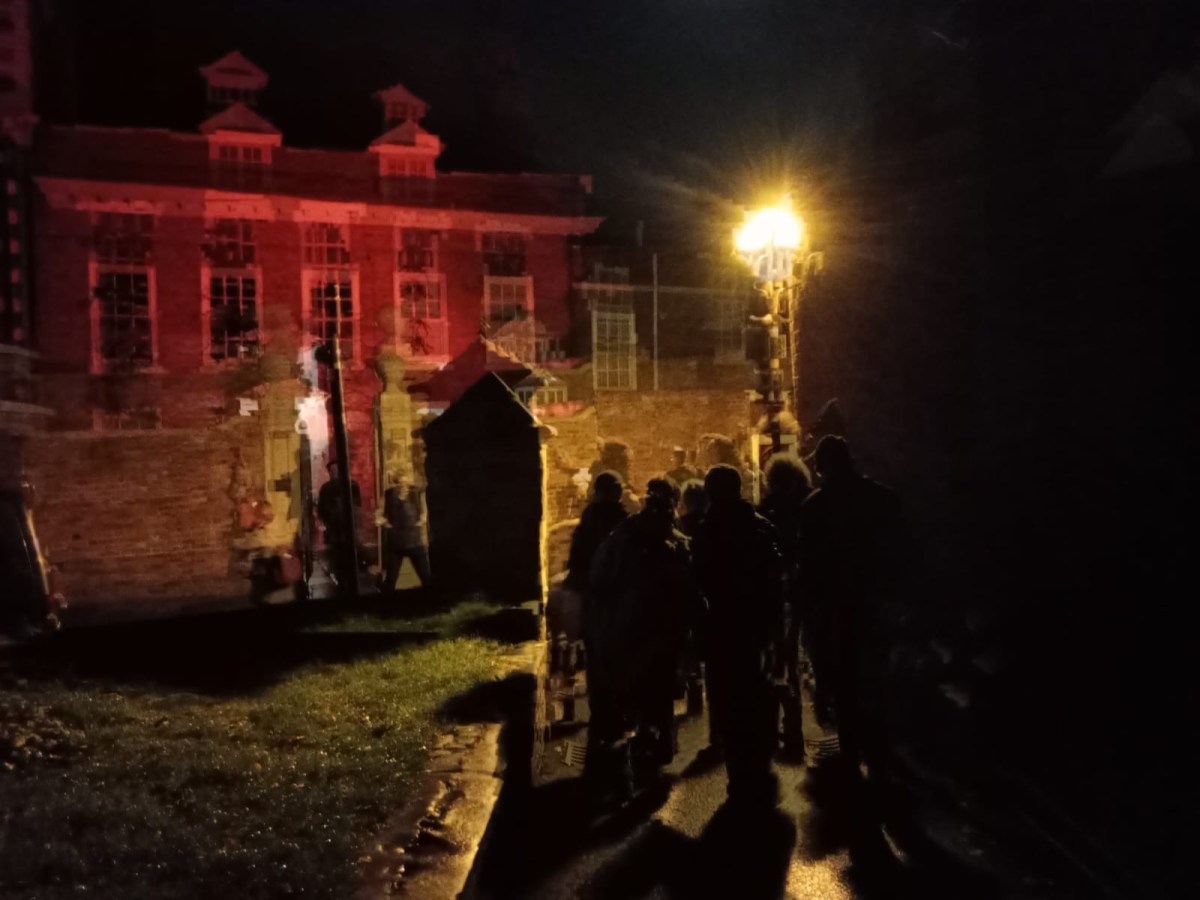
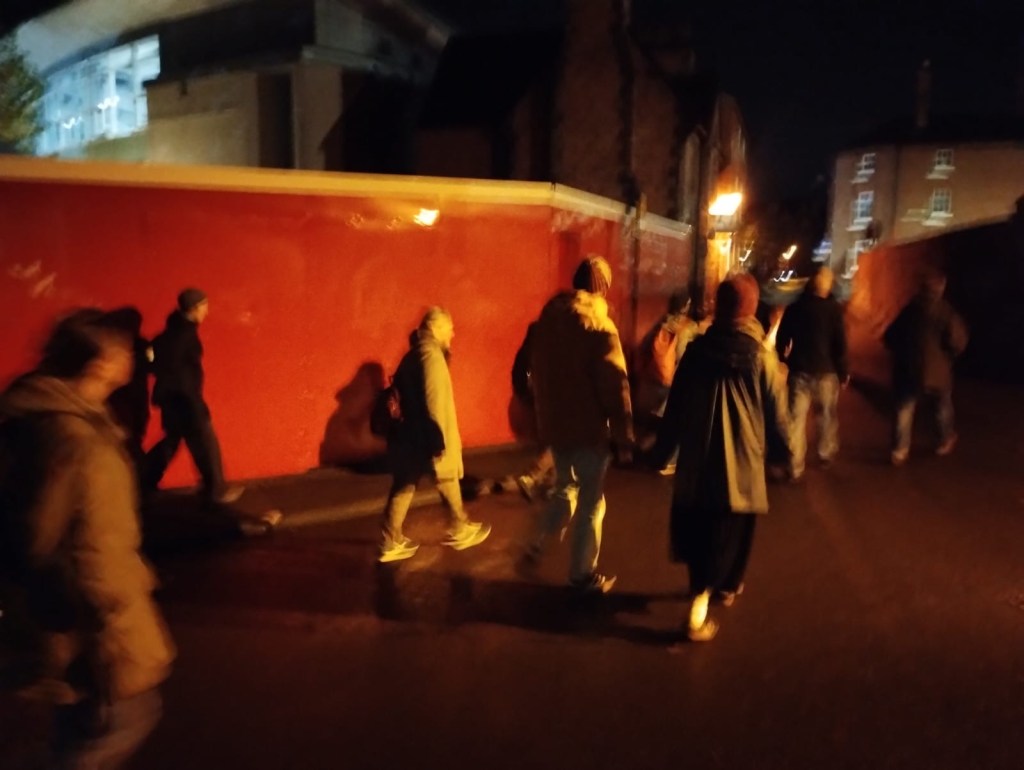
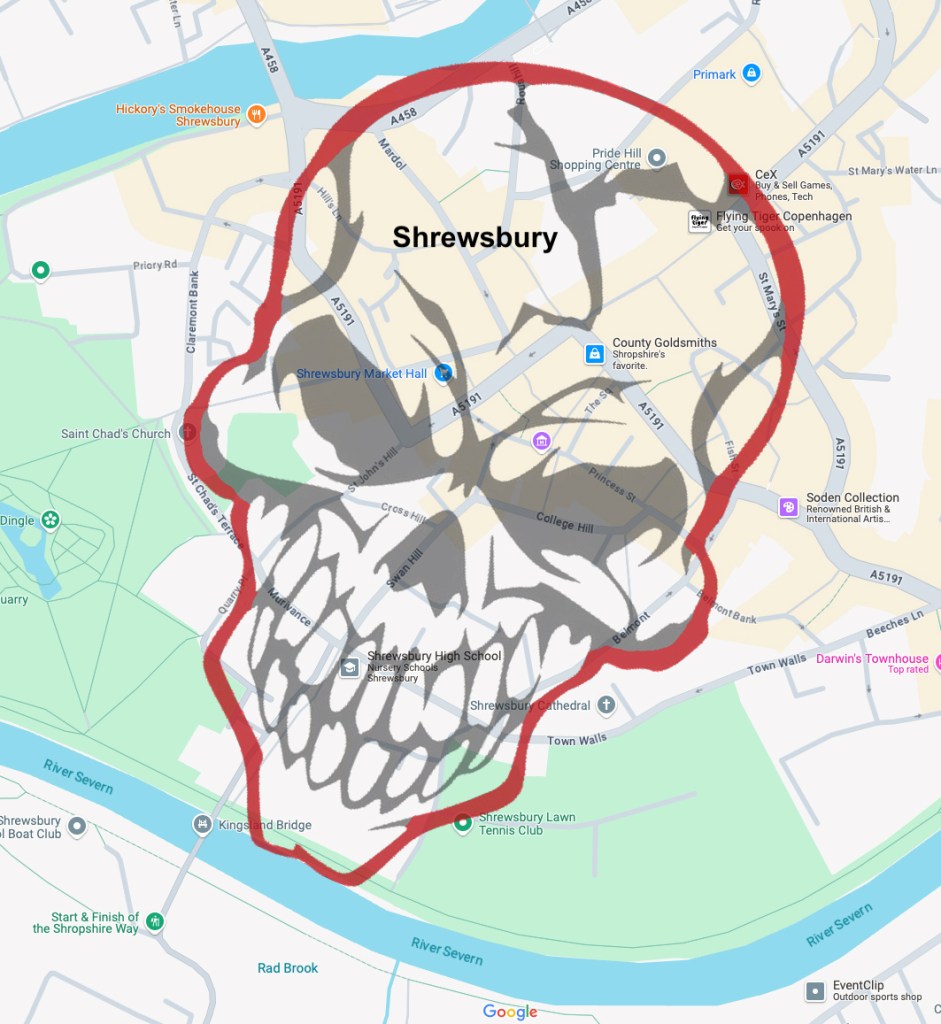
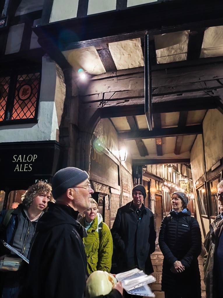
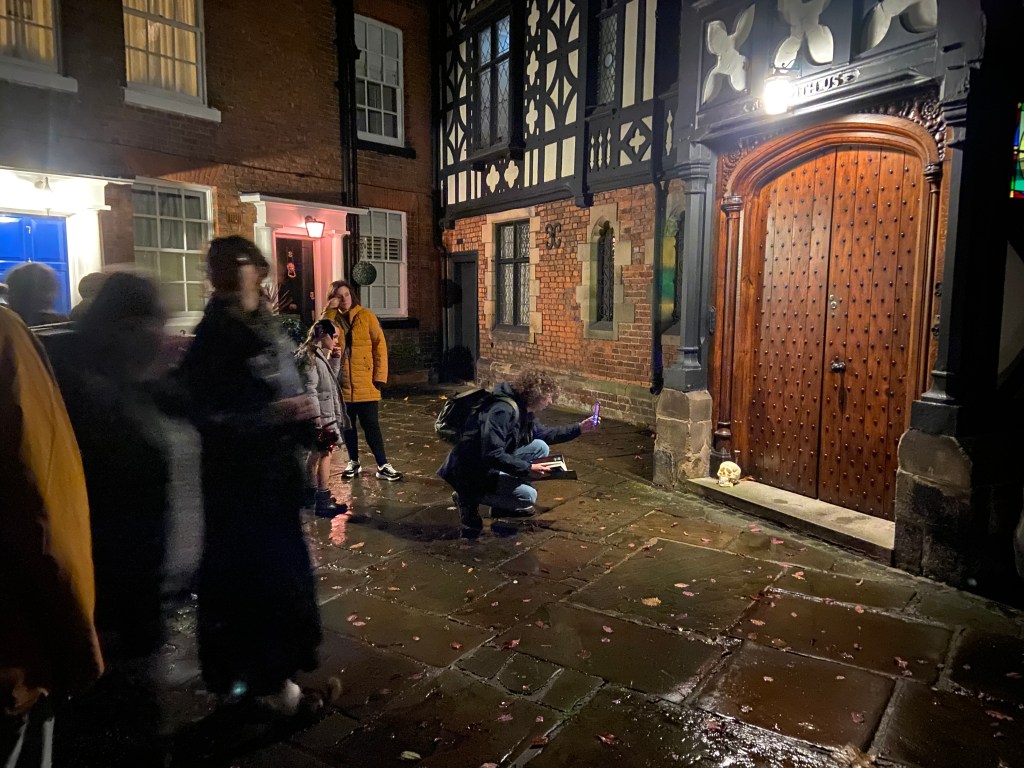

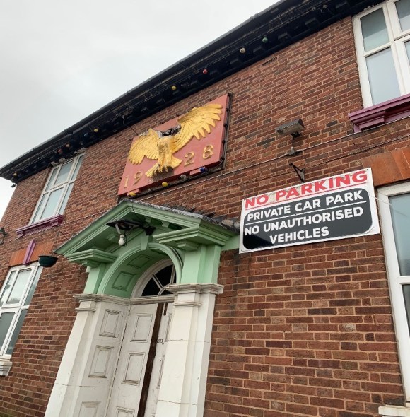
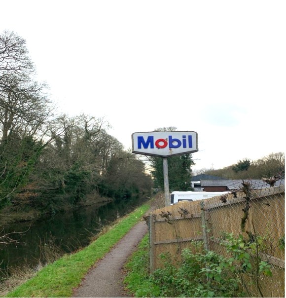
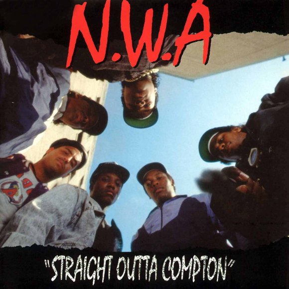
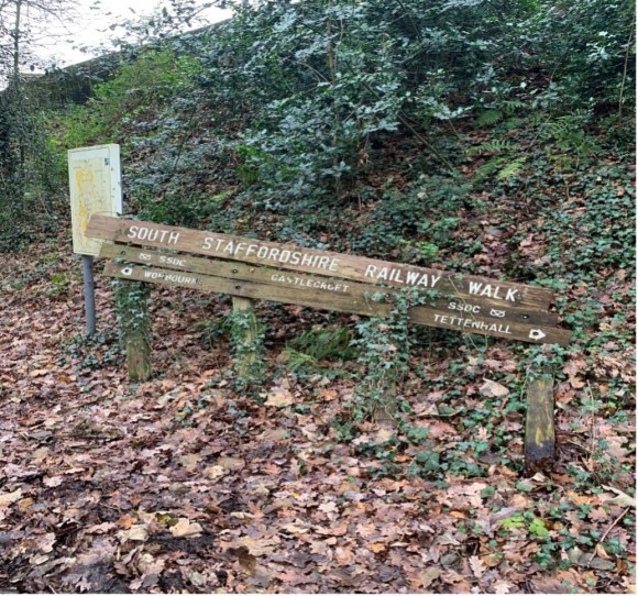
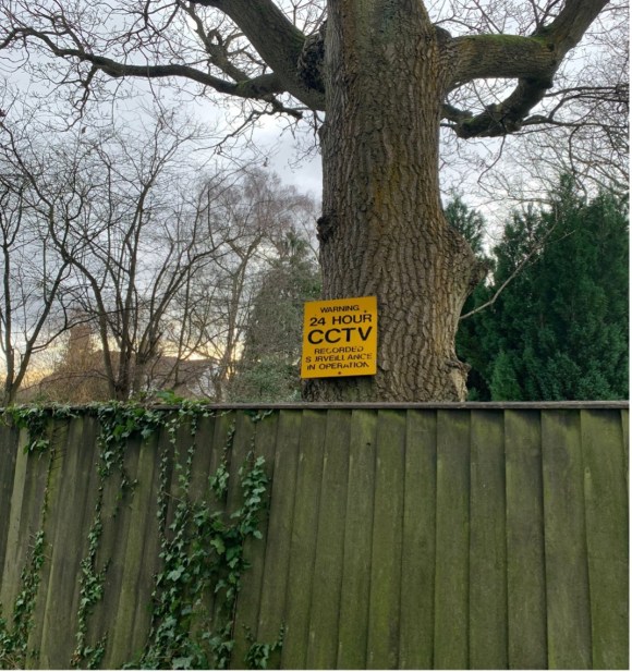
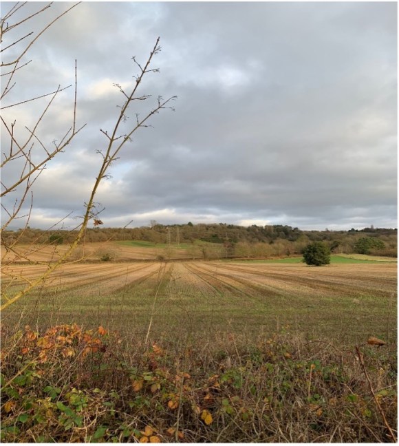
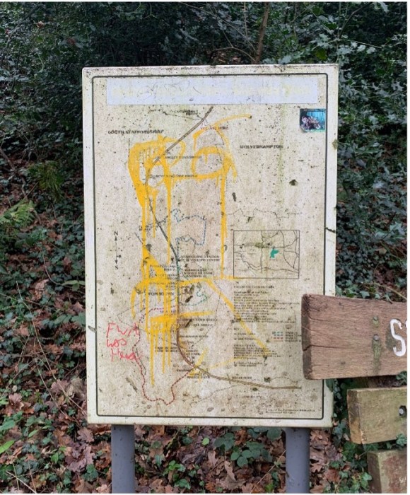
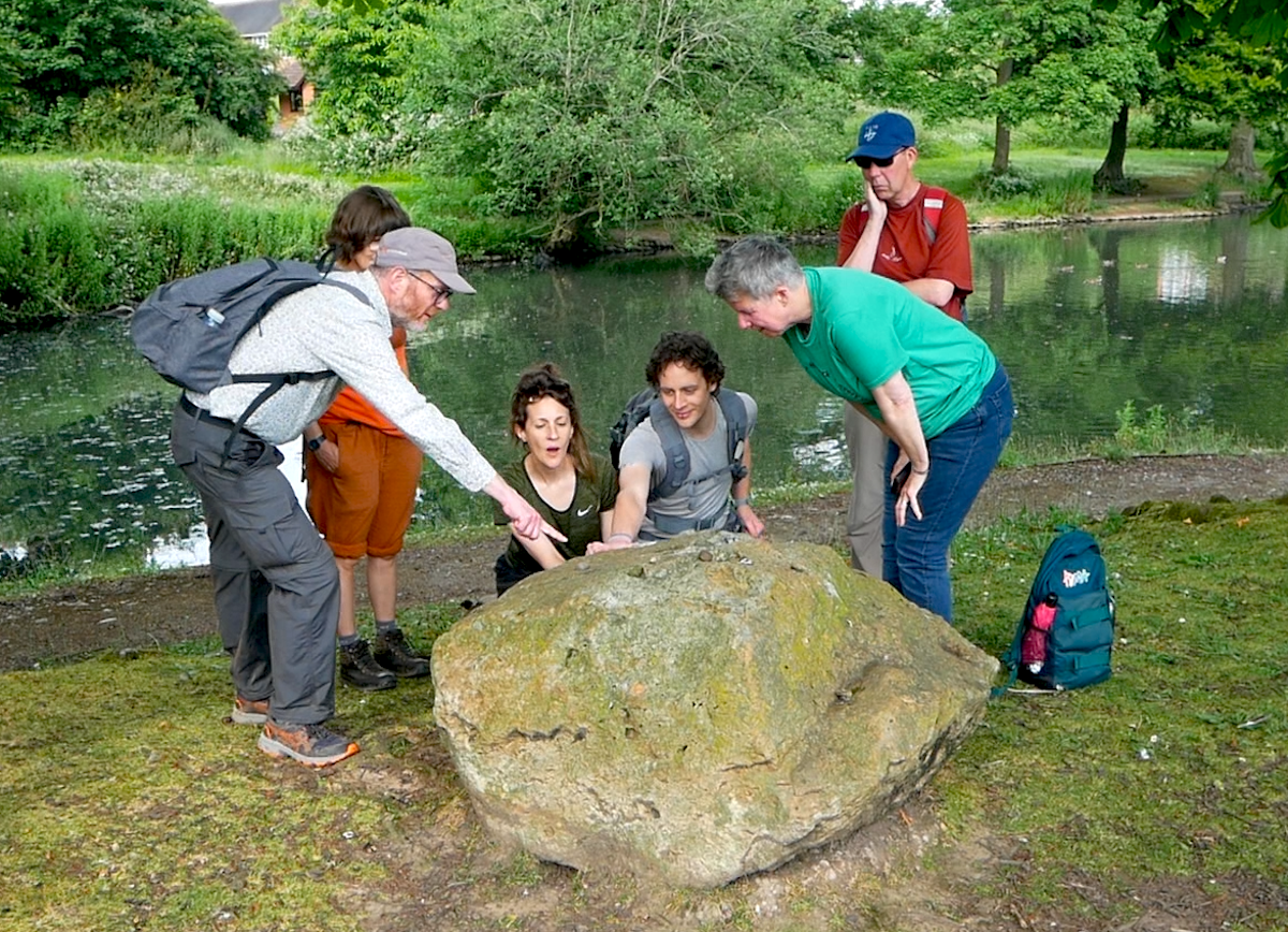
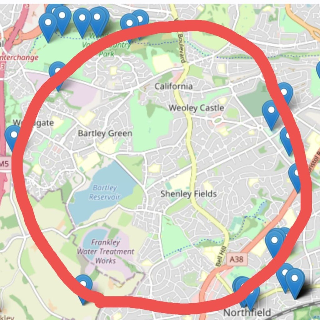
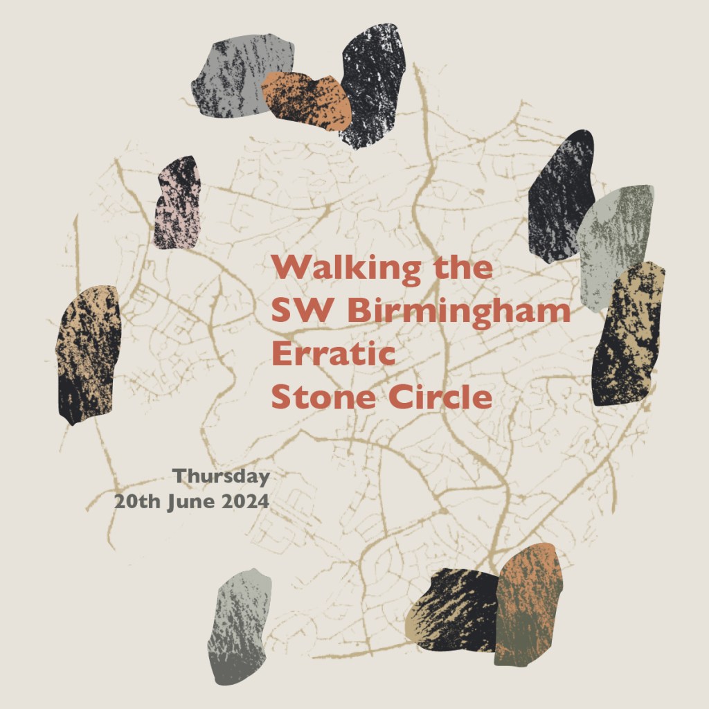
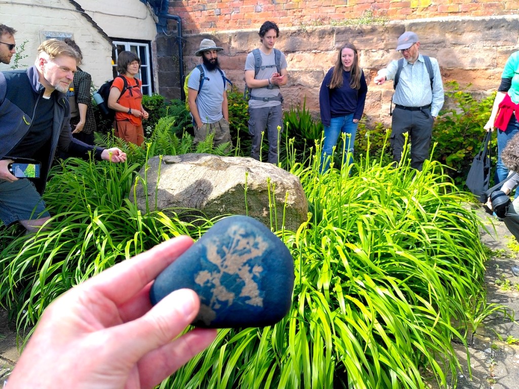
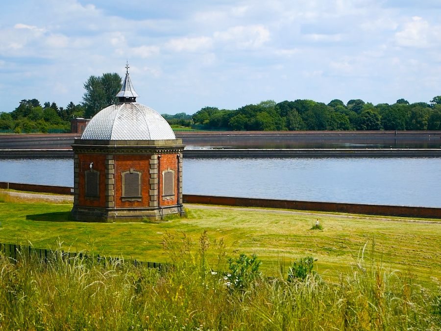
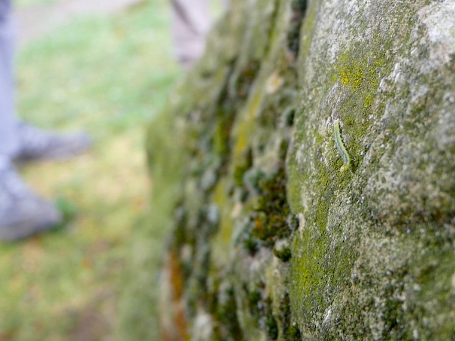
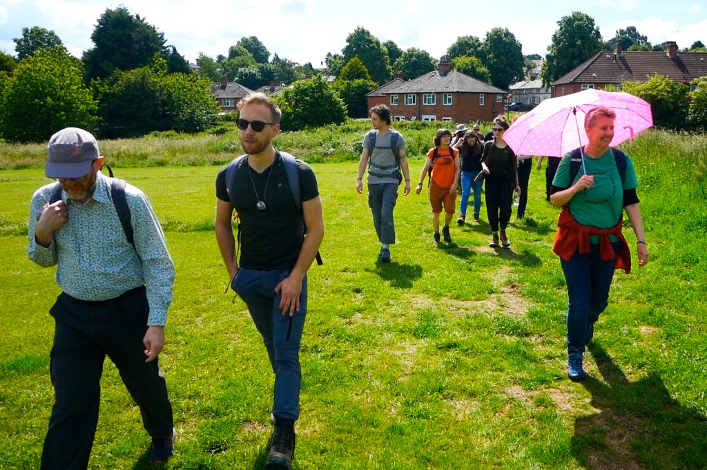
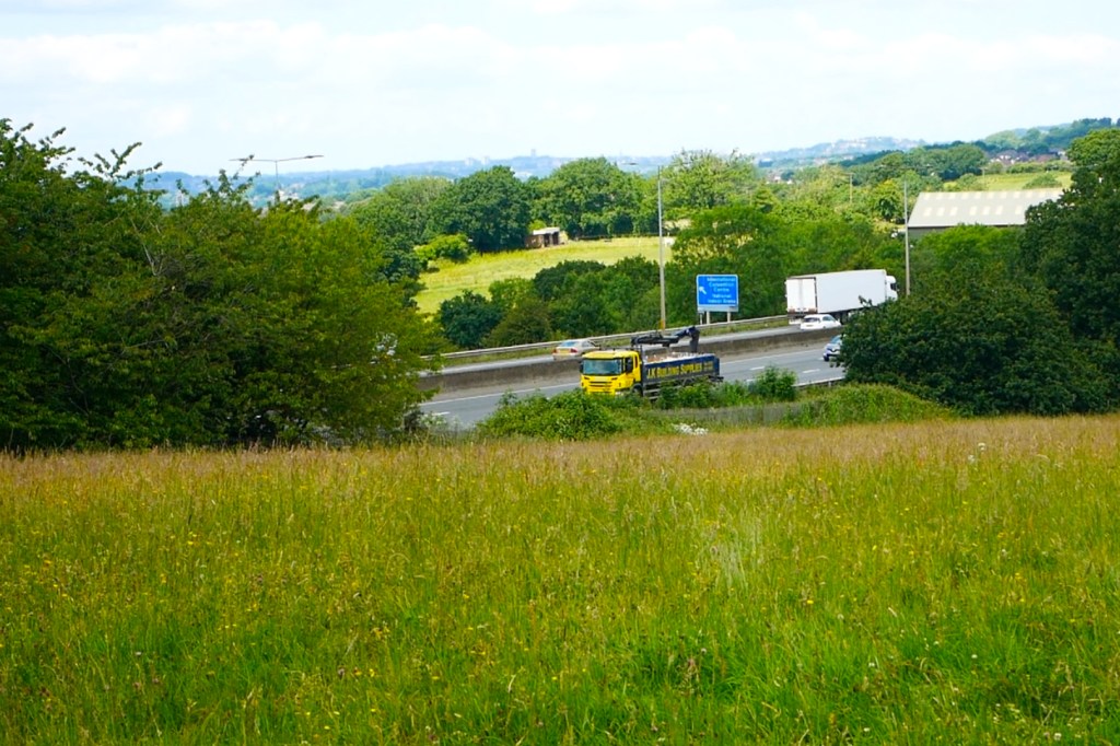
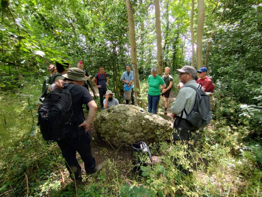
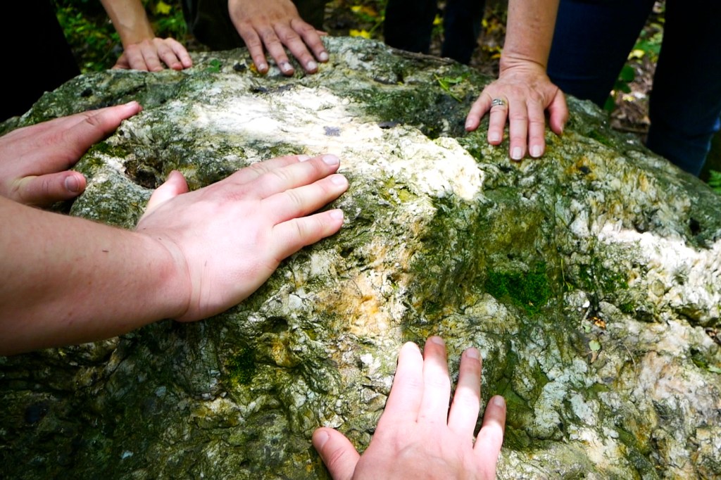
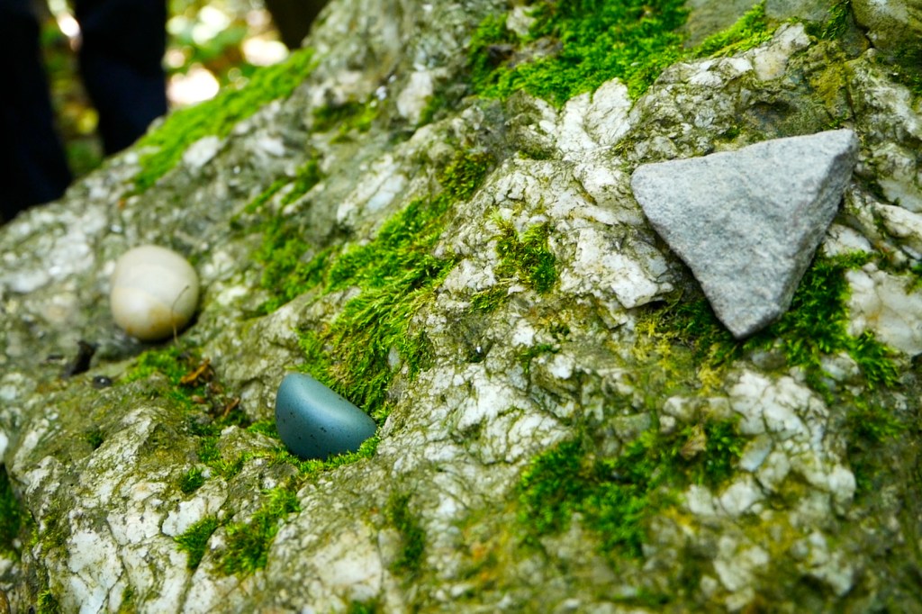
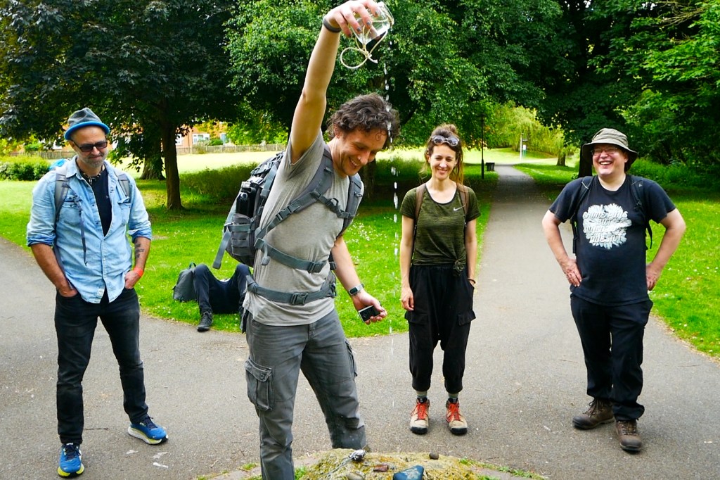
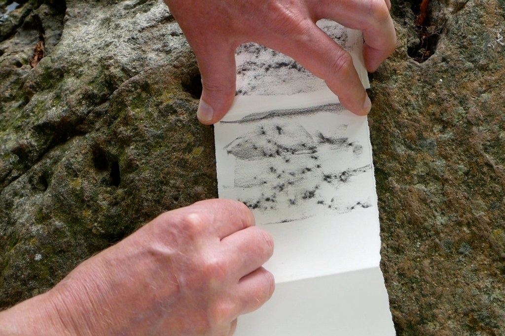
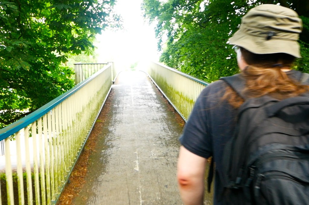
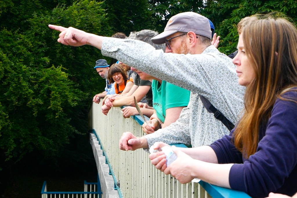
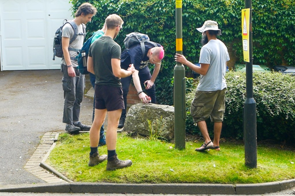
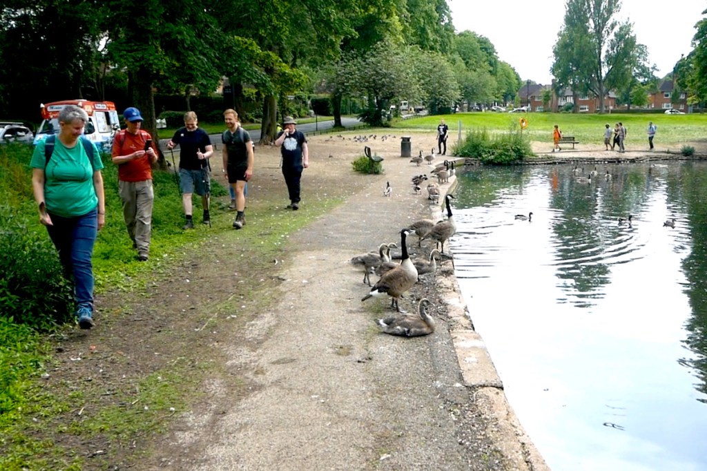
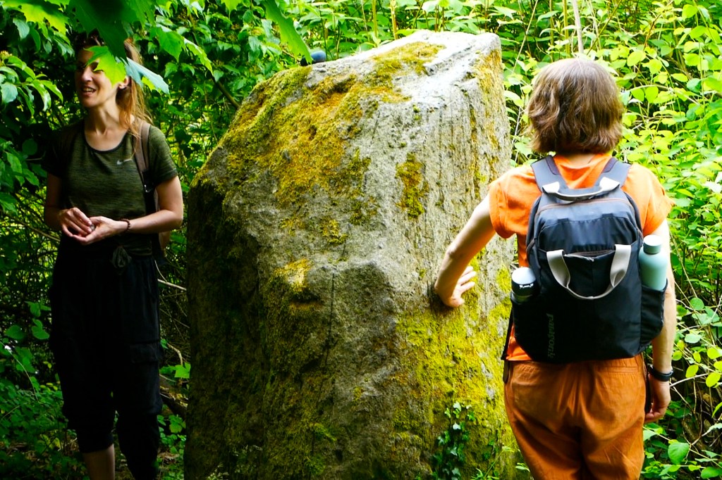
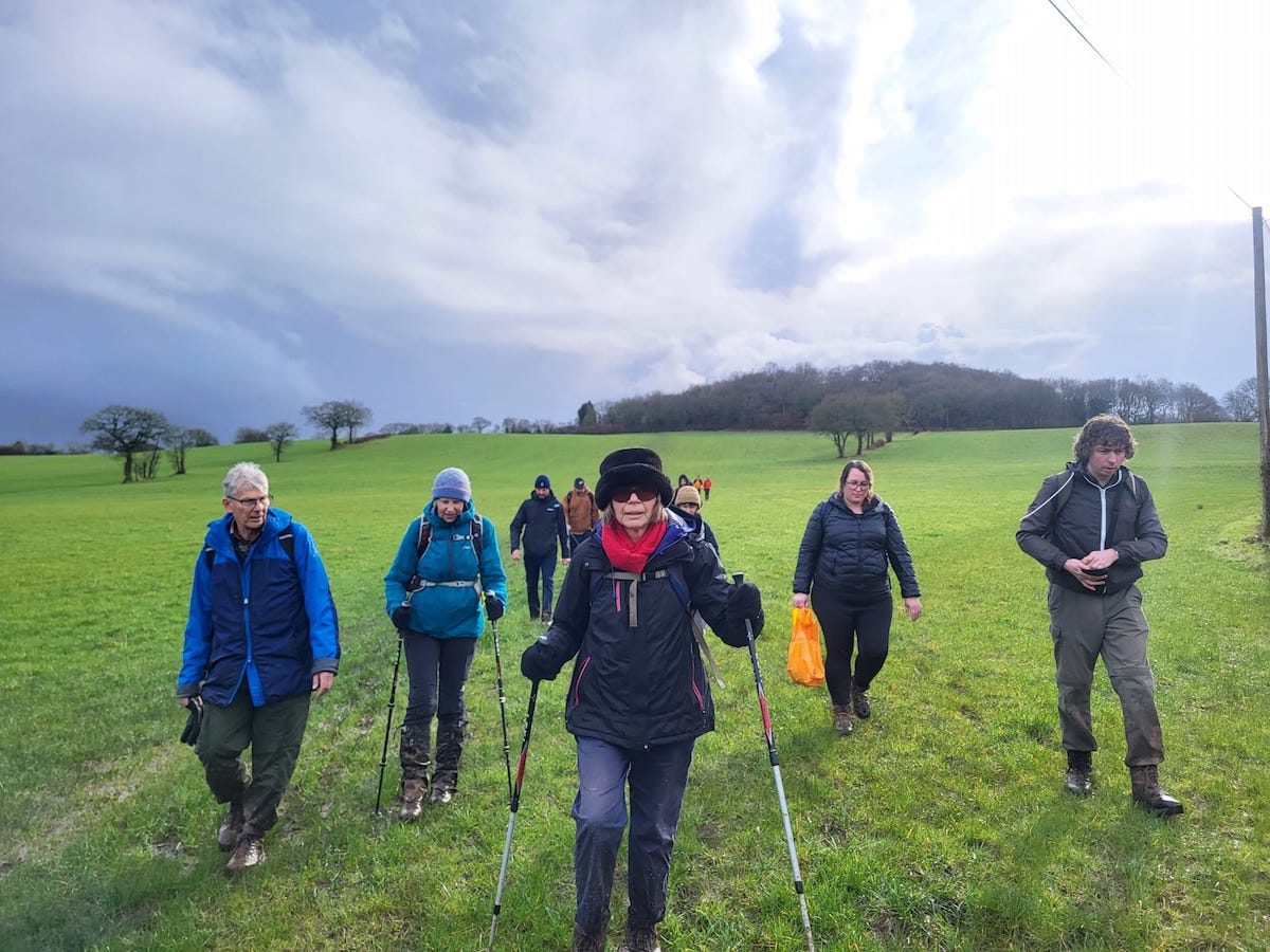
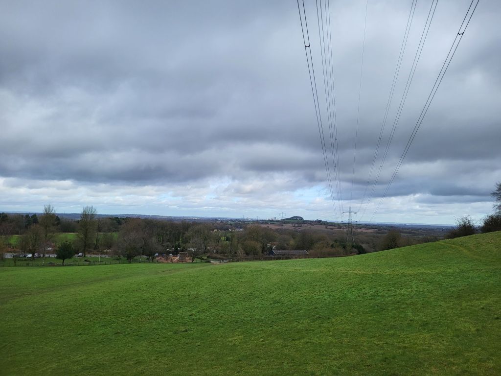
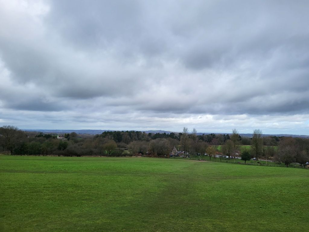
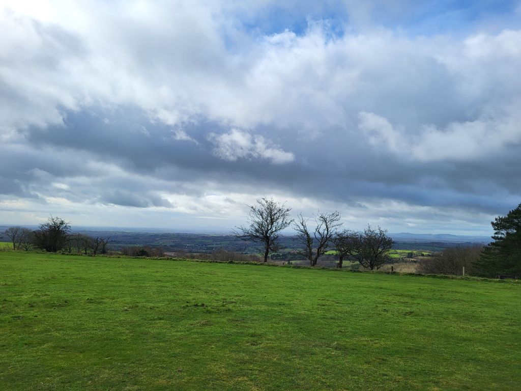

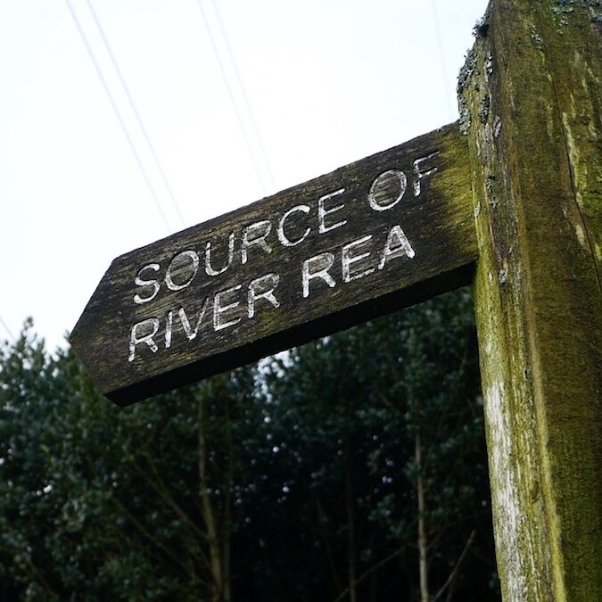

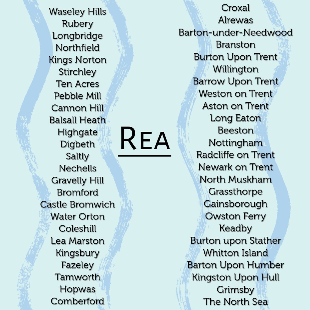
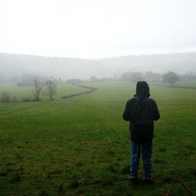

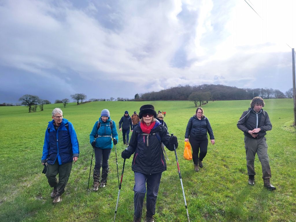
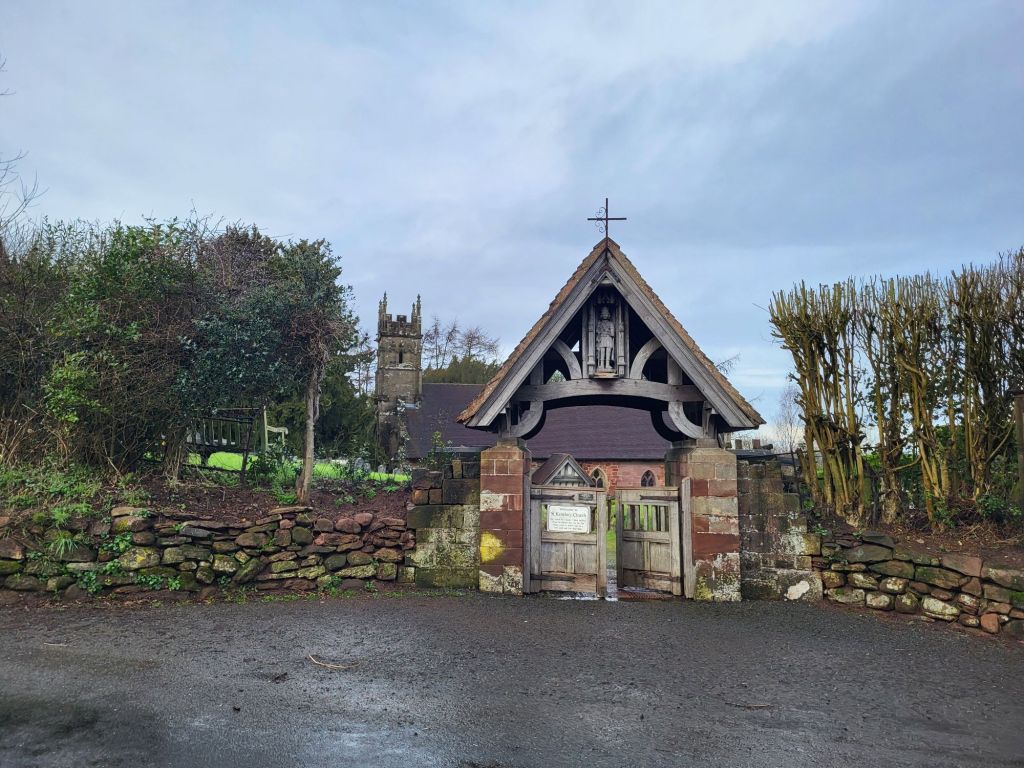


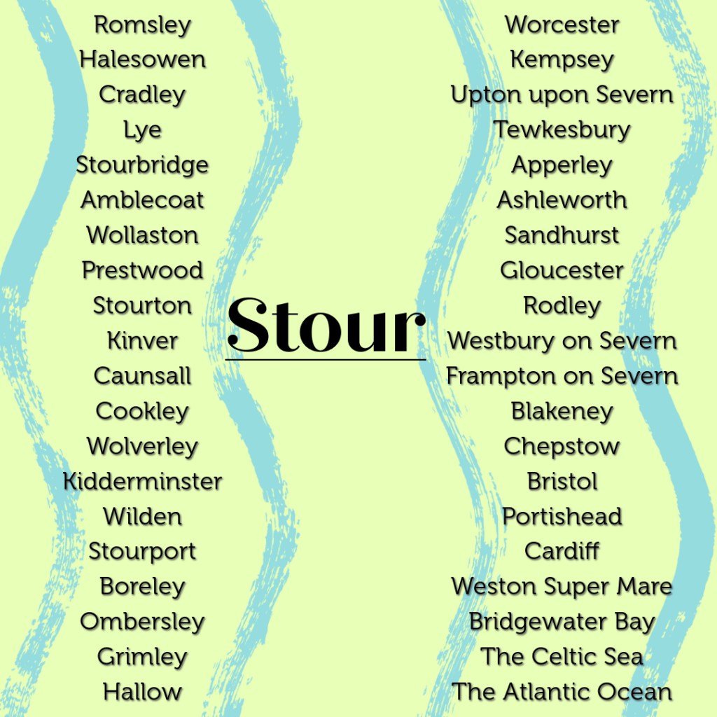
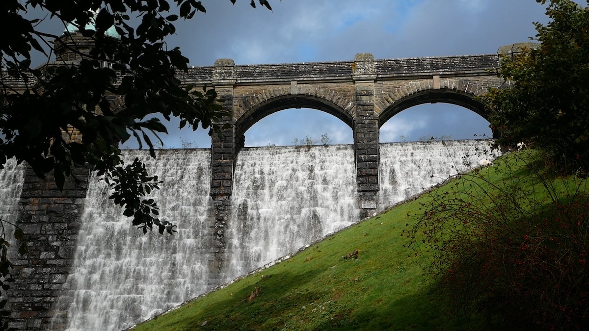


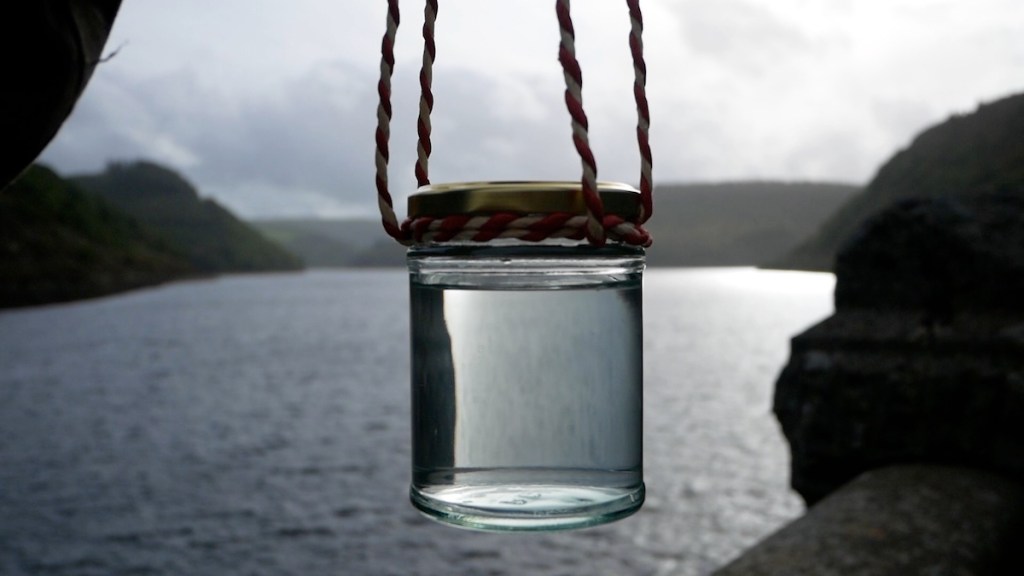

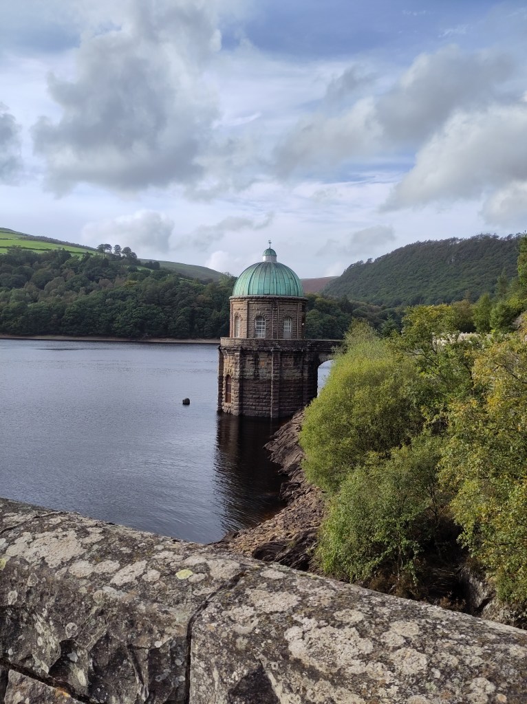
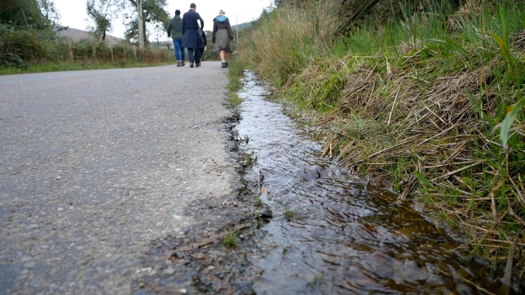
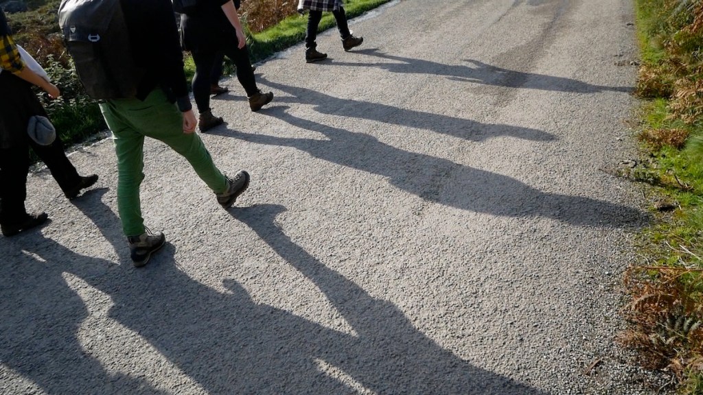


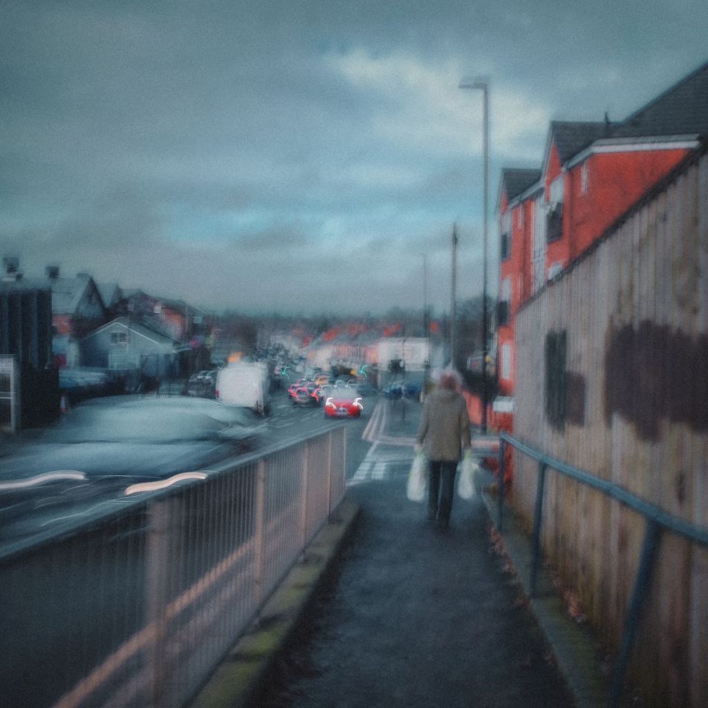
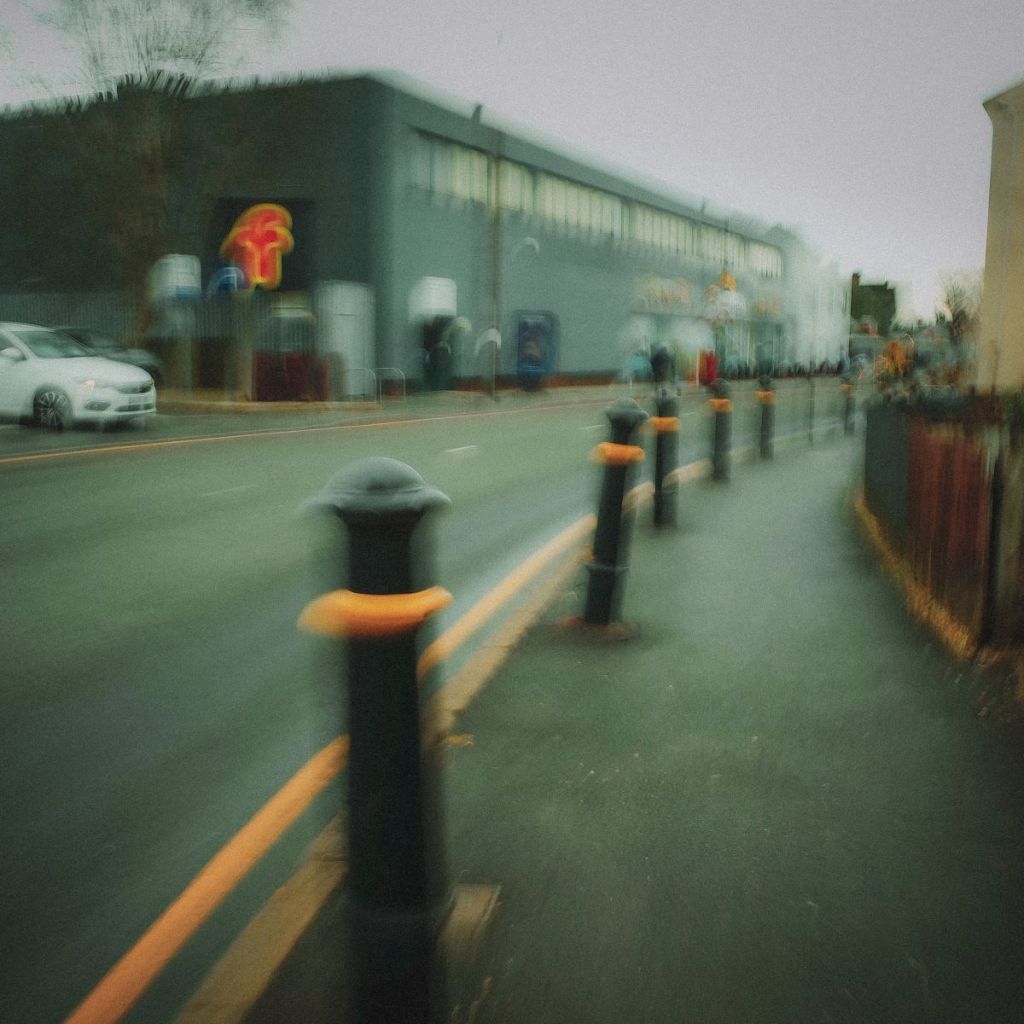


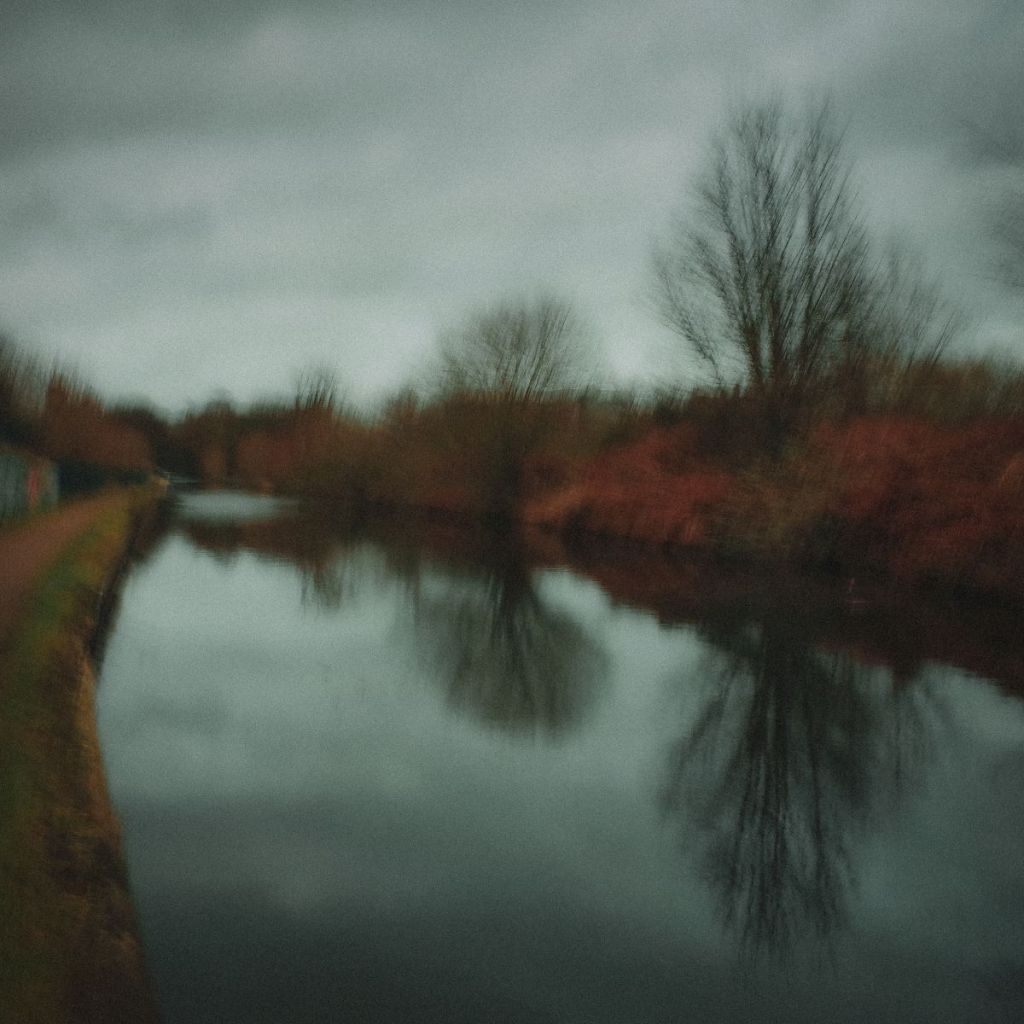
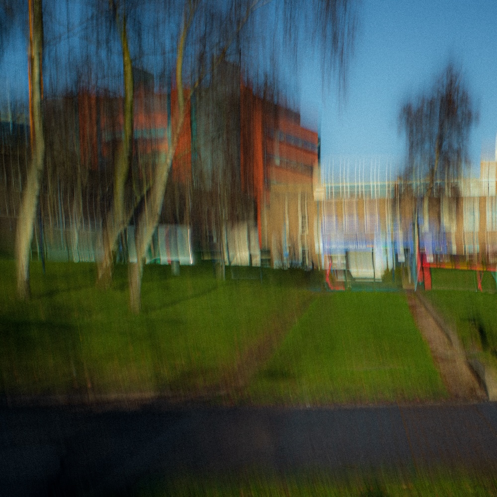
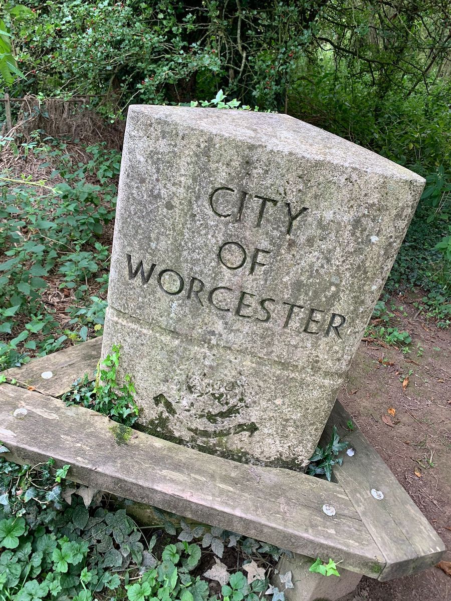
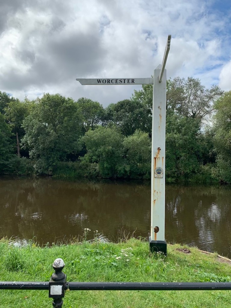
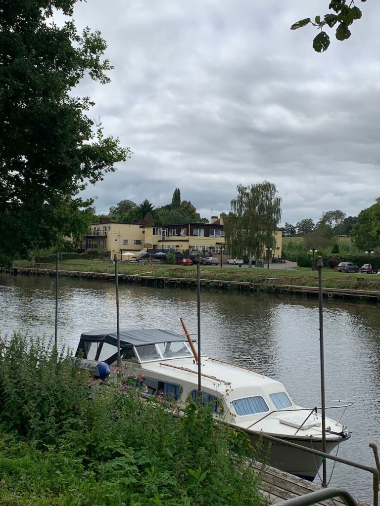
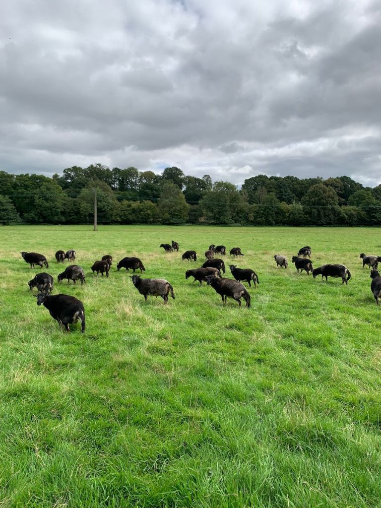
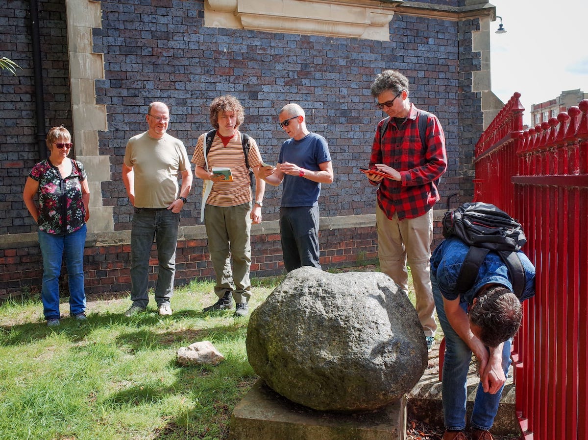
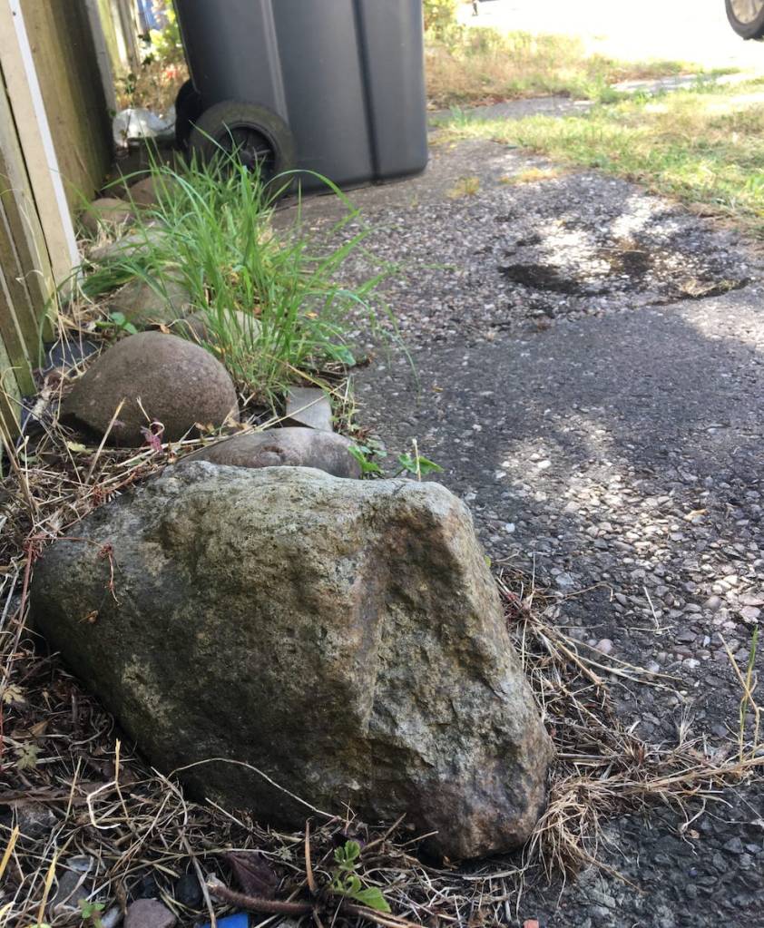
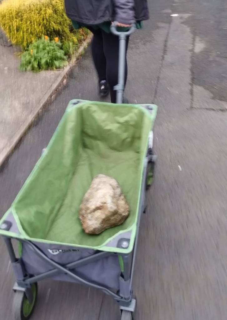
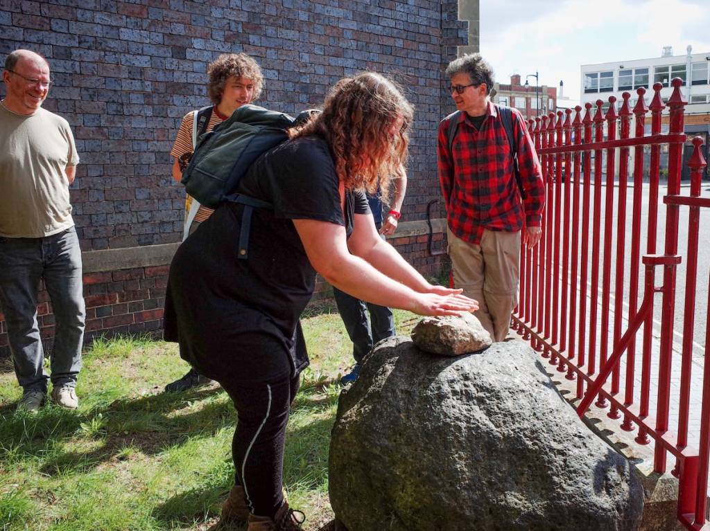
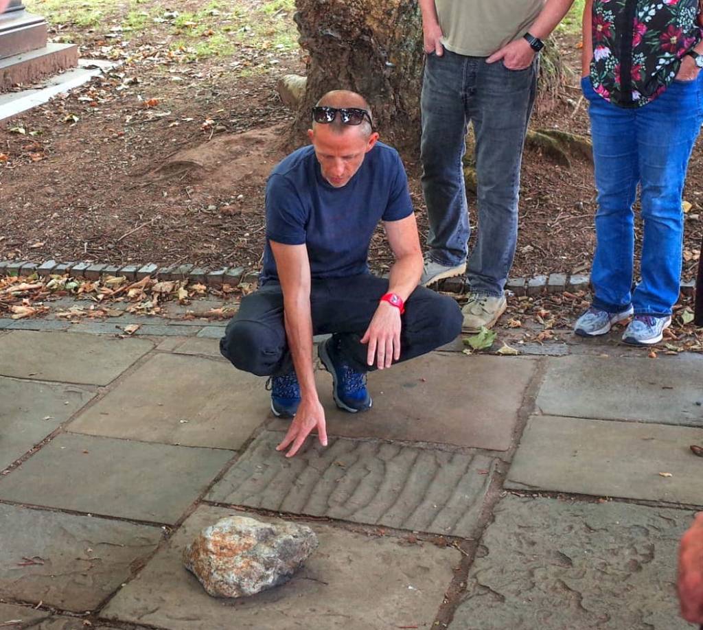
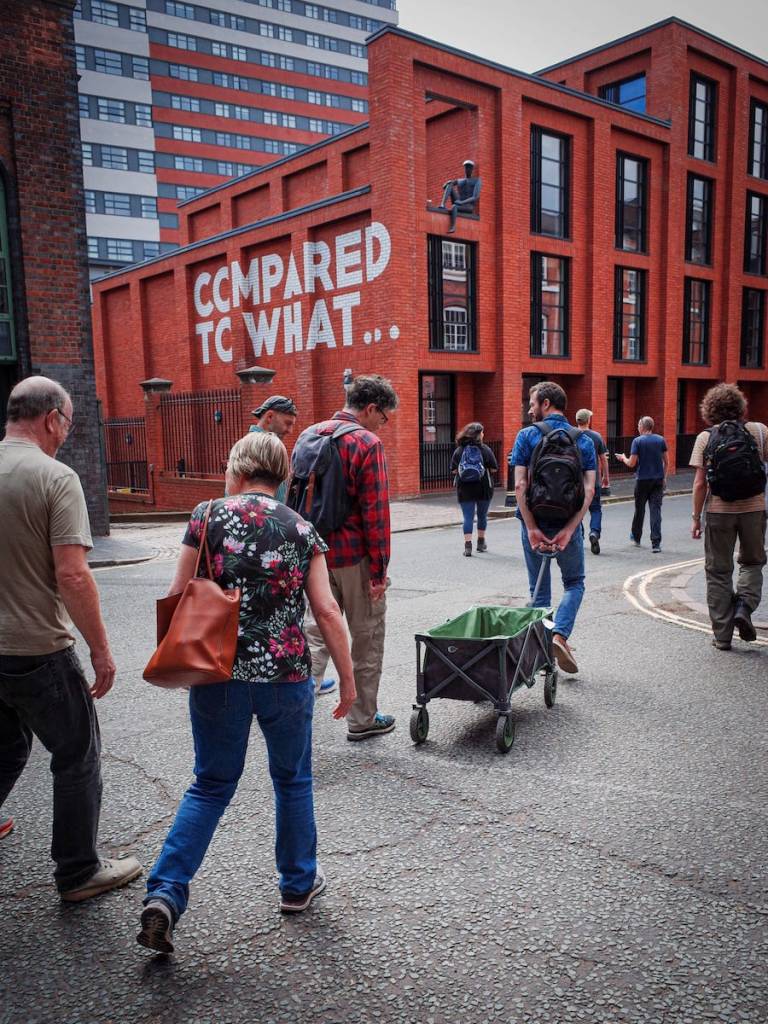
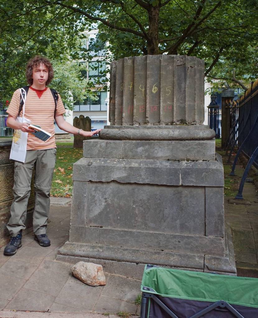
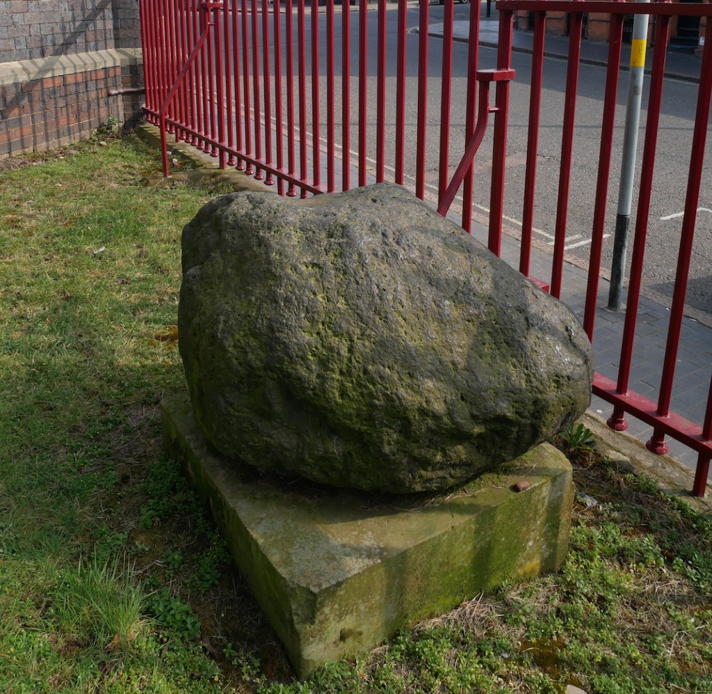
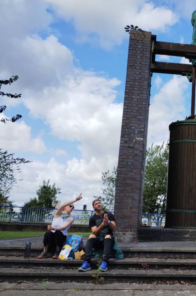
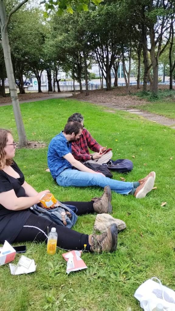

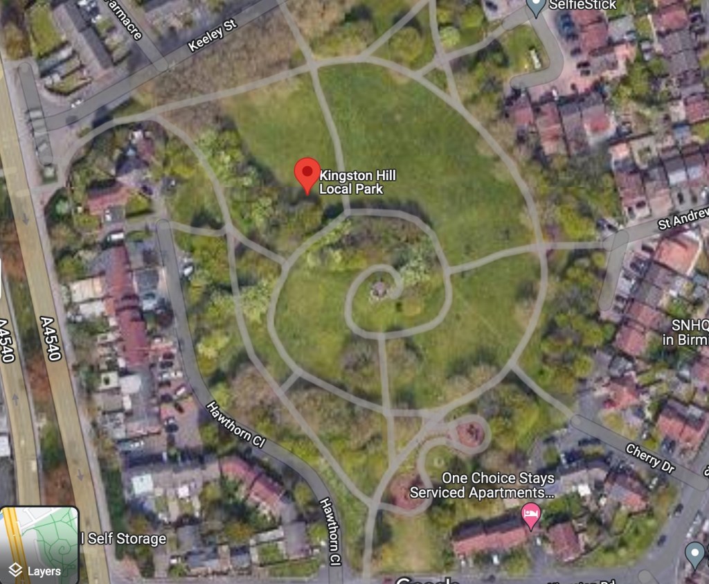
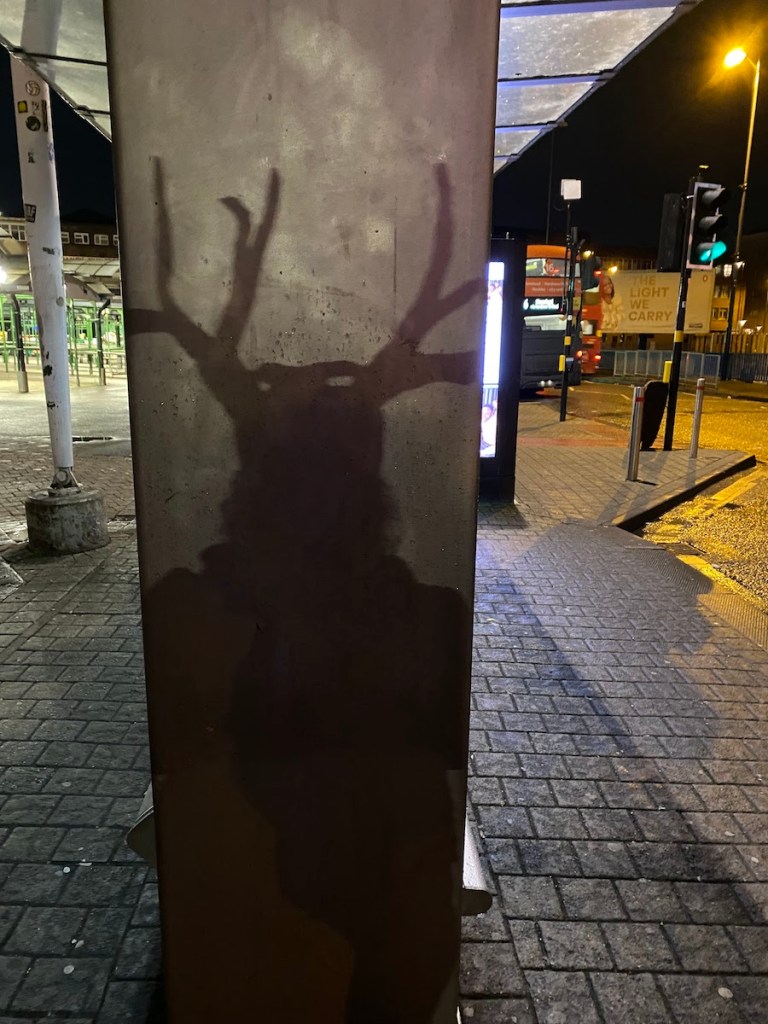
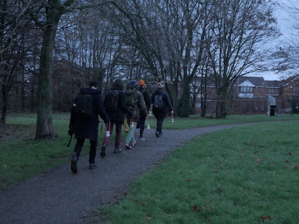
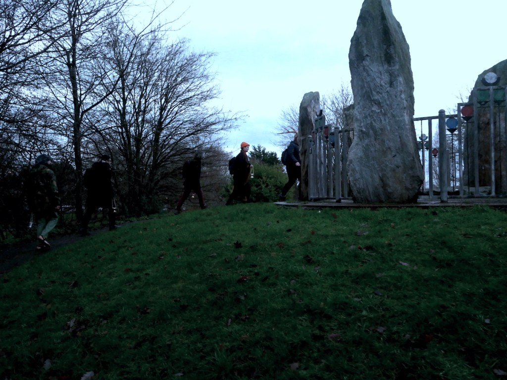
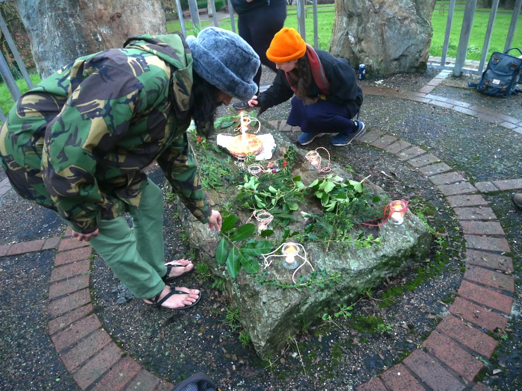
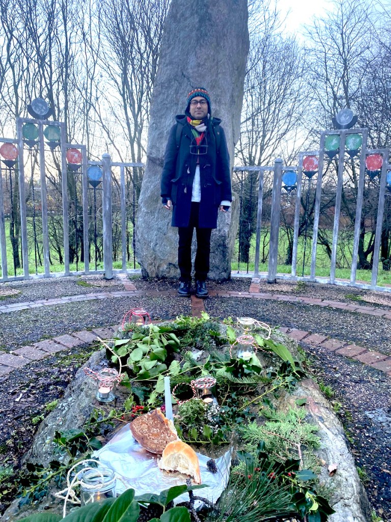
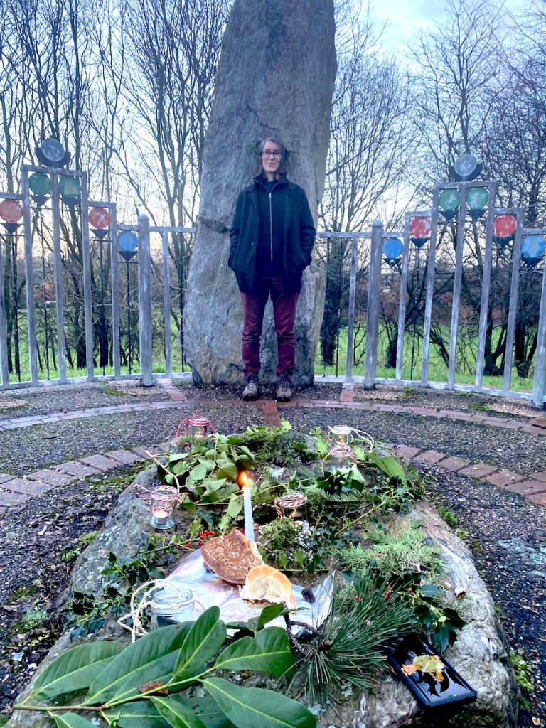
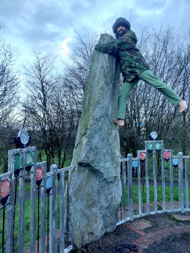
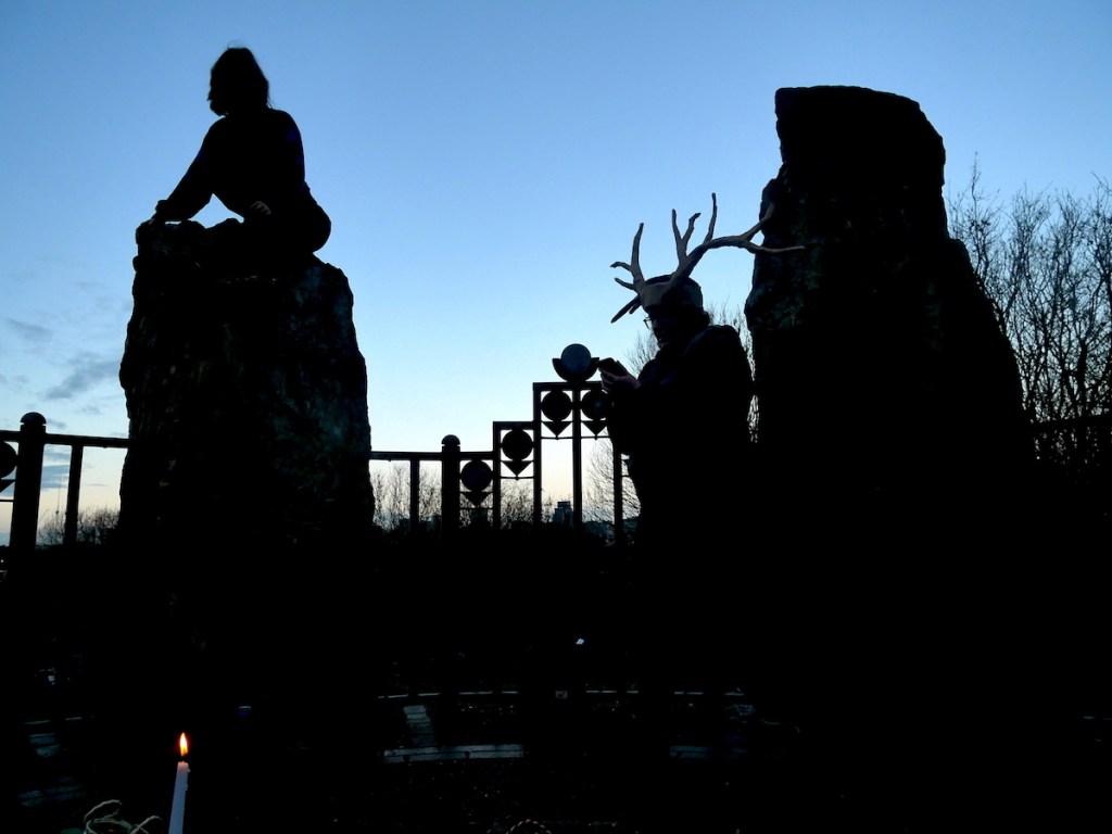
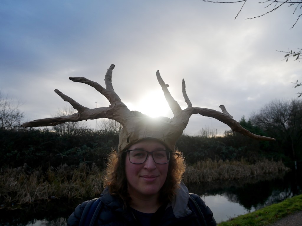
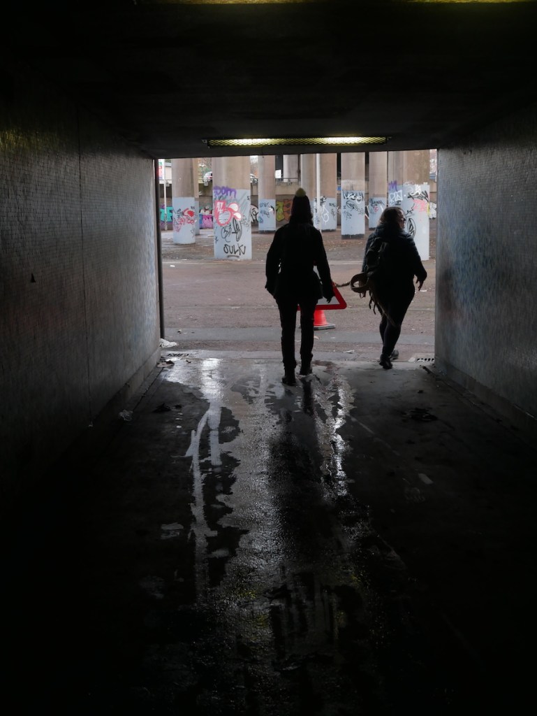
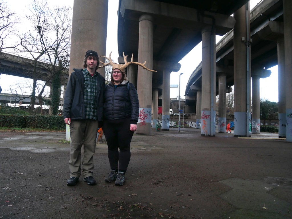
