Just over two years ago I embarked on a voyage of discovery in a part of the UK where there is only one scrap of coastline. A project called Walk Midlands (NOTE: that this is distinct from Walkspace, of which I am a proud member). This sees me – usually on a Friday – embark on a walk somewhere in the English Midlands, which I then write-up and share with the world via the Walk Midlands website, social channels and in the form of a monthly digest via the Walk Midlands Newsletter.
The project is first and foremost a practical walking guide for those interested in day walks that they can do without a car in the English Midlands. It is also a kind of reflection upon how we live now, a means of telling stories from history and a mediation on the landscape and topography of the central part of England, that comprises the bulk of the mighty River Severn and Trent catchment areas.

It is a natural extension of my practice as a journalist and creative non-fiction writer as well as my commitment to a form of politics where, to improve the world around you, you first have to understand it. This comes through in the choice of walks, which provide routes for non-drivers to access historical sites, culture and beauty spots across the English Midlands. As well as in the introductions which frame the walks, short, accessible, magazine style texts which explore all manner and facets of the Midlands region.
It is these components which attracted me to Walkspace. If one thread unites the medley of walking artists and other creatives comprising the collective, it is an orientation, perhaps even a compulsion, towards using walking as a means of tilting the everyday world 90 degrees and looking at the familiar askance. Walk Midlands, I hope, does it in spades and provides all those who appreciate and are intrigued by the English Midlands with a new route to explore it every week.
Why walk the Midlands?
There is a story I have told many times about Walk Midlands’ genesis. Like many of the best stories it has the benefit of being true. It goes like this: in the summer of 2021, struck down with a bout of COVID-19, thankfully not very ill but having to isolate, as the days of quarantine passed so the desire to go out walking grew in my mind. While confined in this way a project swam into focus which would give me an excuse to go on walks each week; that project became Walk Midlands.
I set out on my first walk, a triangular shaped stroll from Kidderminster to Stourport-on-Severn and back via Bewdley as soon as my time in isolation ended seeking to walk off the effects of ten days confinement. This walk was undocumented, but convinced me the basic concept of a website with a new walk each week, somewhere interesting in the Midlands, doable by public transport, was viable.

My next two walks, along the Malvern Hills ridge between Ledbury and Great Malvern, and tracing the route of the “Lost Lapal Canal”, followed soon after. Looking back at those early walks now – and other ones created near the start like Halesowen to Tipton – it is readily apparent that I had not quite got the style right. Interestingly, I think that it first came together when I segued to the East Midlands and out into bits of the rural West Midlands which I did not know very well, if at all. It was the experience of discovering the feel, stories and what is interesting about places like Wirksworth or its neighbour Cromford (for instance) which I knew only from web pages before visiting, which taught me how best to structure the individual posts. Making them effective in terms of what would be useful to have photographs of, how to write the walk notes, and explain regarding the public transport connections, etc. It is fair to say that voyaging in more “distant” parts of the region taught me how to write about more familiar places.
I had several reasons for wanting to get to know the Midlands region and help others do so too. The most simple was basic curiosity. Having got into walking, I was keen on getting to know the “near abroad”. A concept writer, filmmaker and retired restaurant critic Jonathan Meades has spent the best of three decades exploring, making many BBC TV series, consisting of taking off-kilter deep dives into provincial England along the way.

And there was also a political motivation, rooted in the politics of the late 2010s, shaped as it was by the Brexit vote and the wildly different electoral outcomes of the 2017 and 2019 Parliamentary General Elections. Like many people this whirlwind, and the onslaught of COVID with all the separation that induced, left me wondering how much I actually knew about the country which I had now inhabited for a whole generation’s worth of time. This led me, returning to the concept of “near abroad”, to decide that given there is no way anybody can get to know as tightly packed, variegated and fissiparous a country as Britain in its entirety, that instead I should strive to better understand nearby parts of the country. Albeit beyond the archipelago of southern and central Birmingham, other regional city centres, and university campuses which I broadly consider my usual habitat.
Walking and storytelling
A third motivation, also political in character, relates to the walks on Walk Midlands themselves. Each walk is preceded by a contextual essay, typically pretty short and to the point, but in other instances more expansive. These usually take the form of a story, typically historical in nature. My primary intention with these is a form of light infotainment for readers. Hopefully they get enjoyment from reading the pieces and finding out a bit about facets of places, probably not too far from where they live, which they could visit on foot.

And there is a serious component to this exercise too. Browsing Walk Midlands you will encounter stories about the role of extractive industries, the factory system, and the industrial revolution in the creation of the modern Midlands. As well as those like the followers of the (probably fictional) General Ned Ludd, who purportedly hailed from Anstey just north of Leicester, who have challenged capitalism since it emerged fully fleshed in the 18th Century. Alongside an older, yet also highly contemporarily resonant history of resistance and rebellion to the privatisation and enclosure of public space, from the “Midlands Revolt” of 1607, through 1932’s Young Communist-led Mass Trespass of Kinder Scout, to 1992’s 40,000 strong Castlemorton Common Rave. This is not to say stories associated with some of the Midland’s famous monuments to aristocratic, ecclesiastical and capitalist wealth and power are not told. They are present and correct, their stories narrated from the standpoint of the people whose labour – whether in the Midlands or overseas – generated the resources and wealth which made their construction, and ongoing upkeep possible.

Perusing the walks and getting out on foot to visit key locations, gives readers a better sense of the extractive and exploitative processes which have shaped the contemporary Midlands over millennia. Regimes of power which have damaged ecologies and the regulatory systems of our planet alike, while also restricting freedom and ensuring material want amongst the majority of people. Through the decidedly middlebrow medium of a local walking website, Walk Midlands helps readers discover how this is played out in their region. While also, more positively showing how people in the Midlands, whether individually or collectively, have always come together and resisted.
Walking the Midlands without a car
Another unabashedly political facet of Walk Midlands is the fact all the walks are doable without a car.
There is a practical reason for this which relates to the fact that I possess neither a driving licence nor a car. This was one of the practical drivers of the project. For years there were places in the Midlands which I had wanted to visit, but which due to my lack of a car or ability to drive seemed out of reach, meaning I was dependent upon talking automobile friends into accompanying me. Nearly a quarter of British households lack access to a car, so I figured that I was far from the only person who would like a website explaining how to get to far-flung sites and attractions by public transport and on foot.

This hunch has proven correct. Amongst the most popular walks on the sites are those to West Midlands beauty spots like Wychbury and Turner’s Hill, as well as attractions further afield like: Bardon Hill, Bennerley Viaduct and Knypersley Reservoir.
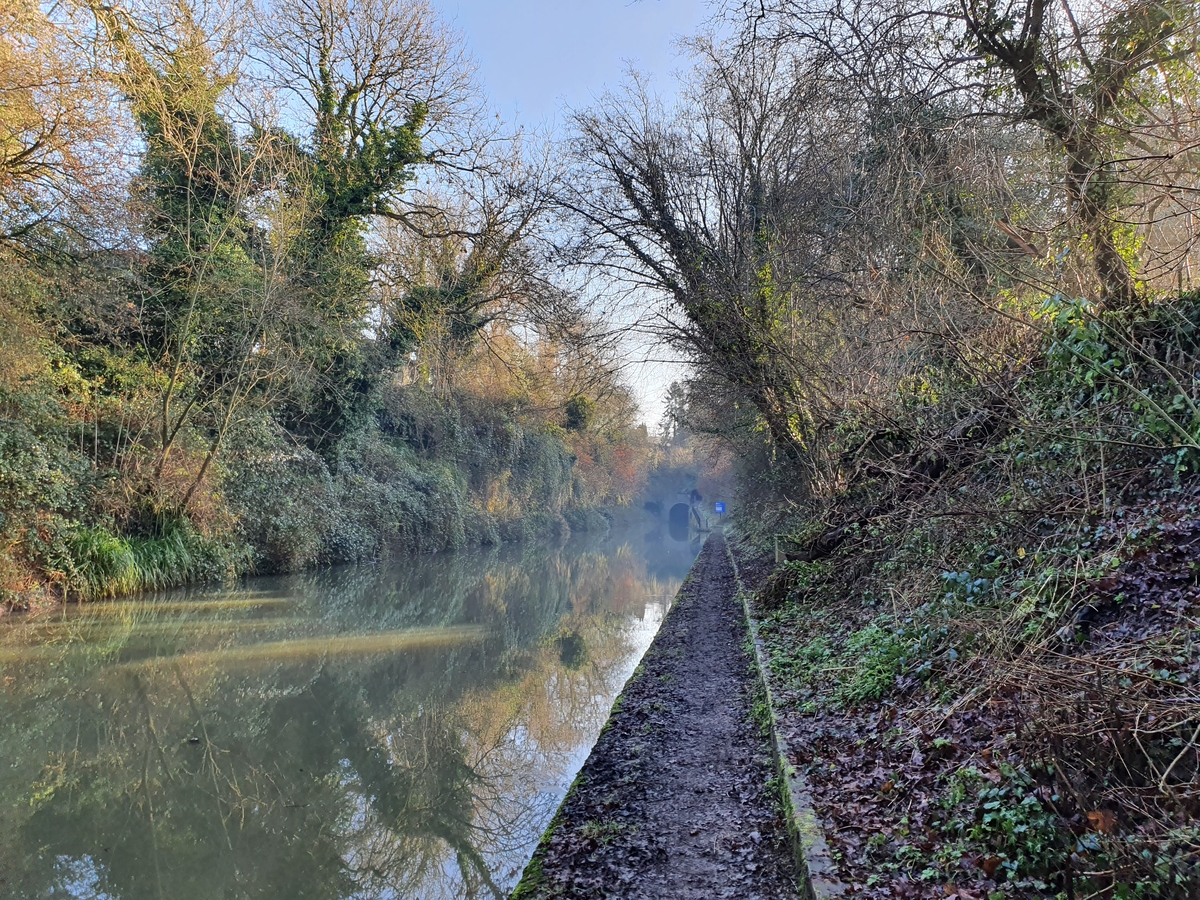
Perhaps ironically the most consistently popular “attraction” walk on the site is to Spaghetti Junction. Other popular walks are rural and suburban strolls between railway stations, typically along canal towpaths, like: Ambergate – Cromford, Droitwich Spa – Worcester or Stourbridge – Dudley.

Decisions about how we get about and the transport technologies our society is constructed around are political. Fundamentally determining whose needs and interests lie at the heart of decision making, whose needs are subsidised and whose are ignored. My lack of ability to drive and access to a car is simultaneously due to a learning disability I possess, which would make it pretty tricky for me to learn to drive, and a personal choice: a conscious decision to reject the polluting and atomising impacts of personal automobility.
In this way Walk Midlands’ inherent bias against the driving and driver-centric way in which so much of our society is organised becomes political. How could questions about access and the distribution of resources not be? Just contrast the vast resource in terms of tracts of land given over by the National Trust and English Heritage at their properties and beauty spots with the intensely squeezed financial resources local councils have to subsidise patchy, often to the point of non-existent, bus services outside major urban areas.
What I have discovered walking the Midlands
One of the key things of course, when I embarked upon the Walk Midlands project, was getting to know the region better, and on the most straightforward of levels I feel that I have been repaid in spades.

Over the last two years I have discovered beautiful, intriguing, often overlooked locations like the Weaver Hills, Chatterley Whitfield Colliery and Charnwood Forest. Uncovered fascinating stories like: the tragedy of the Pentrich Rebels, Perry Barr’s coining gang, the lost Lapal Canal, the trans-Peak District railway that clung on into the late 1960s constructed like a canal, Dowery Dell Viaduct, and how Gibbet Hill acquired its current grim moniker. My sense of the region and how it fits together has been altered. I have got to know well-known beauty spots like the Peak District, Shropshire Hills and Wye Valley. Discovered places previously known to me only at 100+ miles per hour from train windows such as Northamptonshire (ironically the only Midlands county to which I have a substantial, long lasting family connection). Had my sense of how the region is arranged altered – Stratford-upon-Avon is nearly in the Cotswolds –and the eastern edge of Stoke-on-Trent is arguably in the Peak District. Who knew?

Other discoveries relate to the varied fabric of the region. The difference between the culturally vibrant centres of Birmingham, Coventry, Leicester, Nottingham, Derby and their hinterlands. Hinterlands which are a mixture of incredibly affluent, seriously in need and very everyday in terms of how they feel to a visitor passing through. Whether in Wirksworth, Ledbury, Edwinstowe, Upton-upon-Severn or Ironbridge the small towns of the Midlands can also be vibrant, sometimes quirky, but in a very different way to the major cities, or lively small ones like Worcester or Shrewsbury.

Rural parts of the region are now distinguished in my mind by the quality of their walking infrastructure and the amenities in their villages. Worcestershire has copious footpaths and is a patchwork of little villages; it is one of the most scenic, deeply mythical and interesting of the Midlands counties, but its network of stiles, waymarks and footbridges across the county’s copious ditches are often very poorly kept. Neighbouring Shropshire, Warwickshire and Herefordshire are far better on this score.
Most of Worcestershire’s villages are now utterly lacking in amenities; by contrast little Herefordshire next door, far more sparsely populated, tends to have tiny community shops dotted here and there serving locals and passing walkers alike.
It is a similar story with public transport. Despite the horrendous cuts of the last decade some counties like Derbyshire, Nottinghamshire and Warwickshire have managed to retain fairly comprehensive, reasonably frequent networks. Shropshire, Herefordshire, Staffordshire and Northamptonshire present a very mixed picture, while Worcestershire, again, seems to now be largely without buses outside of Worcester and the larger towns.
Walking watersheds and administrative regions
Individual local attractions and the quality of public infrastructure and amenities in the era of public austerity and internet capitalism aside, perhaps the most incisive thing I have discovered walking the Midlands is a stronger sense of how the region should be chunked up.
There is a certain logic to the traditional division, crystallised by the creation of government regional offices in the 1990s, but in practice dating back at least as far as the Norse Invasions in the 10th and 11th Centuries, of talking about the East and West Midlands as distinctive entities. However, I have in writing up Walk Midlands walks chosen to present readers with the hazier, less definitive, unofficial sounding “eastern Midlands” and “western Midlands”.

Administrative divisions are a useful frame of reference and explain a little bit about the provision, or lack of provision, of public amenities. However, they’re ultimately just lines on a map. A mixed inheritance that is the uneasy marriage of Medieval landlordism and the modern bureaucratic desire to create easy to file units. One Walk Midlands walk, an admittedly relatively lengthy and at times circumlocutious 11 miles from Tamworth in Staffordshire to Moira in Leicestershire, passes through four counties, and crosses a regional boundary, twice.

Far more important I now feel is the division between the land comprising the Trent watershed and that where rainfall ends up in the River Severn. Crudely speaking the Trent and Severn watersheds comprise respectively the more northern and eastern and the more southern and western halves of the area commonly considered the English Midlands.
As a rule the counties which drain into the Severn, such as Herefordshire, Shropshire, Warwickshire and Worcestershire, are more sparsely populated and agricultural in terms of both their traditional and contemporary cultures. By contrast the land drained by the River Trent comprising counties such as Nottinghamshire, Staffordshire, Derbyshire, Leicestershire and the vast majority of the West Midlands conurbation, is more industrial and urban in terms of past and present alike.
Of course this is a crude schema, Shropshire has a long history of coal mining, while the Midlands section of the Pennines is firmly in the centre of the Trent catchment area. Lincolnshire, however, offers a case in point, being a sparsely populated agricultural county drained partly by the Trent, albeit one where agriculture is perhaps more mechanised and industrial in terms of its scale than anywhere else in the UK.
Contours of Banburyshire, Greater Nottingham and the conurbations bookending Staffordshire
Exploring the Midlands slowly and meticulously on foot also leads to other schemas materialising for dividing up the region. The jokey local name “Banburyshire” for the uplands, partly in the Cotswolds, in the far south of Warwickshire, south western Northamptonshire and northern Oxfordshire, turns out to have a lot of grounding in topographical fact.
Likewise, Nottingham is officially only the fourth largest city in the Midlands, despite having the feel of a far larger place. This discrepancy is explained by the fact that the city lies at the heart of a decentralised conurbation, sprawling to the north of the city and west into Derbyshire, which in practice is actually home to around 700,000 or 800,000 people.

Being from the eastern half of West Midlands county it is easy to read, hear and consume visual media about just how varied the Black Country is while seldom experiencing it. However, whenever I go out and about on foot, I am always amazed by the sheer plethora of Black Country sub-regions. Dudley’s green fringe is very different from the tightly wound towns of north Sandwell, southern Wolverhampton and Walsall, which in turn are quite unlike the semi-rural area to the north of Walsall.
Yet they are all equally Black Country, as are Bearwood and Smethwick, which almost feel like they should be in Birmingham, and nearly were, yet are very distinct places in their own right. Stoke-on-Trent and its surrounds, underappreciated yet utterly brilliant, at the far end of historical Staffordshire from the Black Country, bizarrely also feel like they’d be at home nestling somewhere above Wolverhampton and Willenhall. Yet they are also their own place, Midlands and northern, much as Derbyshire’s High Peak District or the areas around Chesterfield, Bolsover and Worksop are.

Where next?
In truth after two years of walking the Midlands, heading out at least once a week pretty much every week unless I have been away, there is nowhere I have visited I wouldn’t go back, nowhere without its charms, fascinating quirks and lovable character. Nor do I have any favourites, though there have been places where I have been keen to devise further routes so that I can get to know them better.
I hope to keep walking the Midlands and sharing the routes I devise and the stories I am drawn to for a long time to come. Hopefully I am not jinxing it but I have relatively few tales of scrapes to impart. Walking to Croft Castle from Leominster I was chased across a field by a herd of marauding piglets. The last bus (at 15:38…) out of Upton-upon-Severn once failed to turn up, necessitating a taxi ride back to Malvern with a friendly cabbie who was keen to talk about the brilliantly bonkers Monarch’s Way.
I got lost once, in the early days before I had invested in the Ordnance Survey Explorer app, trying to find the ruins of the Dowery Dell Viaduct, but luckily stumbled upon the Elan Valley pipeline and used it as navigational aid to get back to near the M5. More recently I slipped over repeatedly in the mid-March snow at the top of the spectacular, deeply underappreciated Bardon Hill, but there again that is what waterproof trousers are made for.

There’ll be some hopefully interesting individual walks and monthly themes coming up in the near future. And I have a longform writing project planned for 2024, which will extend what I have been doing with Walk Midlands over the last couple of years, as well as opening up some new directions. Don’t hit backspace on your browser.
