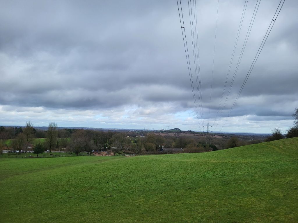
Looking south from Windmill Hill (287 metres above sea level) in the heart of the Waseley Hills Country Park you can see Bredon, Malvern and Abberley, the three great ridges which dominate the otherwise gently hilly landscape of Worcestershire.
To the north and east inside West Midlands county sprawls the raised metropolis of Birmingham and the Black Country up upon the Midlands plateau. Due north of Windmill Hill the towers of Birmingham city centre align closely with the curve of the M5 motorway and the patch of woodland, Frankley Beeches, above a hill straight ahead. To the east lies the craggy boundary between urban West Midlands and rural Worcestershire that are the Lickey Hills. While on the western horizon the towns of the southwestern Black Country, Rowley Regis, Blackheath, Halesowen, Old Hill, Cradley, Lye and Stourbridge, cluster like the names of calling points a railway carriage or express double decker’s passenger information screen. Running up the slopes of Turner’s Hill, the vulcanised limestone, communications masts bedecked, highest point in West Midlands.
Atop Windmill Hill, the toposcope that illustrates all of this in engraved form, was the first calling point of Walkspace West Midlands’ Severn/Trent Watershed Walk for Terminalia Festival 2024. Occurring on the 23rd of February each year Terminalia is a transnational festival inspired by a Roman god which explores boundaries in all their myriad, fluid, culturally contingent, forms.

Why Walk the Watershed?
This year, in conjunction with Andy Howlett (filmmaker, artist and Walkspace Co-founder), I was pleased to deliver Walkpace’s contribution to the event, which celebrated the Severn/Trent watershed, one of the Midland’s most important and defining geographical features. I have written before about how in broad terms the Severn/Trent watershed marks the boundary between the southern and west parts of the Midlands in the Severn catchment area which are considered more bucolic, even mystical, than the modern modern, industrial and postindustrial, heavily populated River Trent basin. It was this which encouraged Andy to reach out to me about co-producing Walkspace’s Terminalia Festival 2024 walk as he was keen to explore the watershed. Though whilst the walk was initiated and developed by Andy and I, many members of the Walkspace Collective contributed to the event on the day.
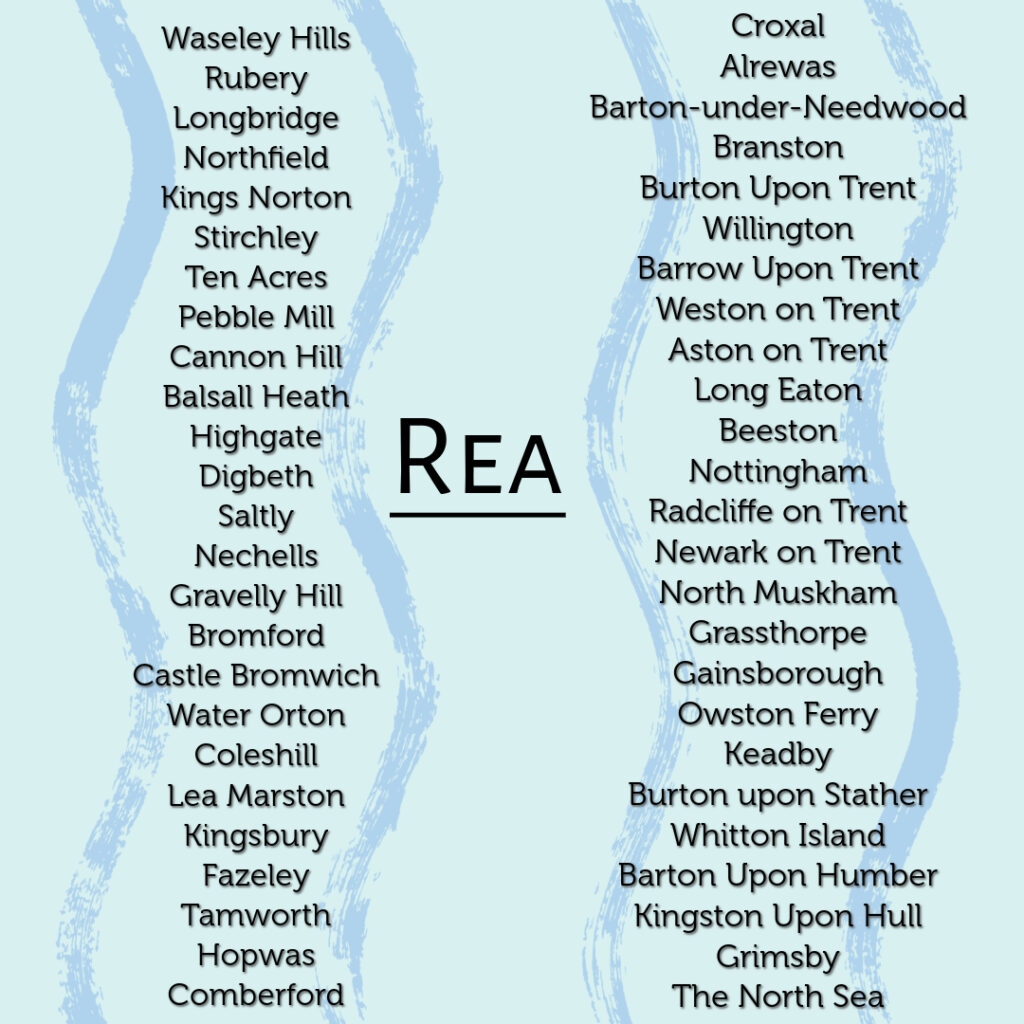
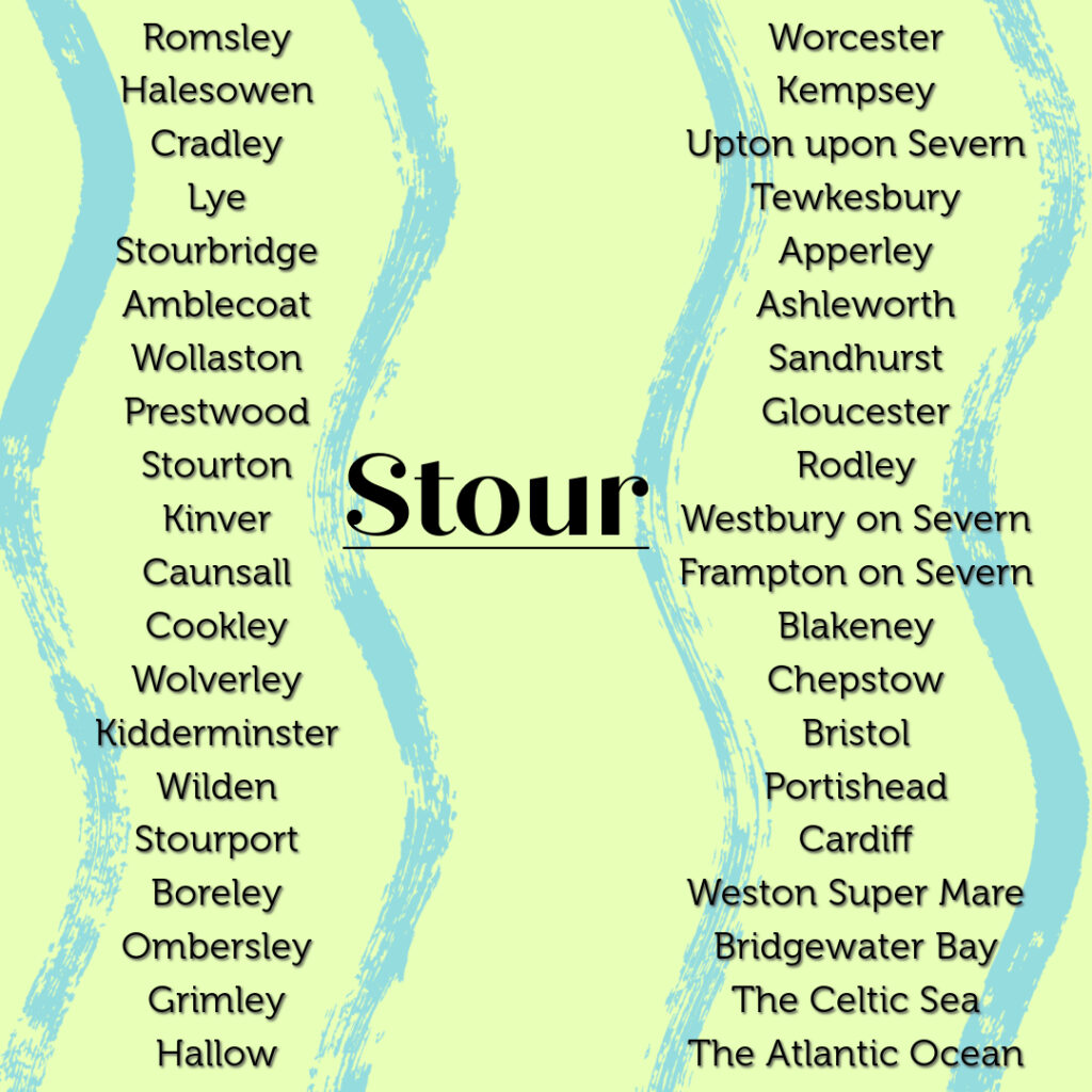
Walking between the two river’s starting points requires a short, but intense, amidst the muddy late-February conditions, hike across quite hilly ground. Rising only two and a half miles apart the River Rea flows north across Birmingham to the Tame, which in turn runs in a northeasterly direction to its confluence with the River Trent, through which it eventually flows out past Kingston-upon-Hull to the North Sea. While from a well behind St. Kenelm’s Church the River Stour trickles forth and commences its journey, wending its way across the southwestern Black Country and out into the Staffordshire and Worcestershire countryside, through Kidderminster and into the River Severn at Stourport. From there the water flows on and out into the Celtic Sea via the Bristol Channel.
The contrasting myths and histories associated with the rivers brilliantly illustrate the contrasting perceptions of the southern and western Midlands versus the north and eastern parts of the region. The Rea is feted as an industrial river. Its waters turned the mill wheels and cooled the metal which drove Birmingham’s growth and expansion as the Midland’s major metropolis. An expansion which led with a certain degree of irony, indicative of Birmingham’s utilitarian unsentimental character, to the Rea being culverted and covered over for large stretches of its course through Birmingham. By contrast, the Stour, flowing through some of the leafier parts of the Black Country and then down through mixed rural and urban terrain in northern Worcestershire, is chiefly associated with the mystical, allegorical, medieval Chrisitan myth of the murdered Merican boy king St. Kenelm. A tale which sounds like it would be more at home in the depths of rural Cornwall, Wales or Ireland, rather than on the skirts of the urban West Midlands.
Walking the Severn/Trent Watershed
Windmill Hills’ toposcope handily aligns with the Severn/Trent Watershed. As a cultural and historical appreciator of watersheds, rather than a geographical, geological and hydrological one, I had naturally assumed that crudely speaking water falling on the southern flank of Windmill Hill would eventually run into the Severn via the Stour. While water falling on the northern slope would flow via the initial conduit of the Rea into the Trent. As Walkspace member Robson observed things are not so simple, rather both the Rea and the Stour initially flow north, albeit one towards the east into Birmingham and the other to the west through the southwestern Black Country.
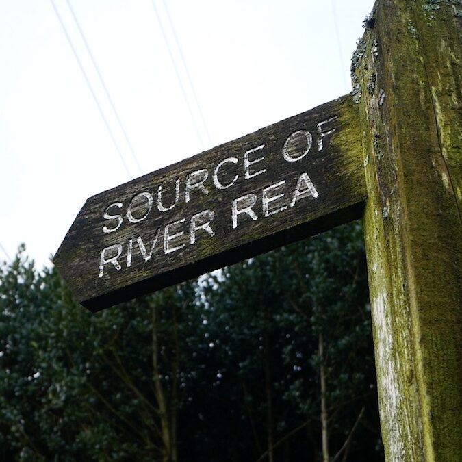
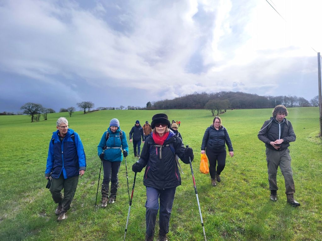
Having clambered down Windmill Hill, the fourteen of us in the party, Walkspace members, and members of the public alike, made for the Source of the River Rea, another of Waseley Hills Country Park’s attractions.

After a brief psychogeographical ceremony and a poetic recital by Andy, resembling in parts a rural North Midlands version of the KLF’s “It's Grim Up North”, of many of the settlements along the Rea, Tame and Trent which the water would flow enroute to the North Sea, the party set-off to head west leaving Waseley Hills Country Park to cross the M5 into rural Worcestershire.
As many on the walk noted, the M5 is an important barrier in its own right. Indeed if Environment Agency maps are to be believed it runs quite close, even in parallel with the Severn/Trent watershed. Perhaps West Midlands residents are conditioned to associate the M5 with escape through years of West Country holidays? However, there can be no doubt that the majesty and thunder of the river of cars flowing beneath the motorway bridge aside, that the massive road does mark a barrier, both psychological and physical, between the West Midlands conurbation and the rural north Worcestershire countryside.
Beyond the M5 the walking party moved into open countryside. Heading downhill towards Dowery Dell then turning left to head up to the hilltop village of Romsley. It is simultaneously a freestanding ancient hilltop village and a suburbanised exurb of Halesowen and the rest of the leafy southwestern Black Country fringe.
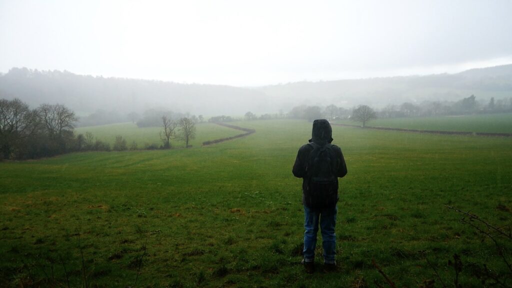
It being February progress was slow across waterlogged fields. Little surprise in a part of the country with rich claggy soil that is the genesis for so many rivers. Then the hail started. A brief pause was made in the car park of the Swallow’s Nest pub, patrons scurrying between the hostelry and their cars eyeing the group with a mixture of respect and pity, before setting up again even further uphill to the southern edge of the village.
Romsley is high up as large villages in England go. The Swallows Nest where we paused stands 241 metres above sea level. Reaching the edge of the village and making good time, despite the mud and the weather, it being the coldest day for at least three weeks, we climbed to nearly 275 metres and the top of Romsley Hill.
Here something went a little bit awry with a footpath not adhering to the right of way, a common problem on the edge of settlements, where villagers tend to carve their own folkways. This lack of local knowledge occasioned a quick scramble across a couple of fields, down into a pretty valley ringed with trees opposite the Clent Hills, and then escape back into human settlement via gaps in a hedge onto a campsite shut for the winter.
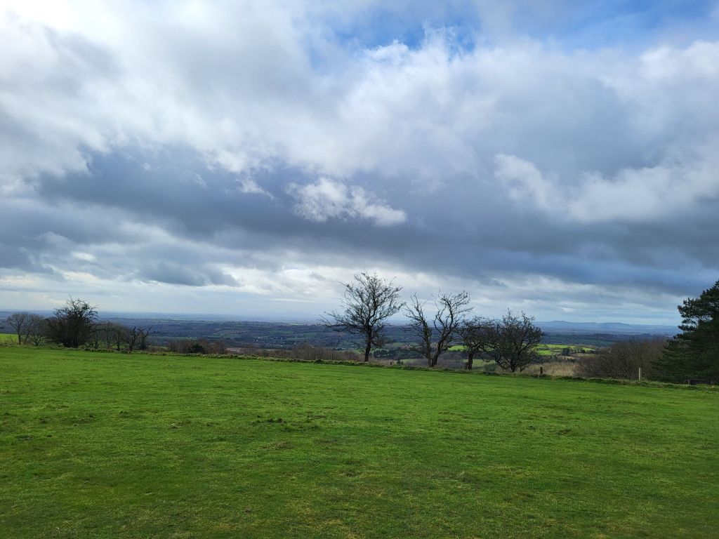
Hastily getting back to where we should have been via the campsite’s access road, having deftly navigated a gate, swift progress the rest of the way to St. Kenelm’s Church was made. The walking route was mostly along the capillary thread of bucolic lanes which skirt the Clent Hills.
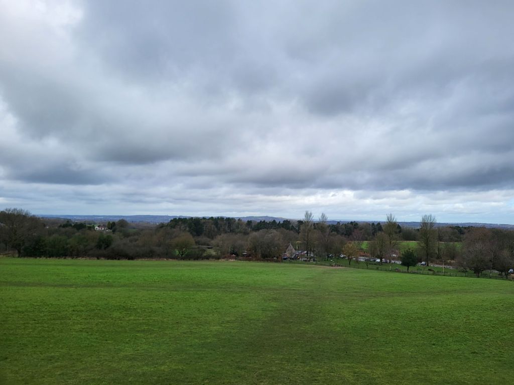
Reaching woodland beneath the larger of the Clent Hills spectacular views of the hilly southwestern edge of the Black Country came into view to the right. Handily the sun came out just at this point illuminating the varied urban, industrial, yet also highly green fringe of West Midlands county. Pleasingly most of the final stretch of the walk to St. Kenelm’s Church and the well which is the source of the River Stour was across a field with spectacular views towards the nearby conurbation.

St. Kenelm, a Midlands saint subject of a popular quasi-religious legend during the middle ages, can be glimpsed in a lovely, characterful carving on the front of the lychgate into the churchyard.
The church itself is ancient and evidently much added to over the years. Today St. Kenelm serves the parish of Romsley and the surrounding villages, the current building evidently Victorian in part, but with lots of far older components and embellishments. If Wikipedia can be believed the little church’s crypt is formed from the remains of a shrine which lay at the heart of the pre-Reformation cult of St. Kenelm.
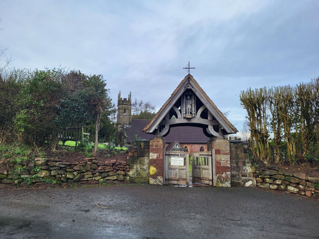
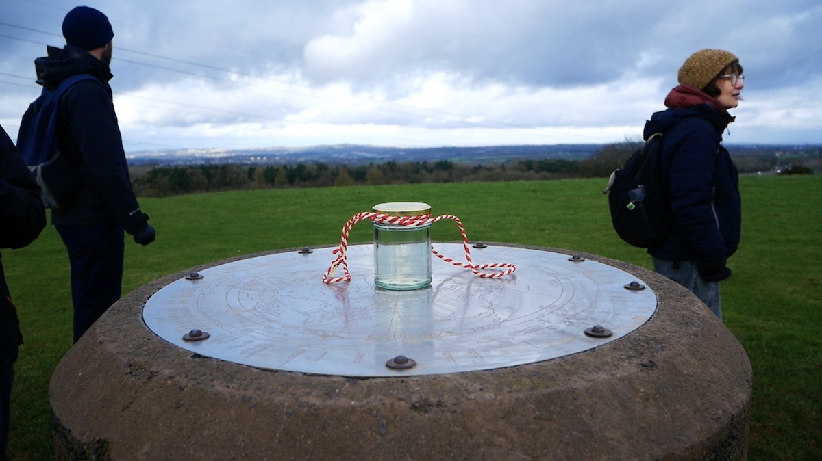
After a late lunch, Andy recounted the legend of St. Kenelm outside the church’s porch, before the watershed walking party made its way down to the well behind the church which is the source of the River Stour. Here there was another psychogeographical ceremony, featuring a sheep skull (providentially discovered in a tree during the walk), spreading of flowers, and a recital of the names of the settlement which the water bubbling from the well would flow through on its way to the sea. A jar half filled with water from the River Rea was dipped into the well to capture water destined for the Stour too.


This event was the closing ceremony for Walkspace West Midlands’ Terminalia Festival 2024 watershed walk. Signifying the boundary between the Trent and the Severn had been well and truly crossed.
Here most of the party continued walking straight downhill in the shadow of the Clent down towards Halesowen and private cars, buses and taxis home. Along the way we passed through scuzzy, almost heath-like countryside on the northernmost edge of Worcestershire. This included skirting the fringe of Uffmoor Wood, a scrap of ancient woodland, surviving in the greenbelt just outside the Black Country. The footpath runs close to the gathering watercourse of the River Stour. This contributed to it being very wet under foot. Soon we reached the dual carriageway on the edge of Halesowen and were rapidly absorbed back into the West Midlands conurbation beyond.
Fancy trying out the route? Get it here, via Ordnance Survey Maps.
This post first appeared on Walk Midlands. It is cross posted here with permission.